
Easier access to scientific data

Brought to you by NOAA CoastWatch Great Lakes Node
|
ERDDAP
Easier access to scientific data |
|
Brought to you by NOAA CoastWatch Great Lakes Node |
| Dataset Title: | Lake Michigan Pentwater/Whitehall Surface Temperature Contour Map (2022- present) 

|
| Institution: | CoastWatch Great Lakes Node (Dataset ID: LM_NRT_TC_m32) |
| Information: | Summary
| License
| Metadata
| Background | Subset
| Data Access Form
| Make a graph
| Subset
| Data Access Form
| Make a graph
|
![[ICO]](https://apps.glerl.noaa.gov/erddap/images/fileIcons/blank.gif) | Name | Last modified | Size | Description |
|---|---|---|---|---|
![[DIR]](https://apps.glerl.noaa.gov/erddap/images/fileIcons/back.gif) | Parent Directory | - | - | |
![[IMG]](https://apps.glerl.noaa.gov/erddap/images/fileIcons/image2.gif) 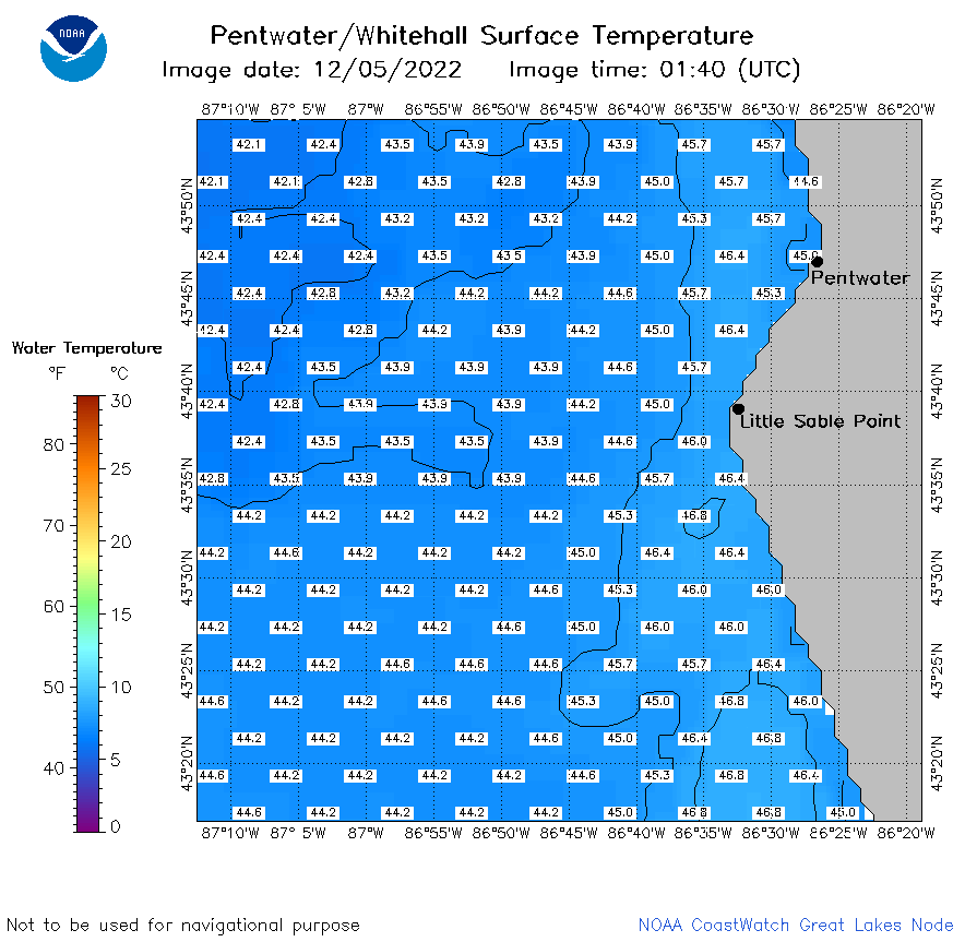 | m32_2022_12_05_0140.png | 13-Dec-2022 17:22 | 29569 | |
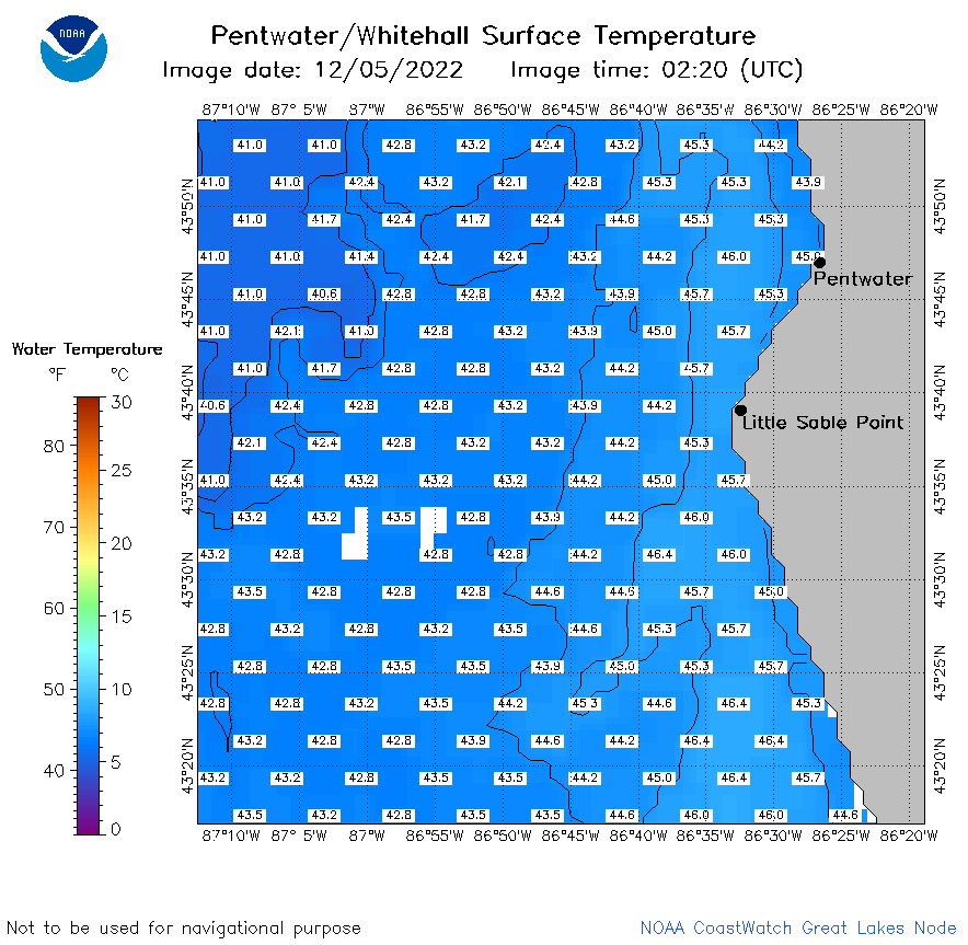 | m32_2022_12_05_0220.png | 13-Dec-2022 17:24 | 32431 | |
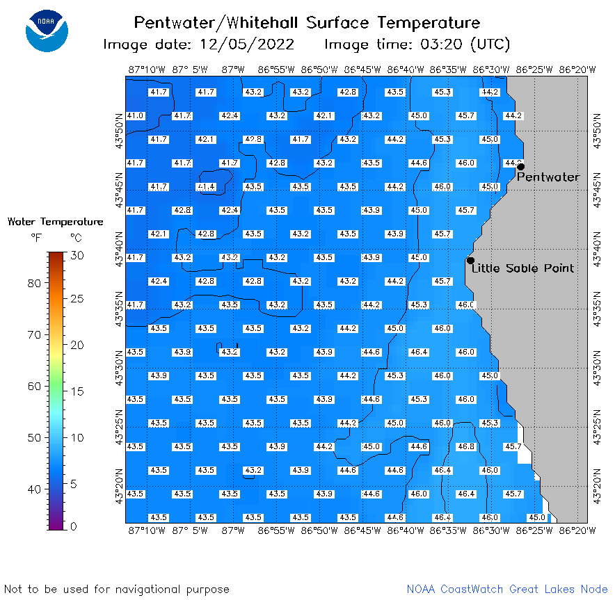 | m32_2022_12_05_0320.png | 13-Dec-2022 17:29 | 30013 | |
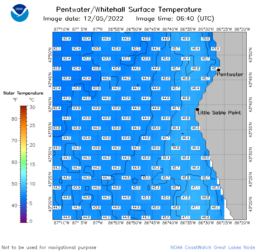 | m32_2022_12_05_0640.png | 13-Dec-2022 17:32 | 32411 | |
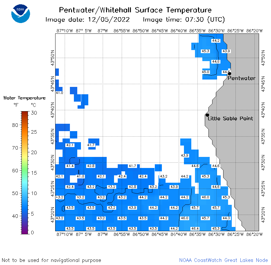 | m32_2022_12_05_0730.png | 13-Dec-2022 17:35 | 22859 | |
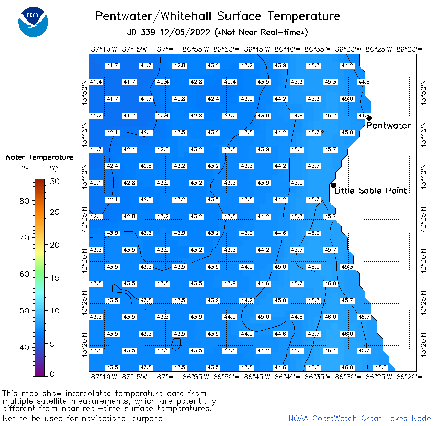 | m32_2022_339.png | 06-Dec-2022 10:41 | 30846 | |