
Easier access to scientific data

Brought to you by NOAA CoastWatch Great Lakes Node
|
ERDDAP
Easier access to scientific data |
|
Brought to you by NOAA CoastWatch Great Lakes Node |
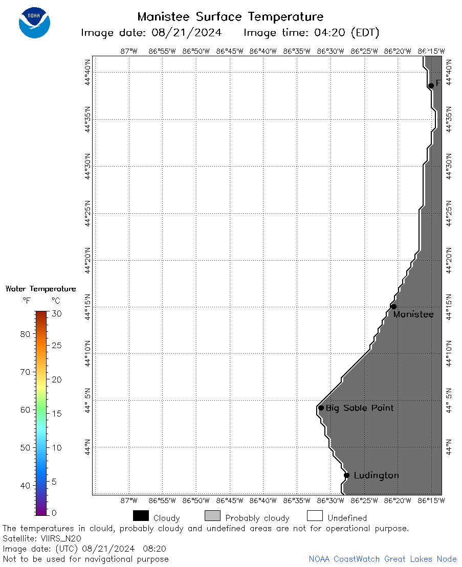
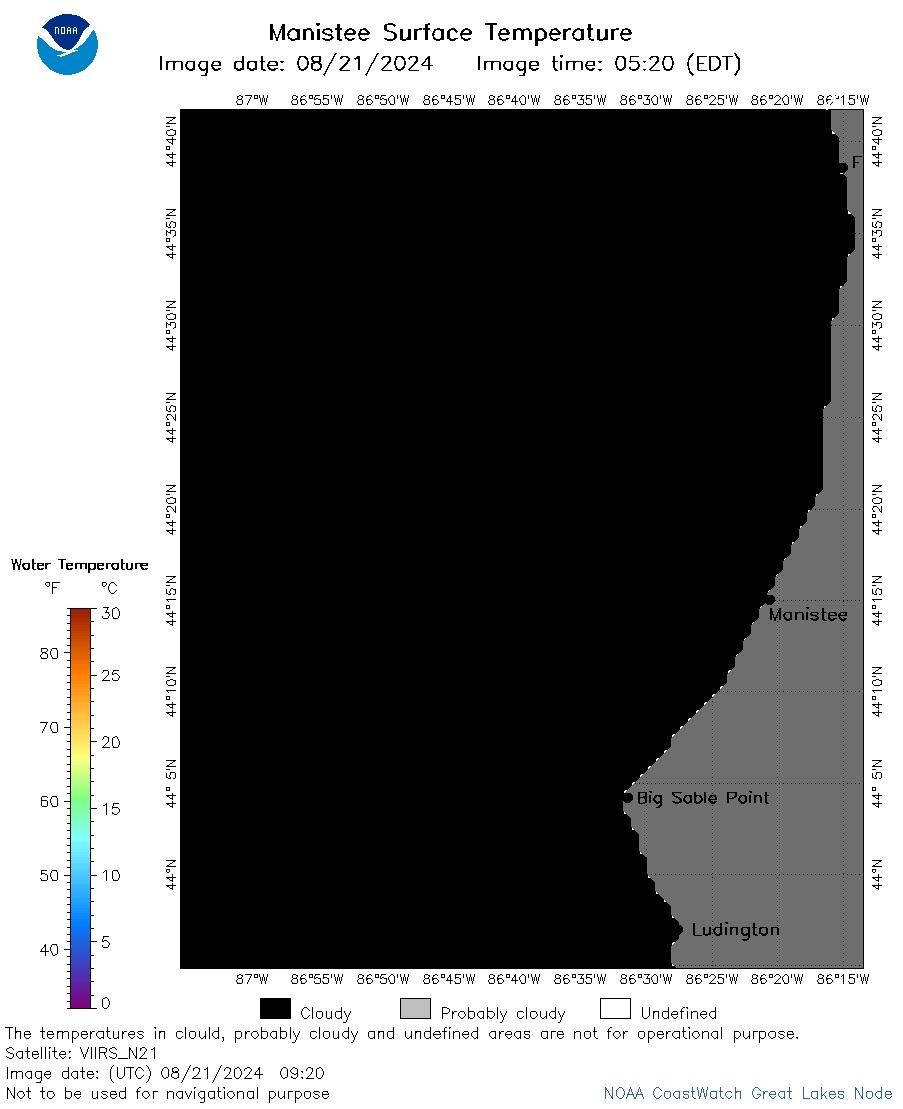
| Dataset Title: | Lake Michigan Manistee Surface Temperature Contour Map (2022-present)


|
| Institution: | CoastWatch Great Lakes Node (Dataset ID: LM_NRT_TC_m23) |
| Information: | Summary
| License
| Metadata
| Background | Subset
| Data Access Form
| Make a graph
| Subset
| Data Access Form
| Make a graph
|
![[ICO]](https://apps.glerl.noaa.gov/erddap/images/fileIcons/blank.gif) | Name | Last modified | Size | Description |
|---|---|---|---|---|
![[DIR]](https://apps.glerl.noaa.gov/erddap/images/fileIcons/back.gif) | Parent Directory | - | - | |
![[IMG]](https://apps.glerl.noaa.gov/erddap/images/fileIcons/image2.gif) 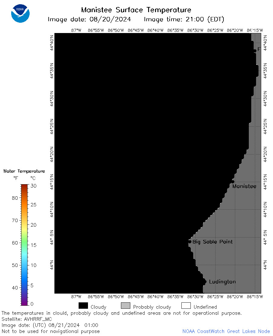 | m23_2024_08_21_0100.png | 21-Aug-2024 16:44 | 18851 | |
 | m23_2024_08_21_0550.png | 21-Aug-2024 16:46 | 18847 | |
 | m23_2024_08_21_0600.png | 21-Aug-2024 16:48 | 18865 | |
 | m23_2024_08_21_0620.png | 21-Aug-2024 16:50 | 20278 | |
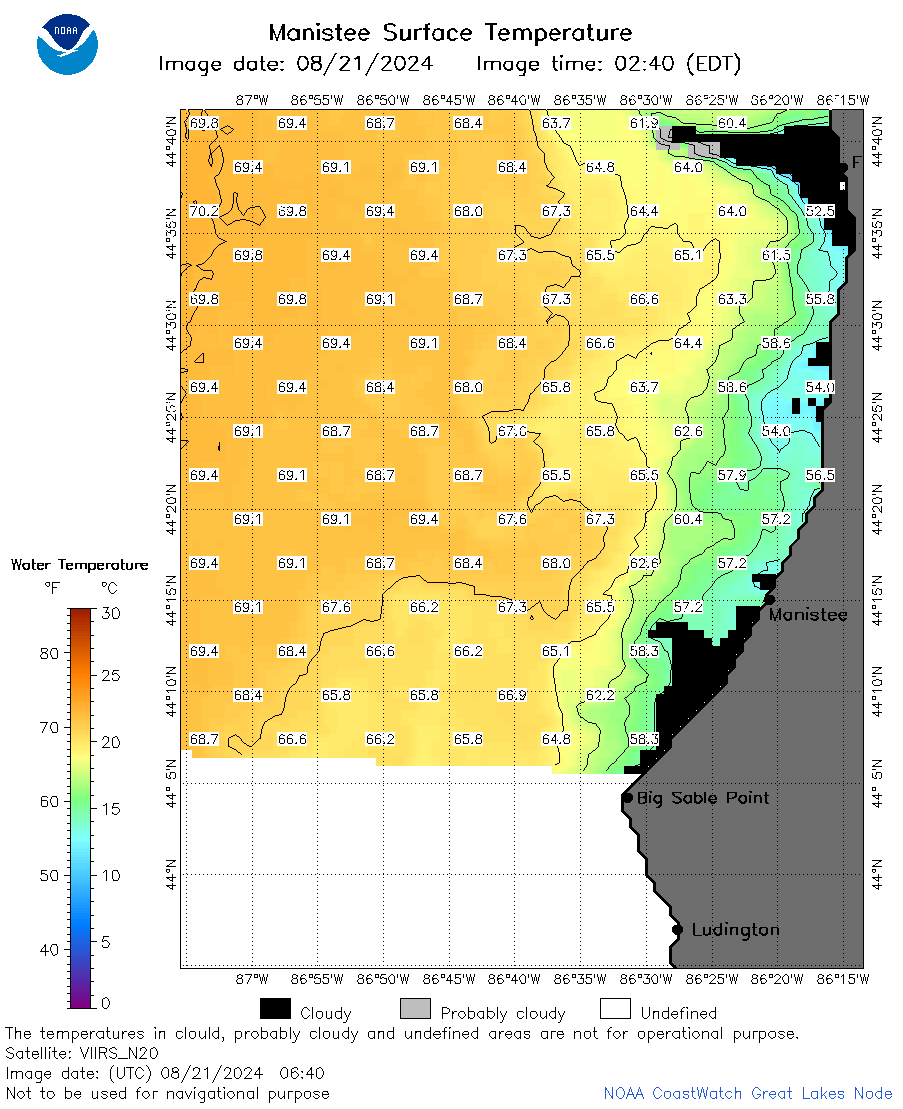 | m23_2024_08_21_0640.png | 21-Aug-2024 16:53 | 48440 | |
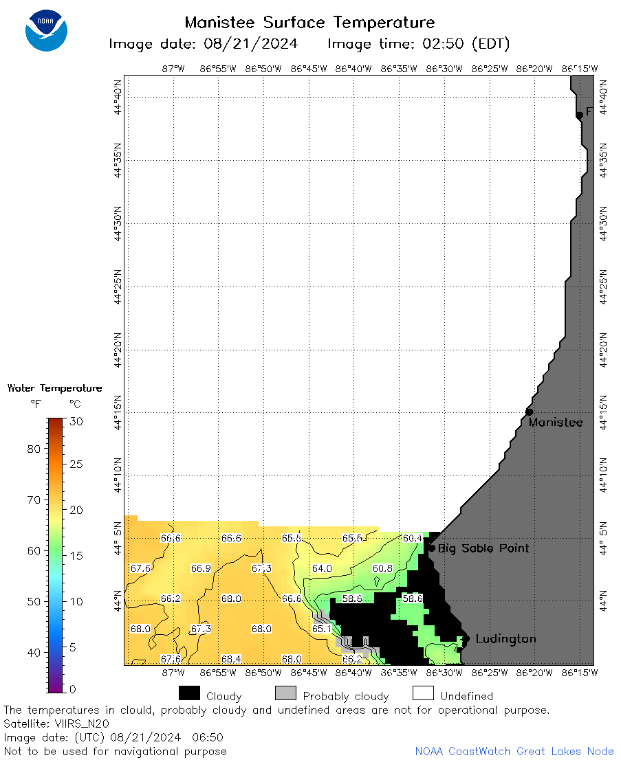 | m23_2024_08_21_0650.png | 21-Aug-2024 16:55 | 28109 | |
 | m23_2024_08_21_0730.png | 21-Aug-2024 16:57 | 18850 | |
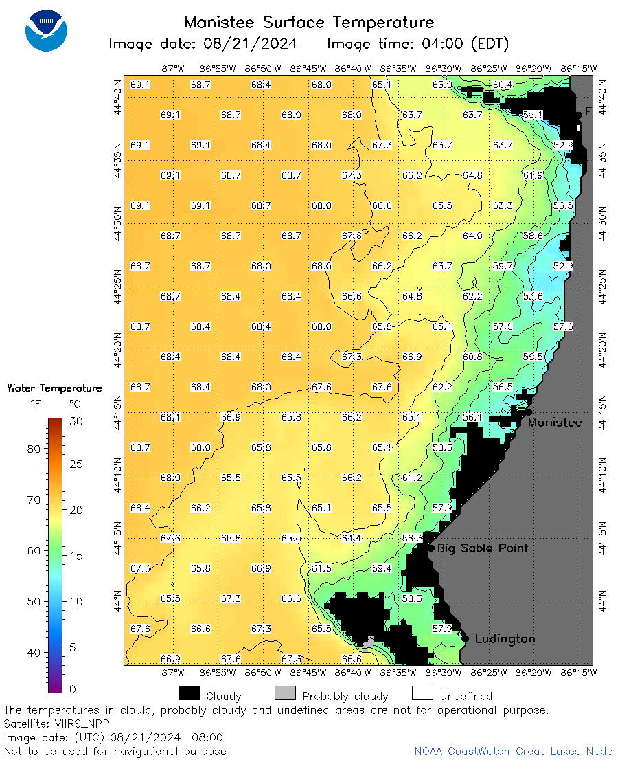
 | m23_2024_08_21_0740.png | 21-Aug-2024 16:59 | 57194 | |
 | m23_2024_08_21_0800.png | 21-Aug-2024 17:01 | 57837 | |
 | m23_2024_08_21_0820.png | 21-Aug-2024 17:04 | 20298 | |
 | m23_2024_08_21_0830.png | 21-Aug-2024 17:06 | 57777 | |
 | m23_2024_08_21_0920.png | 21-Aug-2024 17:08 | 18856 | |
 | m23_2024_08_21_0940.png | 21-Aug-2024 17:10 | 18869 | |
 | m23_2024_08_21_1810.png | 21-Aug-2024 22:32 | 57046 | |
 | m23_2024_08_21_1950.png | 22-Aug-2024 03:32 | 20301 | |
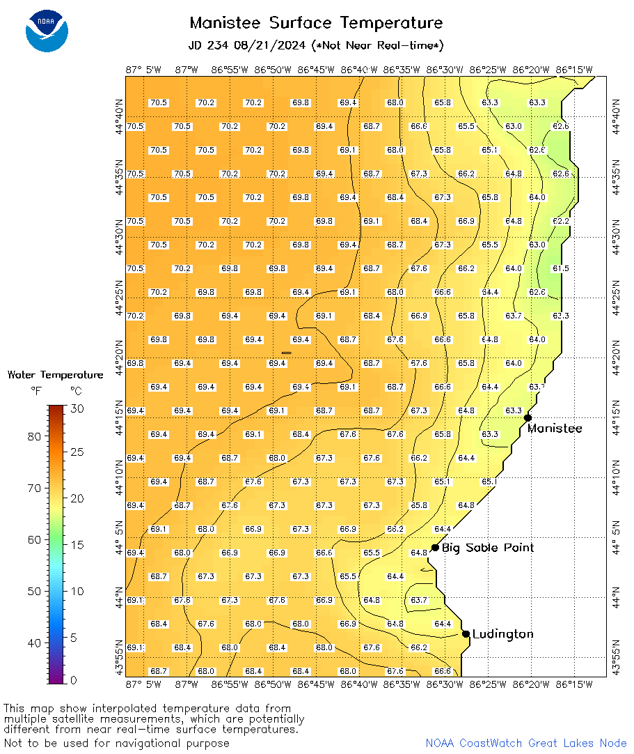 | m23_2024_234.png | 22-Aug-2024 09:19 | 41833 | |