
Easier access to scientific data

Brought to you by NOAA CoastWatch Great Lakes Node
|
ERDDAP
Easier access to scientific data |
|
Brought to you by NOAA CoastWatch Great Lakes Node |
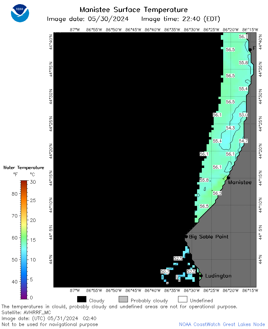
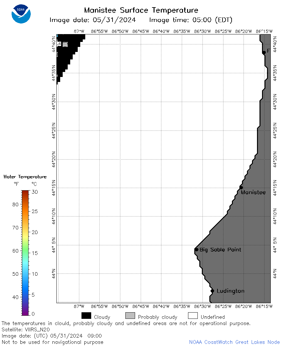
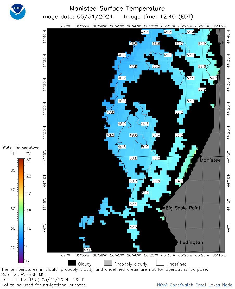
| Dataset Title: | Lake Michigan Manistee Surface Temperature Contour Map (2022-present)


|
| Institution: | CoastWatch Great Lakes Node (Dataset ID: LM_NRT_TC_m23) |
| Information: | Summary
| License
| Metadata
| Background | Subset
| Data Access Form
| Make a graph
| Subset
| Data Access Form
| Make a graph
|
![[ICO]](https://apps.glerl.noaa.gov/erddap/images/fileIcons/blank.gif) | Name | Last modified | Size | Description |
|---|---|---|---|---|
![[DIR]](https://apps.glerl.noaa.gov/erddap/images/fileIcons/back.gif) | Parent Directory | - | - | |
![[IMG]](https://apps.glerl.noaa.gov/erddap/images/fileIcons/image2.gif)  | m23_2024_05_31_0100.png | 31-May-2024 05:28 | 20272 | |
 | m23_2024_05_31_0150.png | 31-May-2024 05:30 | 25661 | |
 | m23_2024_05_31_0240.png | 31-May-2024 05:33 | 25597 | |
 | m23_2024_05_31_0330.png | 31-May-2024 05:36 | 24475 | |
 | m23_2024_05_31_0720.png | 31-May-2024 13:29 | 47603 | |
 | m23_2024_05_31_0730.png | 31-May-2024 13:32 | 18854 | |
 | m23_2024_05_31_0900.png | 31-May-2024 13:34 | 20419 | |
 | m23_2024_05_31_0910.png | 31-May-2024 13:37 | 18858 | |
 | m23_2024_05_31_1400.png | 31-May-2024 17:26 | 18856 | |
 | m23_2024_05_31_1500.png | 31-May-2024 19:28 | 21201 | |
 | m23_2024_05_31_1540.png | 31-May-2024 19:31 | 32823 | |
 | m23_2024_05_31_1550.png | 31-May-2024 19:34 | 18858 | |
 | m23_2024_05_31_1640.png | 31-May-2024 19:36 | 35414 | |
 | m23_2024_05_31_1710.png | 31-May-2024 23:27 | 20269 | |
 | m23_2024_05_31_1720.png | 31-May-2024 19:38 | 18847 | |
 | m23_2024_05_31_1850.png | 31-May-2024 23:30 | 52732 | |
 | m23_2024_152.png | 01-Jun-2024 09:19 | 40495 | |