
Easier access to scientific data

Brought to you by NOAA CoastWatch Great Lakes Node
|
ERDDAP
Easier access to scientific data |
|
Brought to you by NOAA CoastWatch Great Lakes Node |
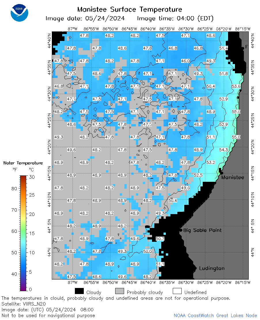
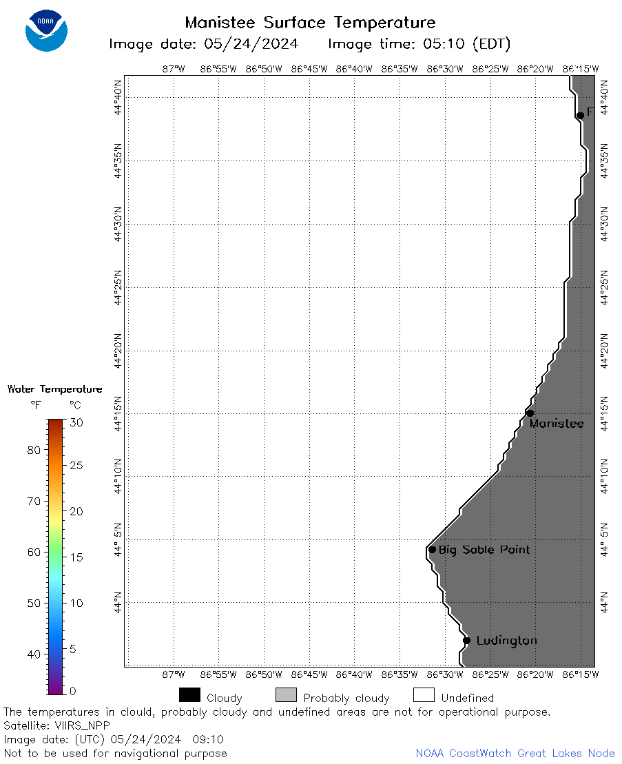
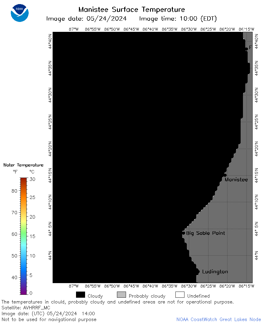
| Dataset Title: | Lake Michigan Manistee Surface Temperature Contour Map (2022-present)


|
| Institution: | CoastWatch Great Lakes Node (Dataset ID: LM_NRT_TC_m23) |
| Information: | Summary
| License
| Metadata
| Background | Subset
| Data Access Form
| Make a graph
| Subset
| Data Access Form
| Make a graph
|
![[ICO]](https://apps.glerl.noaa.gov/erddap/images/fileIcons/blank.gif) | Name | Last modified | Size | Description |
|---|---|---|---|---|
![[DIR]](https://apps.glerl.noaa.gov/erddap/images/fileIcons/back.gif) | Parent Directory | - | - | |
![[IMG]](https://apps.glerl.noaa.gov/erddap/images/fileIcons/image2.gif) 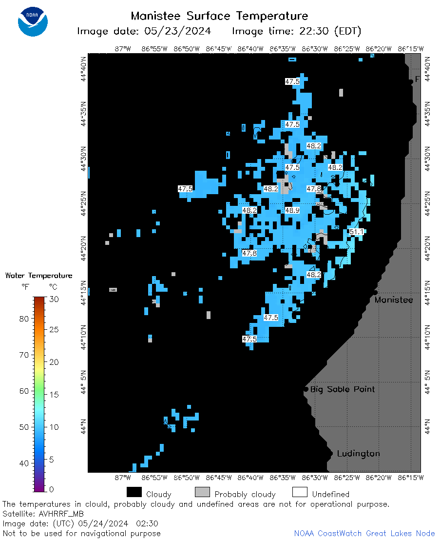 | m23_2024_05_24_0230.png | 24-May-2024 20:27 | 27745 | |
 | m23_2024_05_24_0240.png | 24-May-2024 20:30 | 18861 | |
 | m23_2024_05_24_0610.png | 24-May-2024 09:27 | 20292 | |
 | m23_2024_05_24_0620.png | 24-May-2024 09:30 | 18847 | |
 | m23_2024_05_24_0730.png | 24-May-2024 11:28 | 45507 | |
 | m23_2024_05_24_0750.png | 24-May-2024 11:31 | 20288 | |
 | m23_2024_05_24_0800.png | 24-May-2024 11:33 | 51481 | |
 | m23_2024_05_24_0910.png | 24-May-2024 13:26 | 20274 | |
 | m23_2024_05_24_1400.png | 24-May-2024 18:27 | 18837 | |
 | m23_2024_05_24_1450.png | 24-May-2024 18:30 | 18867 | |
 | m23_2024_05_24_1540.png | 24-May-2024 18:32 | 18849 | |
 | m23_2024_05_24_1630.png | 24-May-2024 18:35 | 18882 | |
 | m23_2024_05_24_1710.png | 24-May-2024 19:27 | 18838 | |
 | m23_2024_05_24_1720.png | 24-May-2024 20:32 | 18833 | |
 | m23_2024_05_24_1740.png | 24-May-2024 19:30 | 18857 | |
 | m23_2024_145.png | 25-May-2024 09:19 | 39733 | |