
Easier access to scientific data

Brought to you by NOAA CoastWatch Great Lakes Node
|
ERDDAP
Easier access to scientific data |
|
Brought to you by NOAA CoastWatch Great Lakes Node |
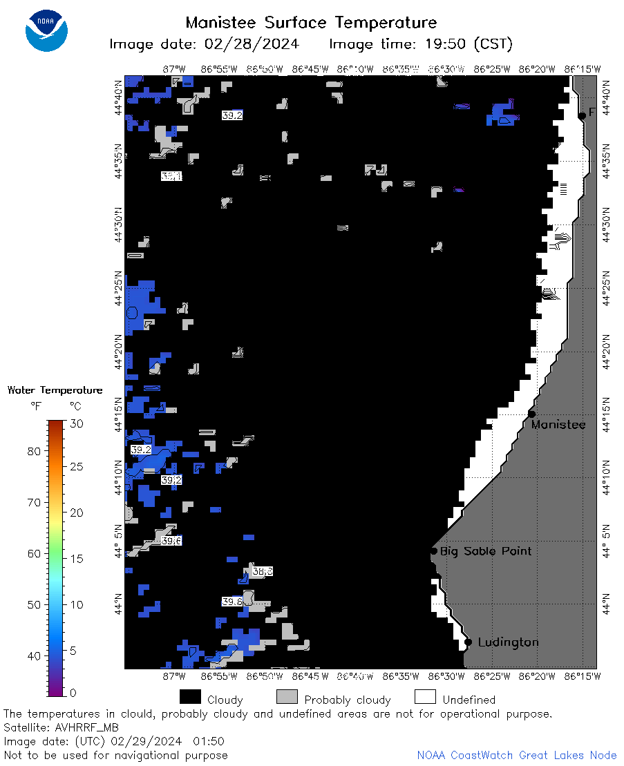
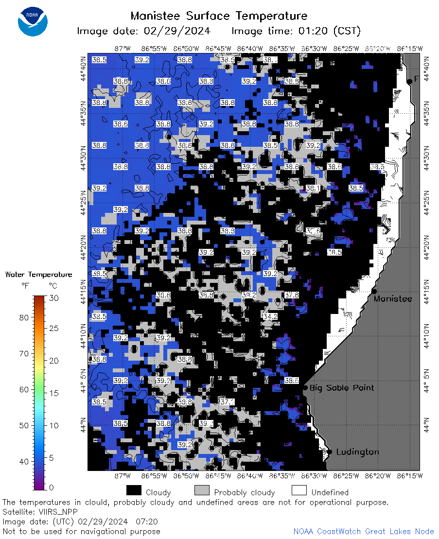
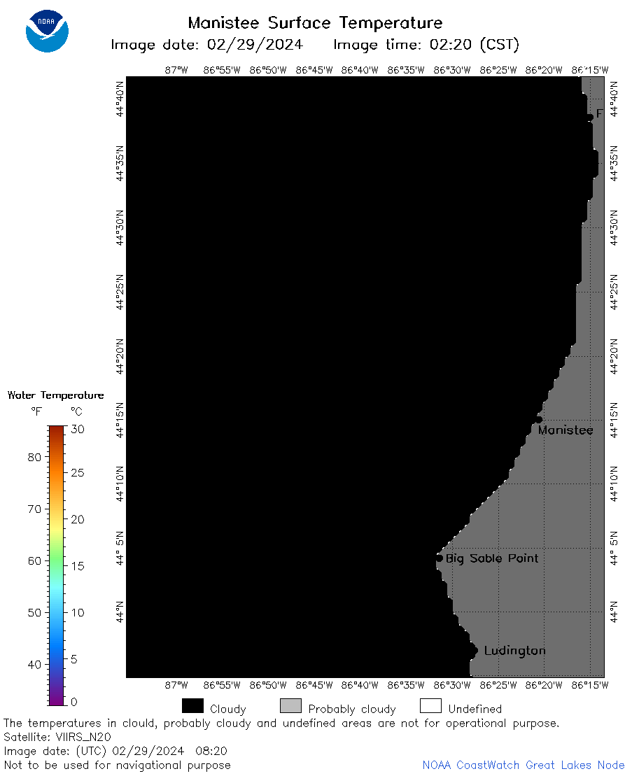
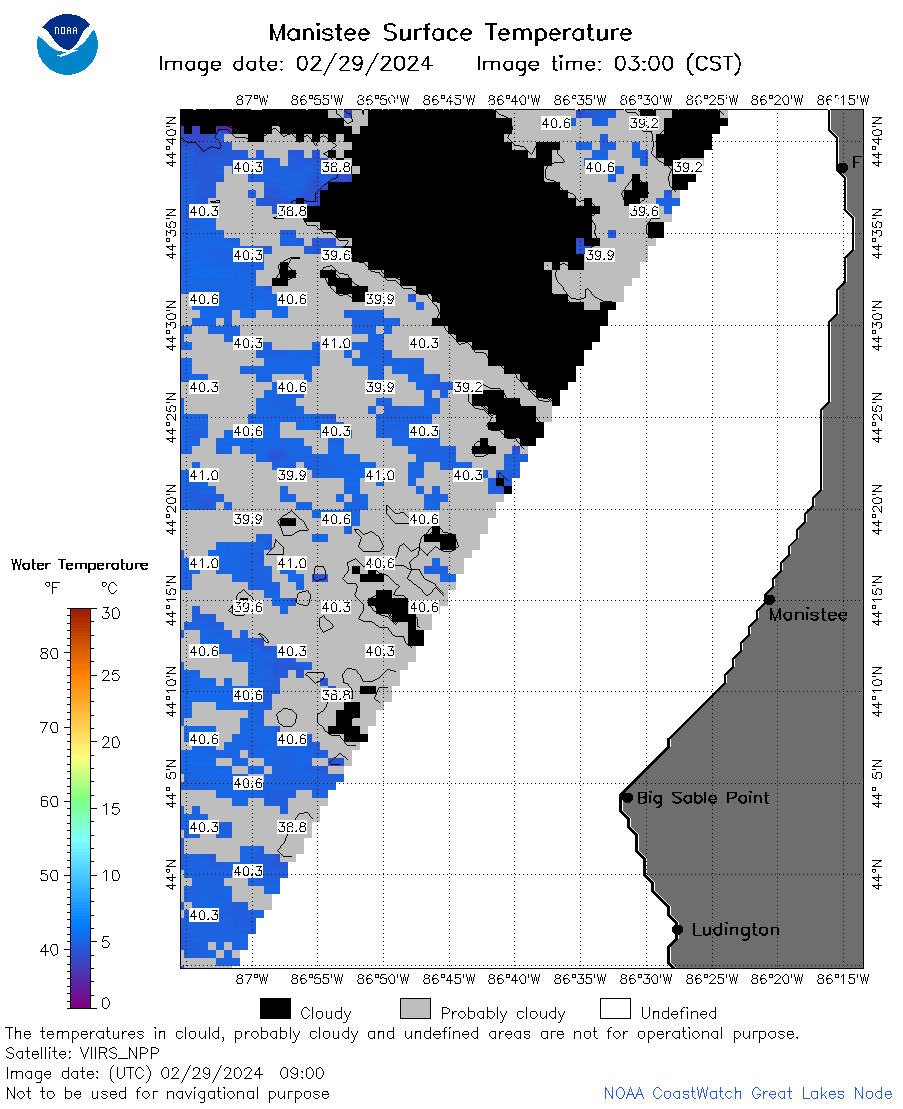
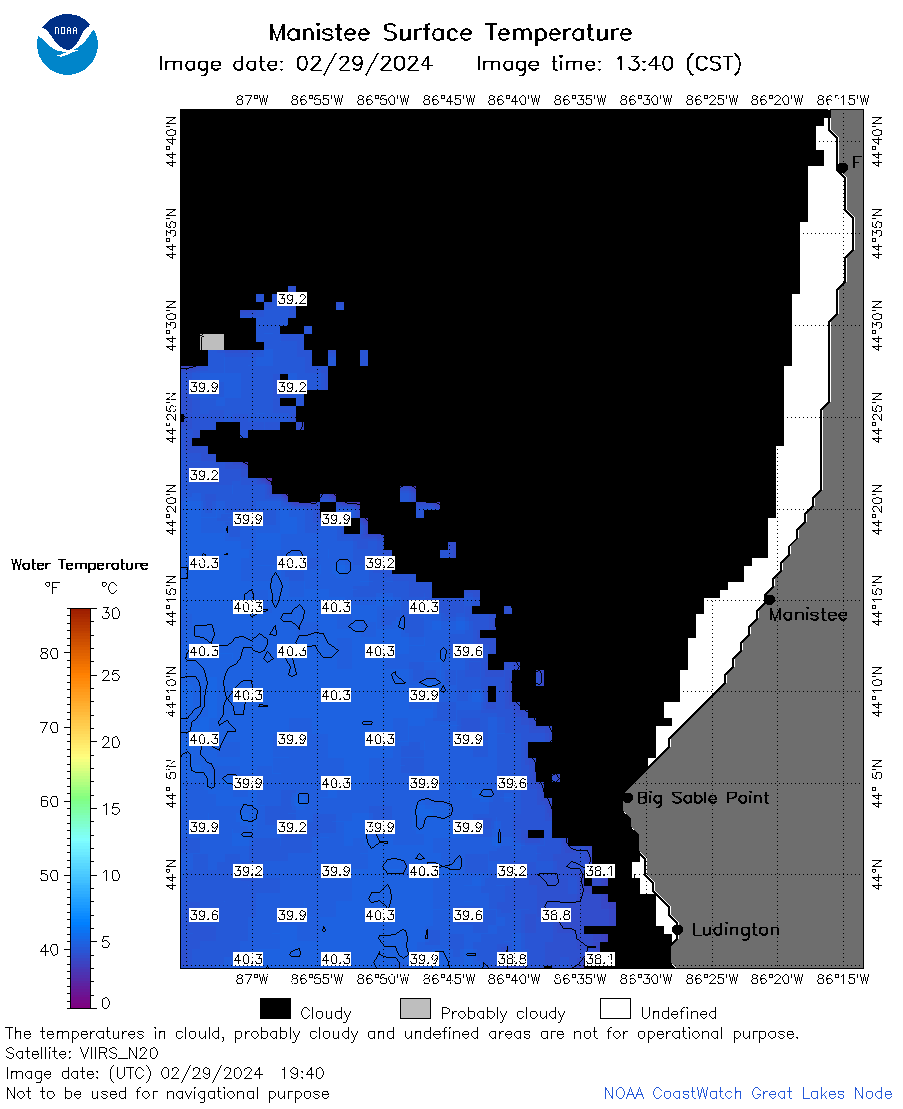
| Dataset Title: | Lake Michigan Manistee Surface Temperature Contour Map (2022-present)


|
| Institution: | CoastWatch Great Lakes Node (Dataset ID: LM_NRT_TC_m23) |
| Information: | Summary
| License
| Metadata
| Background | Subset
| Data Access Form
| Make a graph
| Subset
| Data Access Form
| Make a graph
|
![[ICO]](https://apps.glerl.noaa.gov/erddap/images/fileIcons/blank.gif) | Name | Last modified | Size | Description |
|---|---|---|---|---|
![[DIR]](https://apps.glerl.noaa.gov/erddap/images/fileIcons/back.gif) | Parent Directory | - | - | |
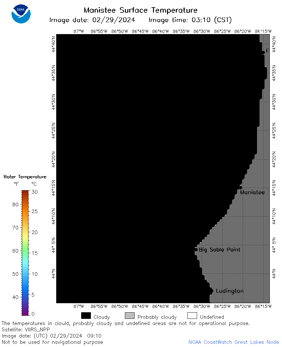
![[IMG]](https://apps.glerl.noaa.gov/erddap/images/fileIcons/image2.gif)  | m23_2024_02_29_0100.png | 29-Feb-2024 07:29 | 18872 | |
 | m23_2024_02_29_0110.png | 29-Feb-2024 07:31 | 20290 | |
 | m23_2024_02_29_0150.png | 29-Feb-2024 07:34 | 27600 | |
 | m23_2024_02_29_0330.png | 29-Feb-2024 07:36 | 29928 | |
 | m23_2024_02_29_0630.png | 29-Feb-2024 18:34 | 41716 | |
 | m23_2024_02_29_0720.png | 29-Feb-2024 18:36 | 57013 | |
 | m23_2024_02_29_0730.png | 29-Feb-2024 18:38 | 18868 | |
 | m23_2024_02_29_0810.png | 29-Feb-2024 18:40 | 40447 | |
 | m23_2024_02_29_0820.png | 29-Feb-2024 18:42 | 18854 | |
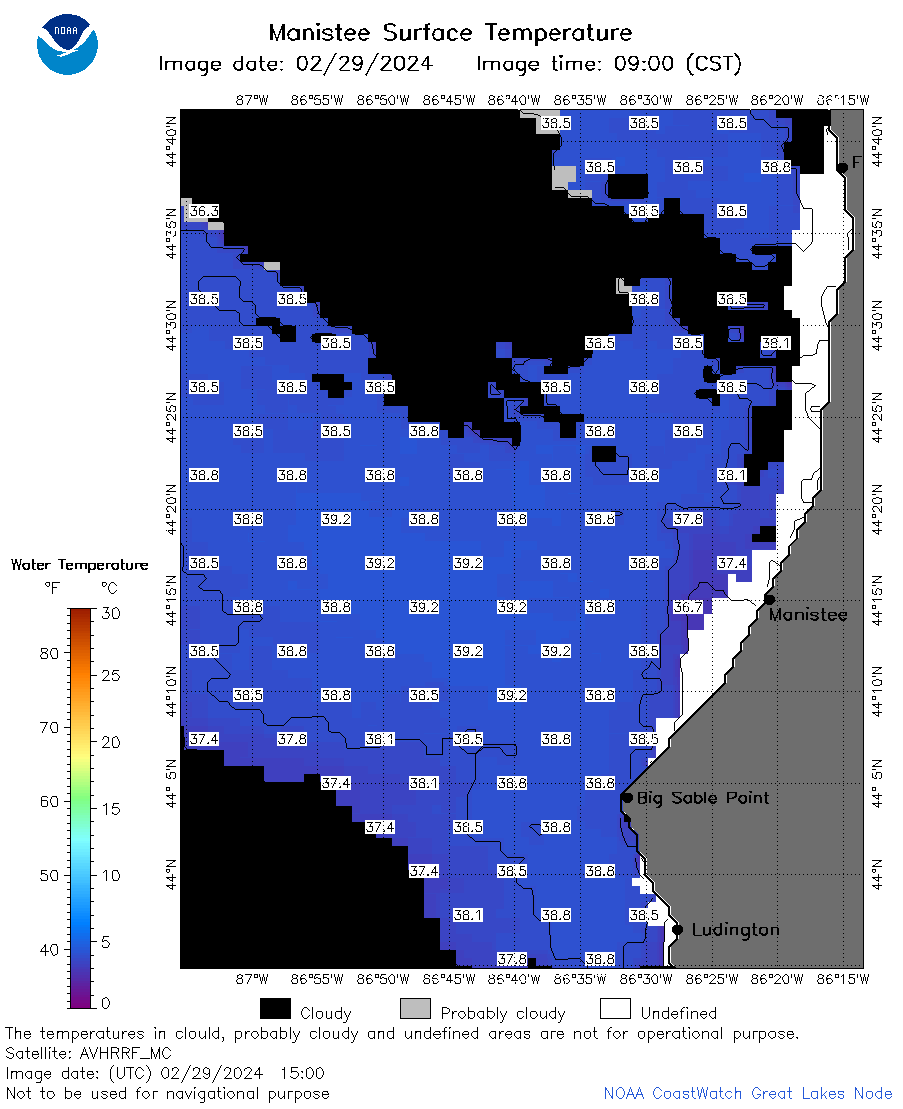
 | m23_2024_02_29_0900.png | 29-Feb-2024 18:44 | 34663 | |
 | m23_2024_02_29_0910.png | 29-Feb-2024 18:47 | 18884 | |
 | m23_2024_02_29_1410.png | 29-Feb-2024 18:49 | 18867 | |
 | m23_2024_02_29_1500.png | 29-Feb-2024 18:51 | 35437 | |
 | m23_2024_02_29_1550.png | 29-Feb-2024 18:53 | 38883 | |
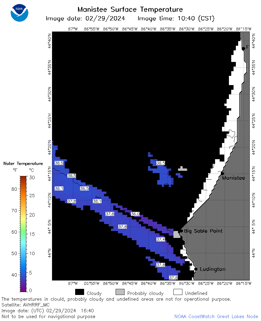 | m23_2024_02_29_1640.png | 29-Feb-2024 19:26 | 24686 | |
 | m23_2024_02_29_1710.png | 29-Feb-2024 19:28 | 20786 | |
 | m23_2024_02_29_1730.png | 29-Feb-2024 19:30 | 18902 | |
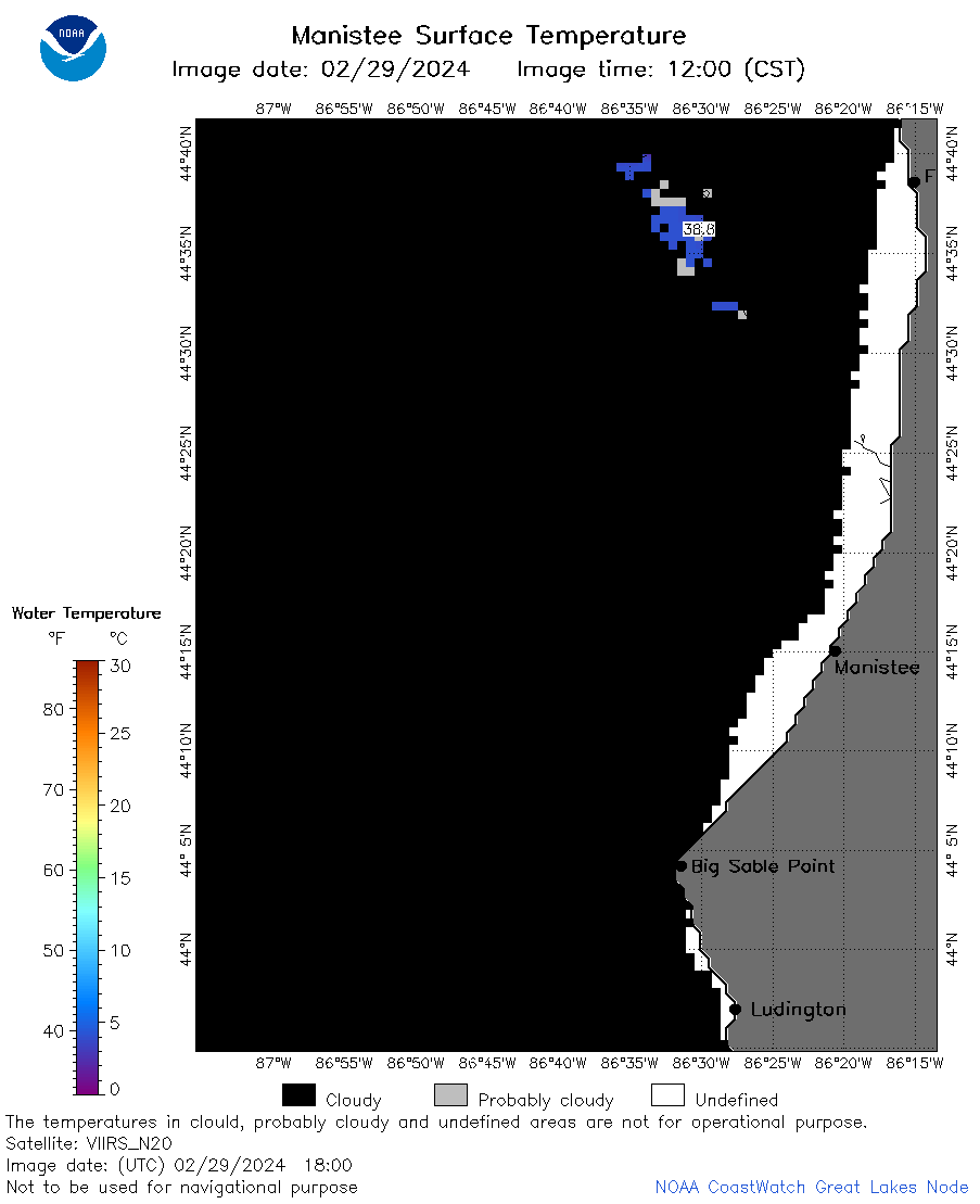 | m23_2024_02_29_1800.png | 29-Feb-2024 20:28 | 21151 | |
 | m23_2024_02_29_1850.png | 29-Feb-2024 21:26 | 20729 | |
 | m23_2024_02_29_1940.png | 29-Feb-2024 21:28 | 32055 | |