
Easier access to scientific data

Brought to you by NOAA CoastWatch Great Lakes Node
|
ERDDAP
Easier access to scientific data |
|
Brought to you by NOAA CoastWatch Great Lakes Node |
| Dataset Title: | Lake Michigan Manistee Surface Temperature Contour Map (2022-present)


|
| Institution: | CoastWatch Great Lakes Node (Dataset ID: LM_NRT_TC_m23) |
| Information: | Summary
| License
| Metadata
| Background | Subset
| Data Access Form
| Make a graph
| Subset
| Data Access Form
| Make a graph
|
![[ICO]](https://apps.glerl.noaa.gov/erddap/images/fileIcons/blank.gif) | Name | Last modified | Size | Description |
|---|---|---|---|---|
![[DIR]](https://apps.glerl.noaa.gov/erddap/images/fileIcons/back.gif) | Parent Directory | - | - | |
![[IMG]](https://apps.glerl.noaa.gov/erddap/images/fileIcons/image2.gif)  | m23_2024_02_16_0120.png | 16-Feb-2024 09:40 | 20487 | |
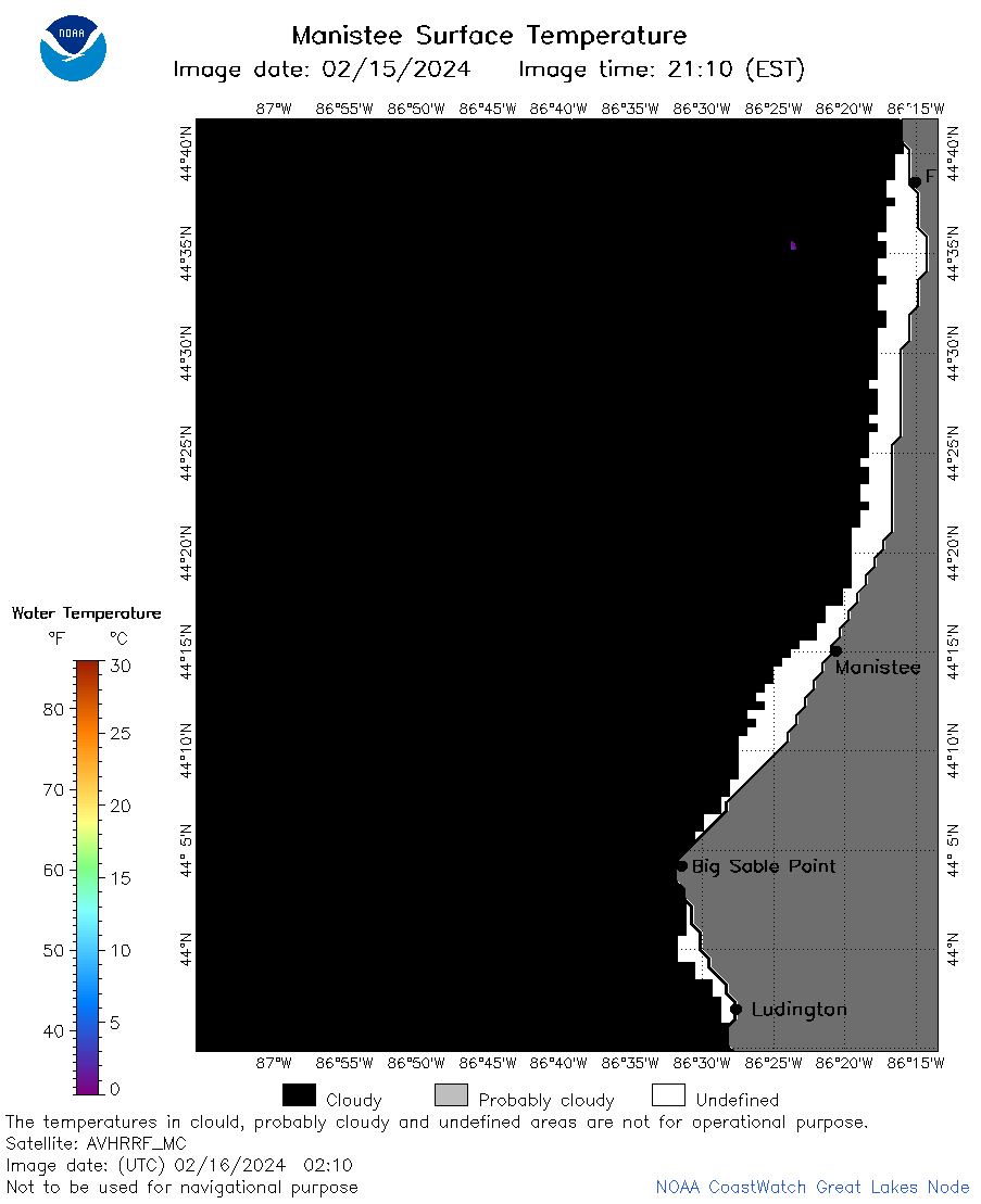 | m23_2024_02_16_0210.png | 16-Feb-2024 09:46 | 20469 | |
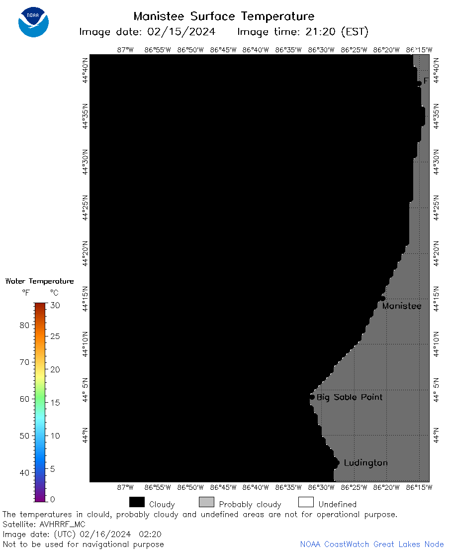 | m23_2024_02_16_0220.png | 16-Feb-2024 09:53 | 18854 | |
 | m23_2024_02_16_0300.png | 16-Feb-2024 09:59 | 20500 | |
 | m23_2024_02_16_0350.png | 16-Feb-2024 10:05 | 18849 | |
 | m23_2024_02_16_0630.png | 16-Feb-2024 10:11 | 20449 | |
 | m23_2024_02_16_0720.png | 16-Feb-2024 10:18 | 20476 | |
 | m23_2024_02_16_0810.png | 16-Feb-2024 12:33 | 20467 | |
 | m23_2024_02_16_0900.png | 16-Feb-2024 12:39 | 20529 | |
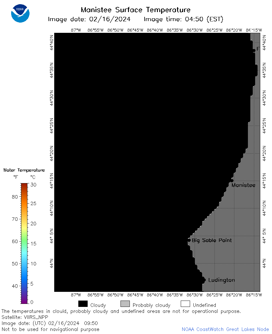 | m23_2024_02_16_0950.png | 16-Feb-2024 14:31 | 18864 | |
 | m23_2024_02_16_1430.png | 16-Feb-2024 18:33 | 20283 | |
 | m23_2024_02_16_1520.png | 16-Feb-2024 18:40 | 20421 | |
 | m23_2024_02_16_1610.png | 16-Feb-2024 20:33 | 20444 | |
 | m23_2024_02_16_1700.png | 16-Feb-2024 20:40 | 22271 | |
 | m23_2024_047.png | 17-Feb-2024 10:37 | 38001 | |