
Easier access to scientific data

Brought to you by NOAA CoastWatch Great Lakes Node
|
ERDDAP
Easier access to scientific data |
|
Brought to you by NOAA CoastWatch Great Lakes Node |
| Dataset Title: | Lake Michigan Escanaba Surface Temperature Contour Map (2022-present)


|
| Institution: | CoastWatch Great Lakes Node (Dataset ID: LM_NRT_TC_m12) |
| Information: | Summary
| License
| Metadata
| Background | Subset
| Data Access Form
| Make a graph
| Subset
| Data Access Form
| Make a graph
|
![[ICO]](https://apps.glerl.noaa.gov/erddap/images/fileIcons/blank.gif) | Name | Last modified | Size | Description |
|---|---|---|---|---|
![[DIR]](https://apps.glerl.noaa.gov/erddap/images/fileIcons/back.gif) | Parent Directory | - | - | |
![[IMG]](https://apps.glerl.noaa.gov/erddap/images/fileIcons/image2.gif)  | m12_2024_06_30_0130.png | 02-Jul-2024 15:09 | 46051 | |
 | m12_2024_06_30_0310.png | 02-Jul-2024 15:11 | 54457 | |
 | m12_2024_06_30_0600.png | 02-Jul-2024 15:14 | 35918 | |
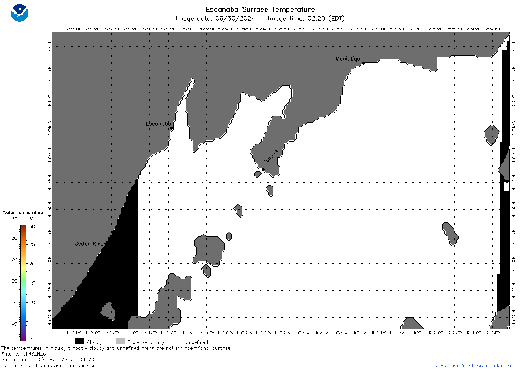 | m12_2024_06_30_0620.png | 02-Jul-2024 15:16 | 39376 | |
 | m12_2024_06_30_0710.png | 02-Jul-2024 15:18 | 84957 | |
 | m12_2024_06_30_0730.png | 02-Jul-2024 15:20 | 38401 | |
 | m12_2024_06_30_0740.png | 02-Jul-2024 15:22 | 80596 | |
 | m12_2024_06_30_0800.png | 02-Jul-2024 15:25 | 100623 | |
 | m12_2024_06_30_0850.png | 02-Jul-2024 15:27 | 106238 | |
 | m12_2024_06_30_0920.png | 02-Jul-2024 15:29 | 37491 | |
 | m12_2024_06_30_0940.png | 02-Jul-2024 15:31 | 35948 | |
 | m12_2024_06_30_1700.png | 02-Jul-2024 15:34 | 38423 | |
 | m12_2024_06_30_1740.png | 02-Jul-2024 15:36 | 37575 | |
 | m12_2024_06_30_1750.png | 02-Jul-2024 15:38 | 99224 | |
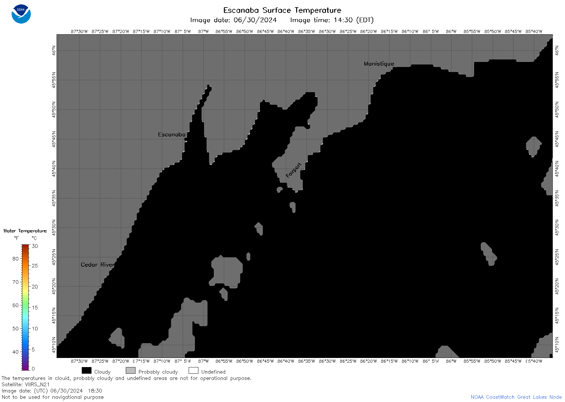 | m12_2024_06_30_1830.png | 02-Jul-2024 15:40 | 35936 | |
 | m12_2024_182.png | 01-Jul-2024 09:18 | 75404 | |