
Easier access to scientific data

Brought to you by NOAA CoastWatch Great Lakes Node
|
ERDDAP
Easier access to scientific data |
|
Brought to you by NOAA CoastWatch Great Lakes Node |
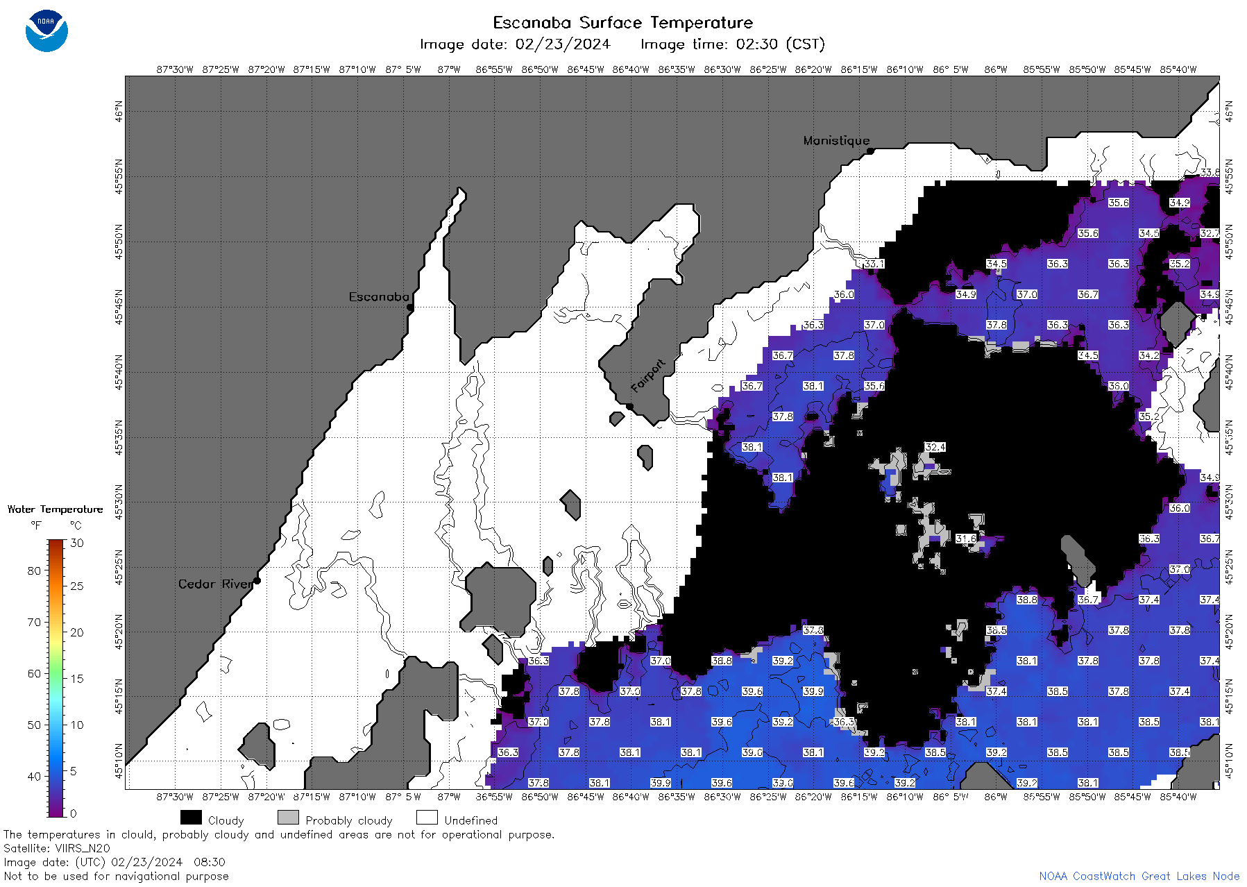
| Dataset Title: | Lake Michigan Escanaba Surface Temperature Contour Map (2022-present)


|
| Institution: | CoastWatch Great Lakes Node (Dataset ID: LM_NRT_TC_m12) |
| Information: | Summary
| License
| Metadata
| Background | Subset
| Data Access Form
| Make a graph
| Subset
| Data Access Form
| Make a graph
|
![[ICO]](https://apps.glerl.noaa.gov/erddap/images/fileIcons/blank.gif) | Name | Last modified | Size | Description |
|---|---|---|---|---|
![[DIR]](https://apps.glerl.noaa.gov/erddap/images/fileIcons/back.gif) | Parent Directory | - | - | |
![[IMG]](https://apps.glerl.noaa.gov/erddap/images/fileIcons/image2.gif)  | m12_2024_02_23_0130.png | 23-Feb-2024 07:29 | 75294 | |
 | m12_2024_02_23_0220.png | 23-Feb-2024 07:31 | 105320 | |
 | m12_2024_02_23_0310.png | 23-Feb-2024 07:33 | 82010 | |
 | m12_2024_02_23_0600.png | 23-Feb-2024 12:28 | 35945 | |
 | m12_2024_02_23_0640.png | 23-Feb-2024 12:30 | 35977 | |
 | m12_2024_02_23_0650.png | 23-Feb-2024 12:32 | 112480 | |
 | m12_2024_02_23_0730.png | 23-Feb-2024 12:34 | 35944 | |
 | m12_2024_02_23_0740.png | 23-Feb-2024 12:37 | 116554 | |
 | m12_2024_02_23_0820.png | 23-Feb-2024 13:27 | 35928 | |
 | m12_2024_02_23_0830.png | 23-Feb-2024 13:29 | 96678 | |
 | m12_2024_02_23_0920.png | 23-Feb-2024 14:27 | 37534 | |
 | m12_2024_054.png | 24-Feb-2024 10:33 | 79327 | |