
Easier access to scientific data

Brought to you by NOAA CoastWatch Great Lakes Node
|
ERDDAP
Easier access to scientific data |
|
Brought to you by NOAA CoastWatch Great Lakes Node |
| Dataset Title: | Lake Huron Southern Region Surface Temperature Contour Map (2022-present)


|
| Institution: | CoastWatch Great Lakes Node (Dataset ID: LH_NRT_TC_h3) |
| Information: | Summary
| License
| Metadata
| Background | Subset
| Data Access Form
| Make a graph
| Subset
| Data Access Form
| Make a graph
|
![[ICO]](https://apps.glerl.noaa.gov/erddap/images/fileIcons/blank.gif) | Name | Last modified | Size | Description |
|---|---|---|---|---|
![[DIR]](https://apps.glerl.noaa.gov/erddap/images/fileIcons/back.gif) | Parent Directory | - | - | |
![[IMG]](https://apps.glerl.noaa.gov/erddap/images/fileIcons/image2.gif)  | h3_2022_11_26_1430.png | 12-Dec-2022 11:15 | 38636 | |
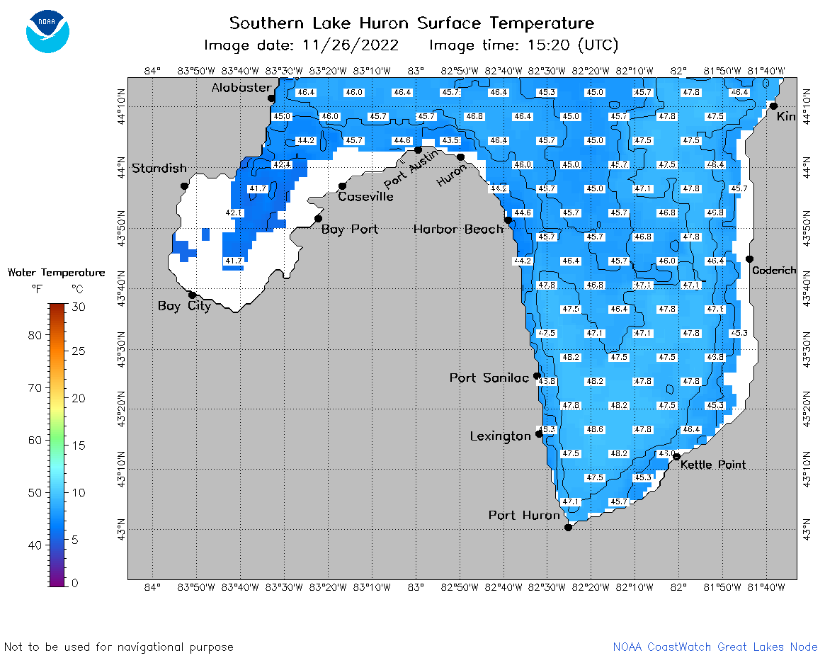 | h3_2022_11_26_1520.png | 13-Dec-2022 08:29 | 43528 | |
 | h3_2022_11_26_1610.png | 13-Dec-2022 08:30 | 43441 | |
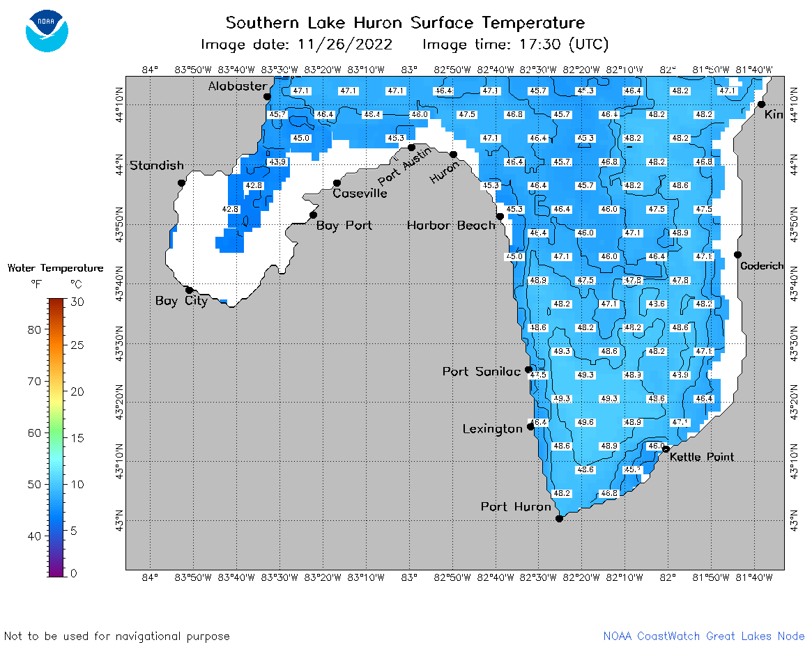 | h3_2022_11_26_1730.png | 12-Dec-2022 11:17 | 43775 | |
 | h3_2022_11_26_1820.png | 12-Dec-2022 11:18 | 42931 | |
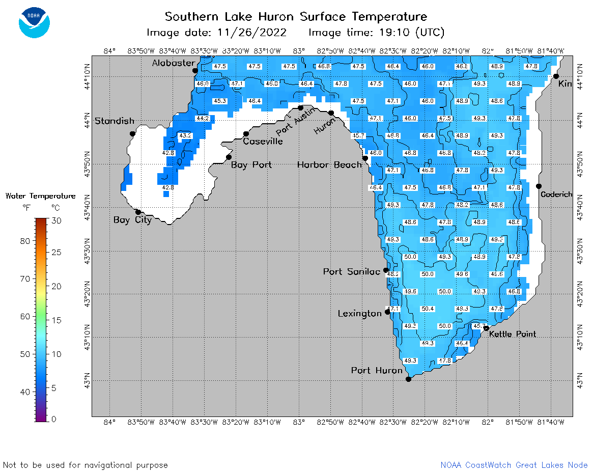 | h3_2022_11_26_1910.png | 12-Dec-2022 11:19 | 44534 | |