
Easier access to scientific data

Brought to you by NOAA CoastWatch Great Lakes Node
|
ERDDAP
Easier access to scientific data |
|
Brought to you by NOAA CoastWatch Great Lakes Node |
| Dataset Title: | Lake Huron Southern Region Surface Temperature Contour Map (2022-present)


|
| Institution: | CoastWatch Great Lakes Node (Dataset ID: LH_NRT_TC_h3) |
| Information: | Summary
| License
| Metadata
| Background | Subset
| Data Access Form
| Make a graph
| Subset
| Data Access Form
| Make a graph
|
![[ICO]](https://apps.glerl.noaa.gov/erddap/images/fileIcons/blank.gif) | Name | Last modified | Size | Description |
|---|---|---|---|---|
![[DIR]](https://apps.glerl.noaa.gov/erddap/images/fileIcons/back.gif) | Parent Directory | - | - | |
![[IMG]](https://apps.glerl.noaa.gov/erddap/images/fileIcons/image2.gif)  | h3_2022_11_02_0120.png | 12-Dec-2022 21:05 | 41831 | |
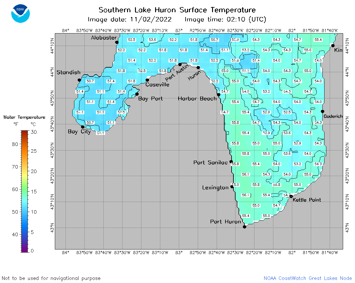 | h3_2022_11_02_0210.png | 12-Dec-2022 21:06 | 44499 | |
 | h3_2022_11_02_0300.png | 12-Dec-2022 21:07 | 42208 | |
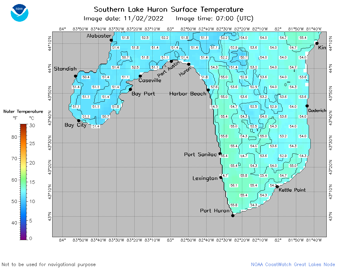 | h3_2022_11_02_0700.png | 12-Dec-2022 21:09 | 44639 | |
 | h3_2022_11_02_0750.png | 12-Dec-2022 21:10 | 45632 | |
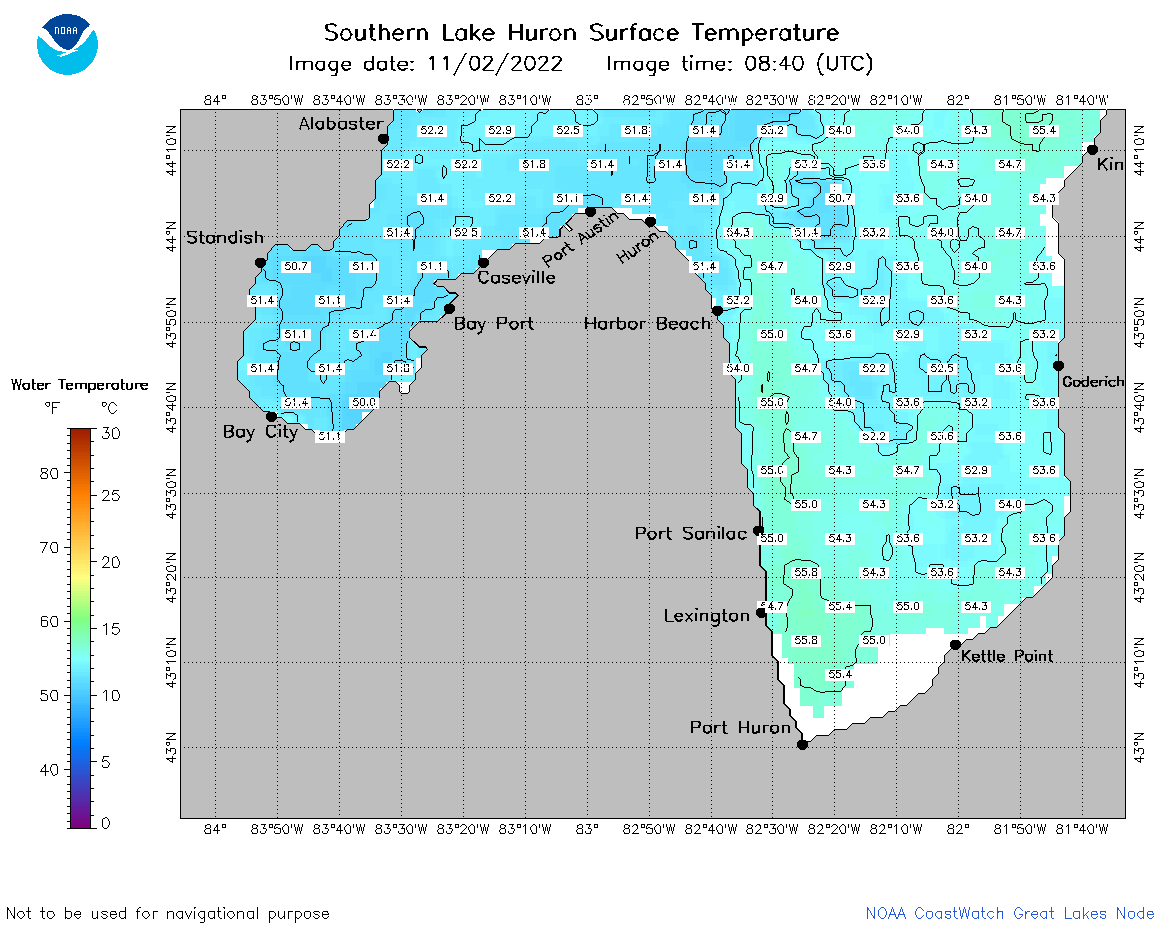 | h3_2022_11_02_0840.png | 12-Dec-2022 21:11 | 44828 | |
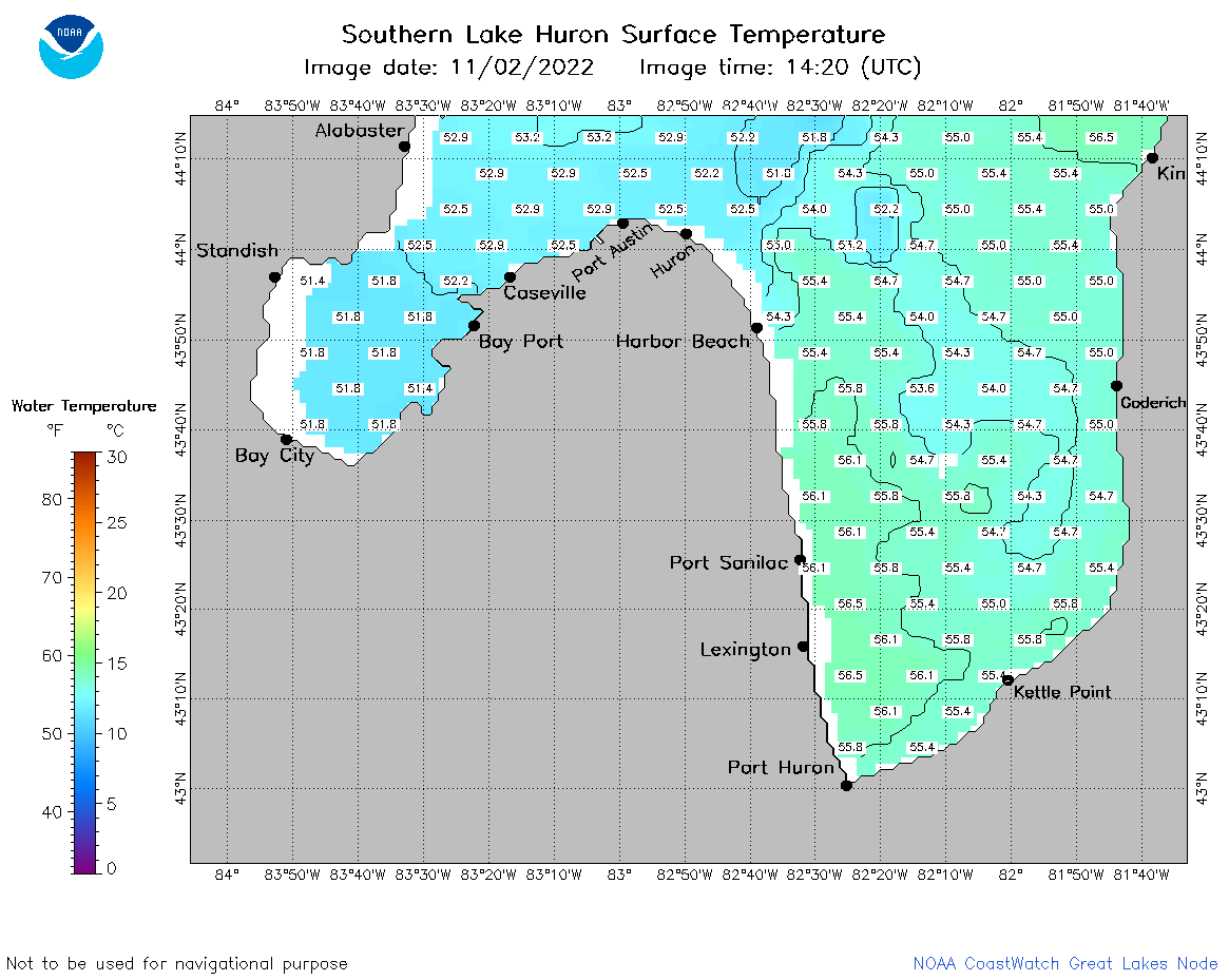 | h3_2022_11_02_1420.png | 12-Dec-2022 21:11 | 39162 | |
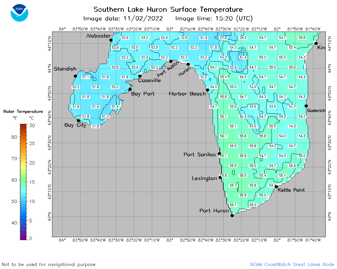 | h3_2022_11_02_1520.png | 12-Dec-2022 21:13 | 42841 | |
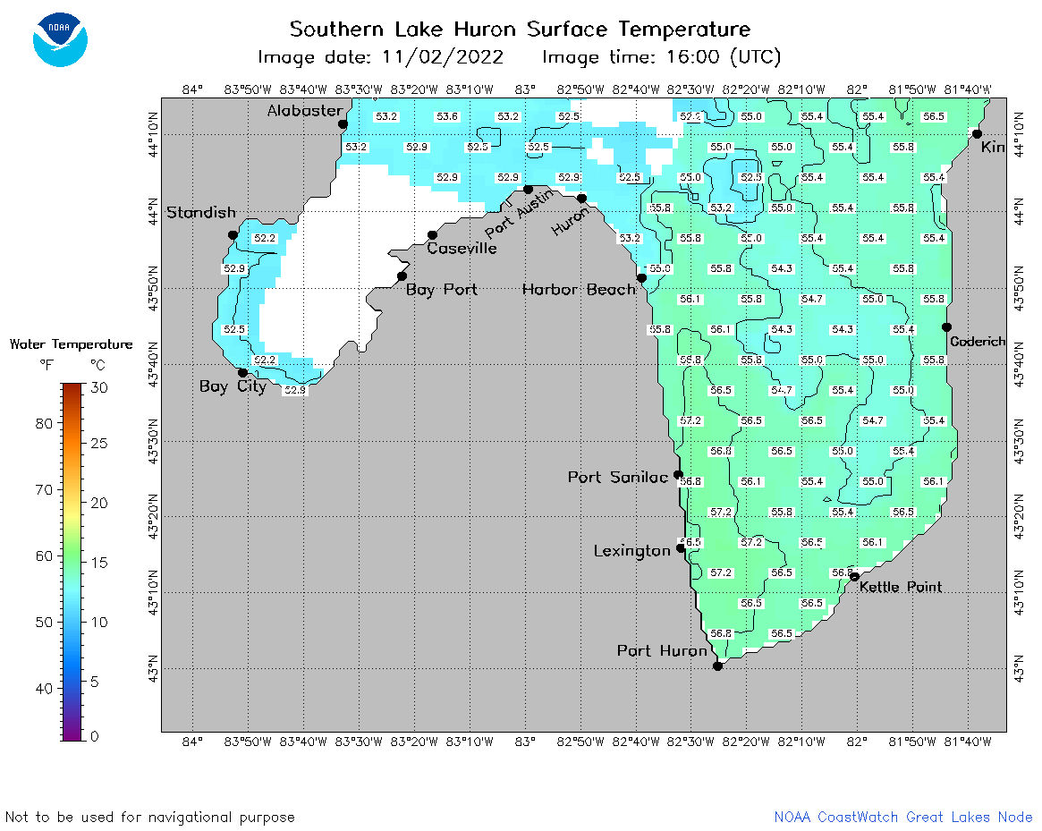 | h3_2022_11_02_1600.png | 12-Dec-2022 21:14 | 40710 | |
 | h3_2022_11_02_1730.png | 12-Dec-2022 21:15 | 42956 | |
 | h3_2022_11_02_1820.png | 12-Dec-2022 21:16 | 44515 | |
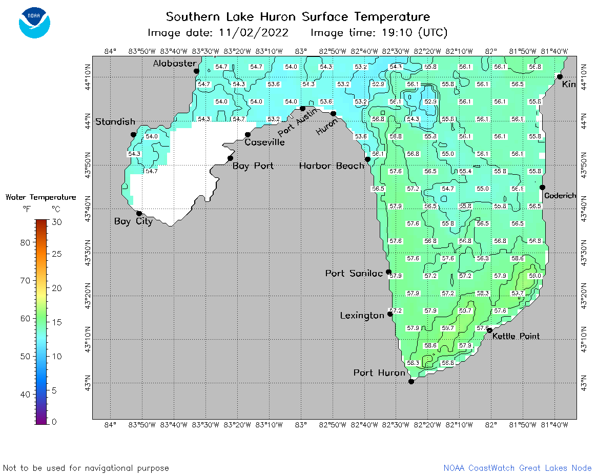 | h3_2022_11_02_1910.png | 12-Dec-2022 21:17 | 44796 | |