
Easier access to scientific data

Brought to you by NOAA CoastWatch Great Lakes Node
|
ERDDAP
Easier access to scientific data |
|
Brought to you by NOAA CoastWatch Great Lakes Node |
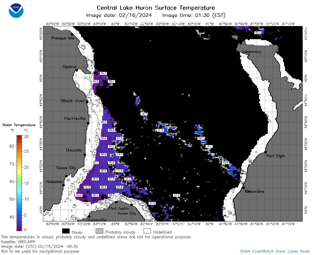
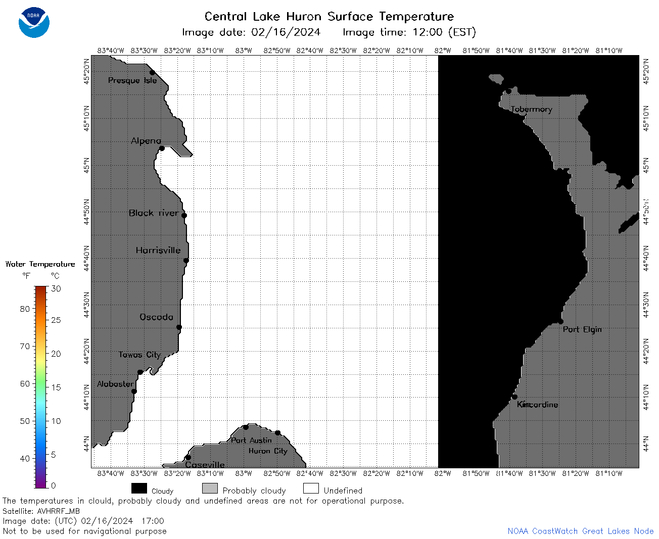
| Dataset Title: | Lake Huron Central Region Surface Temperature Contour Map (2022-present)


|
| Institution: | CoastWatch Great Lakes Node (Dataset ID: LH_NRT_TC_h2) |
| Information: | Summary
| License
| Metadata
| Background | Subset
| Data Access Form
| Make a graph
| Subset
| Data Access Form
| Make a graph
|
![[ICO]](https://apps.glerl.noaa.gov/erddap/images/fileIcons/blank.gif) | Name | Last modified | Size | Description |
|---|---|---|---|---|
![[DIR]](https://apps.glerl.noaa.gov/erddap/images/fileIcons/back.gif) | Parent Directory | - | - | |
![[IMG]](https://apps.glerl.noaa.gov/erddap/images/fileIcons/image2.gif) 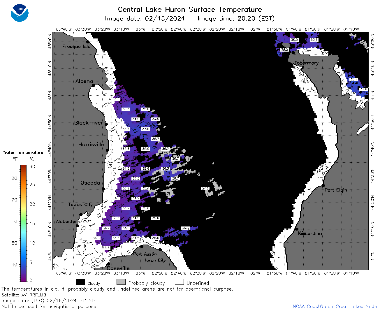 | h2_2024_02_16_0120.png | 16-Feb-2024 09:26 | 58592 | |
 | h2_2024_02_16_0210.png | 16-Feb-2024 09:28 | 75195 | |
 | h2_2024_02_16_0220.png | 16-Feb-2024 09:30 | 27766 | |
 | h2_2024_02_16_0300.png | 16-Feb-2024 09:32 | 55065 | |
 | h2_2024_02_16_0350.png | 16-Feb-2024 09:35 | 27774 | |
 | h2_2024_02_16_0630.png | 16-Feb-2024 10:26 | 58231 | |
 | h2_2024_02_16_0720.png | 16-Feb-2024 10:28 | 66344 | |
 | h2_2024_02_16_0810.png | 16-Feb-2024 12:26 | 57993 | |
 | h2_2024_02_16_0900.png | 16-Feb-2024 12:28 | 32896 | |
 | h2_2024_02_16_0950.png | 16-Feb-2024 14:26 | 27779 | |
 | h2_2024_02_16_1430.png | 16-Feb-2024 18:26 | 32585 | |
 | h2_2024_02_16_1520.png | 16-Feb-2024 18:28 | 32749 | |
 | h2_2024_02_16_1610.png | 16-Feb-2024 20:26 | 32948 | |
 | h2_2024_02_16_1700.png | 16-Feb-2024 20:28 | 32903 | |
 | h2_2024_047.png | 17-Feb-2024 10:14 | 67354 | |