
Easier access to scientific data

Brought to you by NOAA CoastWatch Great Lakes Node
|
ERDDAP
Easier access to scientific data |
|
Brought to you by NOAA CoastWatch Great Lakes Node |
| Dataset Title: | Lake Huron Central Region Surface Temperature Contour Map (2022-present)


|
| Institution: | CoastWatch Great Lakes Node (Dataset ID: LH_NRT_TC_h2) |
| Information: | Summary
| License
| Metadata
| Background | Subset
| Data Access Form
| Make a graph
| Subset
| Data Access Form
| Make a graph
|
![[ICO]](https://apps.glerl.noaa.gov/erddap/images/fileIcons/blank.gif) | Name | Last modified | Size | Description |
|---|---|---|---|---|
![[DIR]](https://apps.glerl.noaa.gov/erddap/images/fileIcons/back.gif) | Parent Directory | - | - | |
![[IMG]](https://apps.glerl.noaa.gov/erddap/images/fileIcons/image2.gif)  | h2_2024_02_06_0130.png | 06-Feb-2024 06:26 | 39960 | |
 | h2_2024_02_06_0220.png | 06-Feb-2024 06:28 | 41445 | |
 | h2_2024_02_06_0310.png | 06-Feb-2024 06:30 | 40033 | |
 | h2_2024_02_06_0610.png | 06-Feb-2024 10:26 | 51767 | |
 | h2_2024_02_06_0620.png | 06-Feb-2024 10:28 | 27767 | |
 | h2_2024_02_06_0750.png | 06-Feb-2024 11:26 | 41032 | |
 | h2_2024_02_06_0800.png | 06-Feb-2024 11:28 | 52309 | |
 | h2_2024_02_06_1430.png | 06-Feb-2024 18:26 | 27782 | |
 | h2_2024_02_06_1440.png | 06-Feb-2024 19:26 | 36506 | |
 | h2_2024_02_06_1520.png | 06-Feb-2024 19:28 | 46172 | |
 | h2_2024_02_06_1530.png | 06-Feb-2024 19:30 | 27804 | |
 | h2_2024_02_06_1610.png | 06-Feb-2024 20:25 | 32015 | |
 | h2_2024_02_06_1620.png | 06-Feb-2024 20:28 | 45231 | |
 | h2_2024_02_06_1700.png | 06-Feb-2024 20:30 | 32909 | |
 | h2_2024_02_06_1740.png | 06-Feb-2024 20:32 | 61833 | |
 | h2_2024_02_06_1920.png | 07-Feb-2024 00:26 | 63779 | |
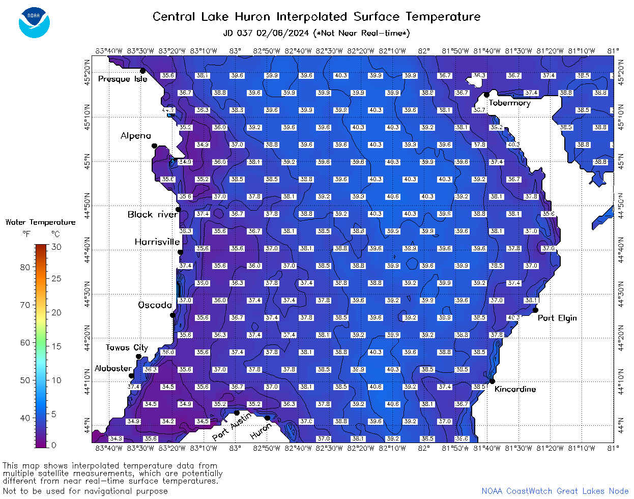 | h2_2024_037.png | 07-Feb-2024 10:14 | 70630 | |