
Easier access to scientific data

Brought to you by NOAA CoastWatch Great Lakes Node
|
ERDDAP
Easier access to scientific data |
|
Brought to you by NOAA CoastWatch Great Lakes Node |
| Dataset Title: | Lake Huron Central Region Surface Temperature Contour Map (2022-present)


|
| Institution: | CoastWatch Great Lakes Node (Dataset ID: LH_NRT_TC_h2) |
| Information: | Summary
| License
| Metadata
| Background | Subset
| Data Access Form
| Make a graph
| Subset
| Data Access Form
| Make a graph
|
![[ICO]](https://apps.glerl.noaa.gov/erddap/images/fileIcons/blank.gif) | Name | Last modified | Size | Description |
|---|---|---|---|---|
![[DIR]](https://apps.glerl.noaa.gov/erddap/images/fileIcons/back.gif) | Parent Directory | - | - | |
![[IMG]](https://apps.glerl.noaa.gov/erddap/images/fileIcons/image2.gif)  | h2_2024_01_27_0130.png | 27-Jan-2024 09:26 | 33935 | |
 | h2_2024_01_27_0140.png | 27-Jan-2024 09:28 | 32357 | |
 | h2_2024_01_27_0230.png | 27-Jan-2024 09:30 | 33444 | |
 | h2_2024_01_27_0310.png | 27-Jan-2024 09:32 | 33323 | |
 | h2_2024_01_27_0320.png | 27-Jan-2024 09:35 | 32080 | |
 | h2_2024_01_27_0600.png | 27-Jan-2024 10:26 | 32292 | |
 | h2_2024_01_27_0650.png | 27-Jan-2024 10:28 | 34138 | |
 | h2_2024_01_27_0740.png | 27-Jan-2024 12:26 | 33281 | |
 | h2_2024_01_27_0830.png | 27-Jan-2024 11:26 | 33407 | |
 | h2_2024_01_27_0920.png | 27-Jan-2024 13:26 | 27757 | |
 | h2_2024_01_27_1440.png | 27-Jan-2024 18:26 | 35184 | |
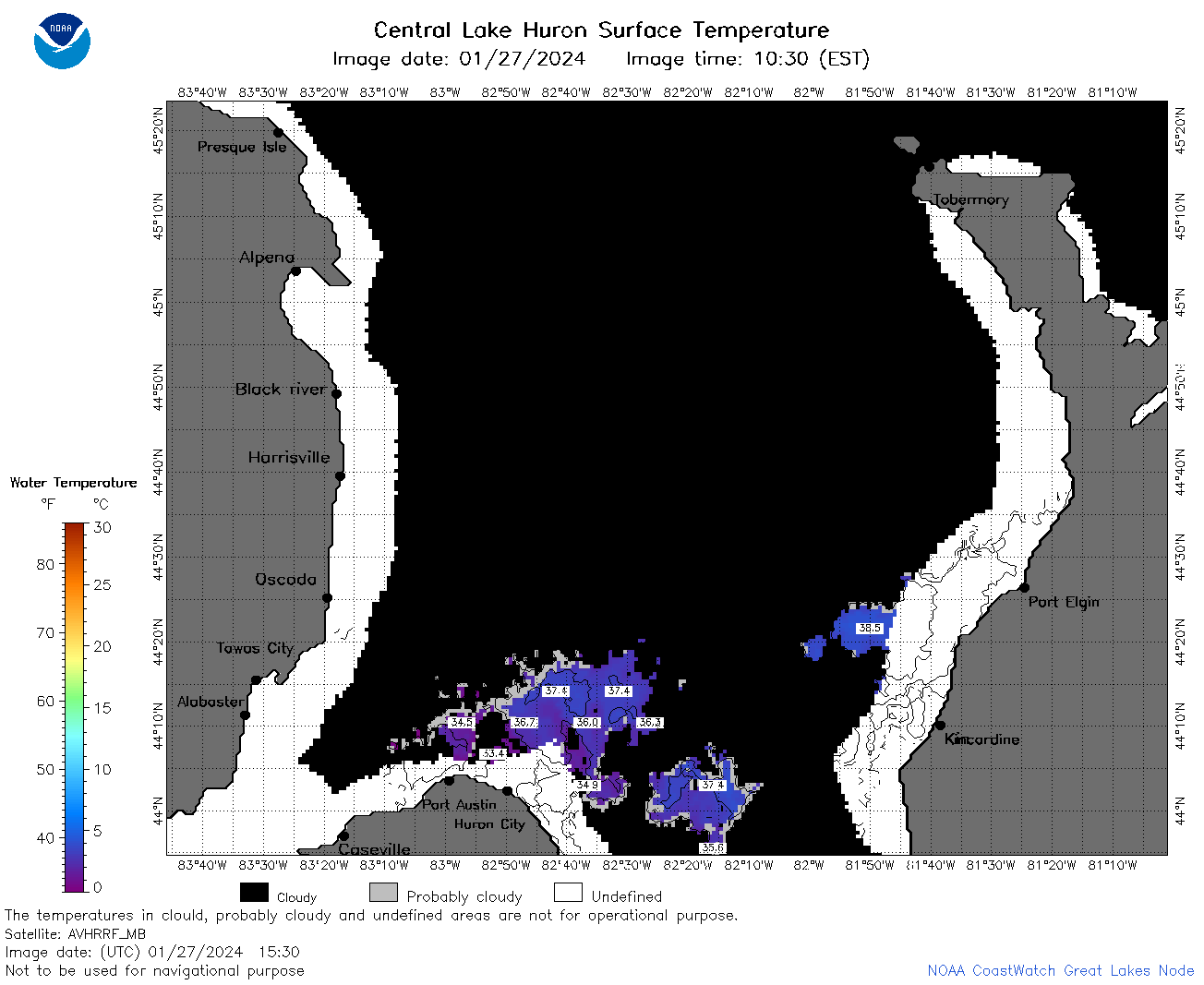 | h2_2024_01_27_1530.png | 27-Jan-2024 18:28 | 43453 | |
 | h2_2024_01_27_1620.png | 27-Jan-2024 20:26 | 50512 | |
 | h2_2024_01_27_1710.png | 27-Jan-2024 20:28 | 27751 | |
 | h2_2024_01_27_1730.png | 27-Jan-2024 20:30 | 67524 | |
 | h2_2024_01_27_1820.png | 27-Jan-2024 20:33 | 75294 | |
 | h2_2024_01_27_1910.png | 27-Jan-2024 23:26 | 41574 | |
 | h2_2024_027.png | 28-Jan-2024 10:14 | 75965 | |