
Easier access to scientific data

Brought to you by NOAA CoastWatch Great Lakes Node
|
ERDDAP
Easier access to scientific data |
|
Brought to you by NOAA CoastWatch Great Lakes Node |
| Dataset Title: | Lake Huron Central Region Surface Temperature Contour Map (2022-present)


|
| Institution: | CoastWatch Great Lakes Node (Dataset ID: LH_NRT_TC_h2) |
| Information: | Summary
| License
| Metadata
| Background | Subset
| Data Access Form
| Make a graph
| Subset
| Data Access Form
| Make a graph
|
![[ICO]](https://apps.glerl.noaa.gov/erddap/images/fileIcons/blank.gif) | Name | Last modified | Size | Description |
|---|---|---|---|---|
![[DIR]](https://apps.glerl.noaa.gov/erddap/images/fileIcons/back.gif) | Parent Directory | - | - | |
![[IMG]](https://apps.glerl.noaa.gov/erddap/images/fileIcons/image2.gif)  | h2_2024_009.png | 10-Jan-2024 10:14 | 69157 | |
 | h2_2024_01_09_0110.png | 09-Jan-2024 06:26 | 32387 | |
 | h2_2024_01_09_0200.png | 09-Jan-2024 06:28 | 32255 | |
 | h2_2024_01_09_0250.png | 09-Jan-2024 06:30 | 32076 | |
 | h2_2024_01_09_0340.png | 09-Jan-2024 06:32 | 32905 | |
 | h2_2024_01_09_0640.png | 09-Jan-2024 11:26 | 32175 | |
 | h2_2024_01_09_0730.png | 09-Jan-2024 10:26 | 32164 | |
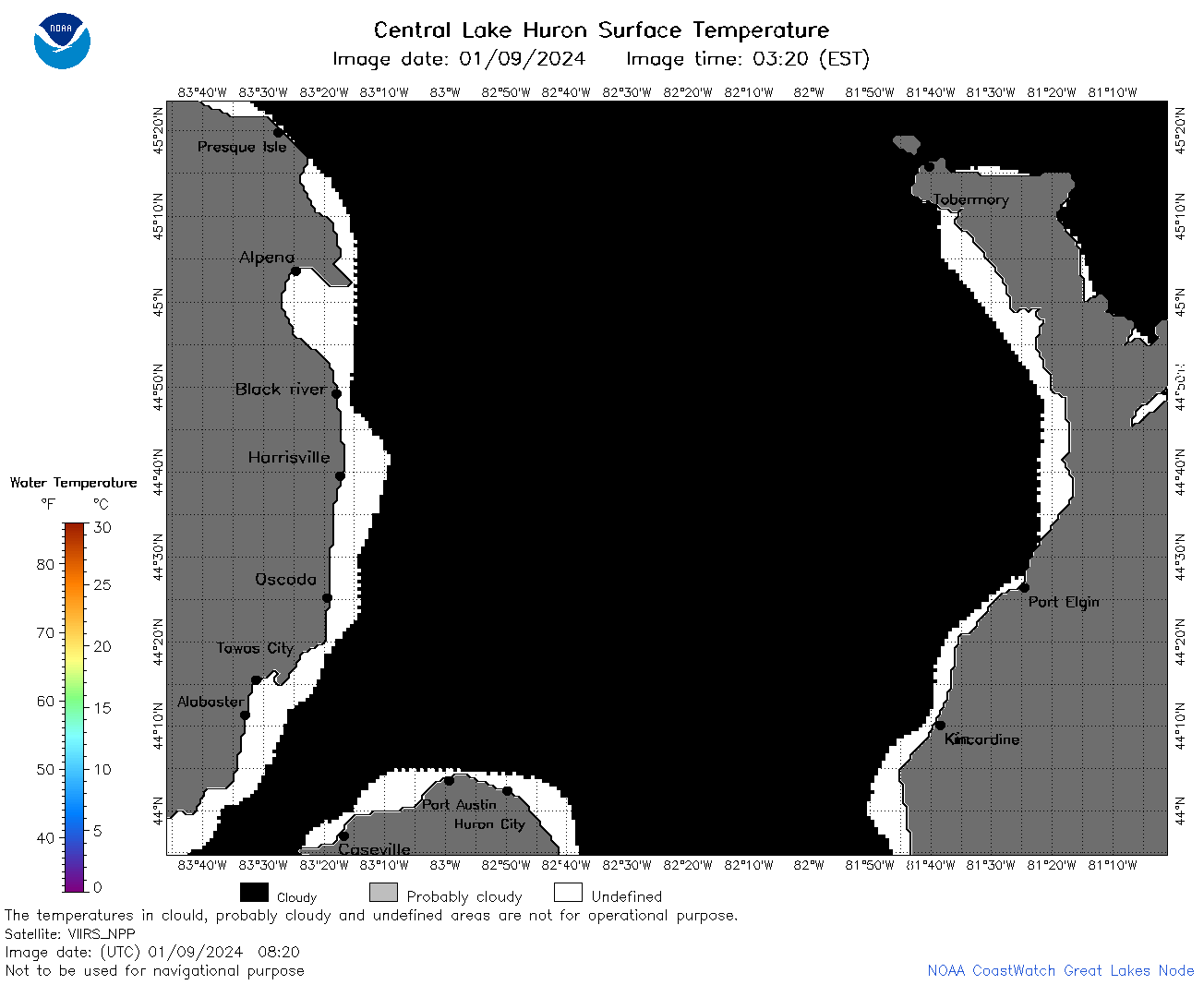 | h2_2024_01_09_0820.png | 09-Jan-2024 12:26 | 32214 | |
 | h2_2024_01_09_0910.png | 09-Jan-2024 12:28 | 32882 | |
 | h2_2024_01_09_1410.png | 10-Jan-2024 00:26 | 31989 | |
 | h2_2024_01_09_1420.png | 10-Jan-2024 00:28 | 34418 | |
 | h2_2024_01_09_1500.png | 10-Jan-2024 00:30 | 32188 | |
 | h2_2024_01_09_1550.png | 10-Jan-2024 00:32 | 31846 | |
 | h2_2024_01_09_1600.png | 10-Jan-2024 00:35 | 32283 | |
 | h2_2024_01_09_1640.png | 10-Jan-2024 00:37 | 34520 | |