
Easier access to scientific data

Brought to you by NOAA CoastWatch Great Lakes Node
|
ERDDAP
Easier access to scientific data |
|
Brought to you by NOAA CoastWatch Great Lakes Node |
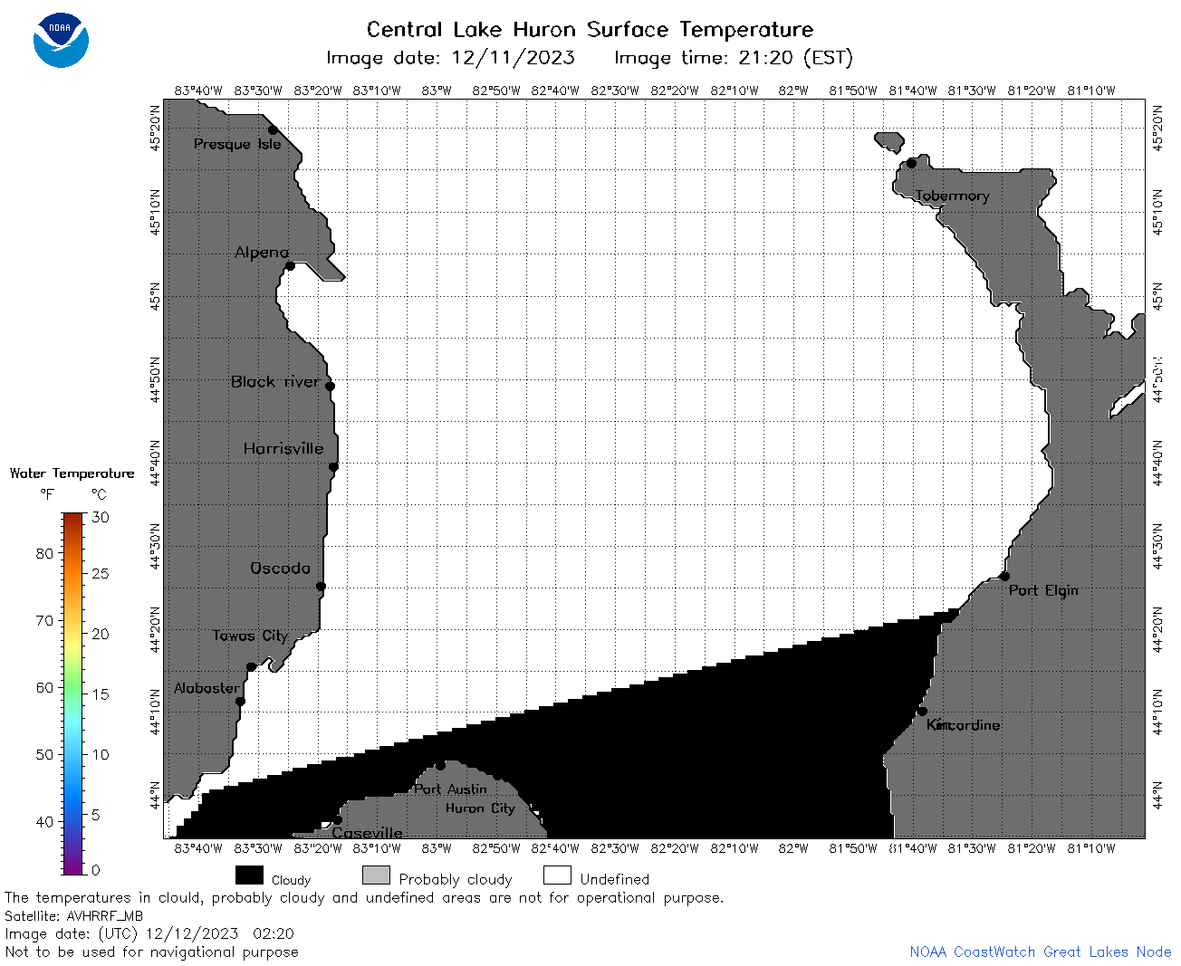
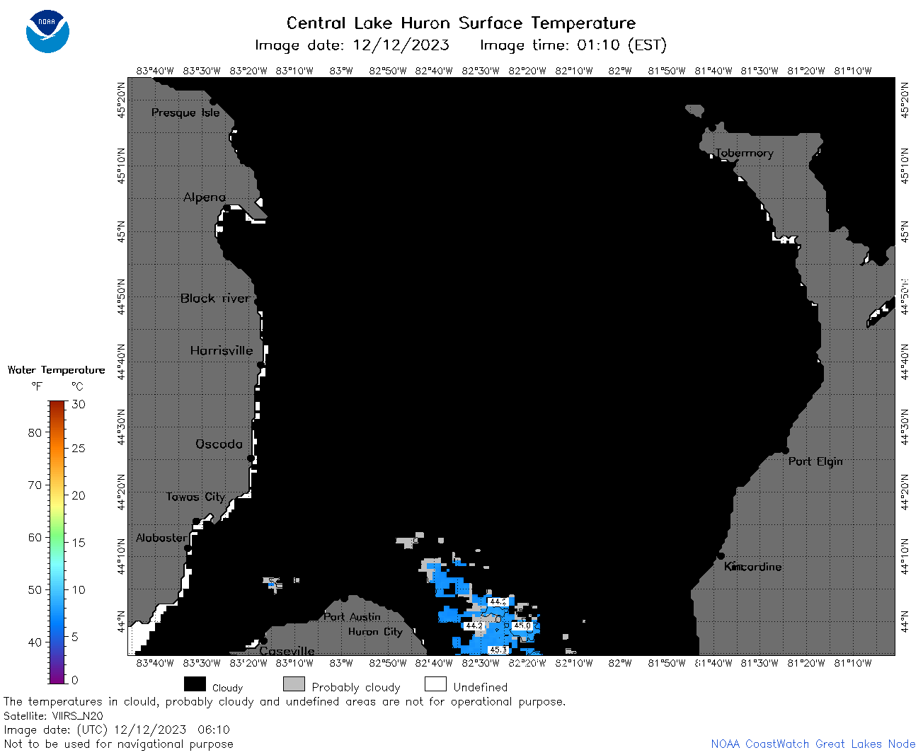
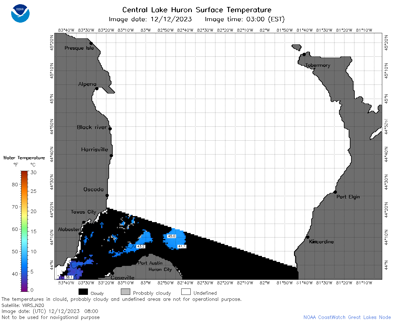
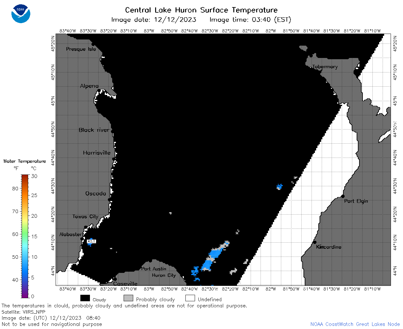
| Dataset Title: | Lake Huron Central Region Surface Temperature Contour Map (2022-present)


|
| Institution: | CoastWatch Great Lakes Node (Dataset ID: LH_NRT_TC_h2) |
| Information: | Summary
| License
| Metadata
| Background | Subset
| Data Access Form
| Make a graph
| Subset
| Data Access Form
| Make a graph
|
![[ICO]](https://apps.glerl.noaa.gov/erddap/images/fileIcons/blank.gif) | Name | Last modified | Size | Description |
|---|---|---|---|---|
![[DIR]](https://apps.glerl.noaa.gov/erddap/images/fileIcons/back.gif) | Parent Directory | - | - | |
![[IMG]](https://apps.glerl.noaa.gov/erddap/images/fileIcons/image2.gif)  | h2_2023_12_12_0140.png | 12-Dec-2023 06:26 | 29389 | |
 | h2_2023_12_12_0220.png | 12-Dec-2023 06:28 | 31852 | |
 | h2_2023_12_12_0230.png | 12-Dec-2023 06:30 | 35007 | |
 | h2_2023_12_12_0320.png | 12-Dec-2023 06:32 | 29069 | |
 | h2_2023_12_12_0610.png | 12-Dec-2023 09:25 | 31769 | |
 | h2_2023_12_12_0620.png | 12-Dec-2023 09:27 | 27755 | |
 | h2_2023_12_12_0700.png | 12-Dec-2023 10:26 | 29550 | |
 | h2_2023_12_12_0710.png | 12-Dec-2023 11:26 | 31843 | |
 | h2_2023_12_12_0750.png | 12-Dec-2023 11:28 | 32519 | |
 | h2_2023_12_12_0800.png | 12-Dec-2023 10:28 | 36859 | |
 | h2_2023_12_12_0840.png | 12-Dec-2023 13:26 | 33258 | |
 | h2_2023_12_12_0850.png | 12-Dec-2023 12:26 | 33155 | |
 | h2_2023_12_12_1440.png | 12-Dec-2023 18:26 | 38764 | |
 | h2_2023_12_12_1530.png | 12-Dec-2023 19:26 | 41121 | |
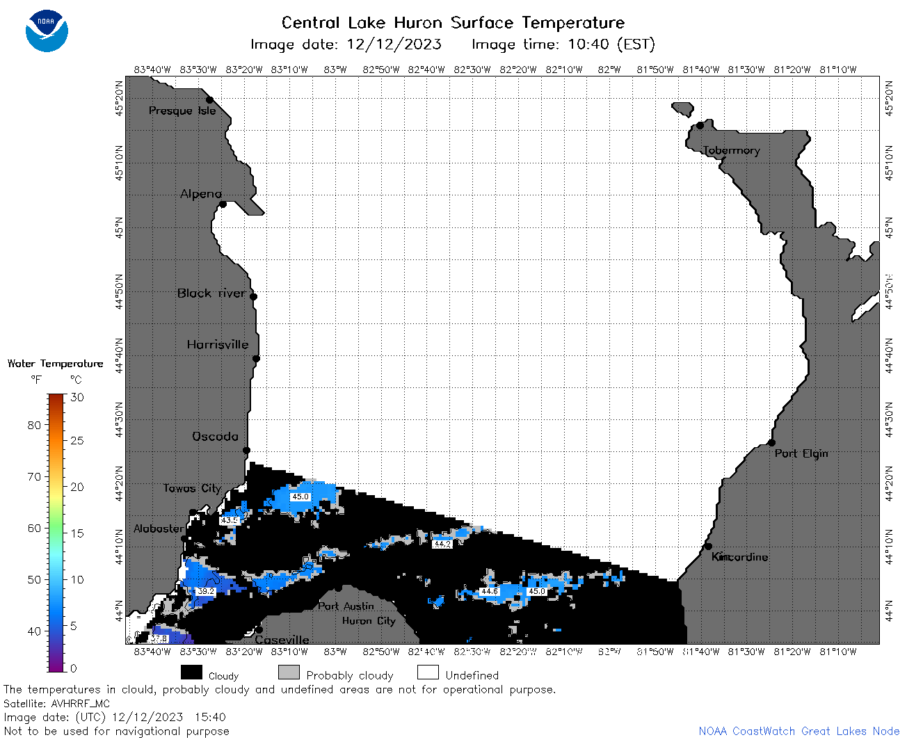 | h2_2023_12_12_1540.png | 12-Dec-2023 19:28 | 38532 | |
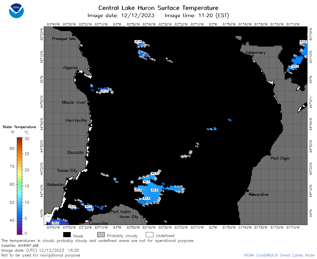 | h2_2023_12_12_1620.png | 12-Dec-2023 19:30 | 34177 | |
 | h2_2023_12_12_1720.png | 12-Dec-2023 23:25 | 27735 | |