
Easier access to scientific data

Brought to you by NOAA CoastWatch Great Lakes Node
|
ERDDAP
Easier access to scientific data |
|
Brought to you by NOAA CoastWatch Great Lakes Node |
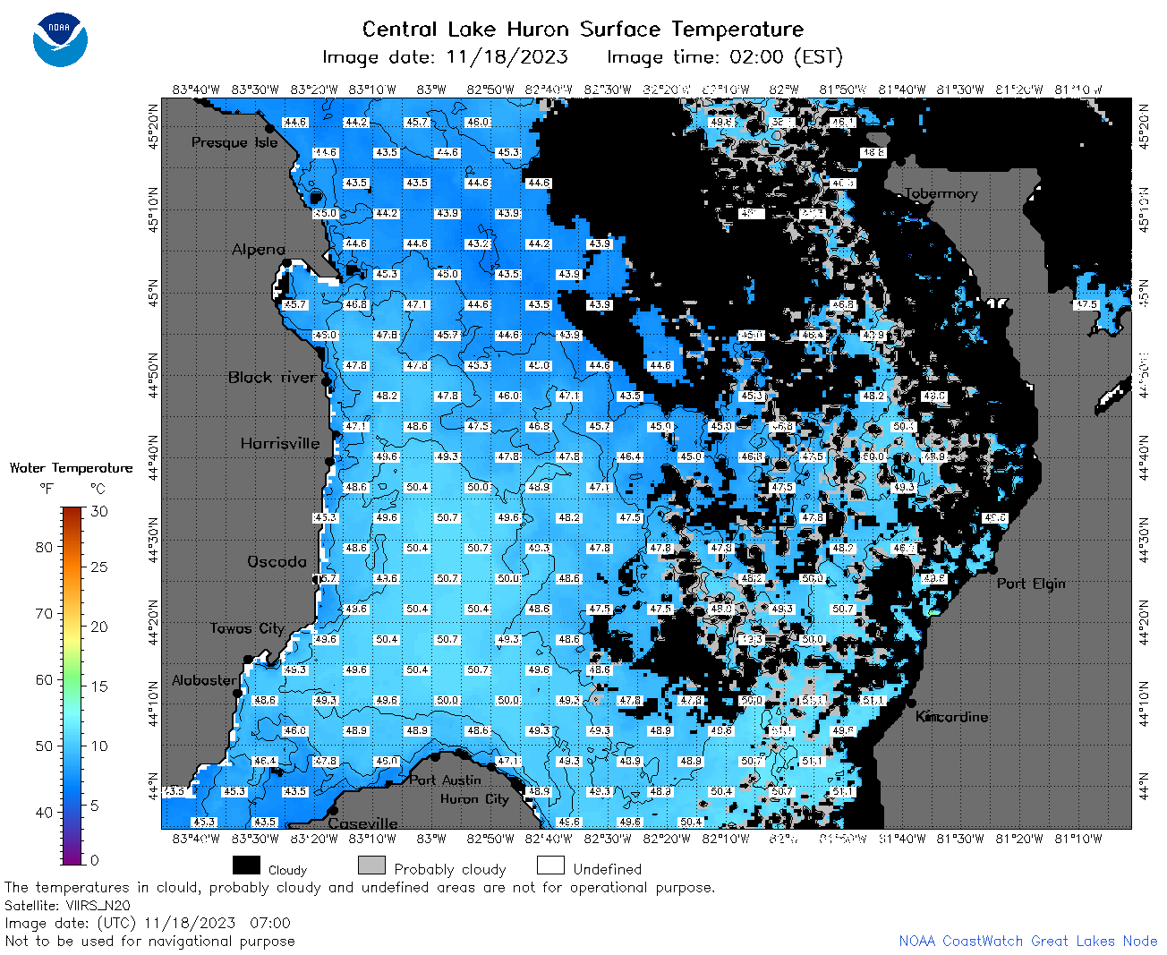
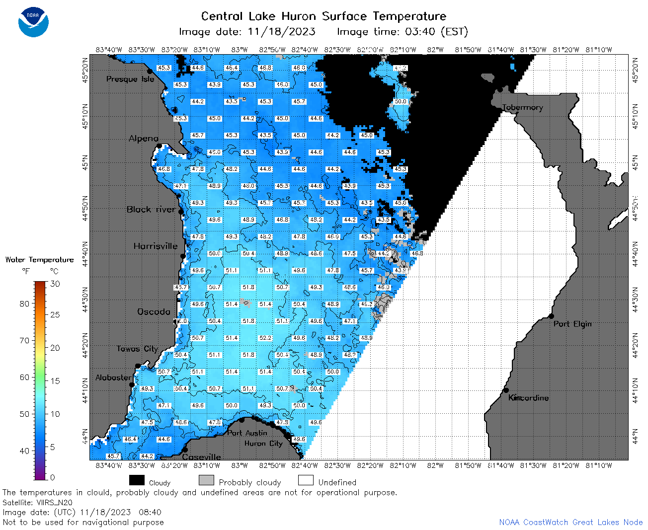
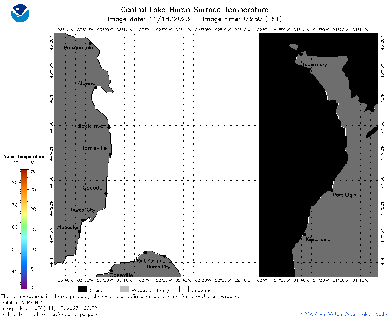
| Dataset Title: | Lake Huron Central Region Surface Temperature Contour Map (2022-present)


|
| Institution: | CoastWatch Great Lakes Node (Dataset ID: LH_NRT_TC_h2) |
| Information: | Summary
| License
| Metadata
| Background | Subset
| Data Access Form
| Make a graph
| Subset
| Data Access Form
| Make a graph
|
![[ICO]](https://apps.glerl.noaa.gov/erddap/images/fileIcons/blank.gif) | Name | Last modified | Size | Description |
|---|---|---|---|---|
![[DIR]](https://apps.glerl.noaa.gov/erddap/images/fileIcons/back.gif) | Parent Directory | - | - | |
![[IMG]](https://apps.glerl.noaa.gov/erddap/images/fileIcons/image2.gif)  | h2_2023_11_18_0130.png | 18-Nov-2023 06:26 | 27794 | |
 | h2_2023_11_18_0140.png | 18-Nov-2023 06:28 | 41091 | |
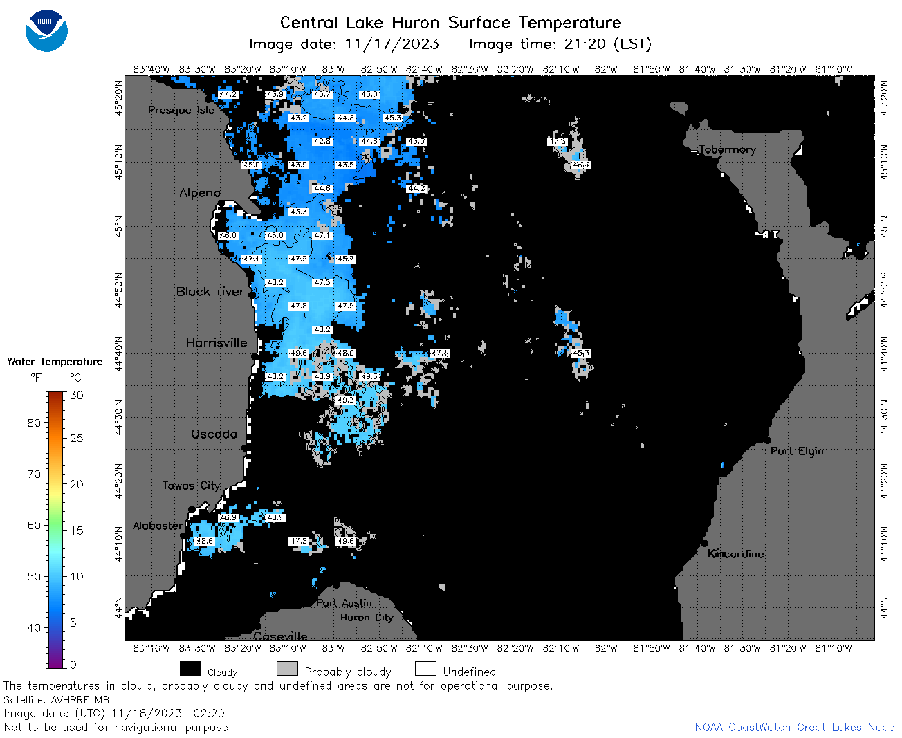 | h2_2023_11_18_0220.png | 18-Nov-2023 06:30 | 55188 | |
 | h2_2023_11_18_0310.png | 18-Nov-2023 06:32 | 27758 | |
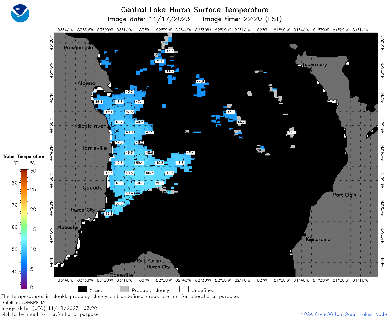 | h2_2023_11_18_0320.png | 18-Nov-2023 06:35 | 40489 | |
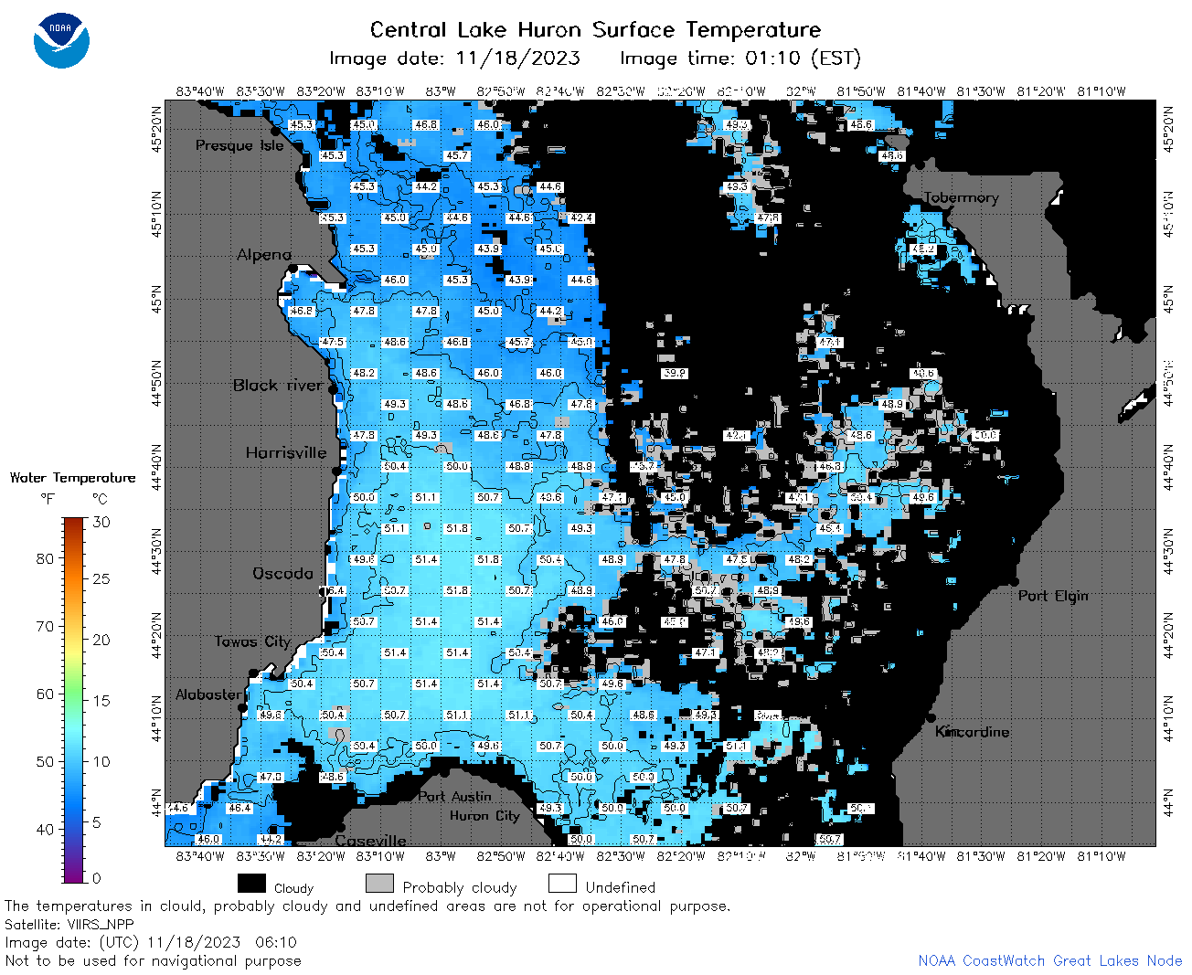 | h2_2023_11_18_0610.png | 18-Nov-2023 10:26 | 91644 | |
 | h2_2023_11_18_0620.png | 18-Nov-2023 10:28 | 27754 | |
 | h2_2023_11_18_0700.png | 18-Nov-2023 10:30 | 107654 | |
 | h2_2023_11_18_0710.png | 18-Nov-2023 10:33 | 32876 | |
 | h2_2023_11_18_0750.png | 18-Nov-2023 11:26 | 34342 | |
 | h2_2023_11_18_0800.png | 18-Nov-2023 12:26 | 106176 | |
 | h2_2023_11_18_0840.png | 18-Nov-2023 12:28 | 90210 | |
 | h2_2023_11_18_0850.png | 18-Nov-2023 11:28 | 32899 | |
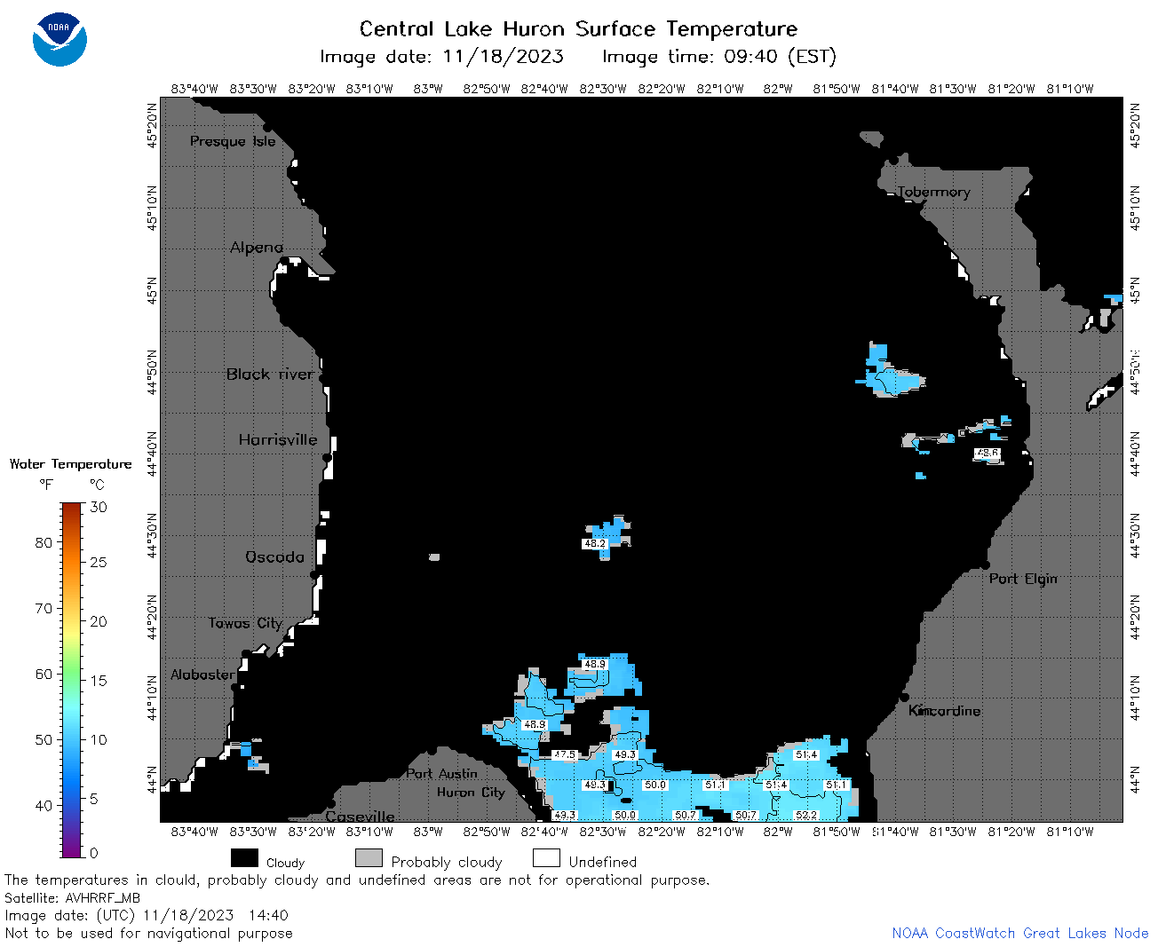 | h2_2023_11_18_1440.png | 18-Nov-2023 18:26 | 35652 | |
 | h2_2023_322.png | 19-Nov-2023 10:14 | 66287 | |