
Easier access to scientific data

Brought to you by NOAA CoastWatch Great Lakes Node
|
ERDDAP
Easier access to scientific data |
|
Brought to you by NOAA CoastWatch Great Lakes Node |
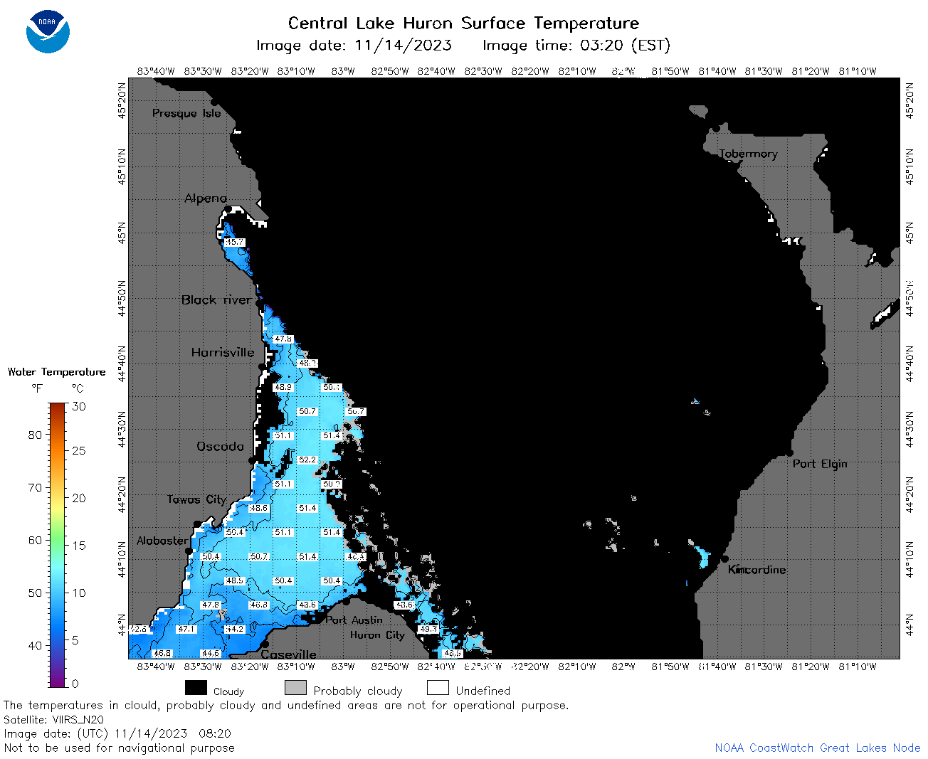
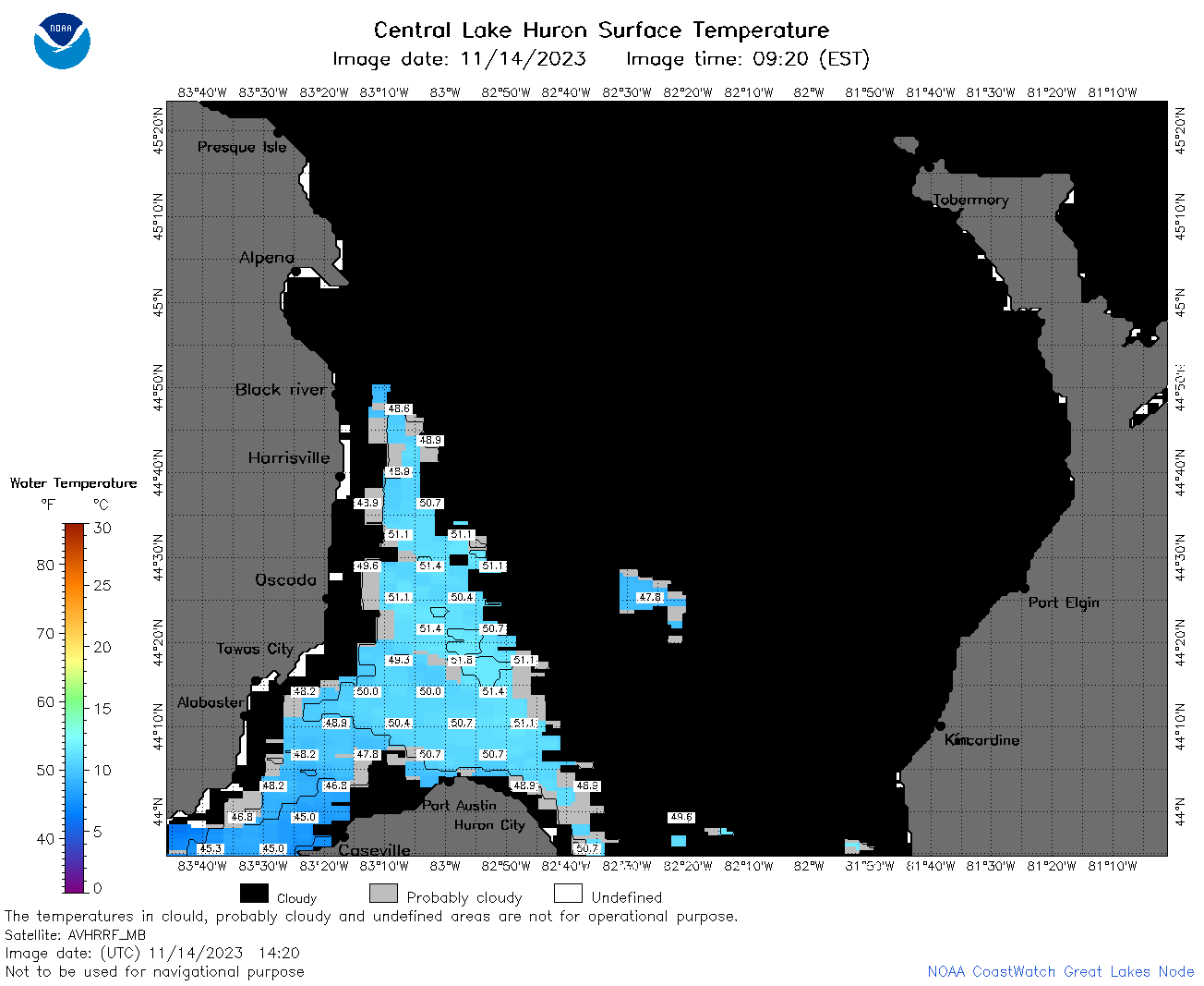
| Dataset Title: | Lake Huron Central Region Surface Temperature Contour Map (2022-present)


|
| Institution: | CoastWatch Great Lakes Node (Dataset ID: LH_NRT_TC_h2) |
| Information: | Summary
| License
| Metadata
| Background | Subset
| Data Access Form
| Make a graph
| Subset
| Data Access Form
| Make a graph
|
![[ICO]](https://apps.glerl.noaa.gov/erddap/images/fileIcons/blank.gif) | Name | Last modified | Size | Description |
|---|---|---|---|---|
![[DIR]](https://apps.glerl.noaa.gov/erddap/images/fileIcons/back.gif) | Parent Directory | - | - | |
![[IMG]](https://apps.glerl.noaa.gov/erddap/images/fileIcons/image2.gif) 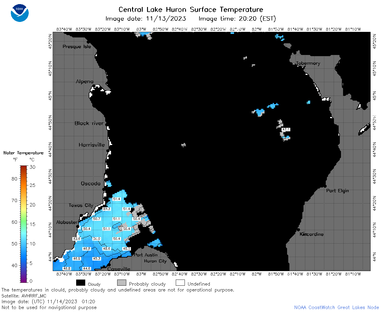 | h2_2023_11_14_0120.png | 14-Nov-2023 06:26 | 39623 | |
 | h2_2023_11_14_0200.png | 14-Nov-2023 06:28 | 44052 | |
 | h2_2023_11_14_0210.png | 14-Nov-2023 06:30 | 39389 | |
 | h2_2023_11_14_0300.png | 14-Nov-2023 06:32 | 43237 | |
 | h2_2023_11_14_0340.png | 14-Nov-2023 06:34 | 27777 | |
 | h2_2023_11_14_0350.png | 14-Nov-2023 06:36 | 32887 | |
 | h2_2023_11_14_0640.png | 14-Nov-2023 13:26 | 47350 | |
 | h2_2023_11_14_0730.png | 14-Nov-2023 13:28 | 48366 | |
 | h2_2023_11_14_0820.png | 14-Nov-2023 13:30 | 49136 | |
 | h2_2023_11_14_0910.png | 14-Nov-2023 13:32 | 32878 | |
 | h2_2023_11_14_1420.png | 14-Nov-2023 17:25 | 38431 | |
 | h2_2023_11_14_1510.png | 14-Nov-2023 19:26 | 58675 | |
 | h2_2023_11_14_1520.png | 14-Nov-2023 19:28 | 27759 | |
 | h2_2023_11_14_1600.png | 14-Nov-2023 19:30 | 67760 | |
 | h2_2023_318.png | 15-Nov-2023 10:14 | 67931 | |