
Easier access to scientific data

Brought to you by NOAA CoastWatch Great Lakes Node
|
ERDDAP
Easier access to scientific data |
|
Brought to you by NOAA CoastWatch Great Lakes Node |
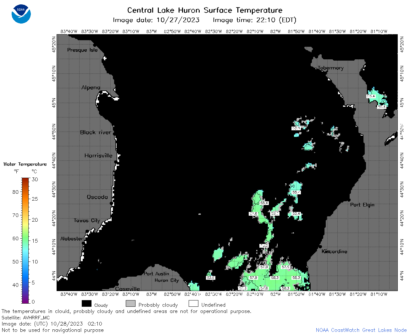
| Dataset Title: | Lake Huron Central Region Surface Temperature Contour Map (2022-present)


|
| Institution: | CoastWatch Great Lakes Node (Dataset ID: LH_NRT_TC_h2) |
| Information: | Summary
| License
| Metadata
| Background | Subset
| Data Access Form
| Make a graph
| Subset
| Data Access Form
| Make a graph
|
![[ICO]](https://apps.glerl.noaa.gov/erddap/images/fileIcons/blank.gif) | Name | Last modified | Size | Description |
|---|---|---|---|---|
![[DIR]](https://apps.glerl.noaa.gov/erddap/images/fileIcons/back.gif) | Parent Directory | - | - | |
![[IMG]](https://apps.glerl.noaa.gov/erddap/images/fileIcons/image2.gif)  | h2_2023_10_28_0120.png | 28-Oct-2023 05:25 | 34470 | |
 | h2_2023_10_28_0210.png | 28-Oct-2023 07:26 | 41506 | |
 | h2_2023_10_28_0610.png | 28-Oct-2023 13:25 | 40465 | |
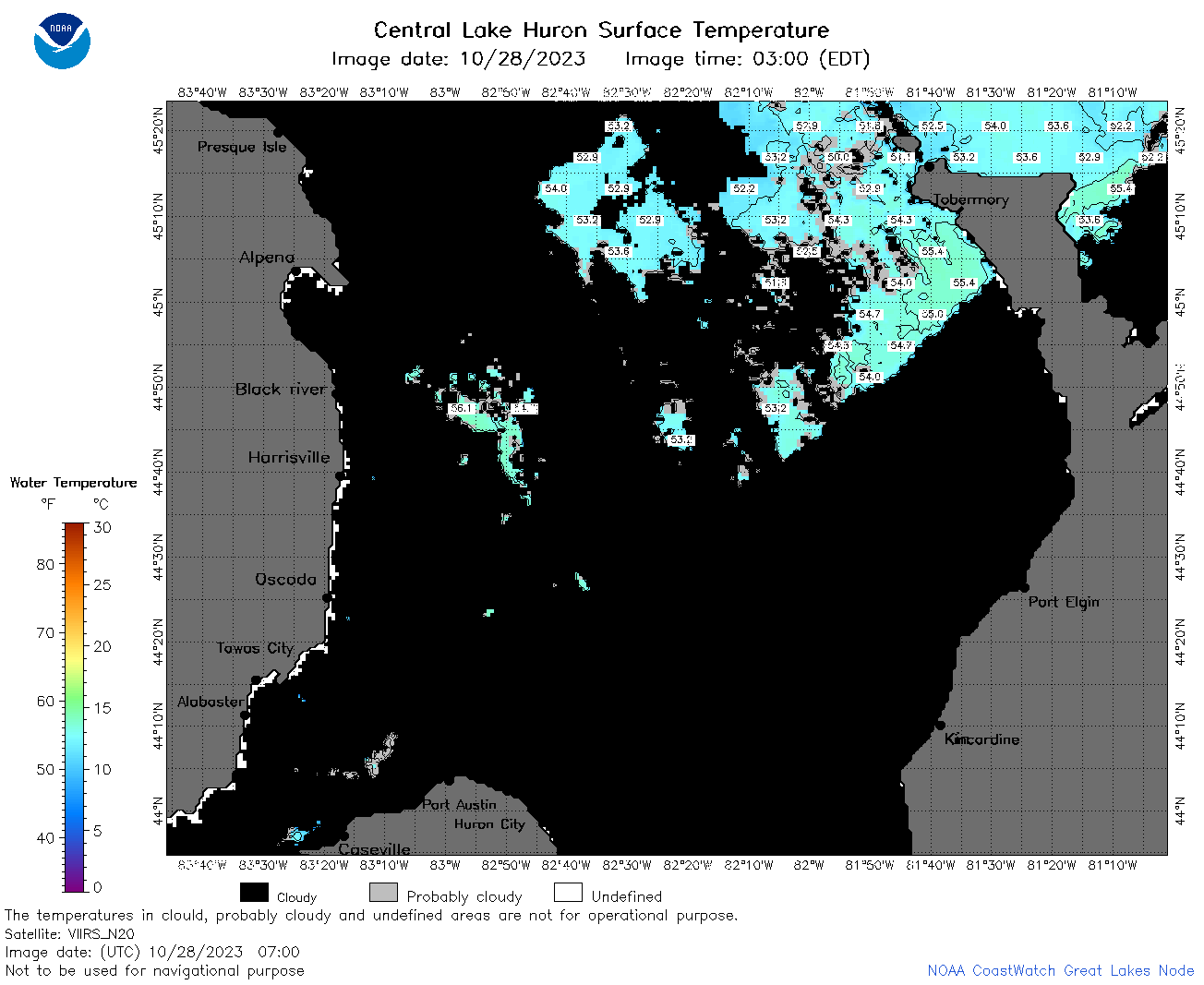 | h2_2023_10_28_0700.png | 28-Oct-2023 13:28 | 56823 | |
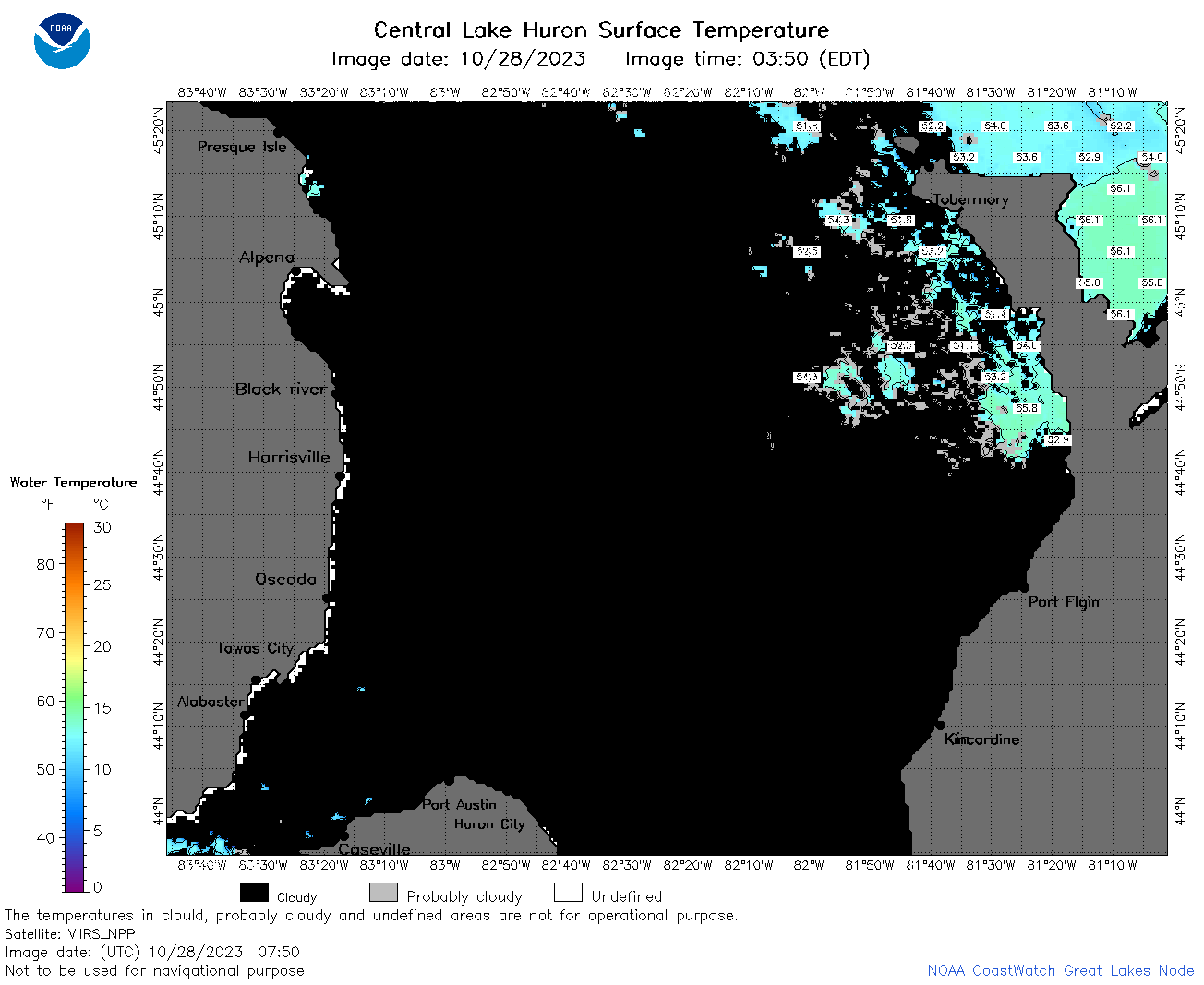 | h2_2023_10_28_0750.png | 28-Oct-2023 13:30 | 48197 | |
 | h2_2023_10_28_0840.png | 28-Oct-2023 13:32 | 43934 | |
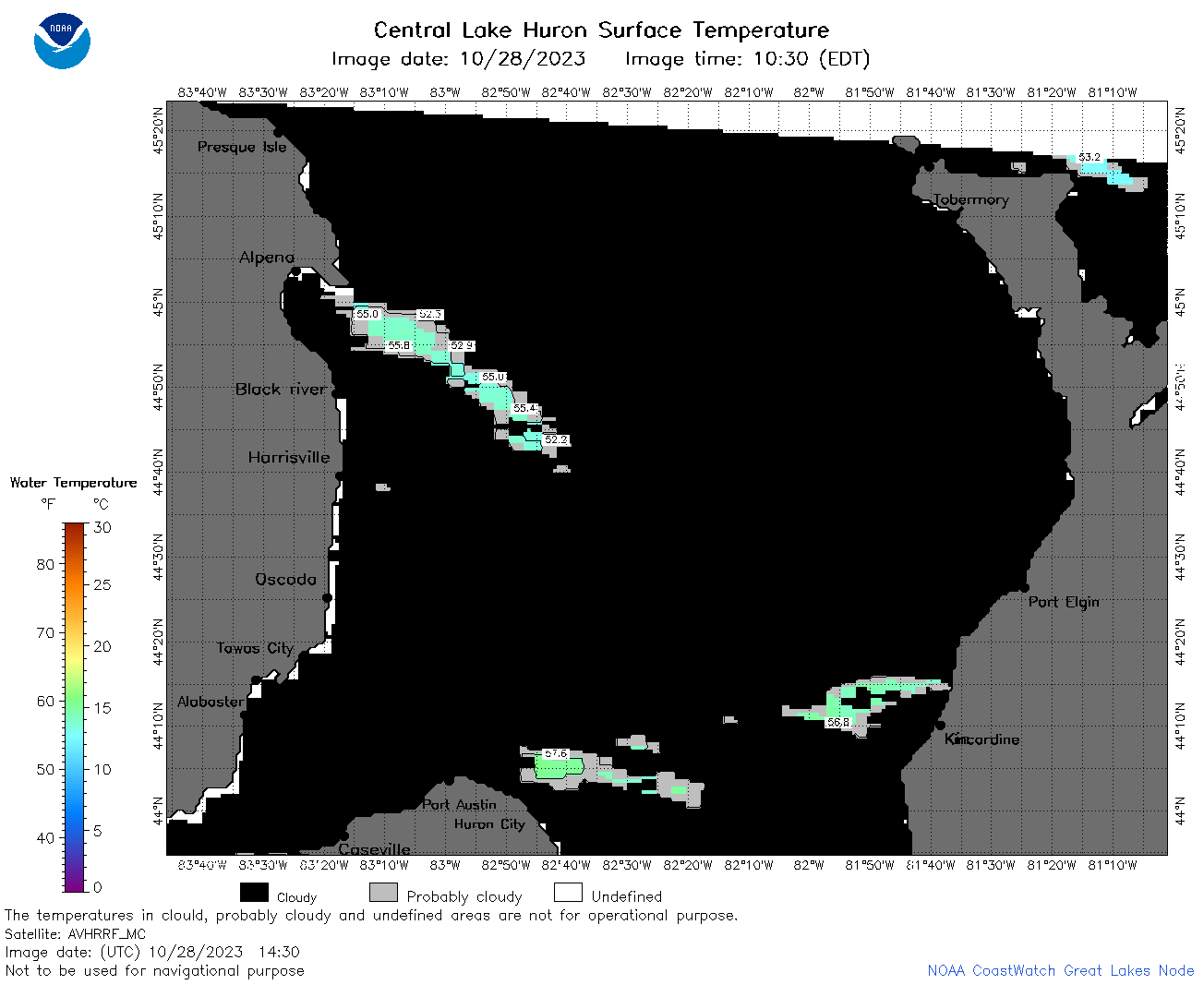 | h2_2023_10_28_1430.png | 28-Oct-2023 18:27 | 32762 | |
 | h2_2023_10_28_1510.png | 28-Oct-2023 18:29 | 39977 | |
 | h2_2023_10_28_1610.png | 28-Oct-2023 20:27 | 37131 | |
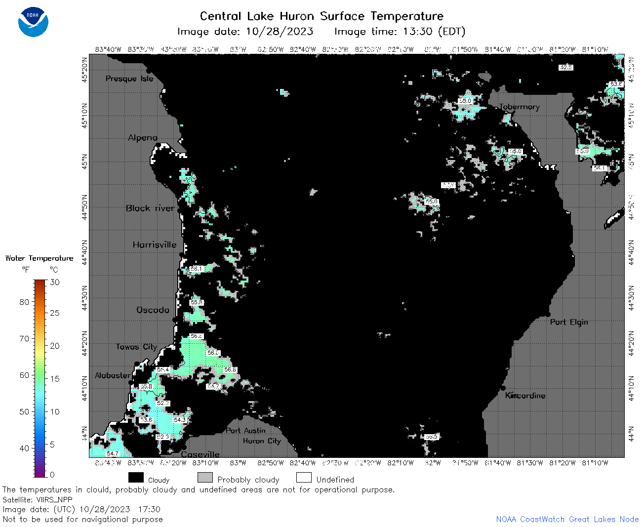 | h2_2023_10_28_1730.png | 28-Oct-2023 21:25 | 44948 | |
 | h2_2023_10_28_1820.png | 28-Oct-2023 22:27 | 57155 | |
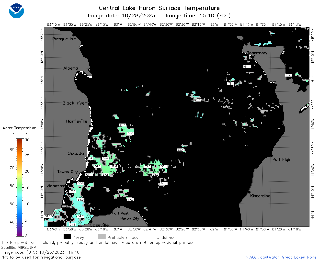 | h2_2023_10_28_1910.png | 28-Oct-2023 22:29 | 42225 | |
 | h2_2023_301.png | 29-Oct-2023 09:14 | 68625 | |