
Easier access to scientific data

Brought to you by NOAA CoastWatch Great Lakes Node
|
ERDDAP
Easier access to scientific data |
|
Brought to you by NOAA CoastWatch Great Lakes Node |
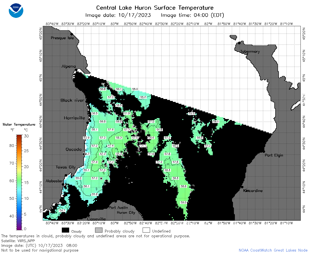
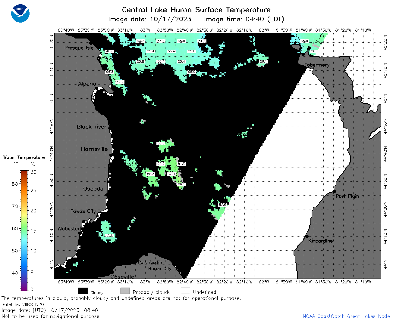
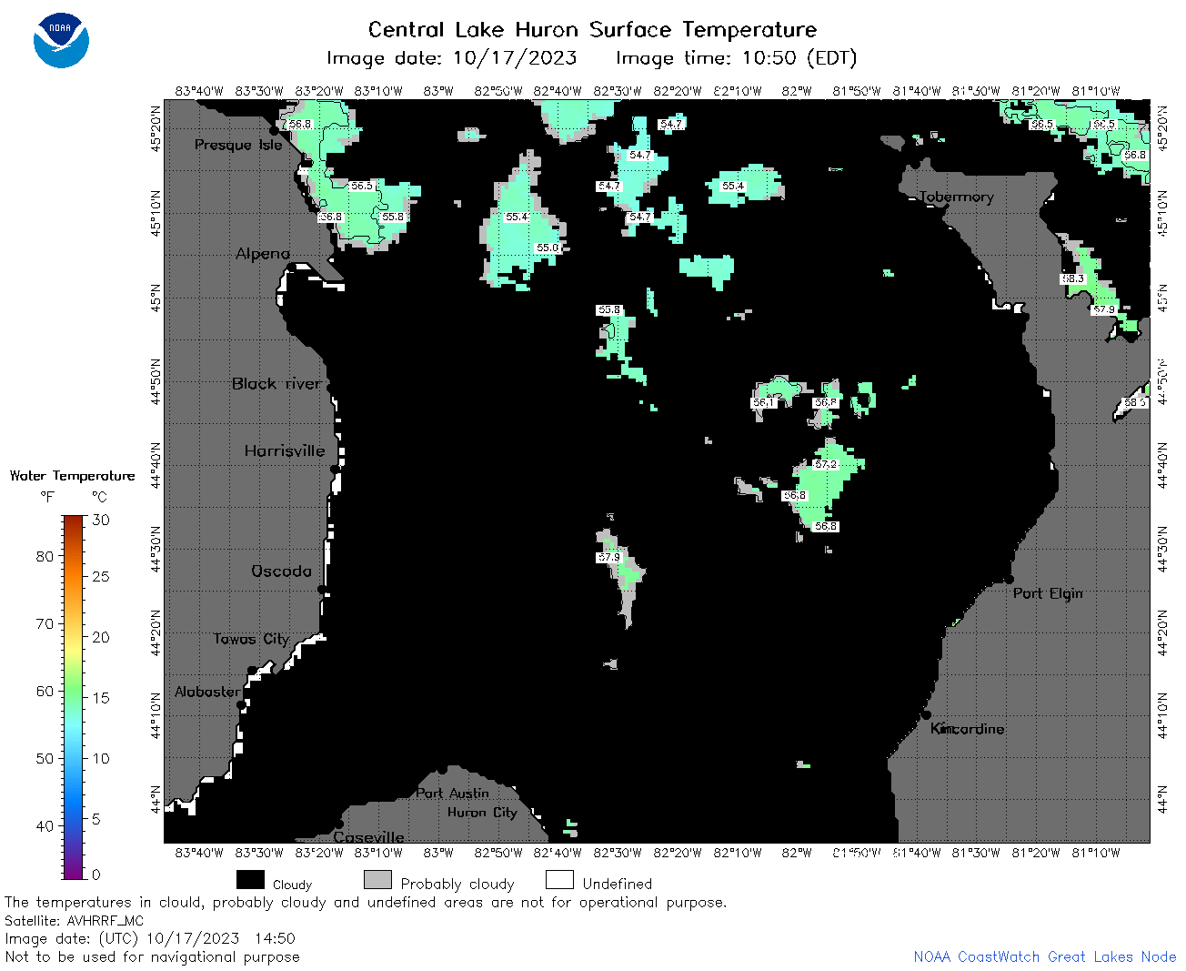
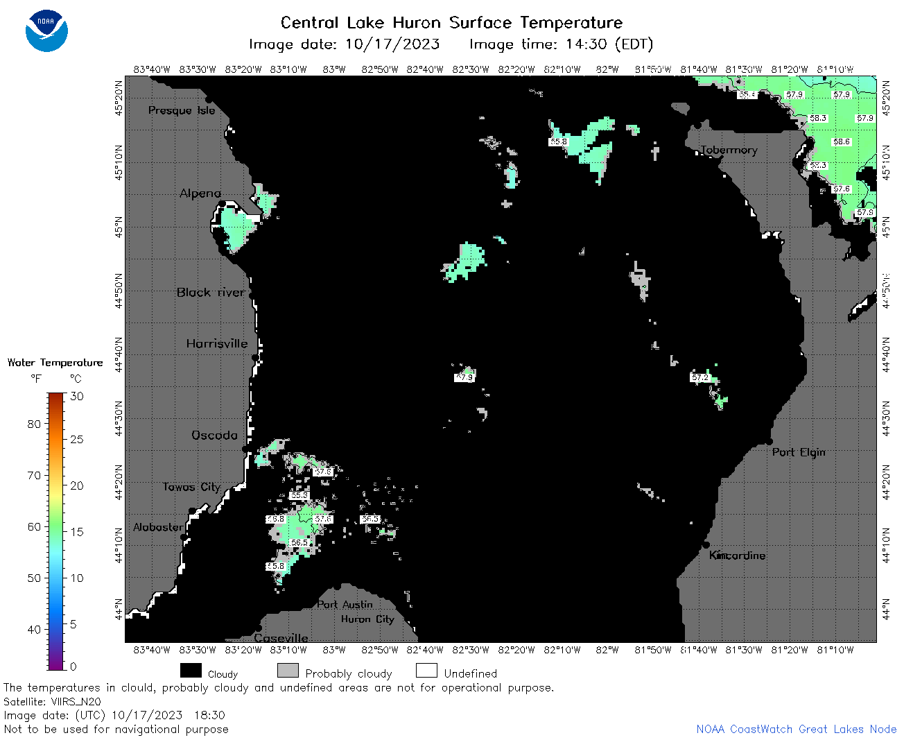
| Dataset Title: | Lake Huron Central Region Surface Temperature Contour Map (2022-present)


|
| Institution: | CoastWatch Great Lakes Node (Dataset ID: LH_NRT_TC_h2) |
| Information: | Summary
| License
| Metadata
| Background | Subset
| Data Access Form
| Make a graph
| Subset
| Data Access Form
| Make a graph
|
![[ICO]](https://apps.glerl.noaa.gov/erddap/images/fileIcons/blank.gif) | Name | Last modified | Size | Description |
|---|---|---|---|---|
![[DIR]](https://apps.glerl.noaa.gov/erddap/images/fileIcons/back.gif) | Parent Directory | - | - | |
![[IMG]](https://apps.glerl.noaa.gov/erddap/images/fileIcons/image2.gif) 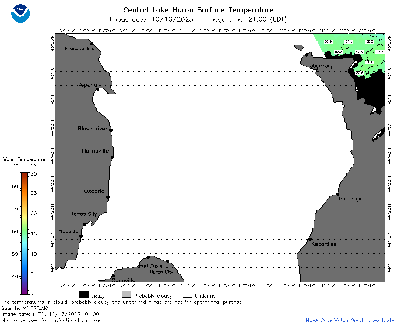 | h2_2023_10_17_0100.png | 17-Oct-2023 05:25 | 35014 | |
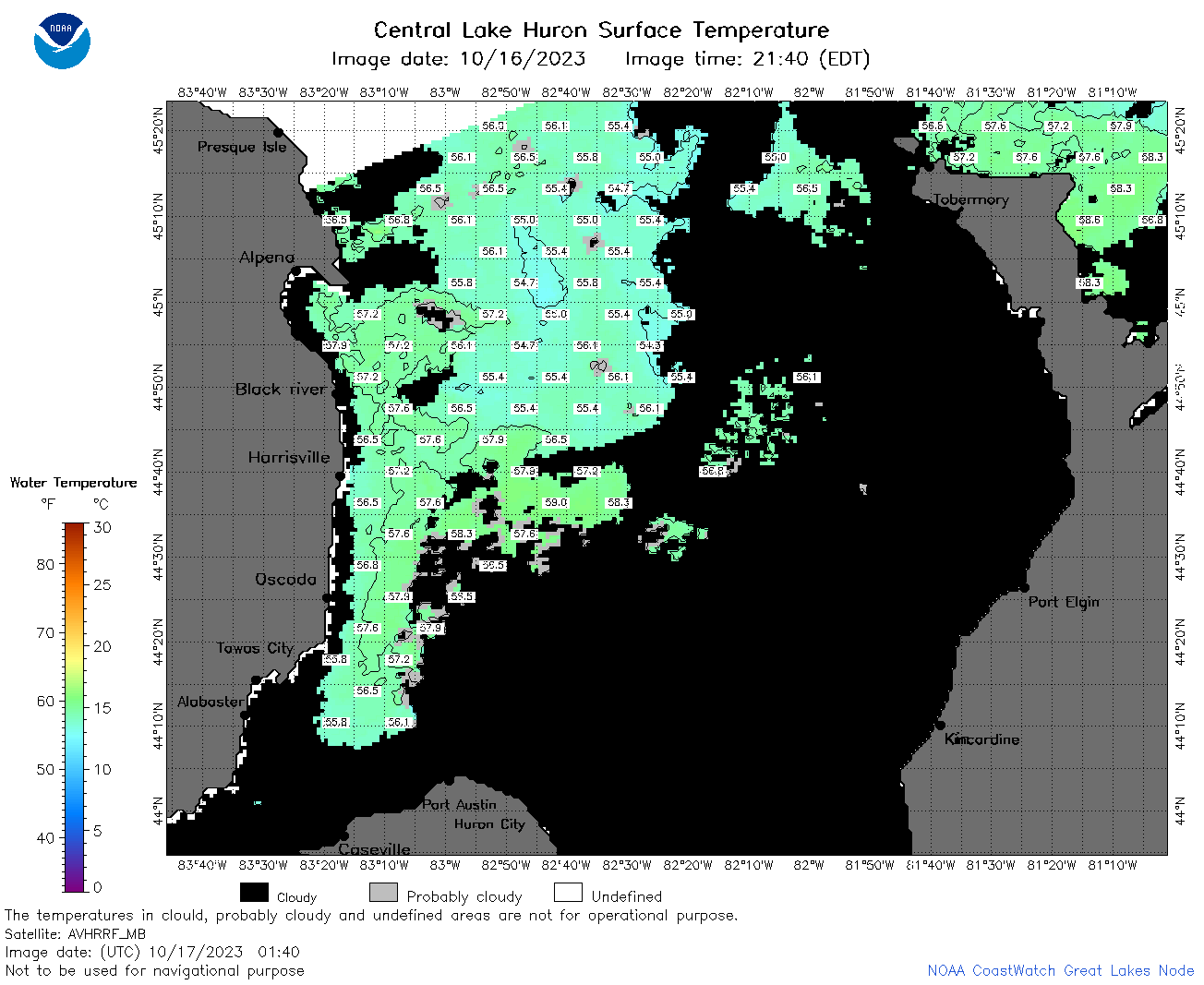 | h2_2023_10_17_0140.png | 17-Oct-2023 05:27 | 64167 | |
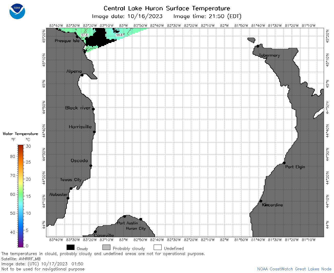 | h2_2023_10_17_0150.png | 17-Oct-2023 05:29 | 33894 | |
 | h2_2023_10_17_0240.png | 17-Oct-2023 05:32 | 48338 | |
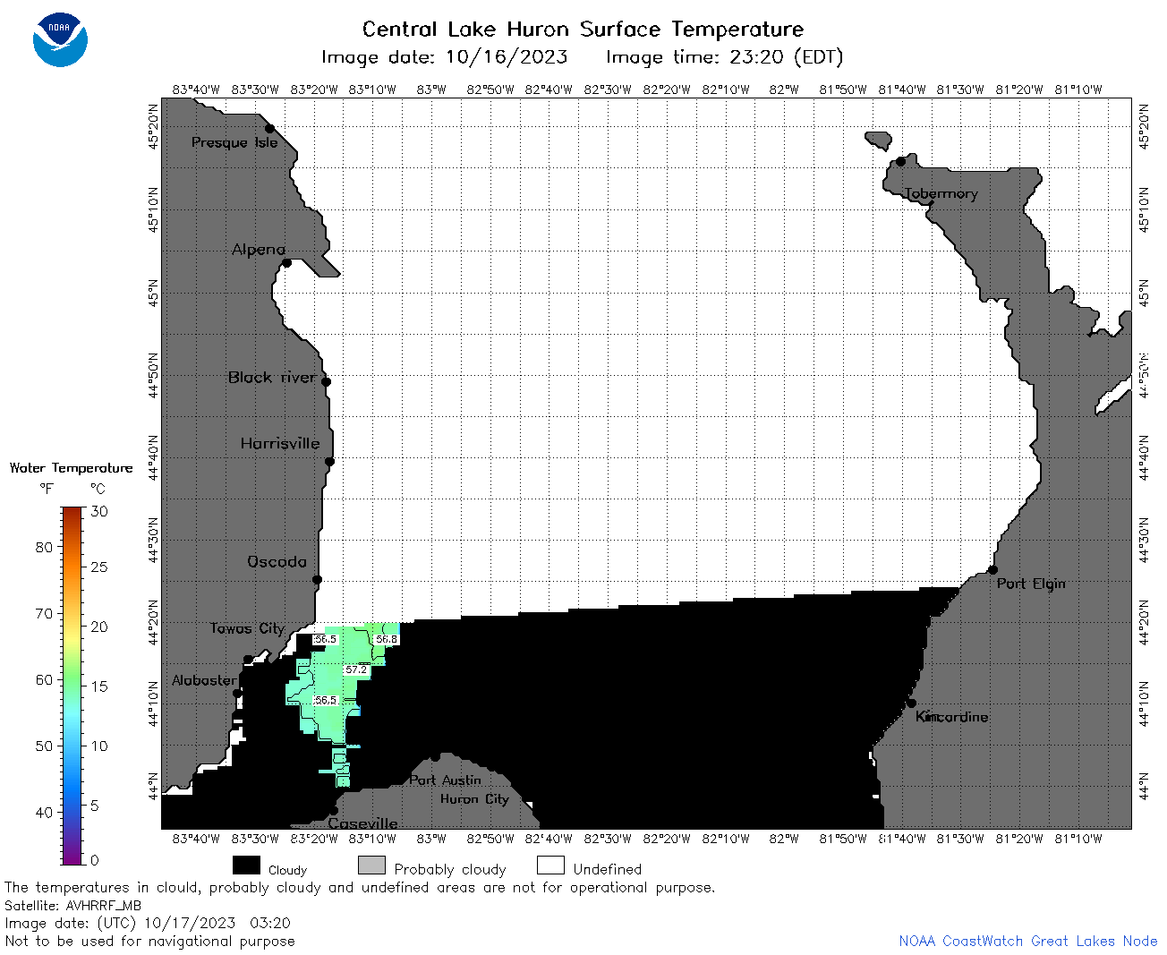 | h2_2023_10_17_0320.png | 17-Oct-2023 06:25 | 33307 | |
 | h2_2023_10_17_0330.png | 17-Oct-2023 06:28 | 40469 | |
 | h2_2023_10_17_0610.png | 17-Oct-2023 10:25 | 61741 | |
 | h2_2023_10_17_0700.png | 17-Oct-2023 10:29 | 85901 | |
 | h2_2023_10_17_0750.png | 17-Oct-2023 11:25 | 62188 | |
 | h2_2023_10_17_0800.png | 17-Oct-2023 11:27 | 57095 | |
 | h2_2023_10_17_0840.png | 17-Oct-2023 12:25 | 47441 | |
 | h2_2023_10_17_1450.png | 17-Oct-2023 21:27 | 40057 | |
 | h2_2023_10_17_1540.png | 17-Oct-2023 21:30 | 41720 | |
 | h2_2023_10_17_1630.png | 17-Oct-2023 21:32 | 37894 | |
 | h2_2023_10_17_1830.png | 04-Nov-2023 07:33 | 38844 | |
 | h2_2023_290.png | 18-Oct-2023 09:14 | 75931 | |