
Easier access to scientific data

Brought to you by NOAA CoastWatch Great Lakes Node
|
ERDDAP
Easier access to scientific data |
|
Brought to you by NOAA CoastWatch Great Lakes Node |
| Dataset Title: | Lake Huron Central Region Surface Temperature Contour Map (2022-present)


|
| Institution: | CoastWatch Great Lakes Node (Dataset ID: LH_NRT_TC_h2) |
| Information: | Summary
| License
| Metadata
| Background | Subset
| Data Access Form
| Make a graph
| Subset
| Data Access Form
| Make a graph
|
![[ICO]](https://apps.glerl.noaa.gov/erddap/images/fileIcons/blank.gif) | Name | Last modified | Size | Description |
|---|---|---|---|---|
![[DIR]](https://apps.glerl.noaa.gov/erddap/images/fileIcons/back.gif) | Parent Directory | - | - | |
![[IMG]](https://apps.glerl.noaa.gov/erddap/images/fileIcons/image2.gif)  | h2_2023_10_03_0130.png | 03-Oct-2023 13:25 | 47990 | |
 | h2_2023_10_03_0230.png | 03-Oct-2023 13:34 | 59527 | |
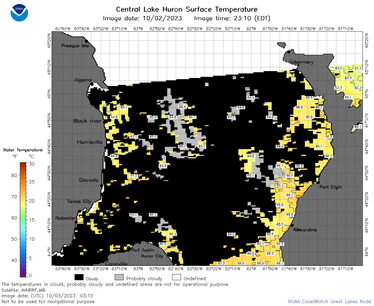 | h2_2023_10_03_0310.png | 03-Oct-2023 06:26 | 50029 | |
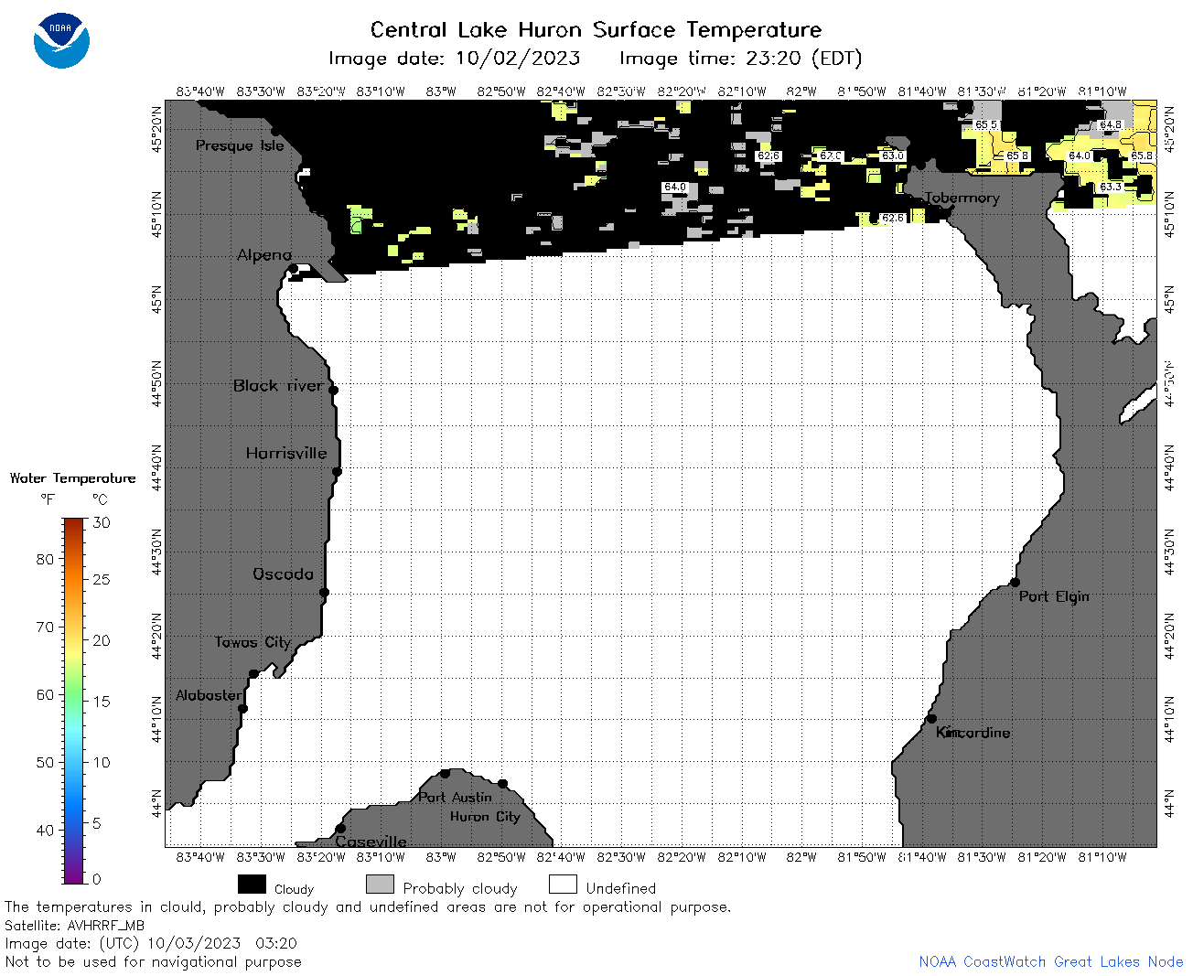 | h2_2023_10_03_0320.png | 03-Oct-2023 13:39 | 36468 | |
 | h2_2023_10_03_0630.png | 03-Oct-2023 13:42 | 93665 | |
 | h2_2023_10_03_0720.png | 03-Oct-2023 13:47 | 82037 | |
 | h2_2023_10_03_0810.png | 03-Oct-2023 13:52 | 85628 | |
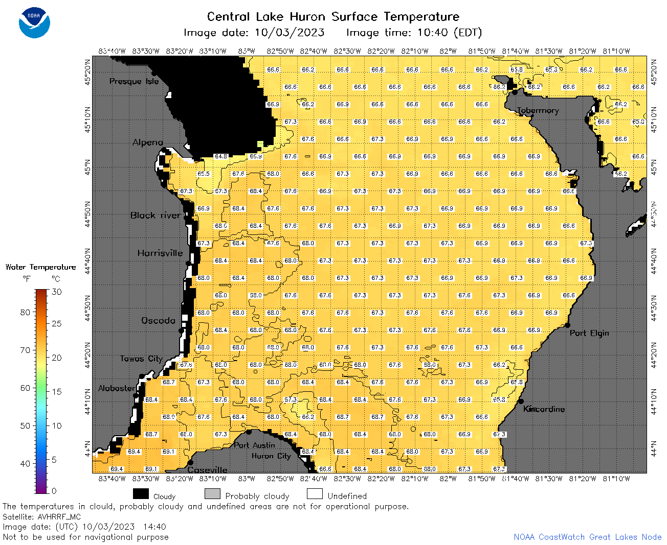 | h2_2023_10_03_1440.png | 03-Oct-2023 18:26 | 72061 | |
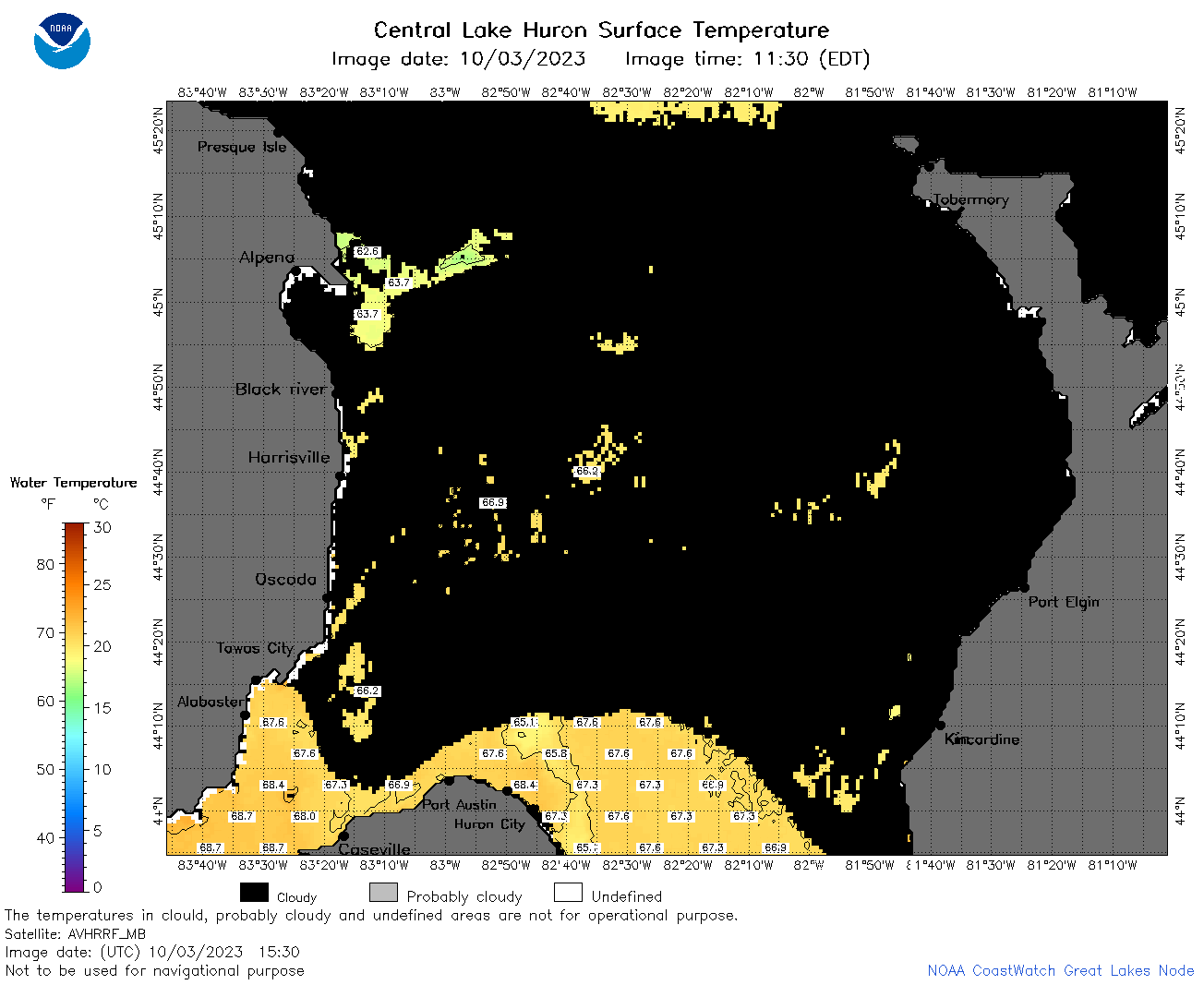 | h2_2023_10_03_1530.png | 03-Oct-2023 18:33 | 42380 | |
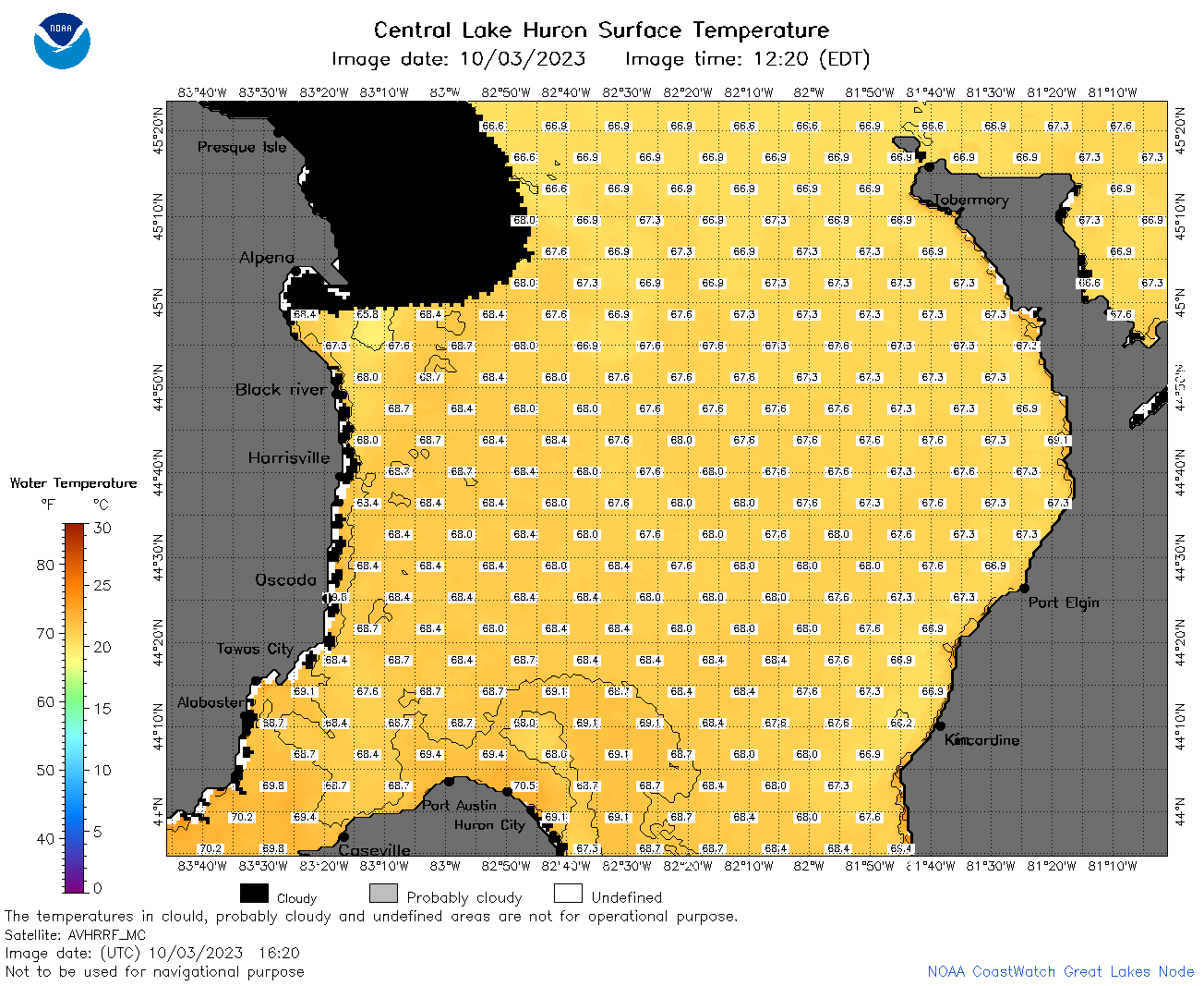 | h2_2023_10_03_1620.png | 03-Oct-2023 20:26 | 74002 | |
 | h2_2023_10_03_1700.png | 03-Oct-2023 20:33 | 89592 | |
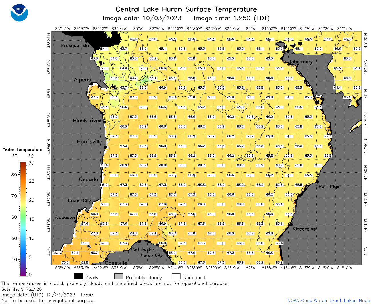 | h2_2023_10_03_1750.png | 03-Oct-2023 20:41 | 84491 | |
 | h2_2023_10_03_1840.png | 03-Oct-2023 21:26 | 85066 | |
 | h2_2023_10_03_1930.png | 03-Oct-2023 22:26 | 52306 | |
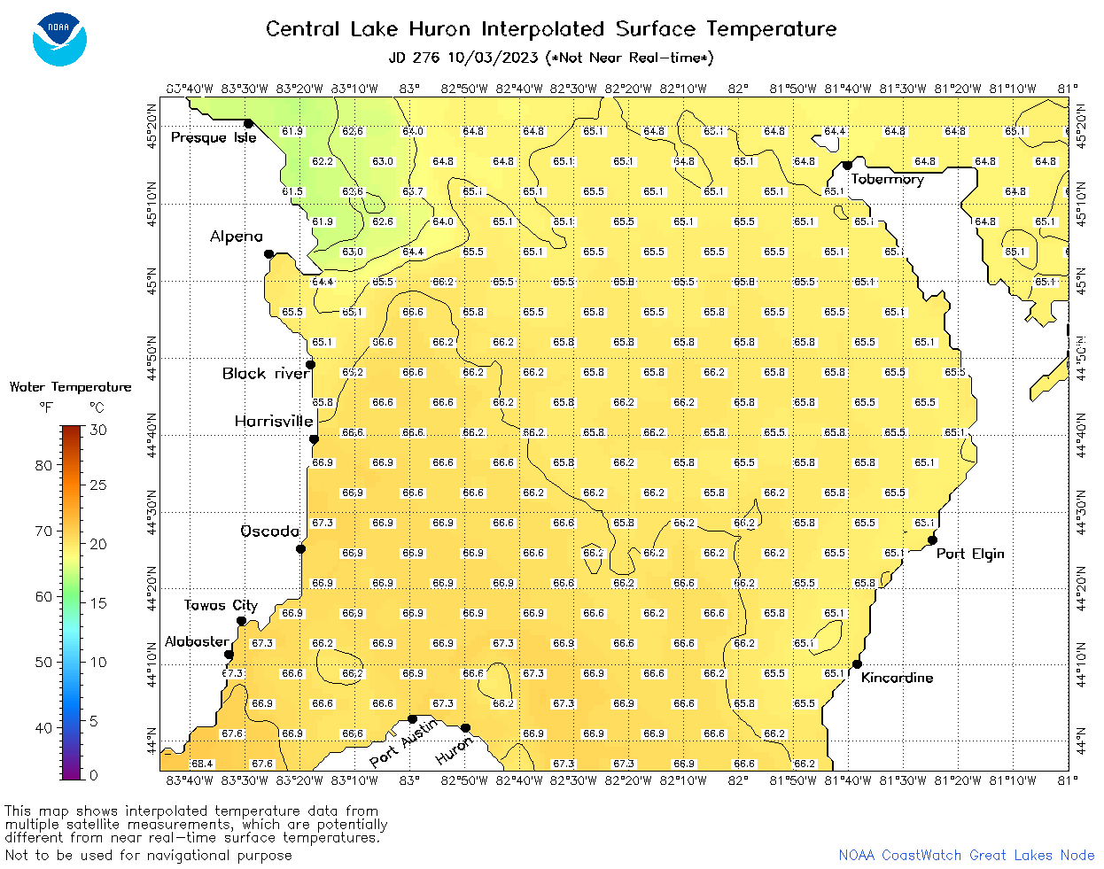 | h2_2023_276.png | 04-Oct-2023 09:16 | 53243 | |