
Easier access to scientific data

Brought to you by NOAA CoastWatch Great Lakes Node
|
ERDDAP
Easier access to scientific data |
|
Brought to you by NOAA CoastWatch Great Lakes Node |
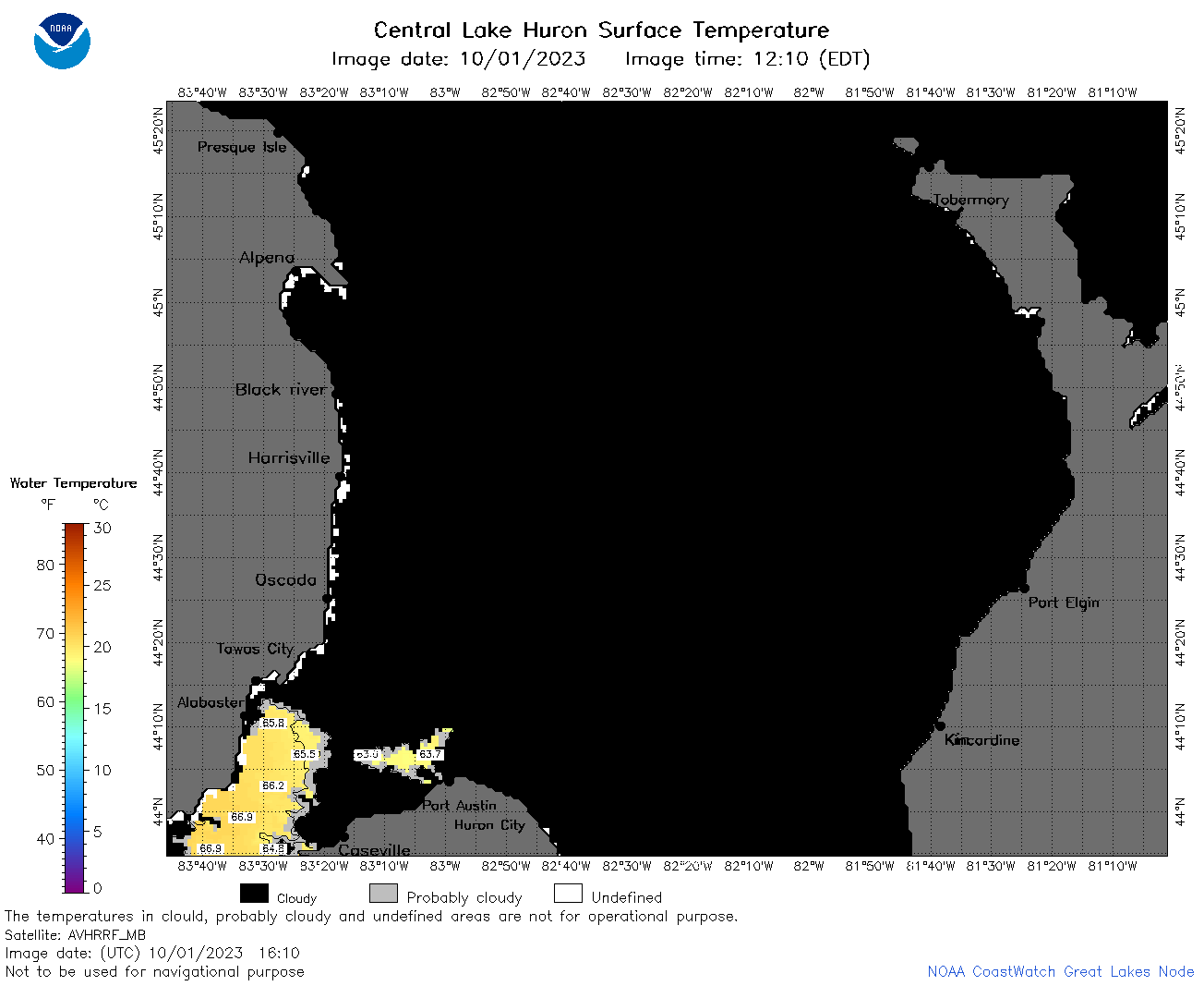
| Dataset Title: | Lake Huron Central Region Surface Temperature Contour Map (2022-present)


|
| Institution: | CoastWatch Great Lakes Node (Dataset ID: LH_NRT_TC_h2) |
| Information: | Summary
| License
| Metadata
| Background | Subset
| Data Access Form
| Make a graph
| Subset
| Data Access Form
| Make a graph
|
![[ICO]](https://apps.glerl.noaa.gov/erddap/images/fileIcons/blank.gif) | Name | Last modified | Size | Description |
|---|---|---|---|---|
![[DIR]](https://apps.glerl.noaa.gov/erddap/images/fileIcons/back.gif) | Parent Directory | - | - | |
![[IMG]](https://apps.glerl.noaa.gov/erddap/images/fileIcons/image2.gif) 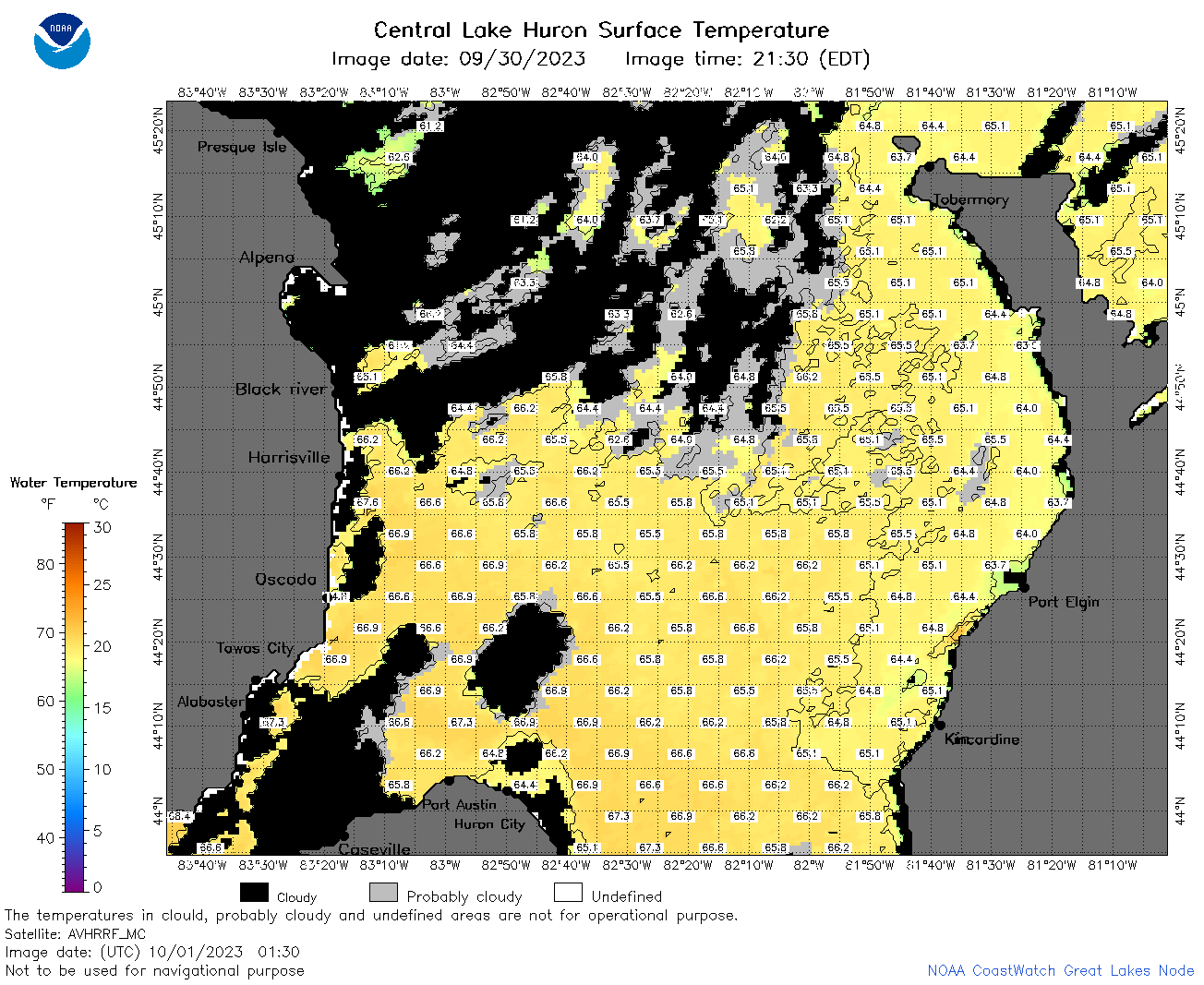 | h2_2023_10_01_0130.png | 01-Oct-2023 05:26 | 96106 | |
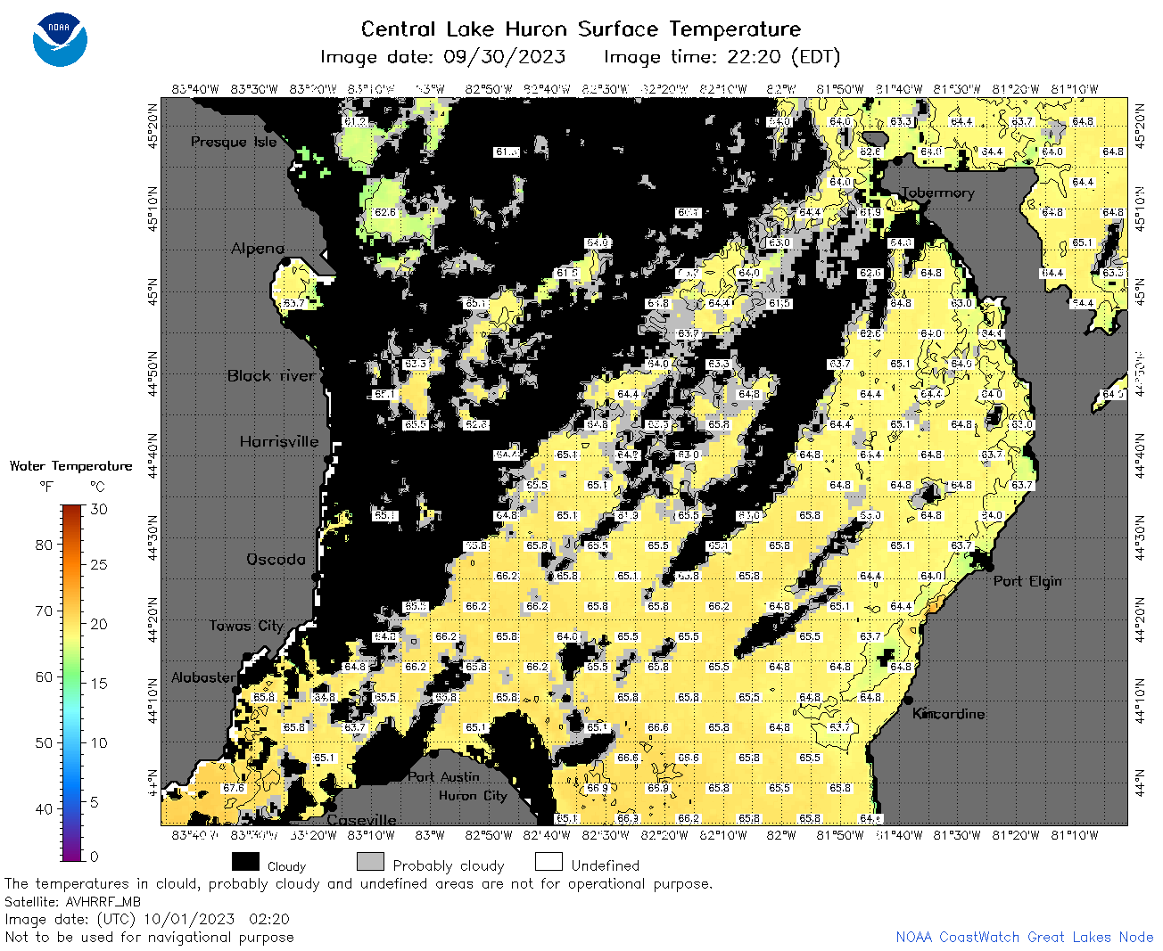 | h2_2023_10_01_0220.png | 01-Oct-2023 05:30 | 103415 | |
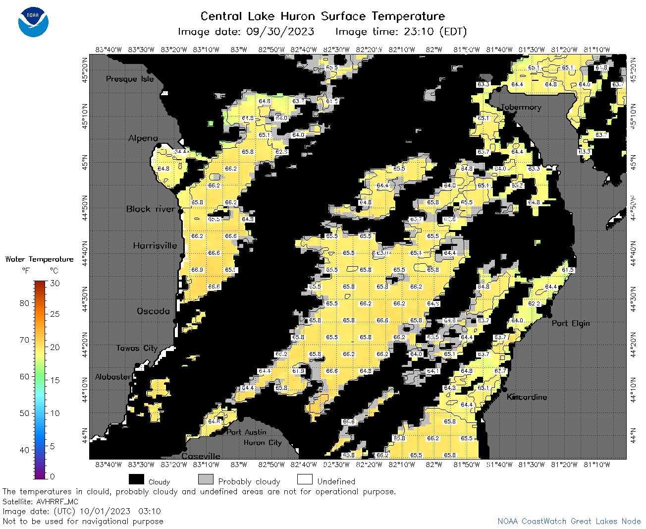 | h2_2023_10_01_0310.png | 01-Oct-2023 06:26 | 75522 | |
 | h2_2023_10_01_0610.png | 01-Oct-2023 10:25 | 52509 | |
 | h2_2023_10_01_0800.png | 01-Oct-2023 11:27 | 40967 | |
 | h2_2023_10_01_1610.png | 01-Oct-2023 19:30 | 32229 | |
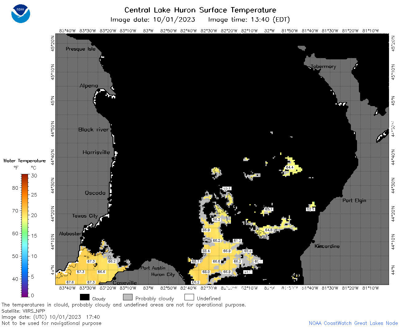 | h2_2023_10_01_1740.png | 01-Oct-2023 20:25 | 40584 | |
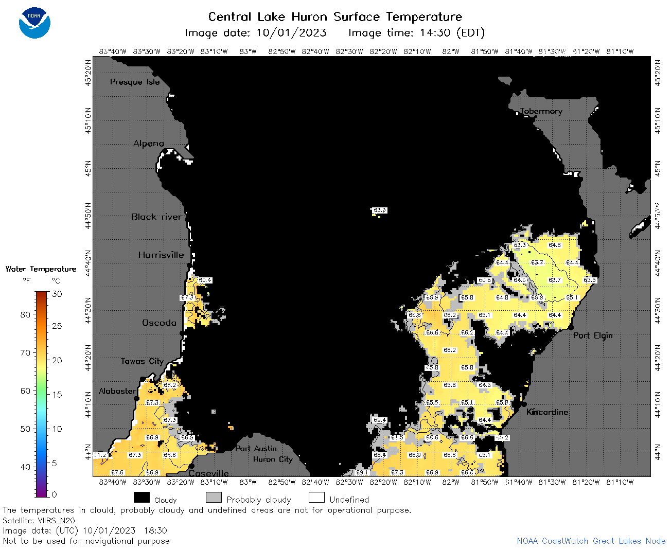 | h2_2023_10_01_1830.png | 01-Oct-2023 21:29 | 50794 | |
 | h2_2023_10_01_1920.png | 01-Oct-2023 23:26 | 38167 | |
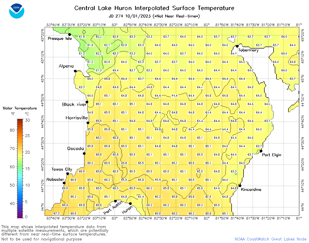 | h2_2023_274.png | 02-Oct-2023 09:14 | 55737 | |