
Easier access to scientific data

Brought to you by NOAA CoastWatch Great Lakes Node
|
ERDDAP
Easier access to scientific data |
|
Brought to you by NOAA CoastWatch Great Lakes Node |
| Dataset Title: | Lake Huron Central Region Surface Temperature Contour Map (2022-present)


|
| Institution: | CoastWatch Great Lakes Node (Dataset ID: LH_NRT_TC_h2) |
| Information: | Summary
| License
| Metadata
| Background | Subset
| Data Access Form
| Make a graph
| Subset
| Data Access Form
| Make a graph
|
![[ICO]](https://apps.glerl.noaa.gov/erddap/images/fileIcons/blank.gif) | Name | Last modified | Size | Description |
|---|---|---|---|---|
![[DIR]](https://apps.glerl.noaa.gov/erddap/images/fileIcons/back.gif) | Parent Directory | - | - | |
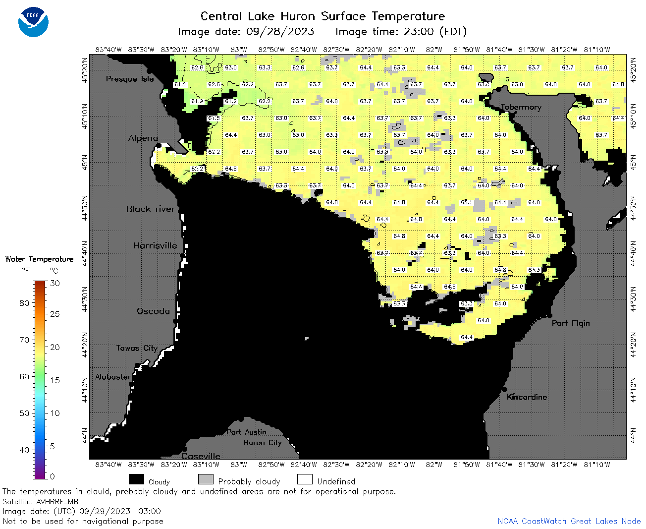
![[IMG]](https://apps.glerl.noaa.gov/erddap/images/fileIcons/image2.gif)  | h2_2023_09_29_0120.png | 29-Sep-2023 05:25 | 66854 | |
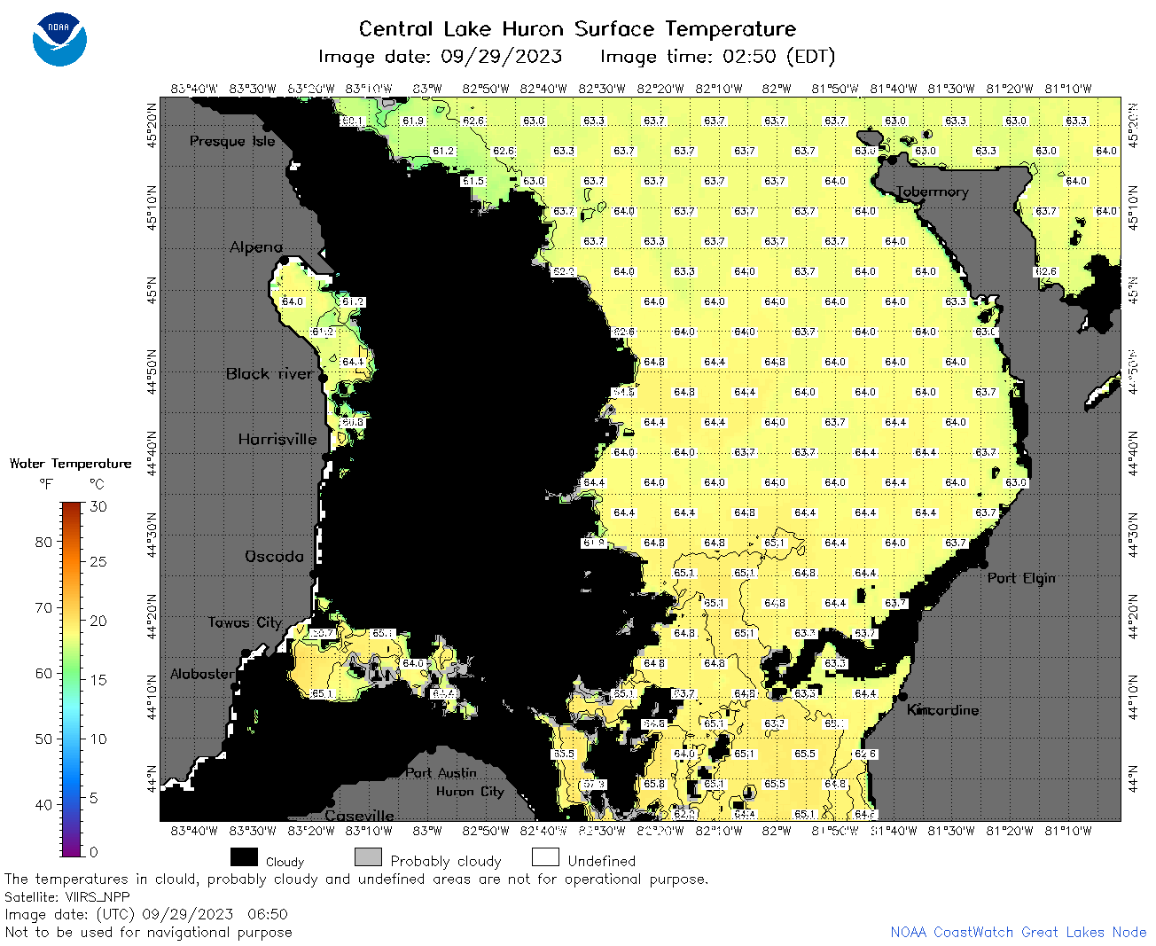
 | h2_2023_09_29_0210.png | 29-Sep-2023 05:28 | 67699 | |
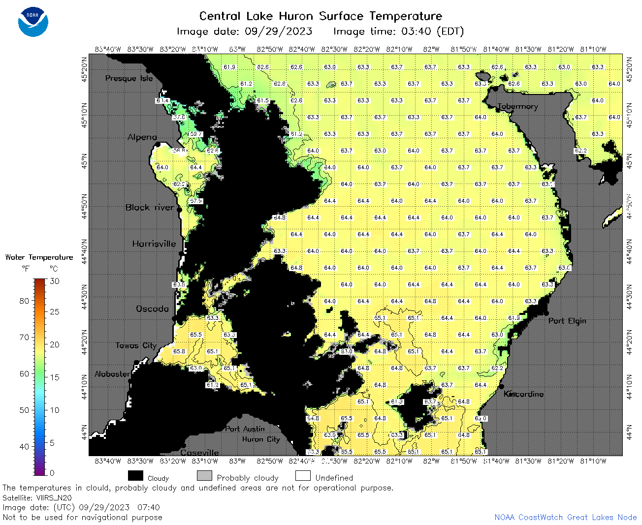
 | h2_2023_09_29_0300.png | 29-Sep-2023 05:30 | 66338 | |
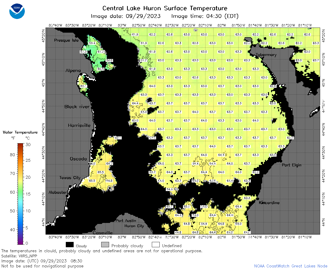
 | h2_2023_09_29_0650.png | 29-Sep-2023 10:26 | 80051 | |
 | h2_2023_09_29_0740.png | 29-Sep-2023 10:28 | 88849 | |
 | h2_2023_09_29_0830.png | 29-Sep-2023 12:26 | 83278 | |
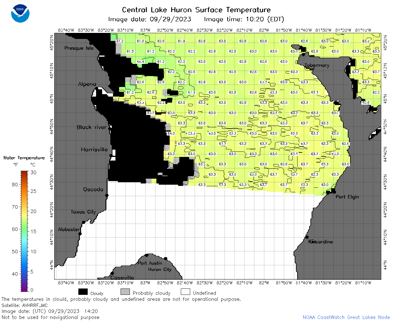 | h2_2023_09_29_1420.png | 29-Sep-2023 18:25 | 55268 | |
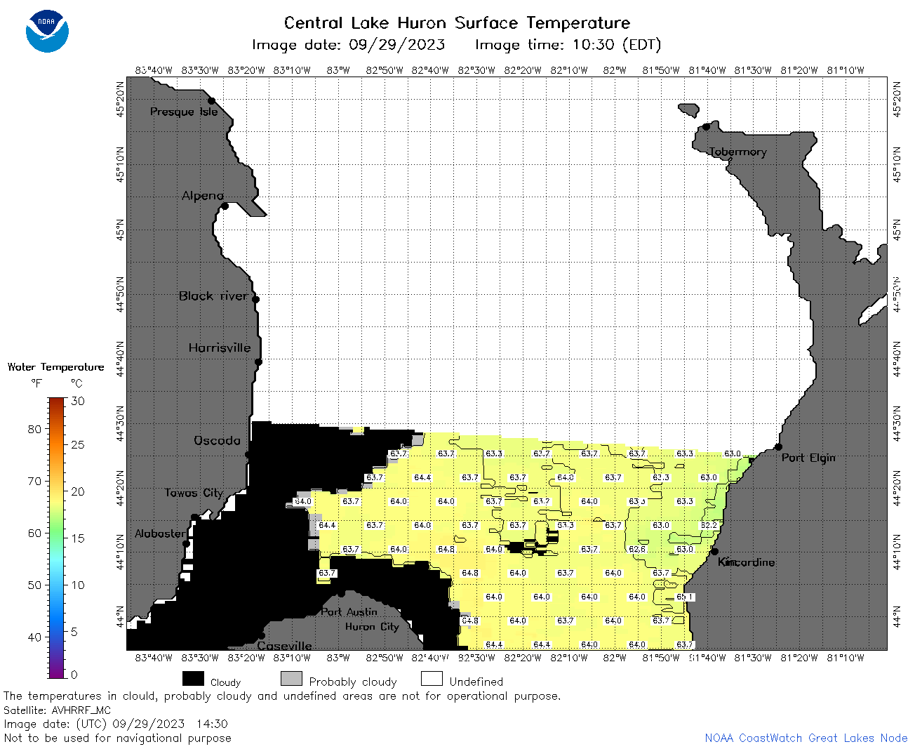 | h2_2023_09_29_1430.png | 29-Sep-2023 18:27 | 41513 | |
 | h2_2023_09_29_1510.png | 29-Sep-2023 18:29 | 80209 | |
 | h2_2023_09_29_1610.png | 29-Sep-2023 21:25 | 80240 | |
 | h2_2023_09_29_1730.png | 29-Sep-2023 19:26 | 86785 | |
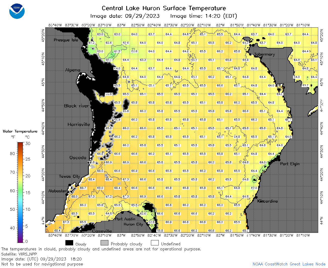 | h2_2023_09_29_1820.png | 29-Sep-2023 22:26 | 86463 | |
 | h2_2023_272.png | 30-Sep-2023 09:14 | 52682 | |