
Easier access to scientific data

Brought to you by NOAA CoastWatch Great Lakes Node
|
ERDDAP
Easier access to scientific data |
|
Brought to you by NOAA CoastWatch Great Lakes Node |
| Dataset Title: | Lake Huron Central Region Surface Temperature Contour Map (2022-present)


|
| Institution: | CoastWatch Great Lakes Node (Dataset ID: LH_NRT_TC_h2) |
| Information: | Summary
| License
| Metadata
| Background | Subset
| Data Access Form
| Make a graph
| Subset
| Data Access Form
| Make a graph
|
![[ICO]](https://apps.glerl.noaa.gov/erddap/images/fileIcons/blank.gif) | Name | Last modified | Size | Description |
|---|---|---|---|---|
![[DIR]](https://apps.glerl.noaa.gov/erddap/images/fileIcons/back.gif) | Parent Directory | - | - | |
![[IMG]](https://apps.glerl.noaa.gov/erddap/images/fileIcons/image2.gif) 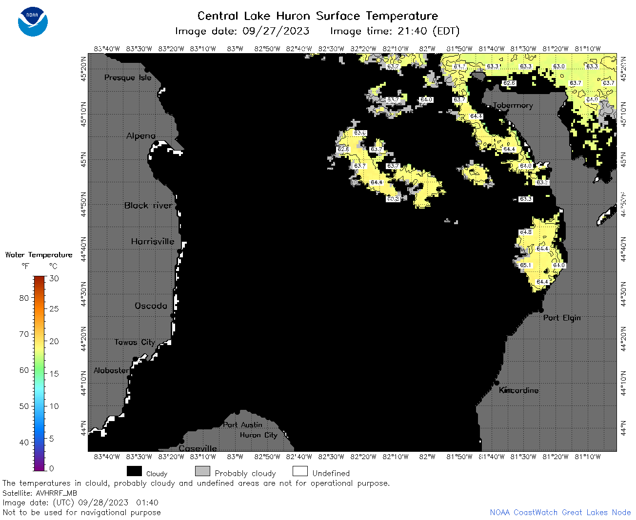 | h2_2023_09_28_0140.png | 28-Sep-2023 05:25 | 46945 | |
 | h2_2023_09_28_0230.png | 28-Sep-2023 05:28 | 39971 | |
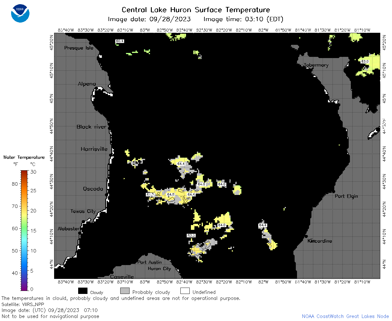
 | h2_2023_09_28_0320.png | 28-Sep-2023 06:25 | 31914 | |
 | h2_2023_09_28_0620.png | 28-Sep-2023 21:25 | 31287 | |
 | h2_2023_09_28_0710.png | 28-Sep-2023 21:27 | 37758 | |
 | h2_2023_09_28_0800.png | 28-Sep-2023 21:30 | 41133 | |
 | h2_2023_09_28_0850.png | 28-Sep-2023 22:26 | 35615 | |
 | h2_2023_09_28_1530.png | 28-Sep-2023 21:38 | 32804 | |
 | h2_2023_09_28_1630.png | 28-Sep-2023 21:43 | 34842 | |
 | h2_2023_09_28_1750.png | 28-Sep-2023 22:30 | 40224 | |
 | h2_2023_09_28_1840.png | 28-Sep-2023 22:32 | 39056 | |
 | h2_2023_09_28_1930.png | 28-Sep-2023 22:34 | 37507 | |