
Easier access to scientific data

Brought to you by NOAA CoastWatch Great Lakes Node
|
ERDDAP
Easier access to scientific data |
|
Brought to you by NOAA CoastWatch Great Lakes Node |
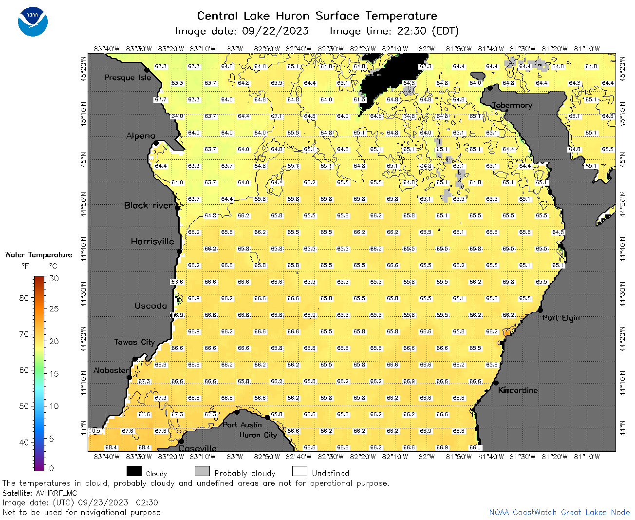
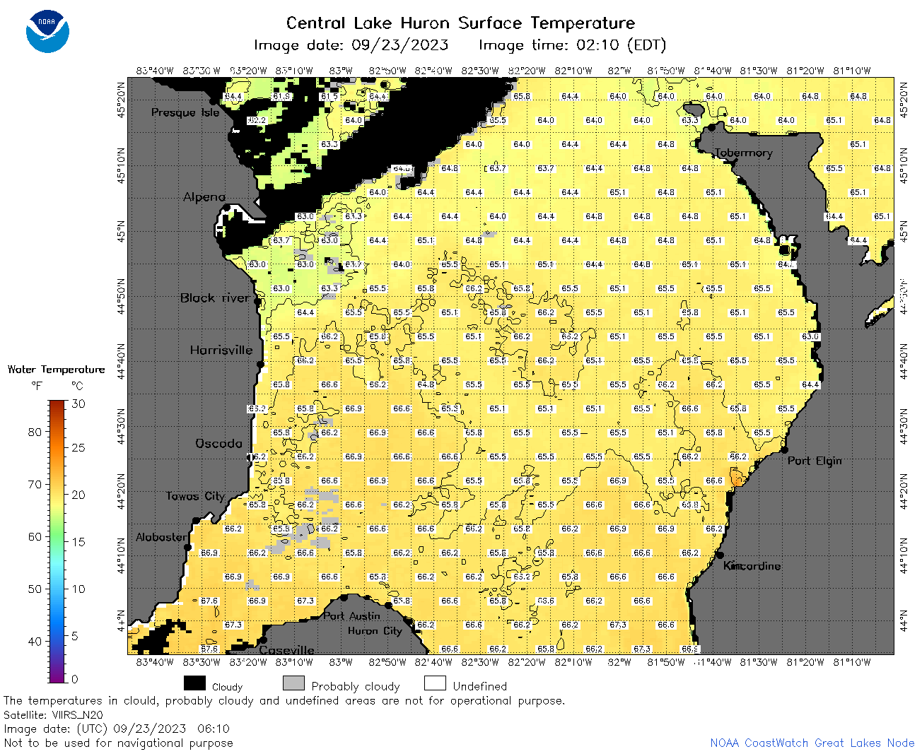
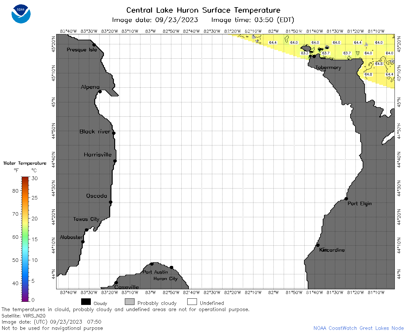
| Dataset Title: | Lake Huron Central Region Surface Temperature Contour Map (2022-present)


|
| Institution: | CoastWatch Great Lakes Node (Dataset ID: LH_NRT_TC_h2) |
| Information: | Summary
| License
| Metadata
| Background | Subset
| Data Access Form
| Make a graph
| Subset
| Data Access Form
| Make a graph
|
![[ICO]](https://apps.glerl.noaa.gov/erddap/images/fileIcons/blank.gif) | Name | Last modified | Size | Description |
|---|---|---|---|---|
![[DIR]](https://apps.glerl.noaa.gov/erddap/images/fileIcons/back.gif) | Parent Directory | - | - | |
![[IMG]](https://apps.glerl.noaa.gov/erddap/images/fileIcons/image2.gif)  | h2_2023_09_23_0140.png | 23-Sep-2023 05:28 | 95902 | |
 | h2_2023_09_23_0230.png | 23-Sep-2023 05:30 | 92430 | |
 | h2_2023_09_23_0320.png | 23-Sep-2023 06:26 | 84664 | |
 | h2_2023_09_23_0610.png | 23-Sep-2023 09:25 | 91416 | |
 | h2_2023_09_23_0710.png | 23-Sep-2023 21:28 | 93164 | |
 | h2_2023_09_23_0750.png | 23-Sep-2023 21:30 | 36341 | |
 | h2_2023_09_23_0800.png | 23-Sep-2023 21:32 | 88863 | |
 | h2_2023_09_23_0840.png | 23-Sep-2023 21:34 | 34924 | |
 | h2_2023_09_23_0850.png | 23-Sep-2023 21:36 | 86254 | |
 | h2_2023_09_23_1450.png | 23-Sep-2023 21:40 | 77375 | |
 | h2_2023_09_23_1540.png | 23-Sep-2023 21:42 | 88176 | |
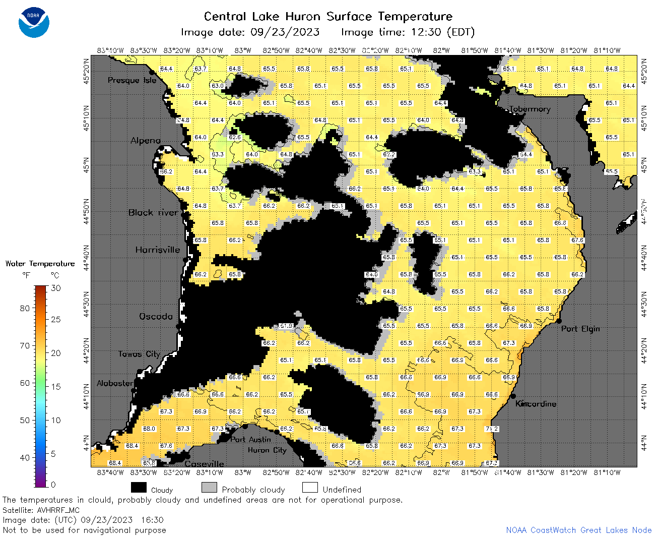 | h2_2023_09_23_1630.png | 23-Sep-2023 21:44 | 79156 | |
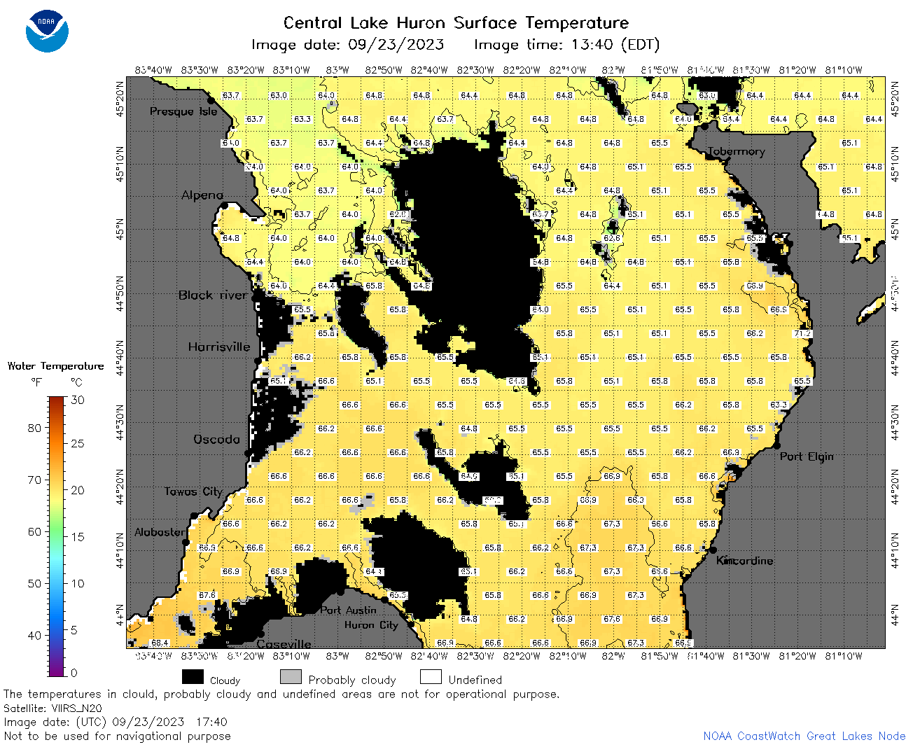 | h2_2023_09_23_1740.png | 23-Sep-2023 22:26 | 90242 | |
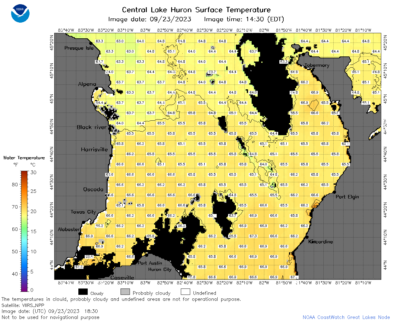 | h2_2023_09_23_1830.png | 23-Sep-2023 22:28 | 89499 | |
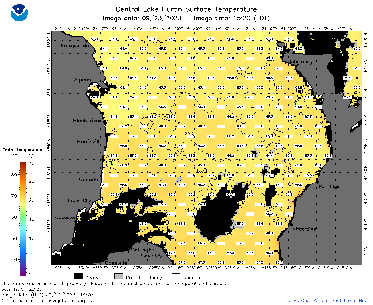 | h2_2023_09_23_1920.png | 23-Sep-2023 22:30 | 85906 | |
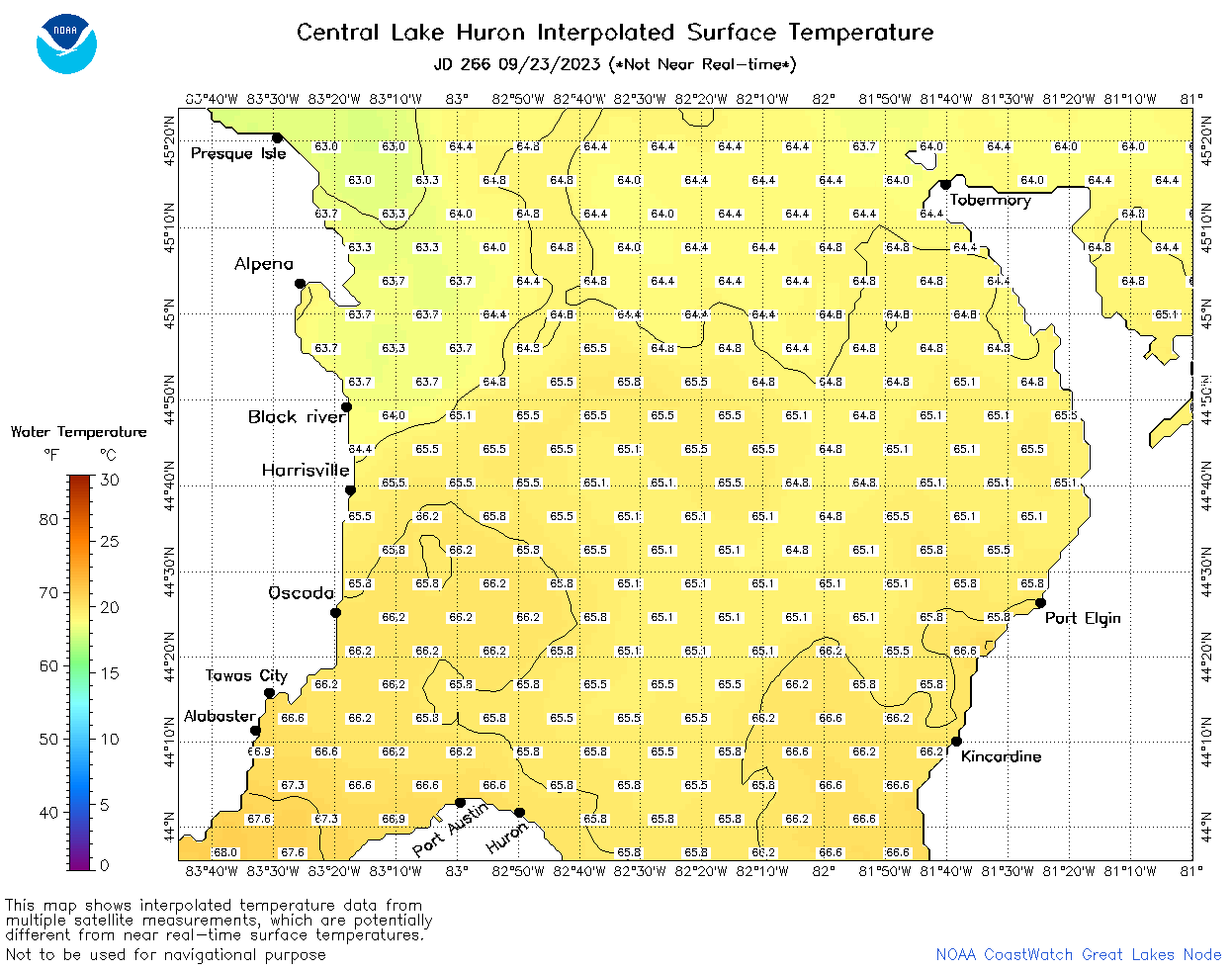 | h2_2023_266.png | 24-Sep-2023 09:14 | 51753 | |