
Easier access to scientific data

Brought to you by NOAA CoastWatch Great Lakes Node
|
ERDDAP
Easier access to scientific data |
|
Brought to you by NOAA CoastWatch Great Lakes Node |
| Dataset Title: | Lake Huron Central Region Surface Temperature Contour Map (2022-present)


|
| Institution: | CoastWatch Great Lakes Node (Dataset ID: LH_NRT_TC_h2) |
| Information: | Summary
| License
| Metadata
| Background | Subset
| Data Access Form
| Make a graph
| Subset
| Data Access Form
| Make a graph
|
![[ICO]](https://apps.glerl.noaa.gov/erddap/images/fileIcons/blank.gif) | Name | Last modified | Size | Description |
|---|---|---|---|---|
![[DIR]](https://apps.glerl.noaa.gov/erddap/images/fileIcons/back.gif) | Parent Directory | - | - | |
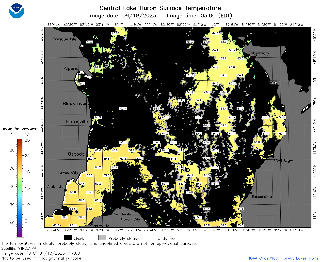
![[IMG]](https://apps.glerl.noaa.gov/erddap/images/fileIcons/image2.gif)  | h2_2023_09_18_0150.png | 18-Sep-2023 05:30 | 43444 | |
 | h2_2023_09_18_0240.png | 18-Sep-2023 05:32 | 69819 | |
 | h2_2023_09_18_0330.png | 18-Sep-2023 06:28 | 57053 | |
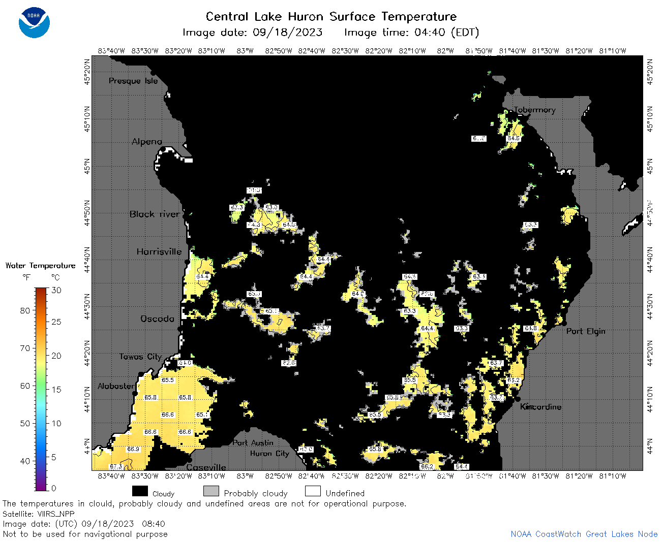
 | h2_2023_09_18_0610.png | 18-Sep-2023 09:25 | 50474 | |
 | h2_2023_09_18_0700.png | 18-Sep-2023 10:26 | 86994 | |
 | h2_2023_09_18_0750.png | 18-Sep-2023 11:26 | 82066 | |
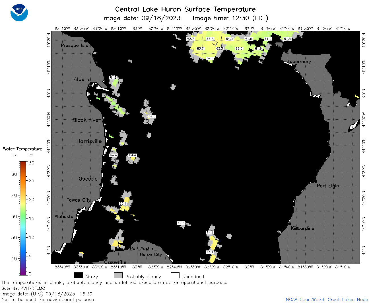
 | h2_2023_09_18_0840.png | 18-Sep-2023 12:26 | 61966 | |
 | h2_2023_09_18_1450.png | 18-Sep-2023 19:26 | 39258 | |
 | h2_2023_09_18_1540.png | 18-Sep-2023 19:28 | 48733 | |
 | h2_2023_09_18_1630.png | 18-Sep-2023 20:26 | 38761 | |
 | h2_2023_09_18_1820.png | 18-Sep-2023 23:26 | 64461 | |
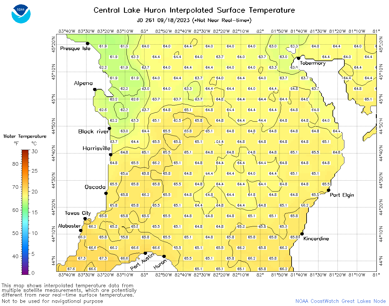 | h2_2023_261.png | 19-Sep-2023 09:14 | 57815 | |