
Easier access to scientific data

Brought to you by NOAA CoastWatch Great Lakes Node
|
ERDDAP
Easier access to scientific data |
|
Brought to you by NOAA CoastWatch Great Lakes Node |
| Dataset Title: | Lake Huron Central Region Surface Temperature Contour Map (2022-present)


|
| Institution: | CoastWatch Great Lakes Node (Dataset ID: LH_NRT_TC_h2) |
| Information: | Summary
| License
| Metadata
| Background | Subset
| Data Access Form
| Make a graph
| Subset
| Data Access Form
| Make a graph
|
![[ICO]](https://apps.glerl.noaa.gov/erddap/images/fileIcons/blank.gif) | Name | Last modified | Size | Description |
|---|---|---|---|---|
![[DIR]](https://apps.glerl.noaa.gov/erddap/images/fileIcons/back.gif) | Parent Directory | - | - | |
![[IMG]](https://apps.glerl.noaa.gov/erddap/images/fileIcons/image2.gif) 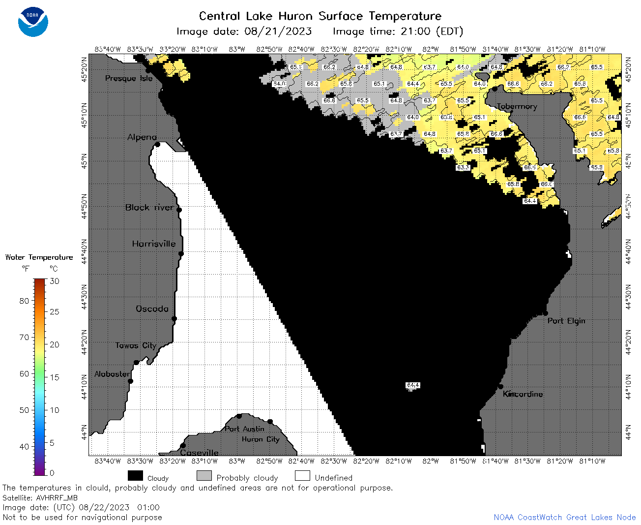 | h2_2023_08_22_0100.png | 22-Aug-2023 05:25 | 50680 | |
 | h2_2023_08_22_0200.png | 22-Aug-2023 05:30 | 83118 | |
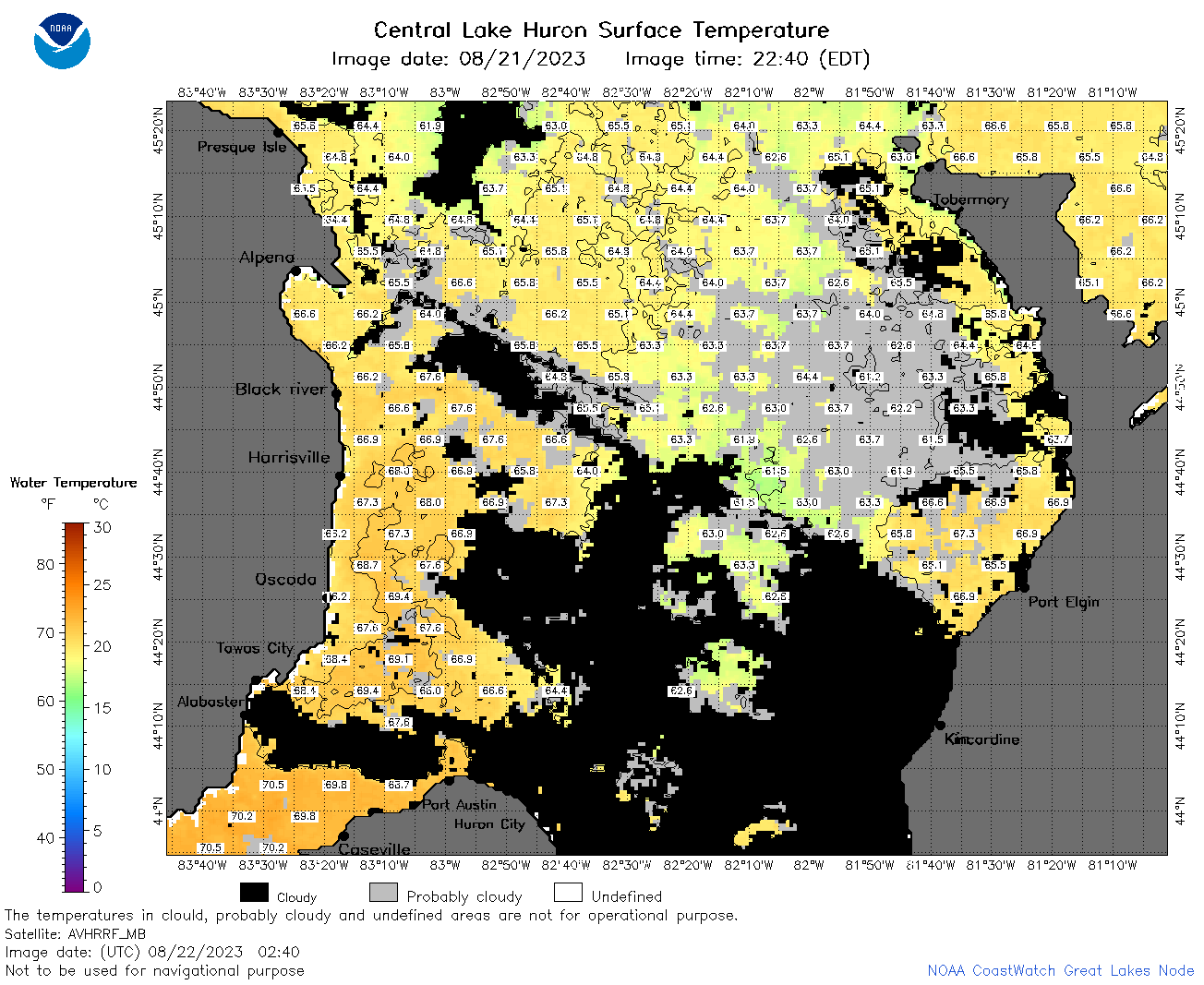 | h2_2023_08_22_0240.png | 22-Aug-2023 05:32 | 100752 | |
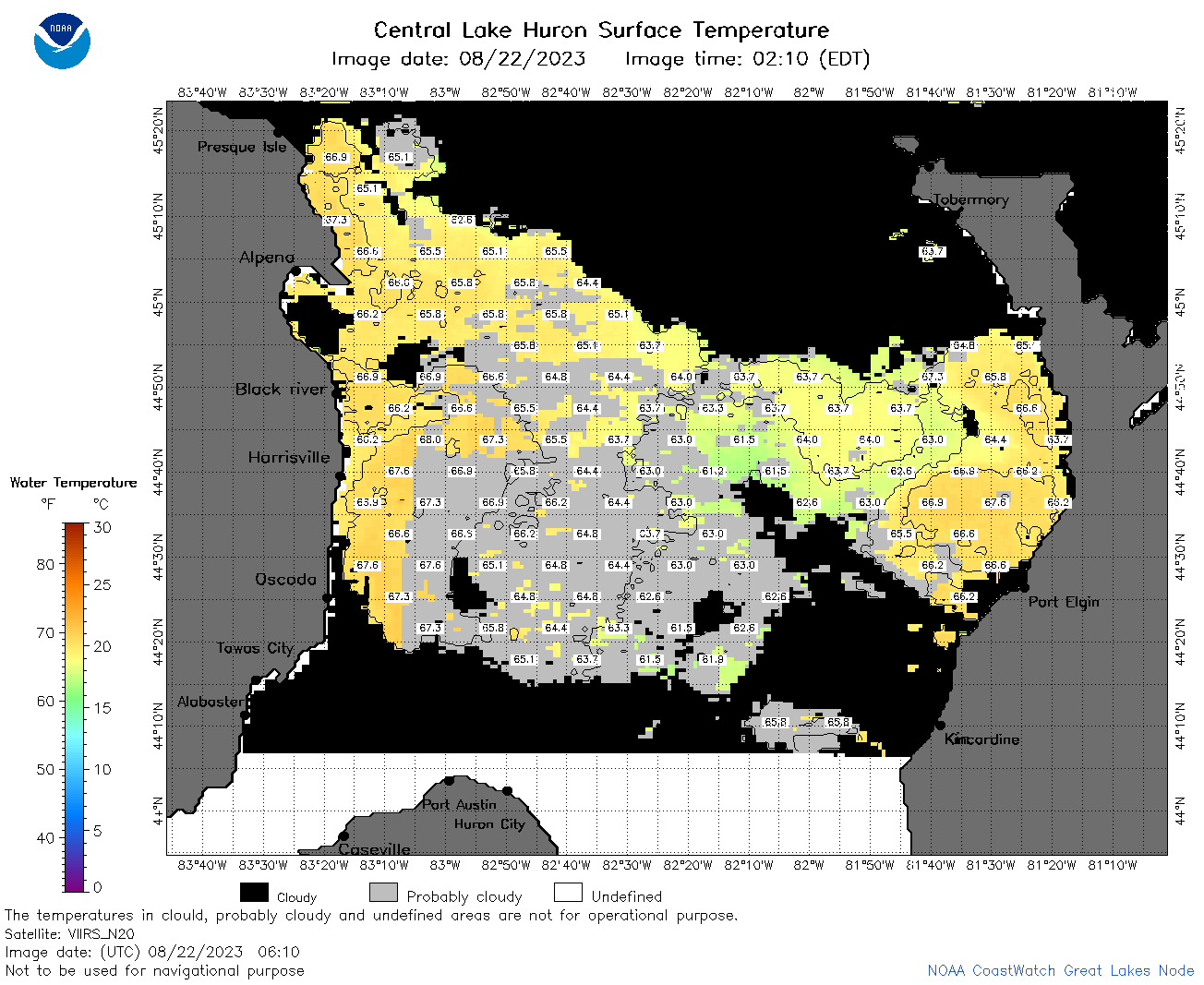 | h2_2023_08_22_0610.png | 22-Aug-2023 09:25 | 65474 | |
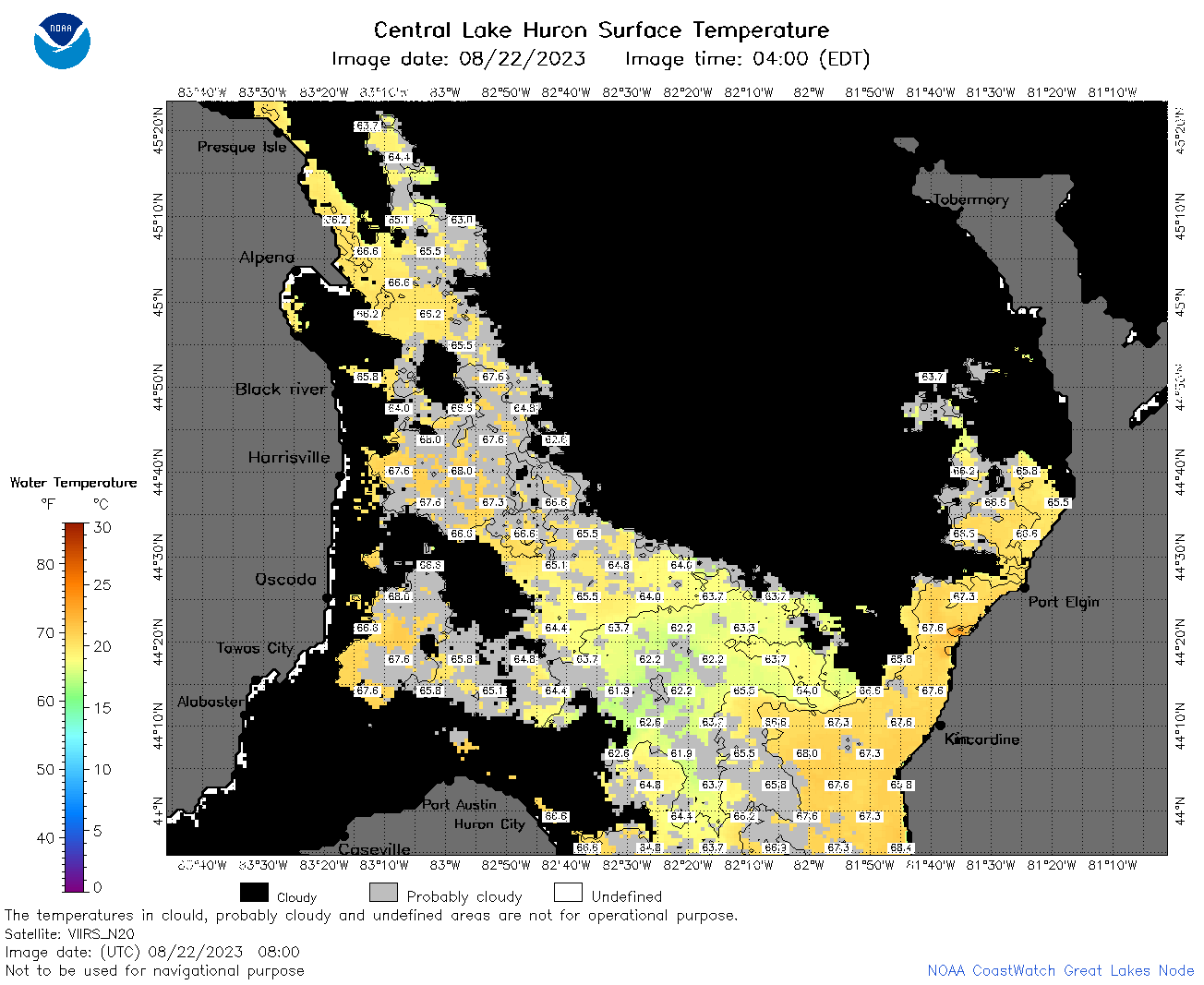
 | h2_2023_08_22_0710.png | 22-Aug-2023 11:25 | 97160 | |
 | h2_2023_08_22_0800.png | 22-Aug-2023 10:27 | 68911 | |
 | h2_2023_08_22_0850.png | 22-Aug-2023 13:27 | 35132 | |
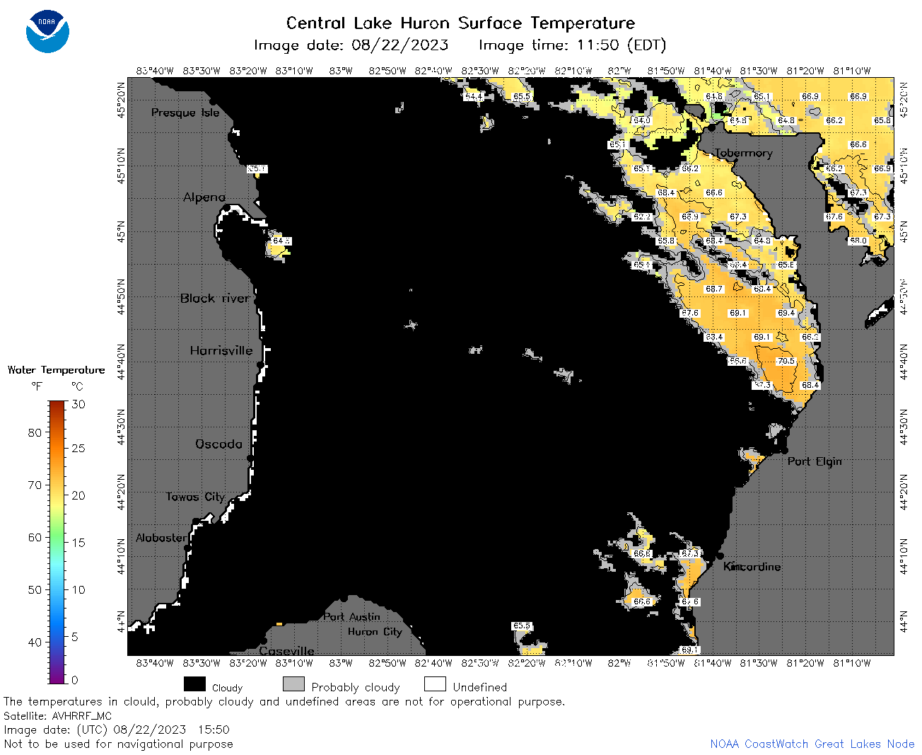
 | h2_2023_08_22_1500.png | 22-Aug-2023 18:28 | 60779 | |
 | h2_2023_08_22_1550.png | 22-Aug-2023 20:26 | 54776 | |
 | h2_2023_08_22_1640.png | 22-Aug-2023 19:26 | 50508 | |
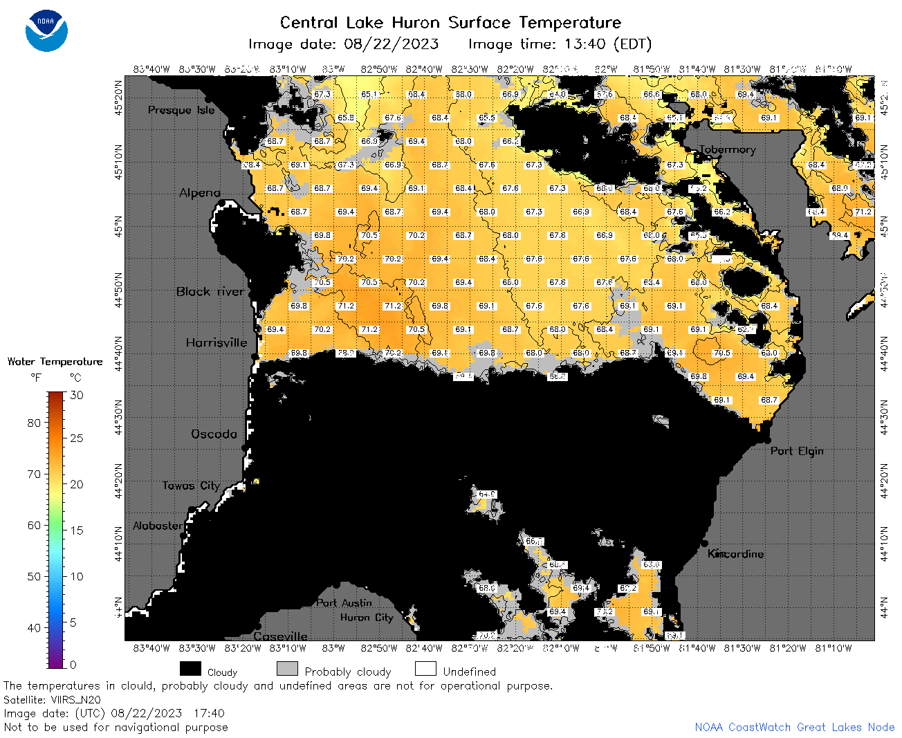 | h2_2023_08_22_1740.png | 22-Aug-2023 21:27 | 84288 | |
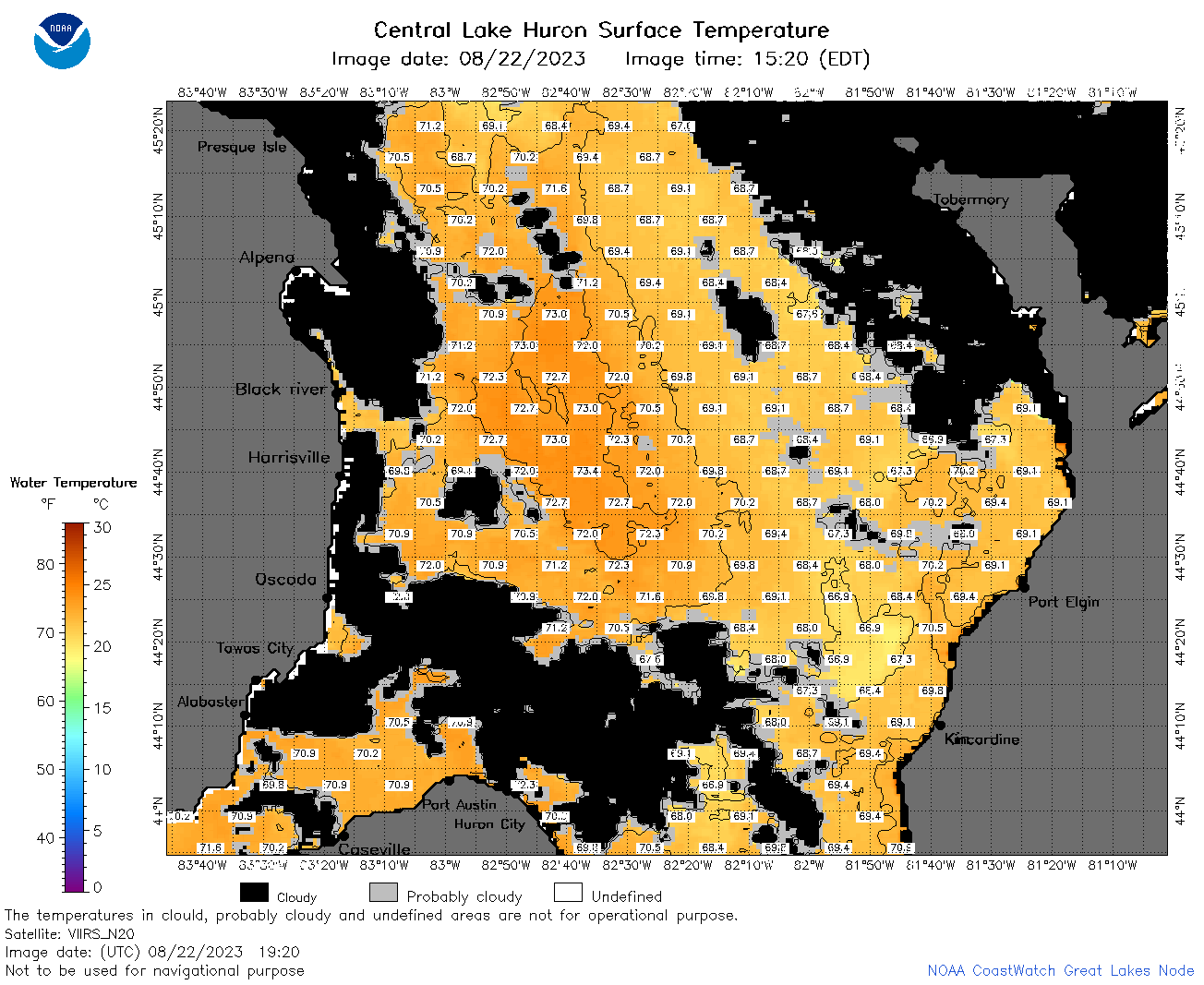
 | h2_2023_08_22_1830.png | 22-Aug-2023 21:30 | 95856 | |
 | h2_2023_08_22_1920.png | 22-Aug-2023 22:26 | 87046 | |
 | h2_2023_234.png | 23-Aug-2023 09:14 | 64320 | |