
Easier access to scientific data

Brought to you by NOAA CoastWatch Great Lakes Node
|
ERDDAP
Easier access to scientific data |
|
Brought to you by NOAA CoastWatch Great Lakes Node |
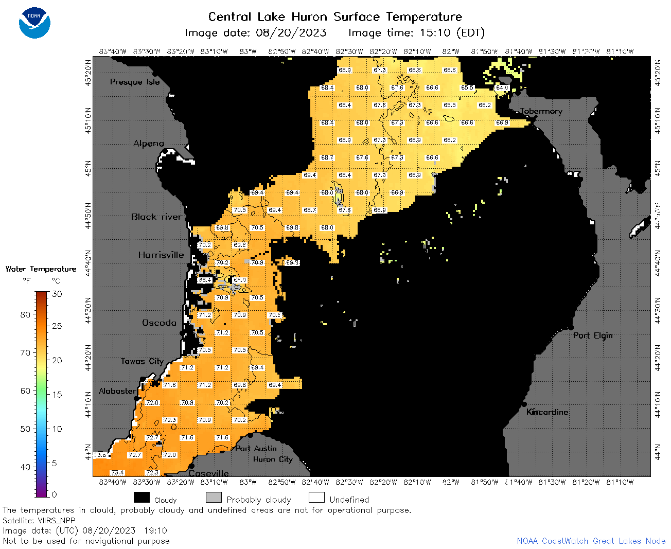
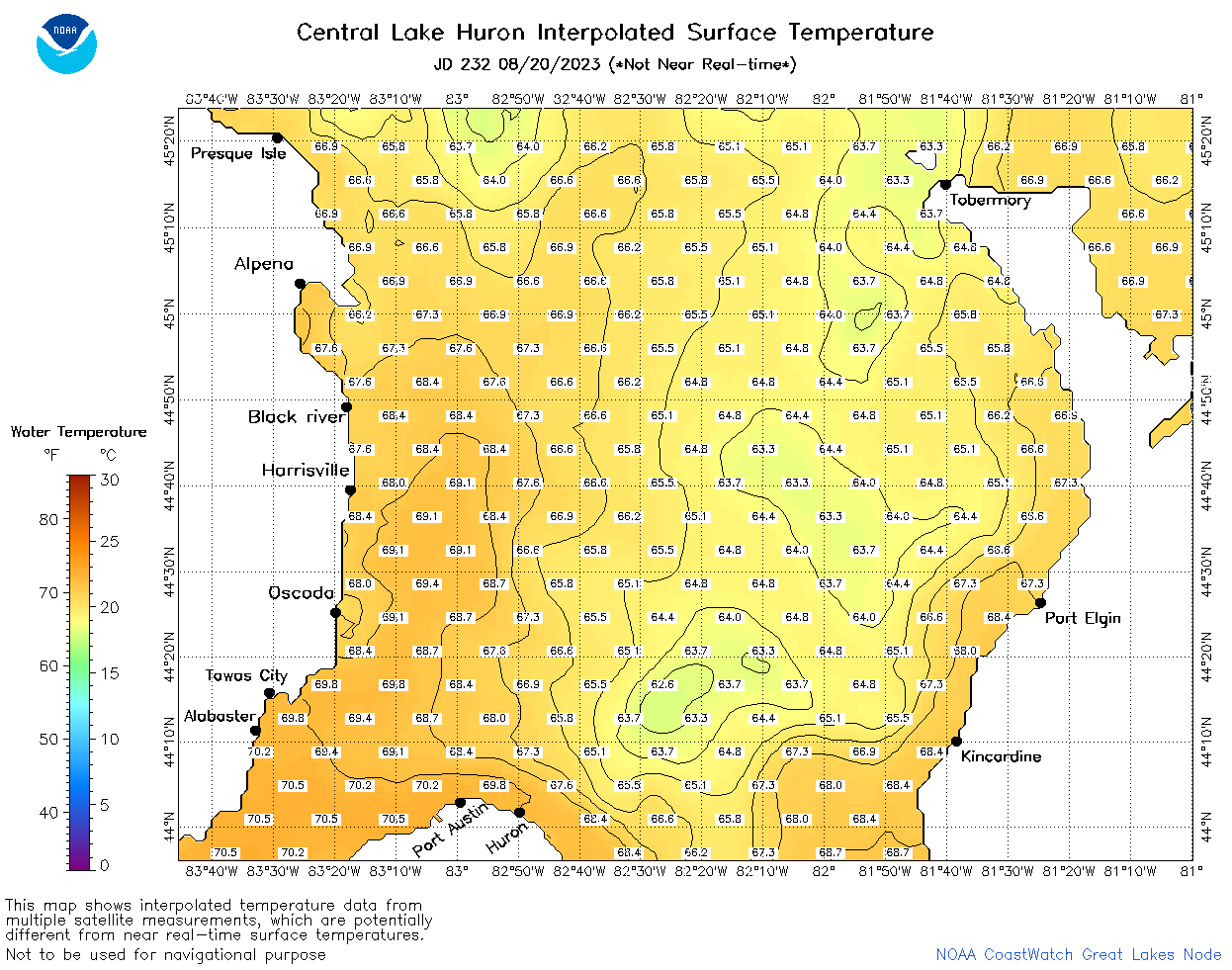
| Dataset Title: | Lake Huron Central Region Surface Temperature Contour Map (2022-present)


|
| Institution: | CoastWatch Great Lakes Node (Dataset ID: LH_NRT_TC_h2) |
| Information: | Summary
| License
| Metadata
| Background | Subset
| Data Access Form
| Make a graph
| Subset
| Data Access Form
| Make a graph
|
![[ICO]](https://apps.glerl.noaa.gov/erddap/images/fileIcons/blank.gif) | Name | Last modified | Size | Description |
|---|---|---|---|---|
![[DIR]](https://apps.glerl.noaa.gov/erddap/images/fileIcons/back.gif) | Parent Directory | - | - | |
![[IMG]](https://apps.glerl.noaa.gov/erddap/images/fileIcons/image2.gif)  | h2_2023_08_20_0100.png | 20-Aug-2023 05:25 | 36940 | |
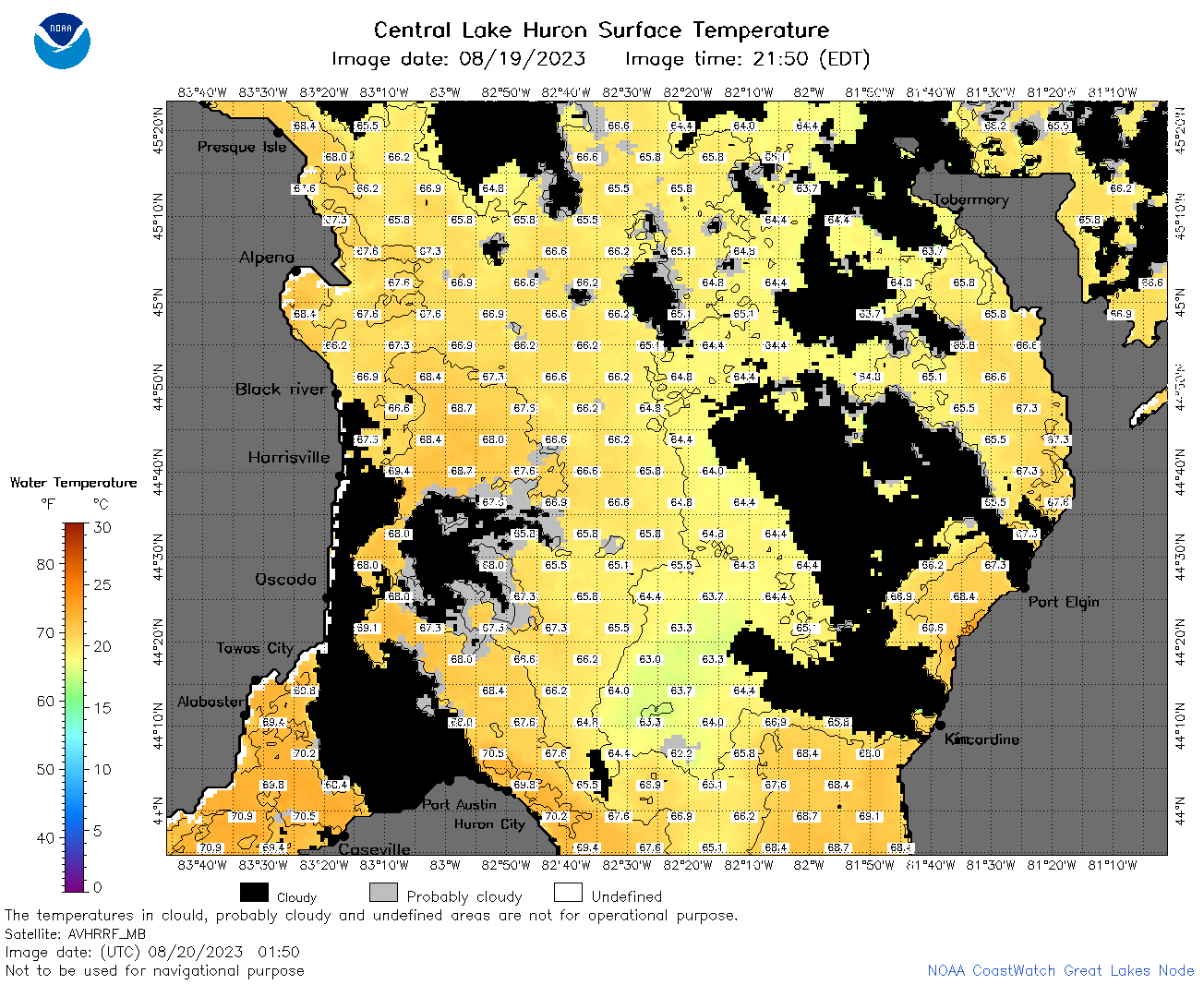 | h2_2023_08_20_0150.png | 20-Aug-2023 05:29 | 101976 | |
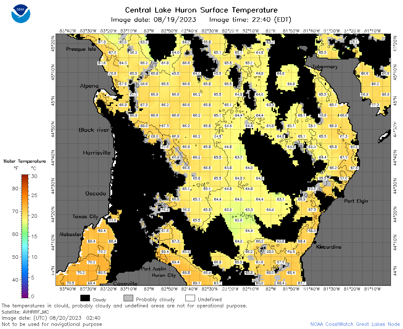 | h2_2023_08_20_0240.png | 20-Aug-2023 05:32 | 93608 | |
 | h2_2023_08_20_0330.png | 20-Aug-2023 06:27 | 72167 | |
 | h2_2023_08_20_0650.png | 20-Aug-2023 10:26 | 109191 | |
 | h2_2023_08_20_0740.png | 20-Aug-2023 11:26 | 105151 | |
 | h2_2023_08_20_0830.png | 20-Aug-2023 11:28 | 105203 | |
 | h2_2023_08_20_1450.png | 20-Aug-2023 19:26 | 39317 | |
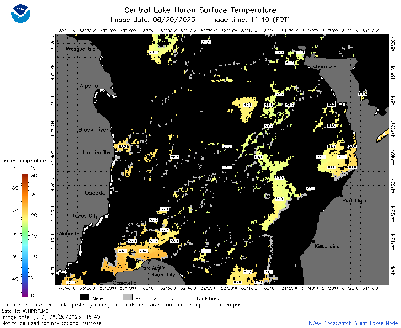 | h2_2023_08_20_1540.png | 20-Aug-2023 19:28 | 55566 | |
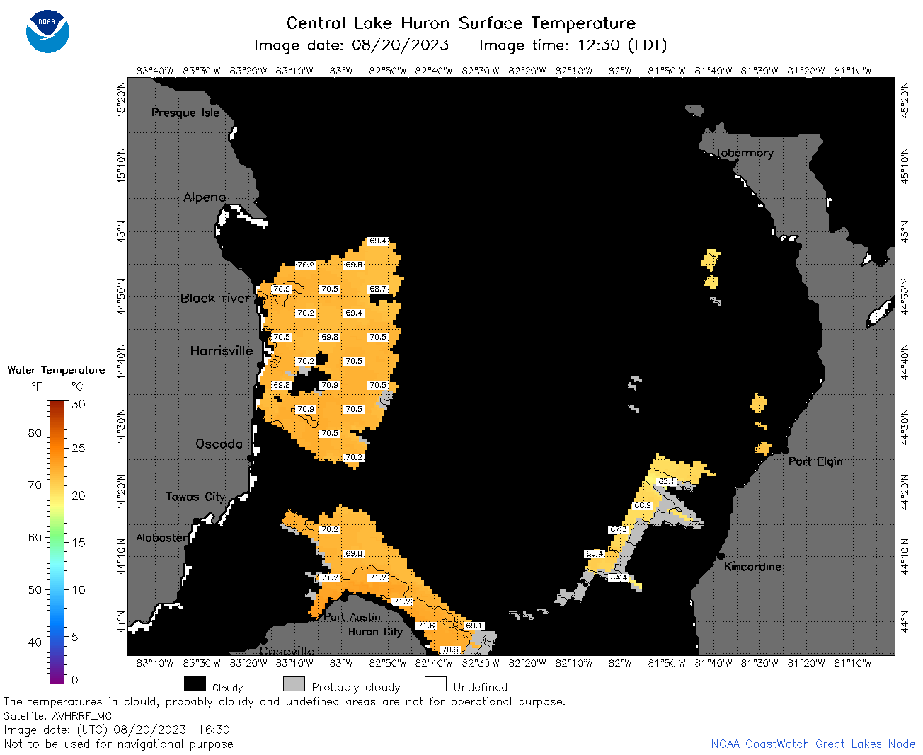 | h2_2023_08_20_1630.png | 20-Aug-2023 20:26 | 41459 | |
 | h2_2023_08_20_1730.png | 20-Aug-2023 20:32 | 71751 | |
 | h2_2023_08_20_1820.png | 20-Aug-2023 20:34 | 64570 | |
 | h2_2023_08_20_1910.png | 20-Aug-2023 23:26 | 58587 | |
 | h2_2023_232.png | 21-Aug-2023 09:14 | 64298 | |