
Easier access to scientific data

Brought to you by NOAA CoastWatch Great Lakes Node
|
ERDDAP
Easier access to scientific data |
|
Brought to you by NOAA CoastWatch Great Lakes Node |
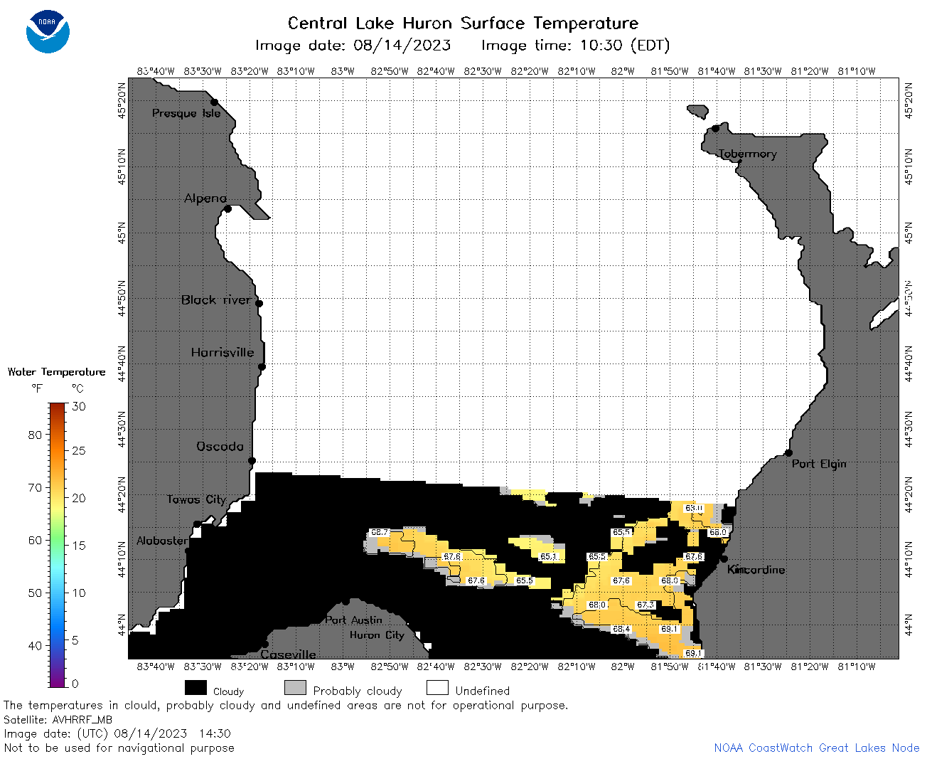
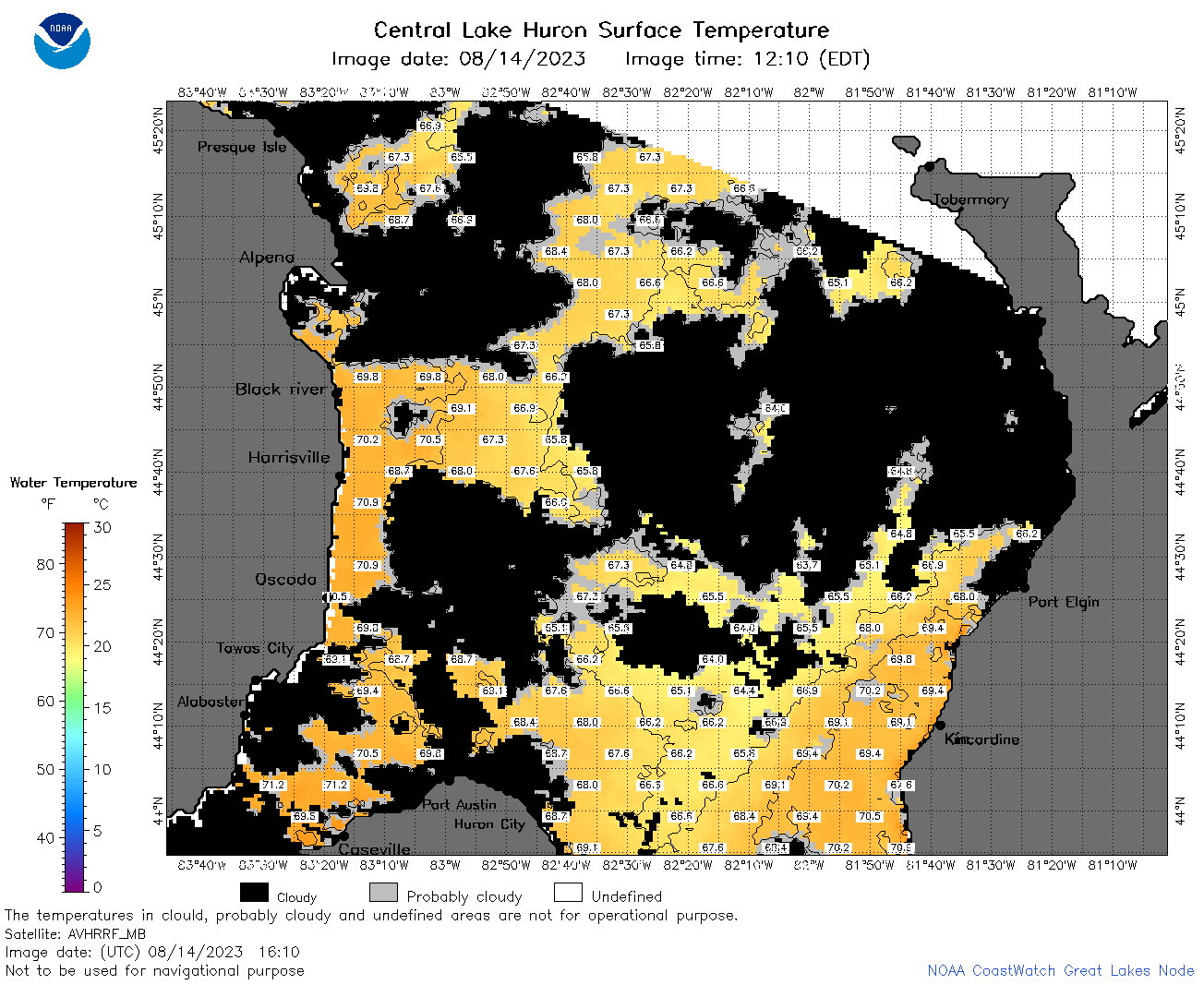
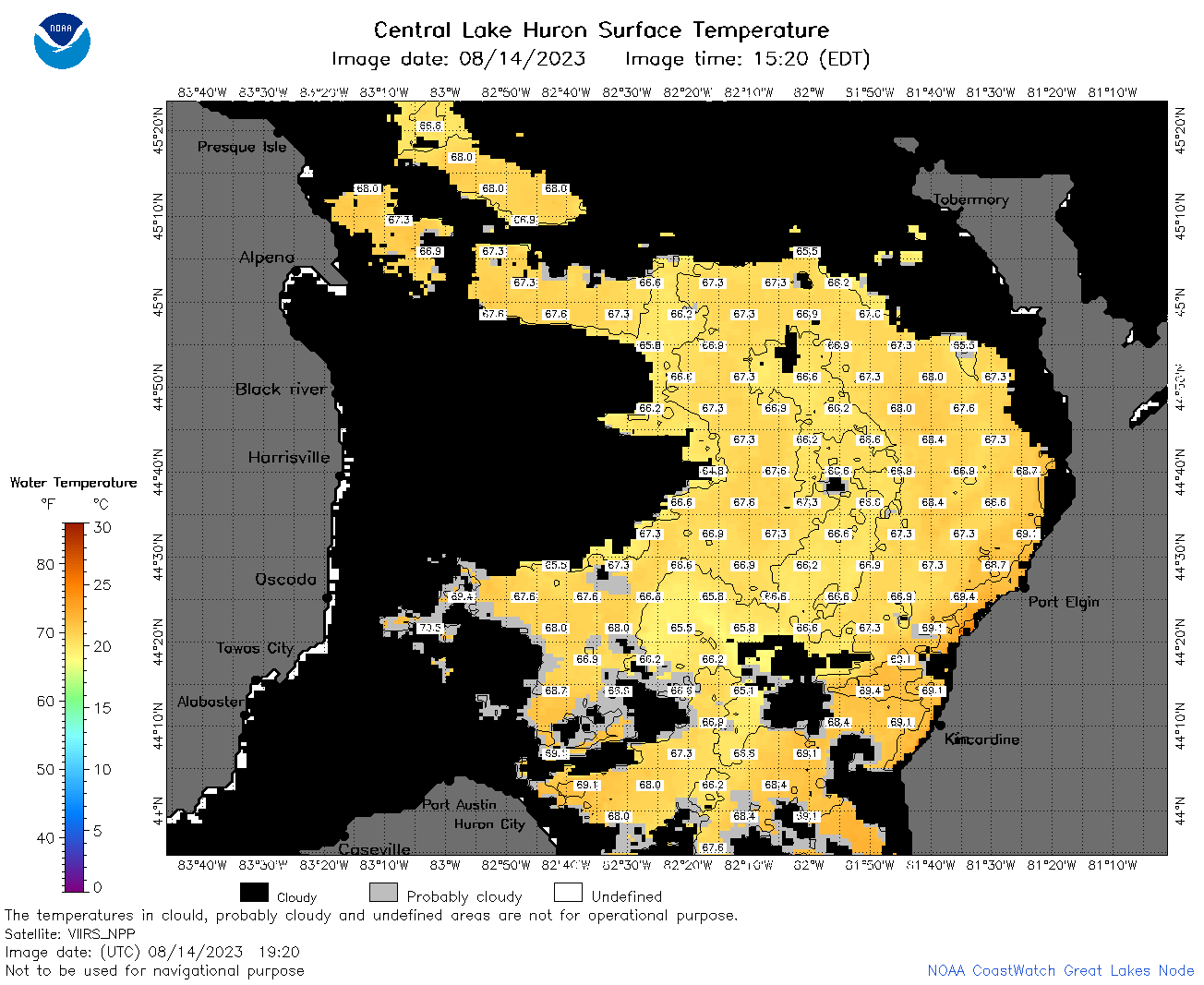
| Dataset Title: | Lake Huron Central Region Surface Temperature Contour Map (2022-present)


|
| Institution: | CoastWatch Great Lakes Node (Dataset ID: LH_NRT_TC_h2) |
| Information: | Summary
| License
| Metadata
| Background | Subset
| Data Access Form
| Make a graph
| Subset
| Data Access Form
| Make a graph
|
![[ICO]](https://apps.glerl.noaa.gov/erddap/images/fileIcons/blank.gif) | Name | Last modified | Size | Description |
|---|---|---|---|---|
![[DIR]](https://apps.glerl.noaa.gov/erddap/images/fileIcons/back.gif) | Parent Directory | - | - | |
![[IMG]](https://apps.glerl.noaa.gov/erddap/images/fileIcons/image2.gif) 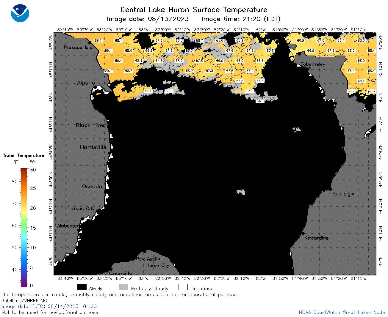 | h2_2023_08_14_0120.png | 14-Aug-2023 05:25 | 49470 | |
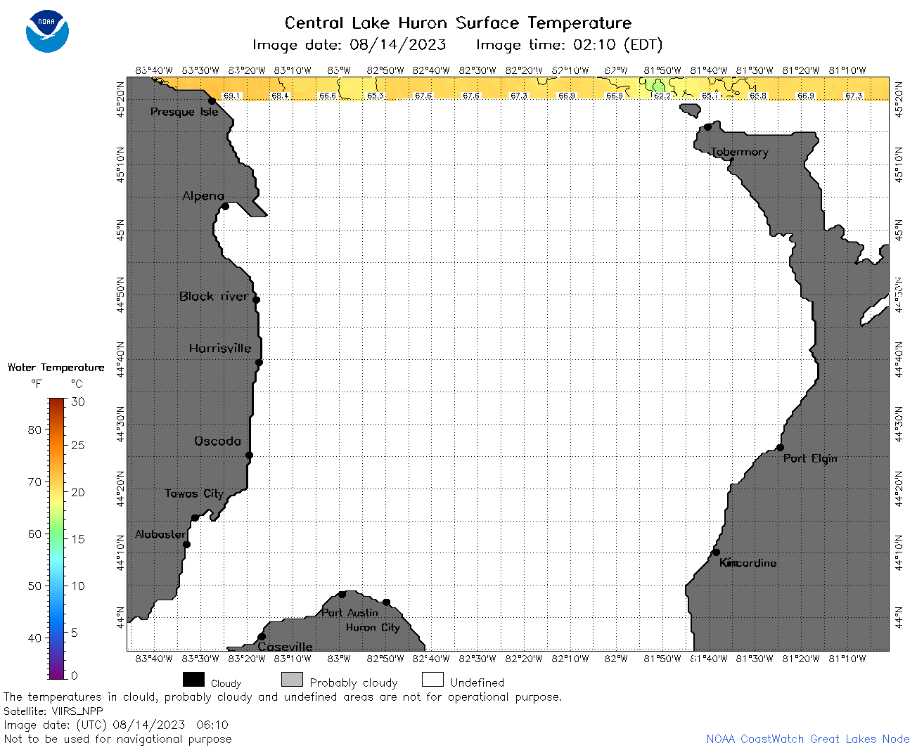
 | h2_2023_08_14_0210.png | 14-Aug-2023 05:28 | 67587 | |
 | h2_2023_08_14_0610.png | 14-Aug-2023 10:26 | 35502 | |
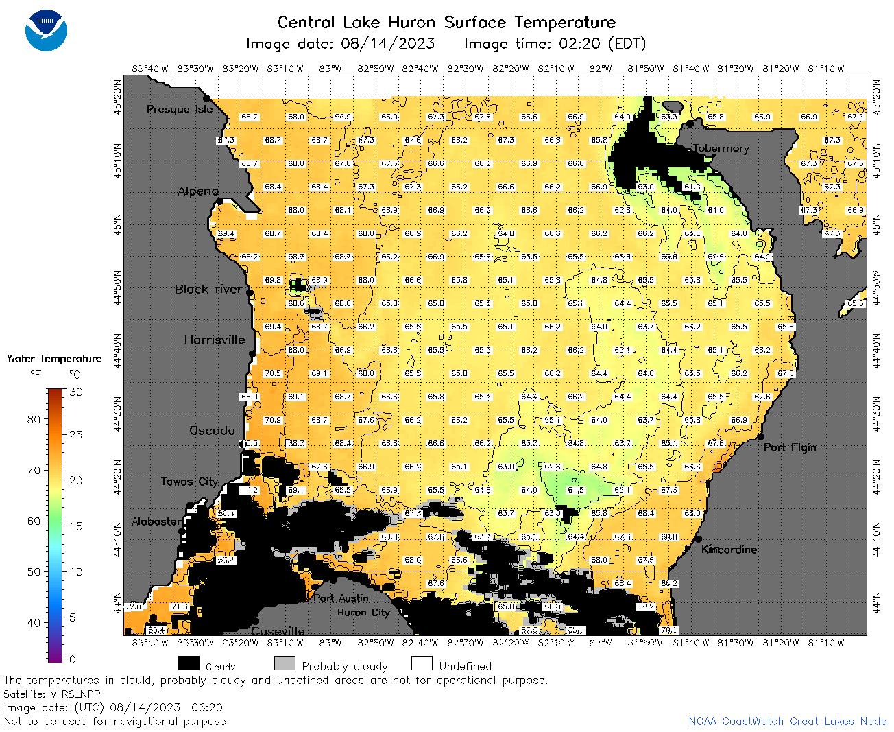 | h2_2023_08_14_0620.png | 14-Aug-2023 10:27 | 99698 | |
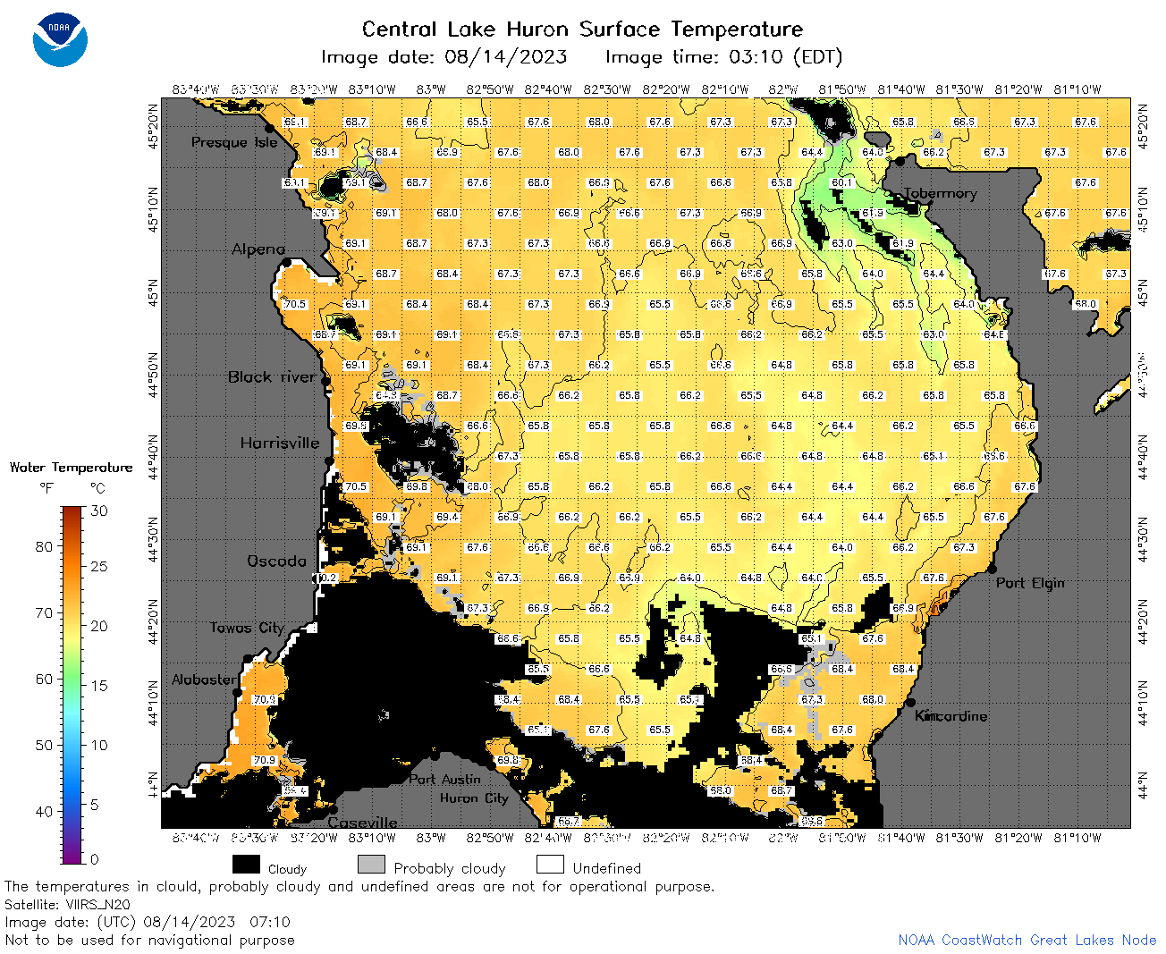 | h2_2023_08_14_0710.png | 14-Aug-2023 10:31 | 101035 | |
 | h2_2023_08_14_0800.png | 14-Aug-2023 11:27 | 109617 | |
 | h2_2023_08_14_0850.png | 14-Aug-2023 11:30 | 78647 | |
 | h2_2023_08_14_1420.png | 14-Aug-2023 17:25 | 40484 | |
 | h2_2023_08_14_1430.png | 14-Aug-2023 17:27 | 36281 | |
 | h2_2023_08_14_1520.png | 14-Aug-2023 19:26 | 69470 | |
 | h2_2023_08_14_1600.png | 14-Aug-2023 19:28 | 37419 | |
 | h2_2023_08_14_1610.png | 14-Aug-2023 19:30 | 76494 | |
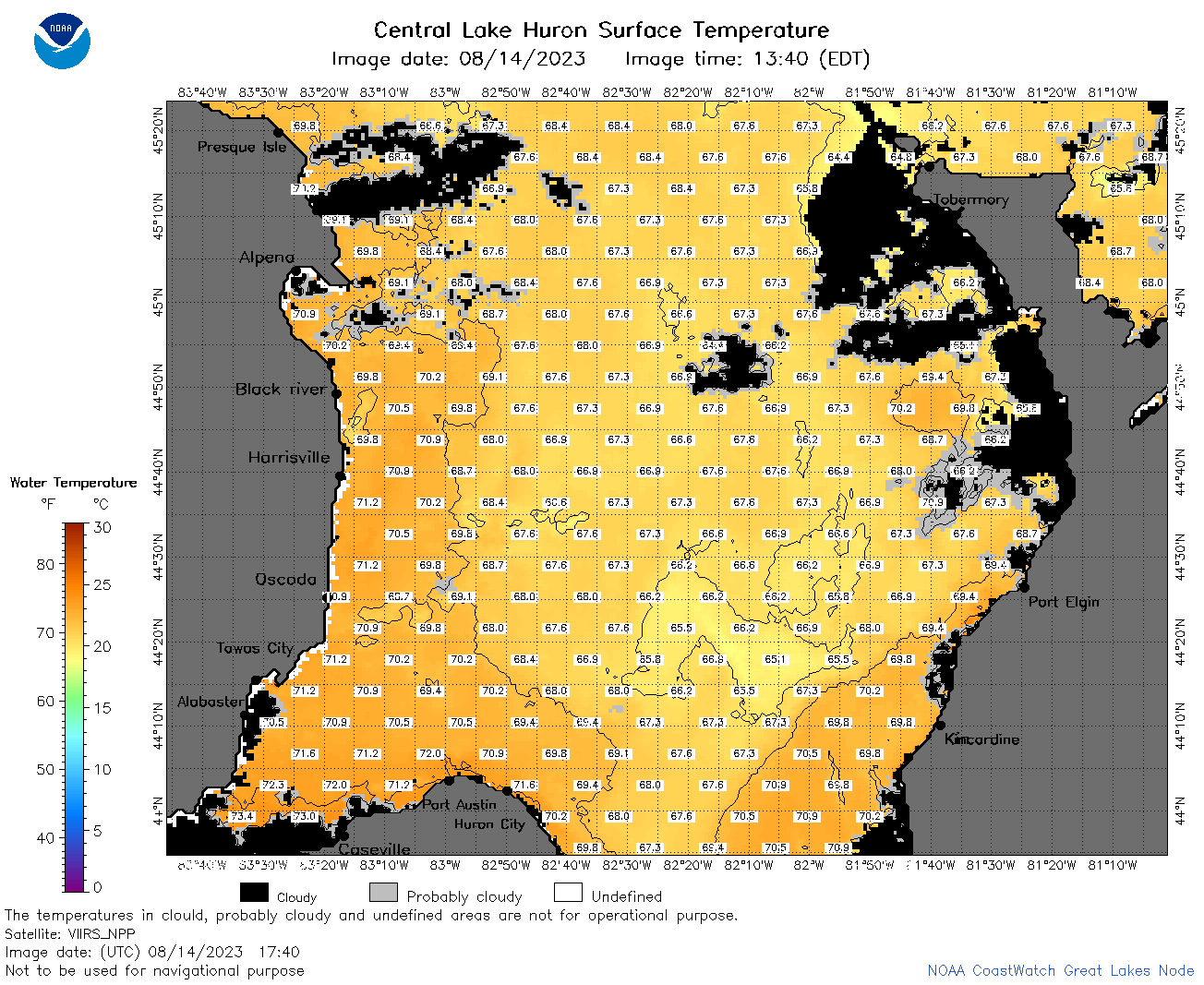 | h2_2023_08_14_1740.png | 14-Aug-2023 20:26 | 98030 | |
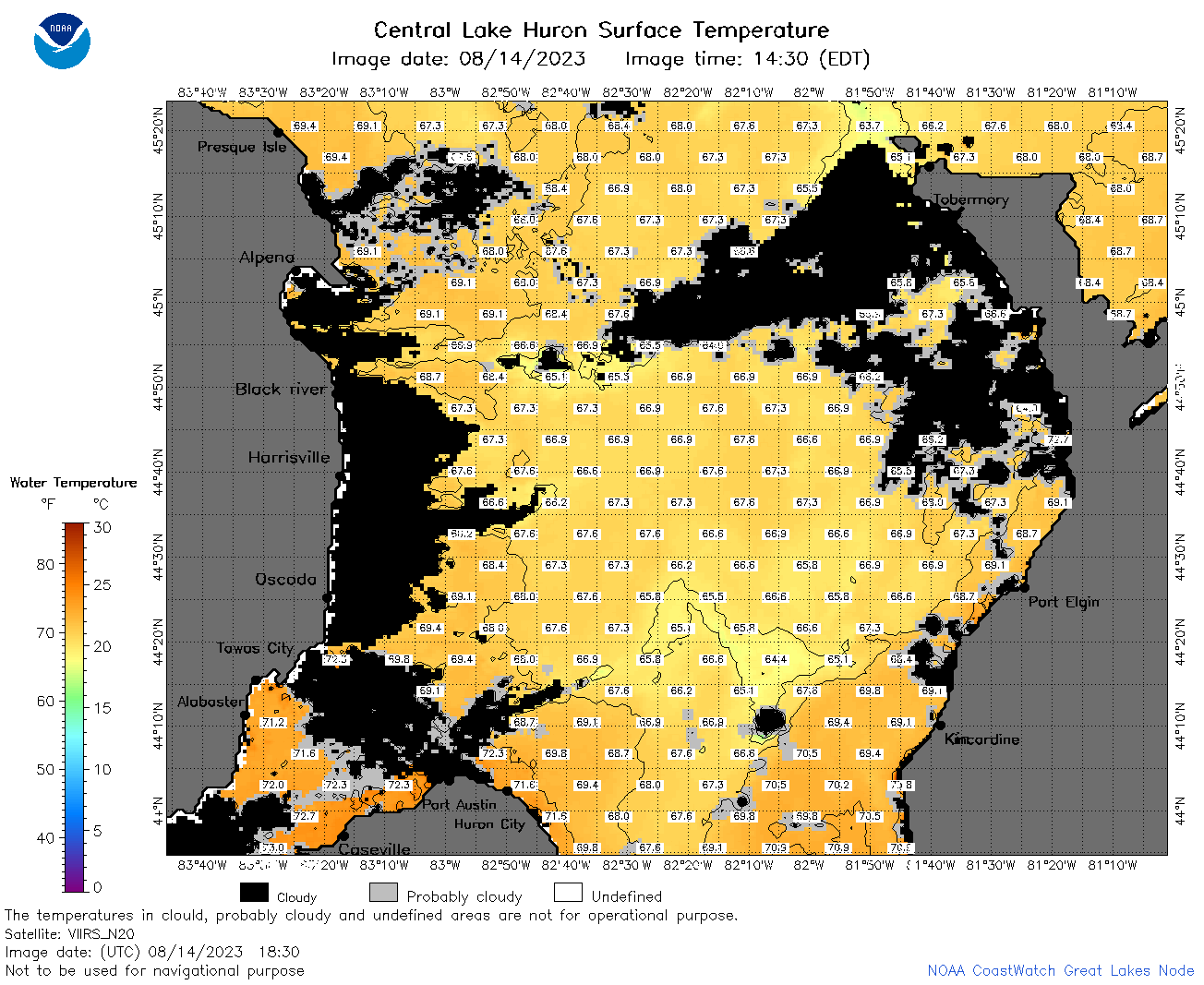 | h2_2023_08_14_1830.png | 14-Aug-2023 21:28 | 93091 | |
 | h2_2023_08_14_1920.png | 14-Aug-2023 22:26 | 69302 | |
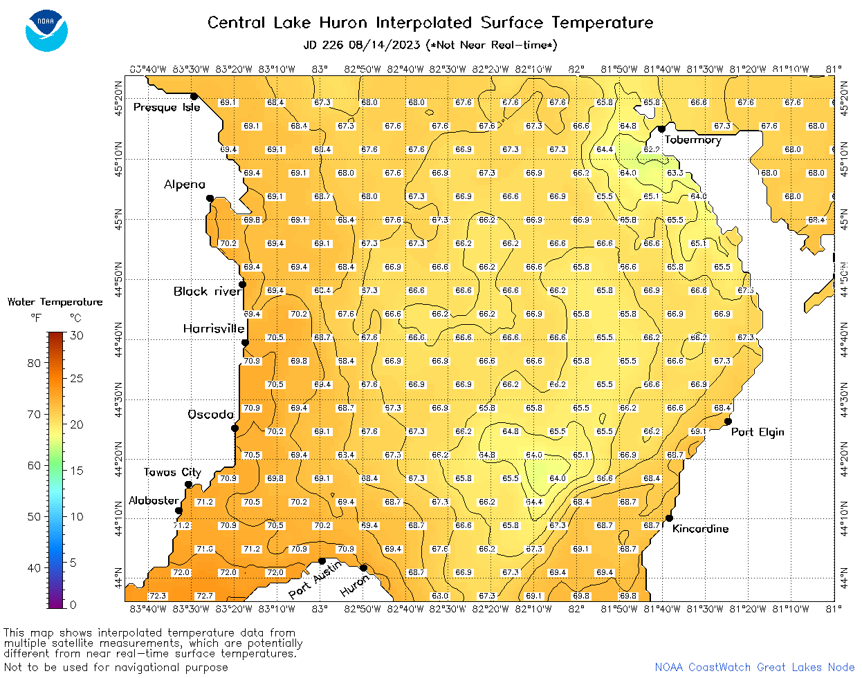 | h2_2023_226.png | 15-Aug-2023 09:14 | 64396 | |