
Easier access to scientific data

Brought to you by NOAA CoastWatch Great Lakes Node
|
ERDDAP
Easier access to scientific data |
|
Brought to you by NOAA CoastWatch Great Lakes Node |
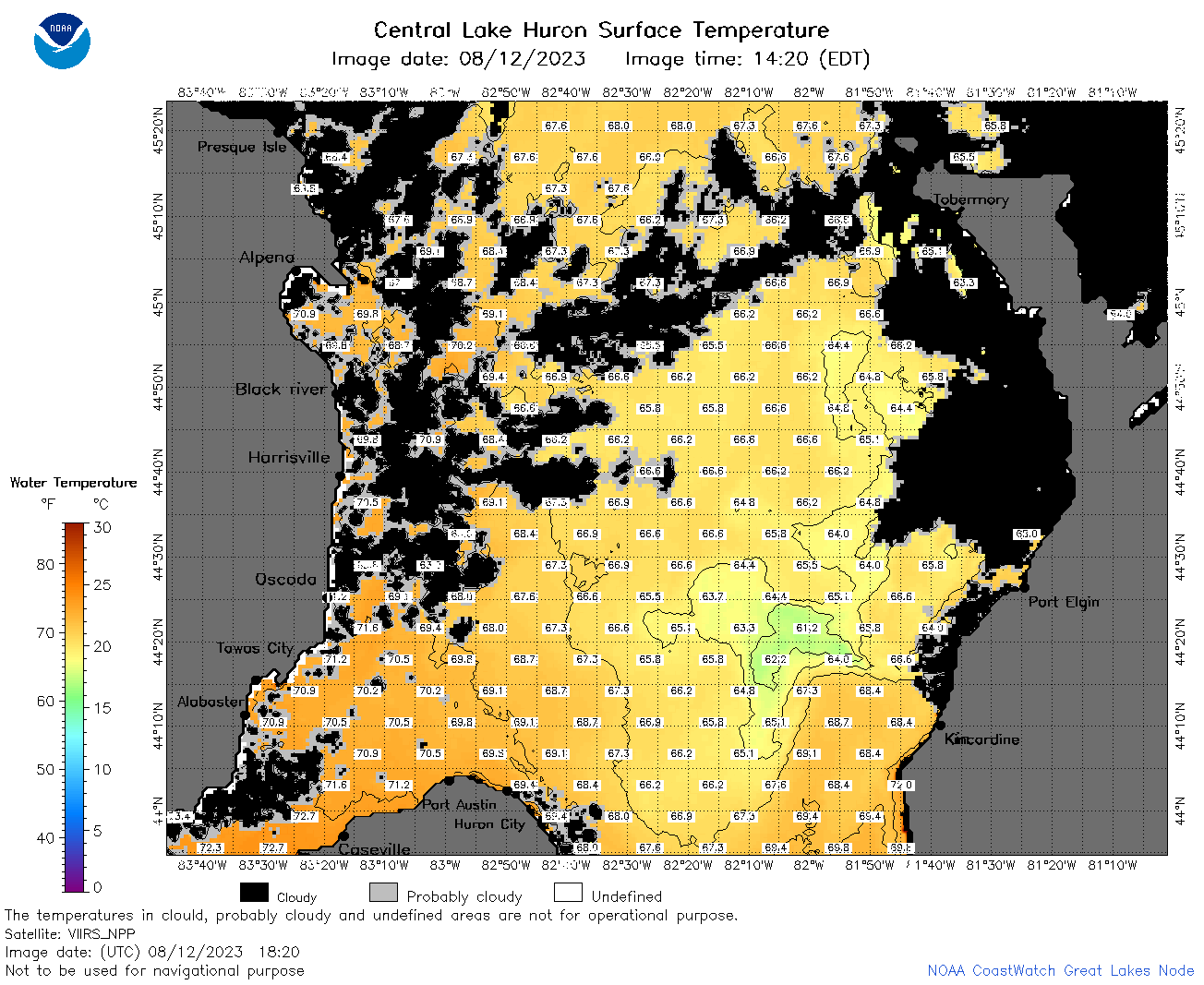
| Dataset Title: | Lake Huron Central Region Surface Temperature Contour Map (2022-present)


|
| Institution: | CoastWatch Great Lakes Node (Dataset ID: LH_NRT_TC_h2) |
| Information: | Summary
| License
| Metadata
| Background | Subset
| Data Access Form
| Make a graph
| Subset
| Data Access Form
| Make a graph
|
![[ICO]](https://apps.glerl.noaa.gov/erddap/images/fileIcons/blank.gif) | Name | Last modified | Size | Description |
|---|---|---|---|---|
![[DIR]](https://apps.glerl.noaa.gov/erddap/images/fileIcons/back.gif) | Parent Directory | - | - | |
![[IMG]](https://apps.glerl.noaa.gov/erddap/images/fileIcons/image2.gif) 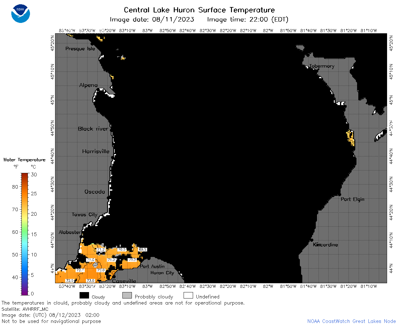 | h2_2023_08_12_0200.png | 12-Aug-2023 05:27 | 35039 | |
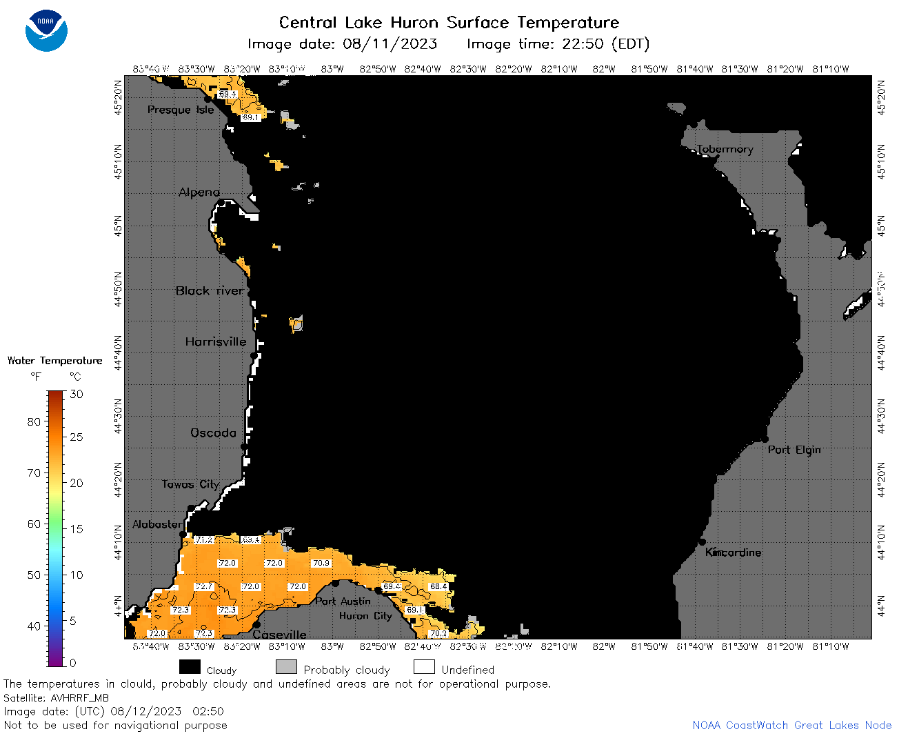 | h2_2023_08_12_0250.png | 12-Aug-2023 05:31 | 39629 | |
 | h2_2023_08_12_0650.png | 12-Aug-2023 10:25 | 43001 | |
 | h2_2023_08_12_0740.png | 12-Aug-2023 11:26 | 36046 | |
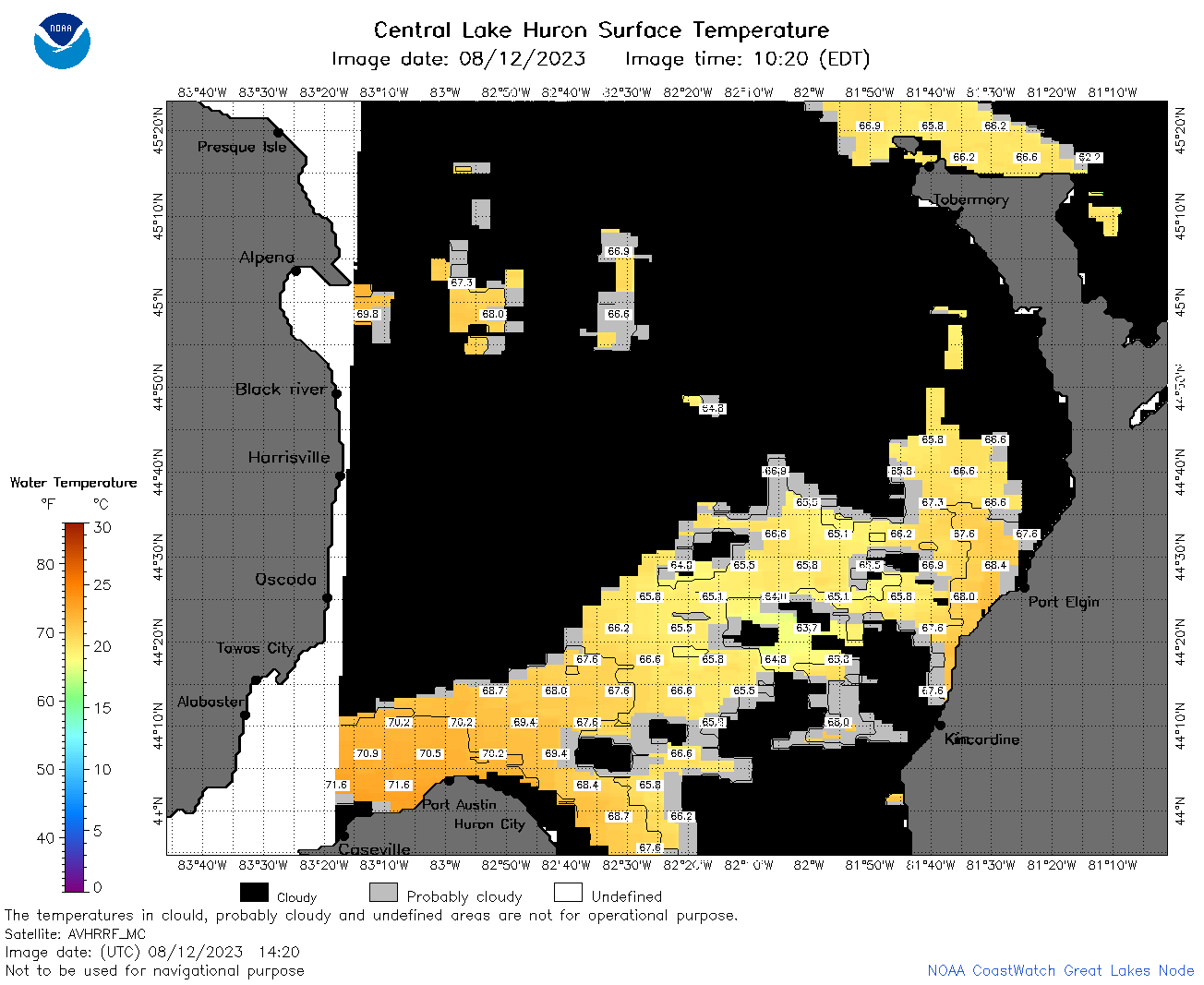 | h2_2023_08_12_1420.png | 12-Aug-2023 18:25 | 48962 | |
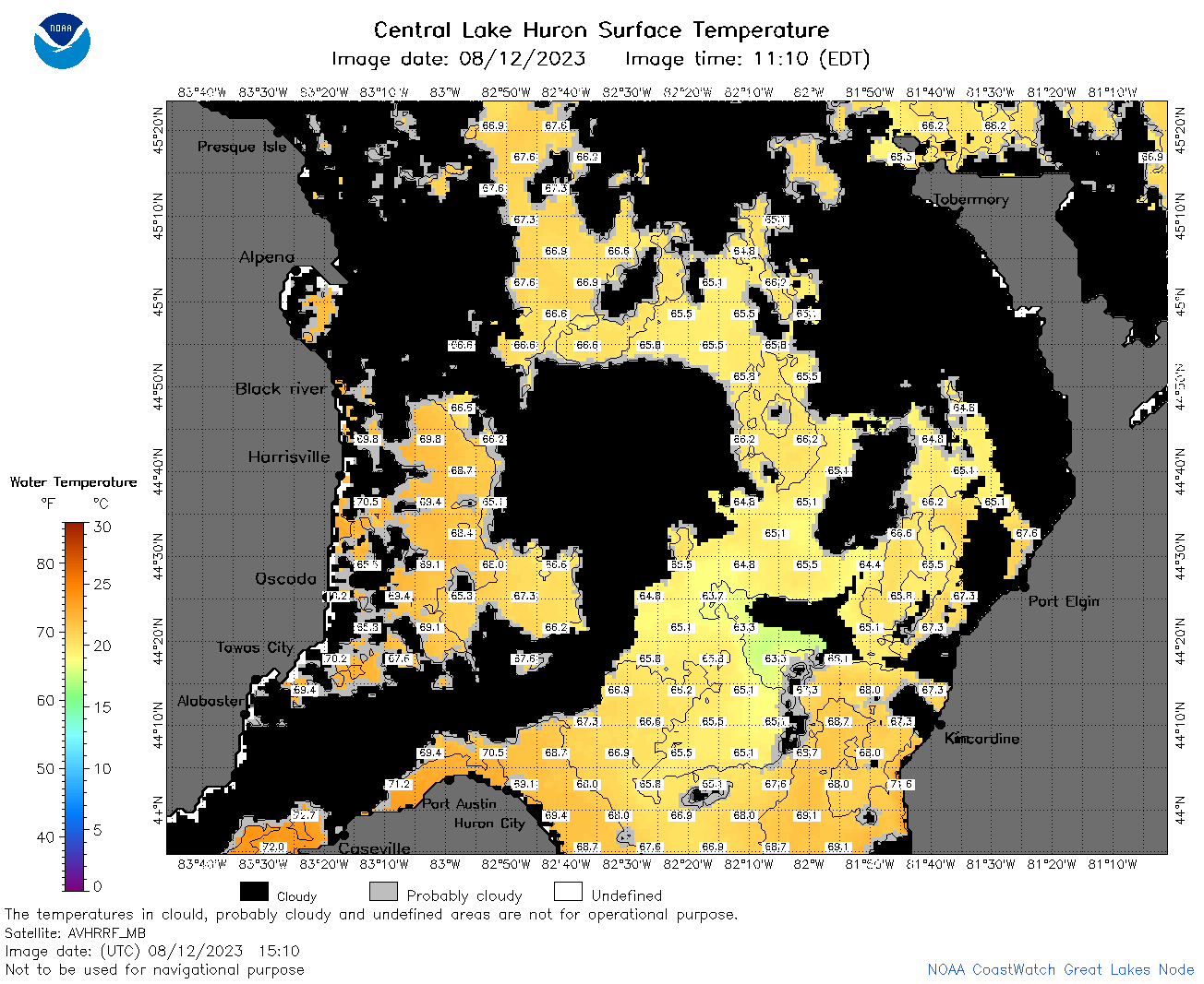 | h2_2023_08_12_1510.png | 12-Aug-2023 18:30 | 80465 | |
 | h2_2023_08_12_1600.png | 12-Aug-2023 20:26 | 94323 | |
 | h2_2023_08_12_1650.png | 12-Aug-2023 20:28 | 47445 | |
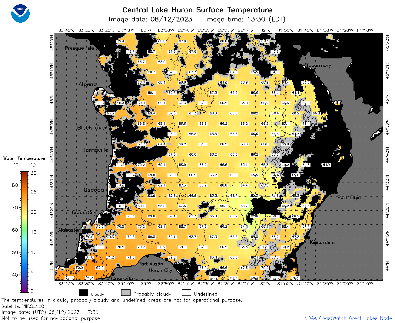 | h2_2023_08_12_1730.png | 12-Aug-2023 19:26 | 97712 | |
 | h2_2023_08_12_1820.png | 12-Aug-2023 22:26 | 92430 | |
 | h2_2023_08_12_1910.png | 12-Aug-2023 22:28 | 90213 | |
 | h2_2023_224.png | 13-Aug-2023 09:14 | 63992 | |