
Easier access to scientific data

Brought to you by NOAA CoastWatch Great Lakes Node
|
ERDDAP
Easier access to scientific data |
|
Brought to you by NOAA CoastWatch Great Lakes Node |
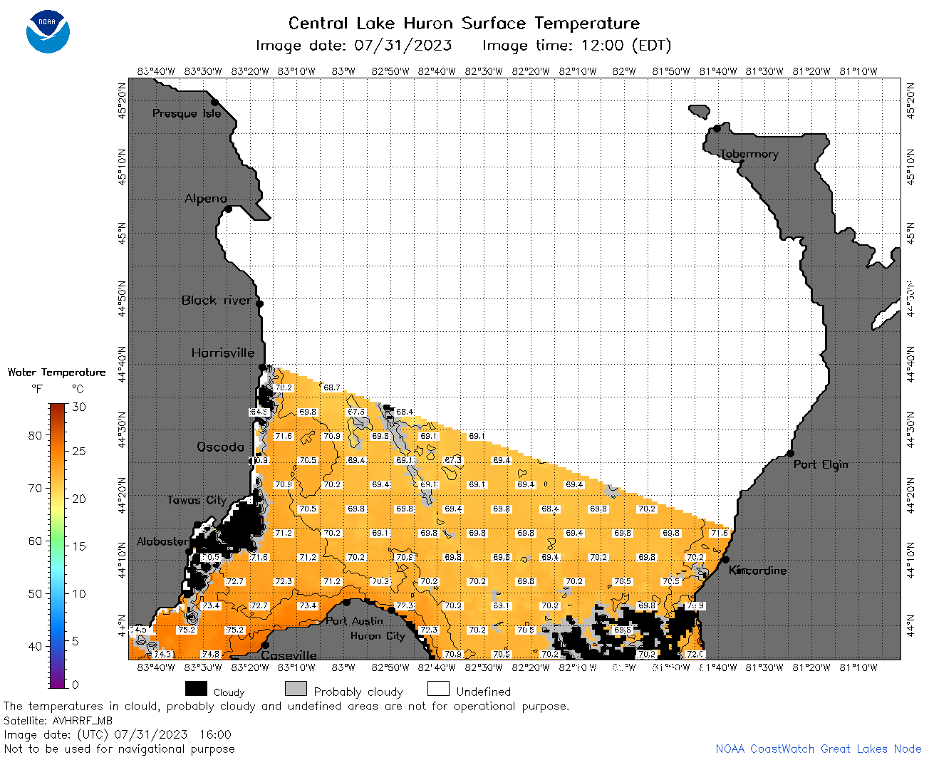
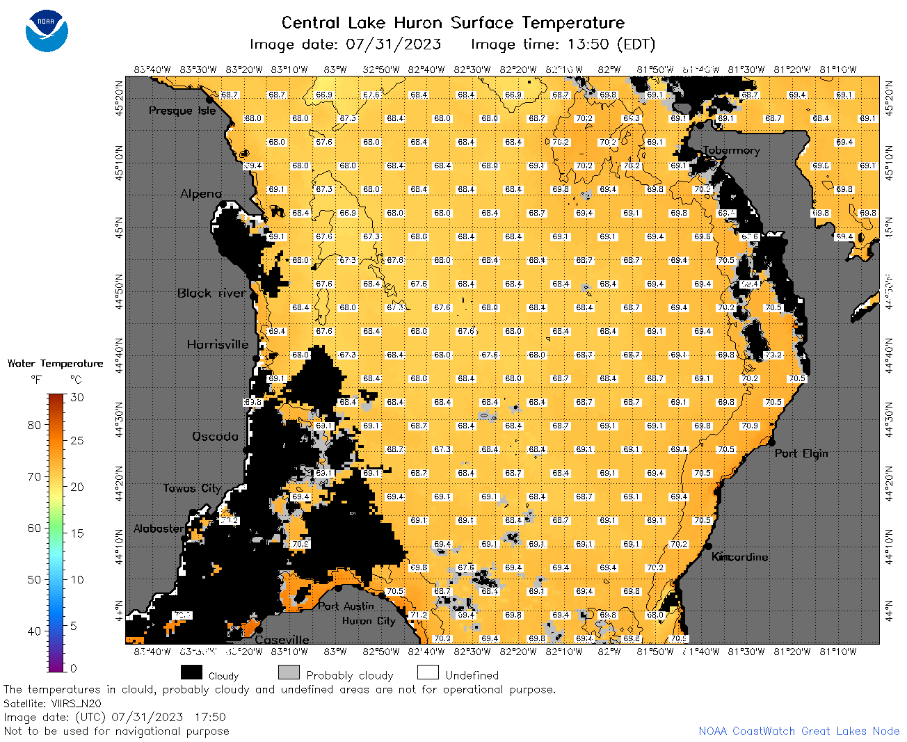
| Dataset Title: | Lake Huron Central Region Surface Temperature Contour Map (2022-present)


|
| Institution: | CoastWatch Great Lakes Node (Dataset ID: LH_NRT_TC_h2) |
| Information: | Summary
| License
| Metadata
| Background | Subset
| Data Access Form
| Make a graph
| Subset
| Data Access Form
| Make a graph
|
![[ICO]](https://apps.glerl.noaa.gov/erddap/images/fileIcons/blank.gif) | Name | Last modified | Size | Description |
|---|---|---|---|---|
![[DIR]](https://apps.glerl.noaa.gov/erddap/images/fileIcons/back.gif) | Parent Directory | - | - | |
![[IMG]](https://apps.glerl.noaa.gov/erddap/images/fileIcons/image2.gif) 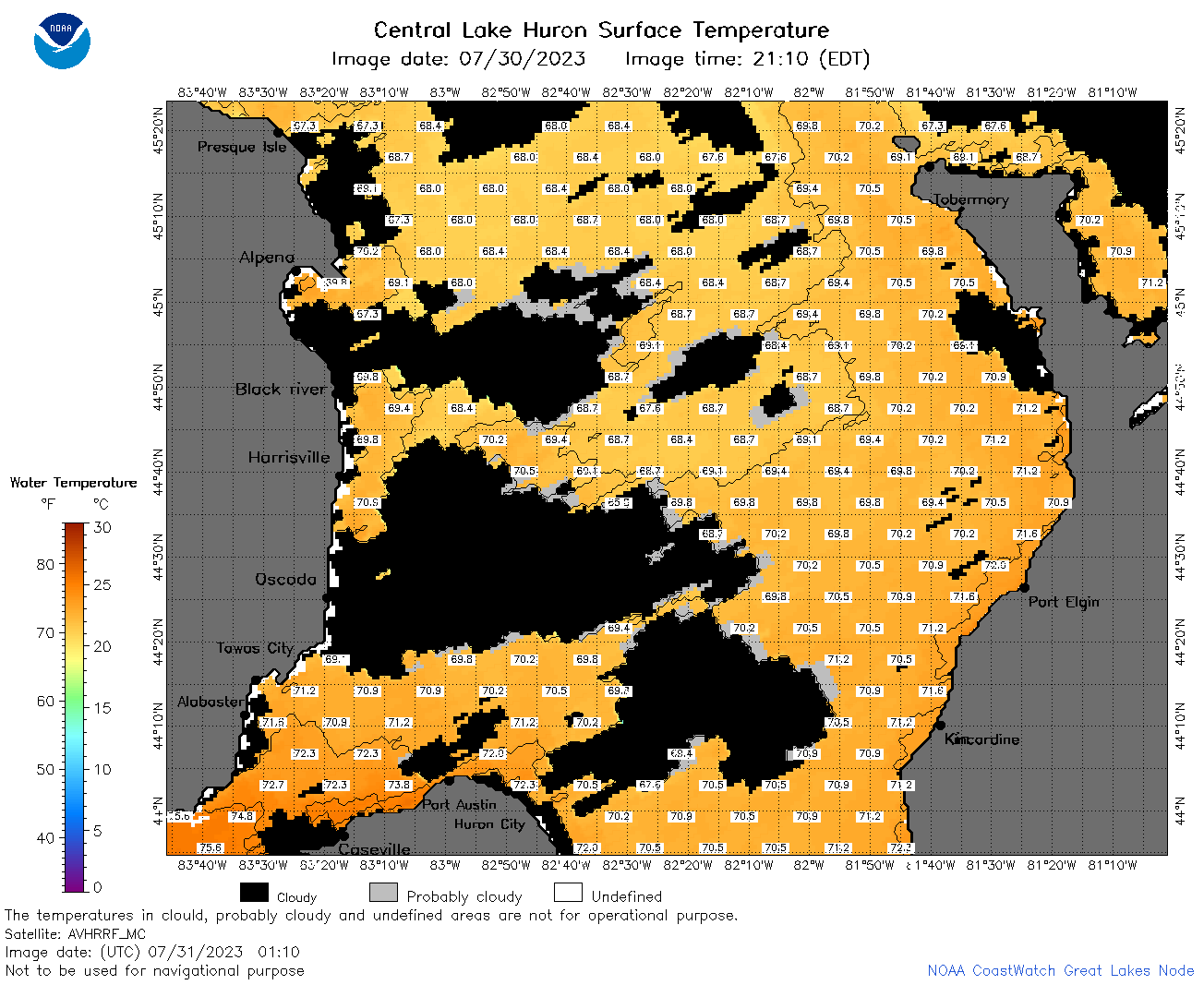 | h2_2023_07_31_0110.png | 31-Jul-2023 05:25 | 84359 | |
 | h2_2023_07_31_0200.png | 31-Jul-2023 05:28 | 103441 | |
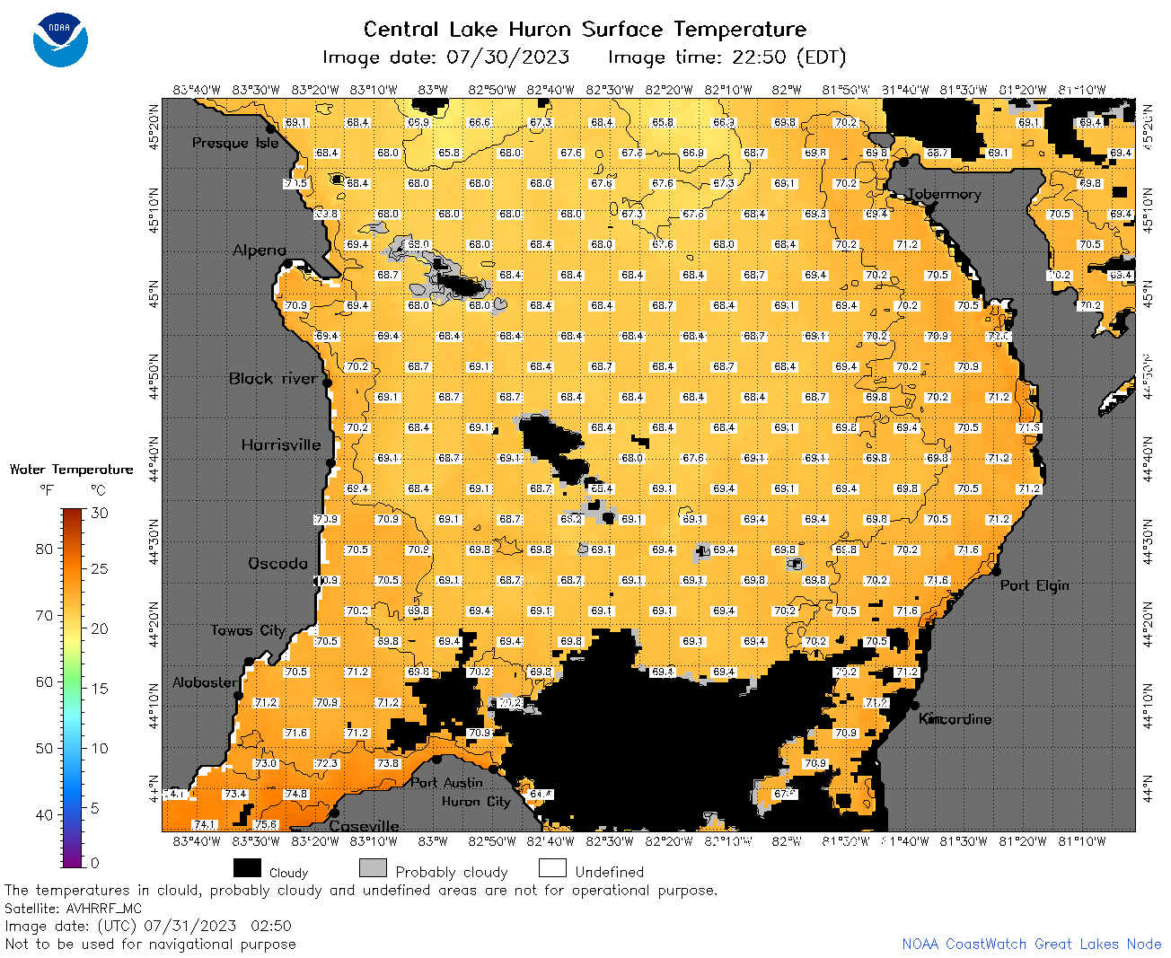 | h2_2023_07_31_0250.png | 31-Jul-2023 05:30 | 86868 | |
 | h2_2023_07_31_0630.png | 31-Jul-2023 09:25 | 105183 | |
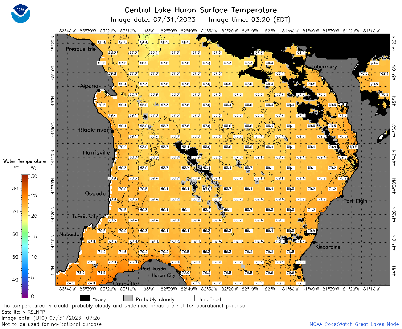 | h2_2023_07_31_0720.png | 31-Jul-2023 11:26 | 98871 | |
 | h2_2023_07_31_0810.png | 31-Jul-2023 11:28 | 101336 | |
 | h2_2023_07_31_1410.png | 31-Jul-2023 18:25 | 41548 | |
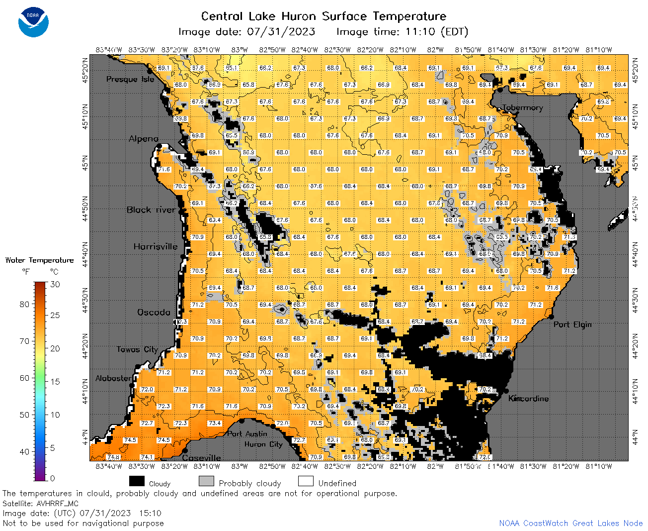 | h2_2023_07_31_1510.png | 31-Jul-2023 19:26 | 102341 | |
 | h2_2023_07_31_1550.png | 31-Jul-2023 19:28 | 76747 | |
 | h2_2023_07_31_1600.png | 31-Jul-2023 19:30 | 58254 | |
 | h2_2023_07_31_1650.png | 31-Jul-2023 20:26 | 45465 | |
 | h2_2023_07_31_1700.png | 31-Jul-2023 19:32 | 77388 | |
 | h2_2023_07_31_1750.png | 31-Jul-2023 20:30 | 86204 | |
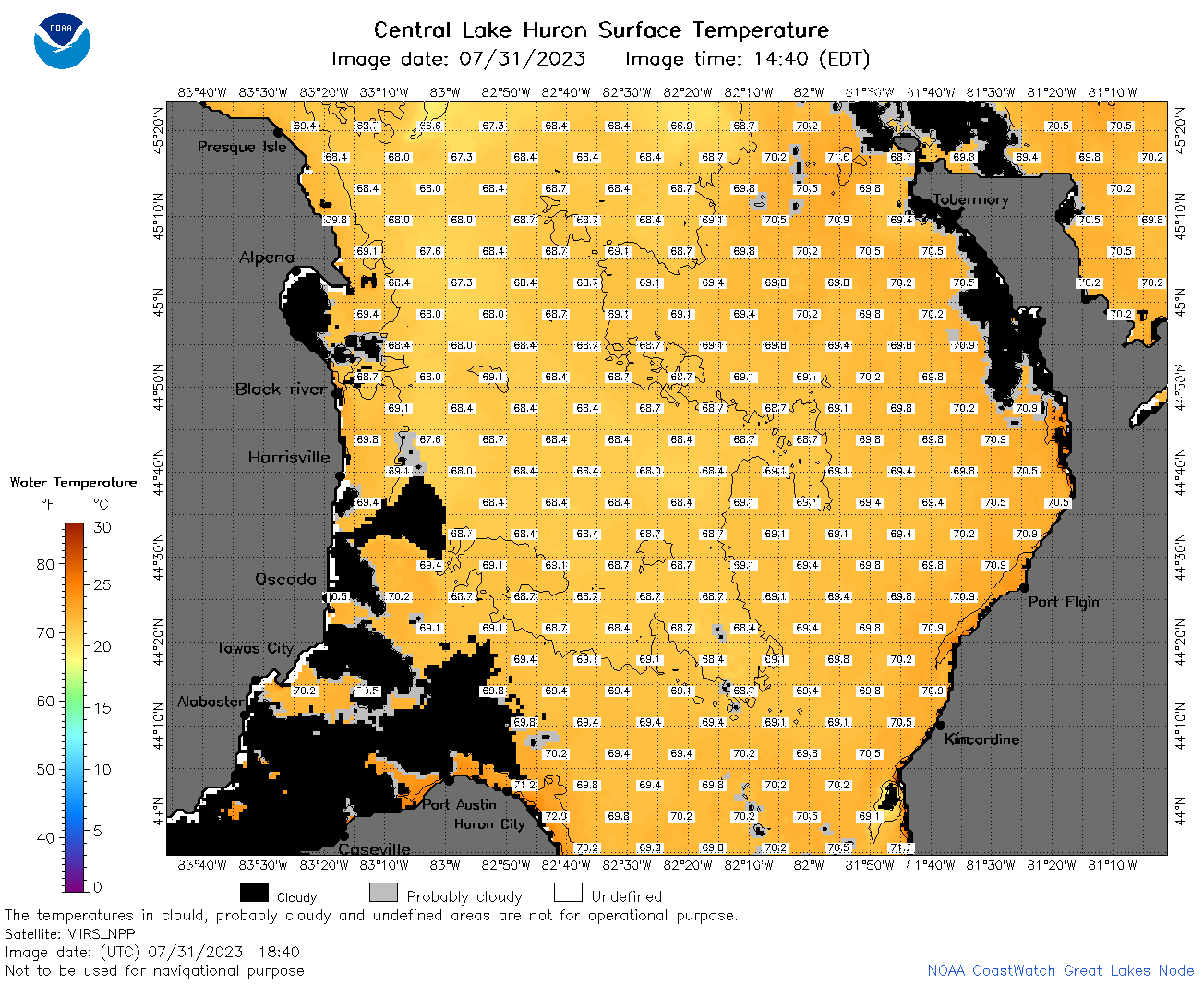 | h2_2023_07_31_1840.png | 31-Jul-2023 21:27 | 84690 | |
 | h2_2023_07_31_1930.png | 31-Jul-2023 22:27 | 43396 | |