
Easier access to scientific data

Brought to you by NOAA CoastWatch Great Lakes Node
|
ERDDAP
Easier access to scientific data |
|
Brought to you by NOAA CoastWatch Great Lakes Node |
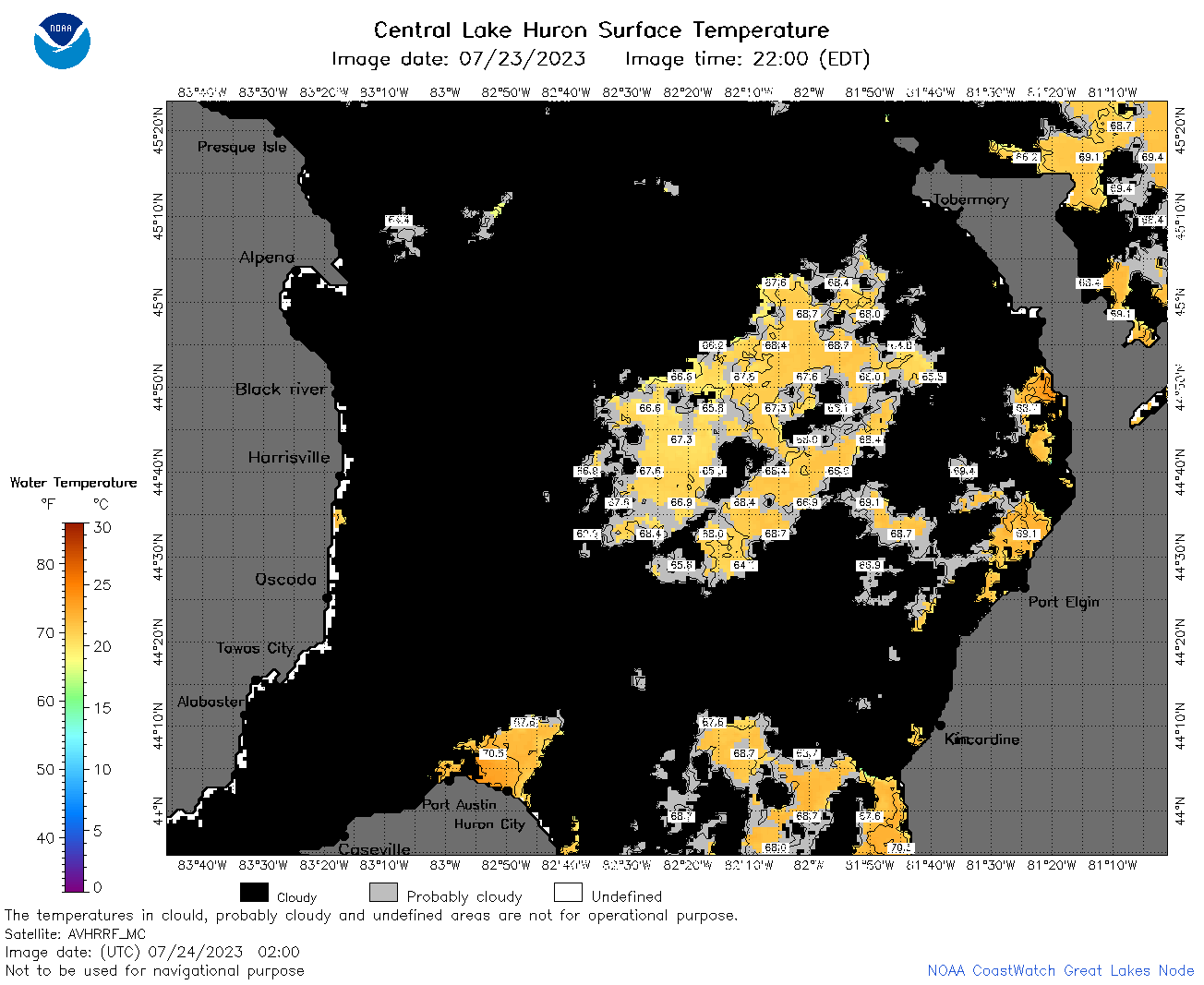
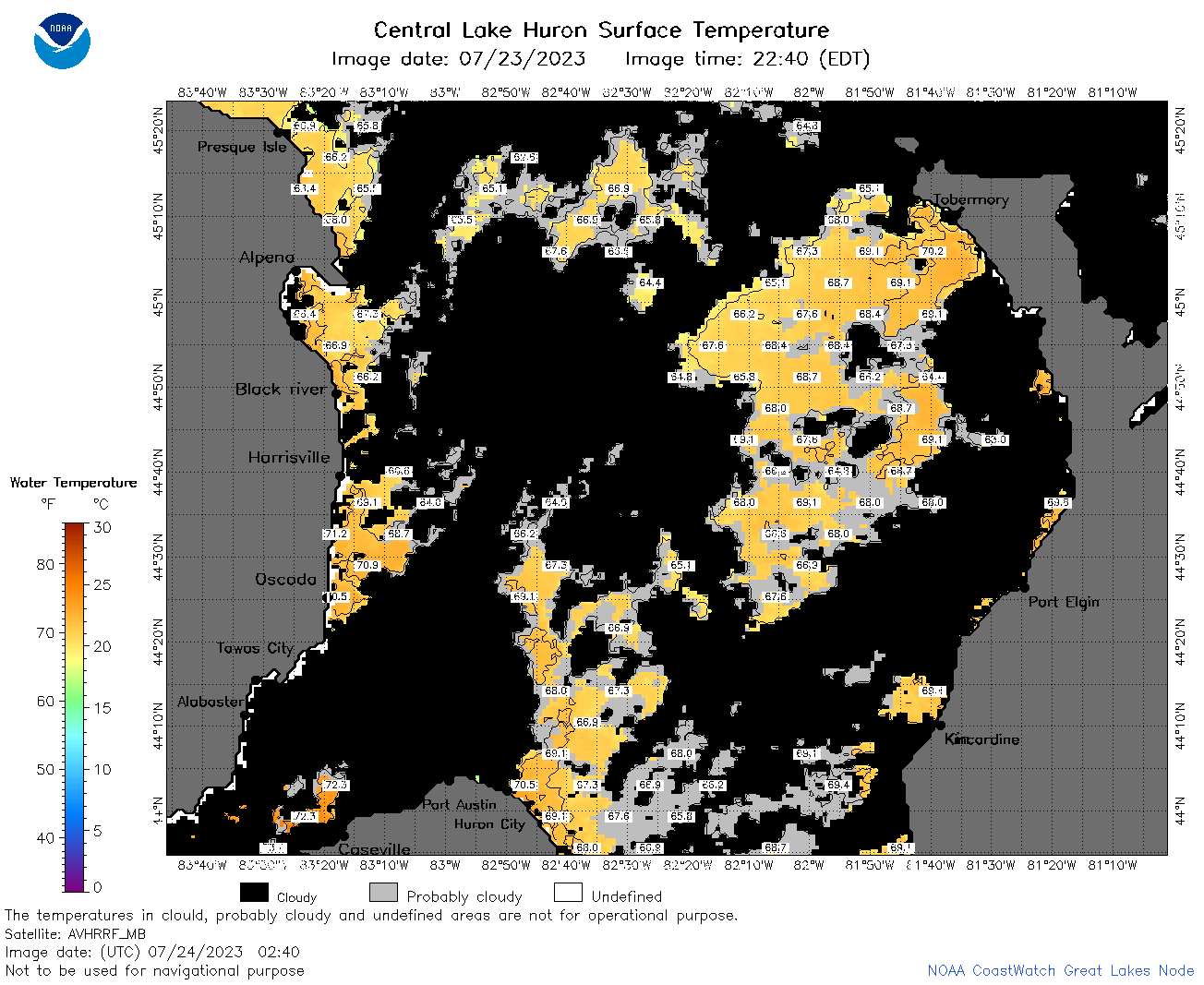
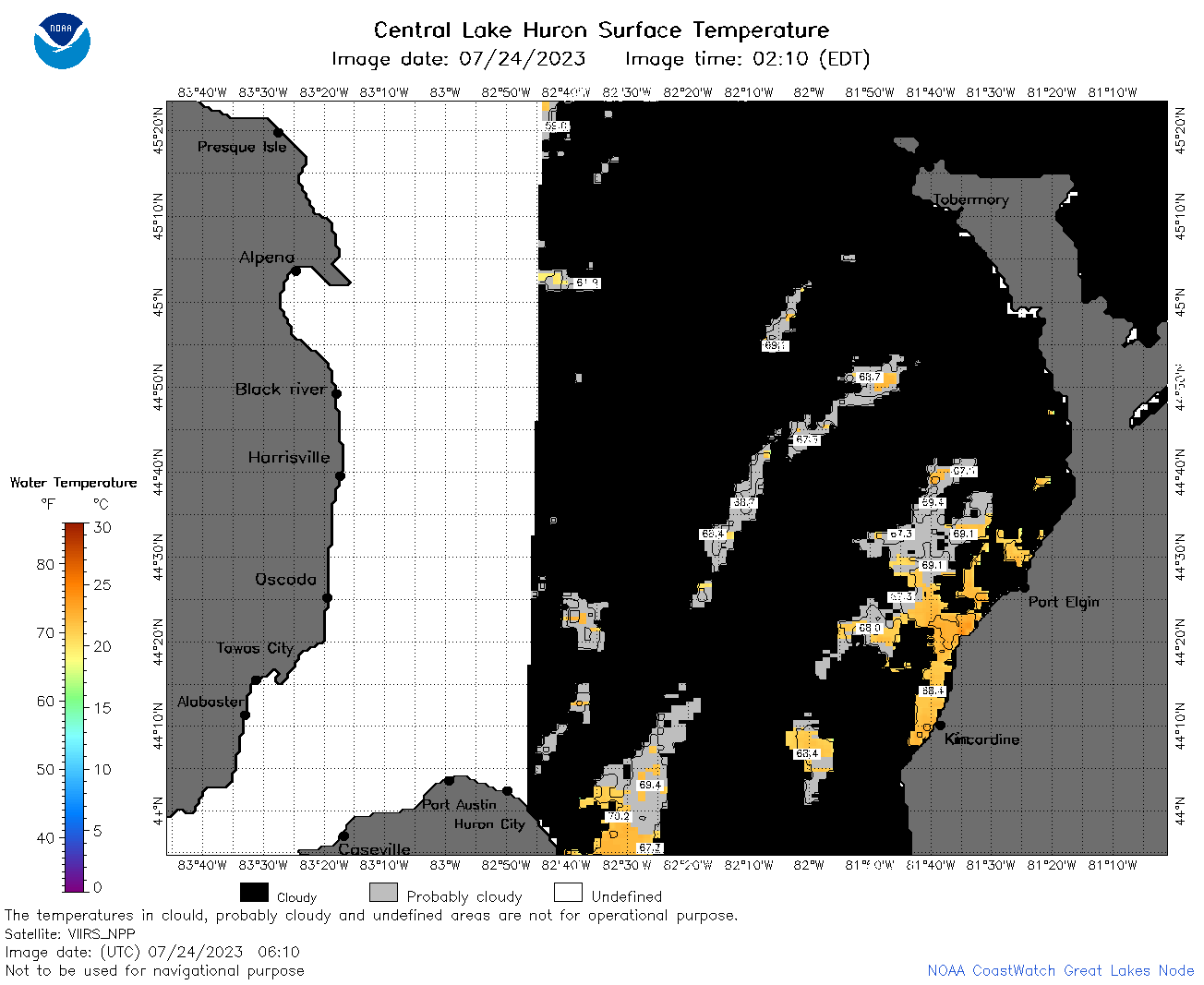
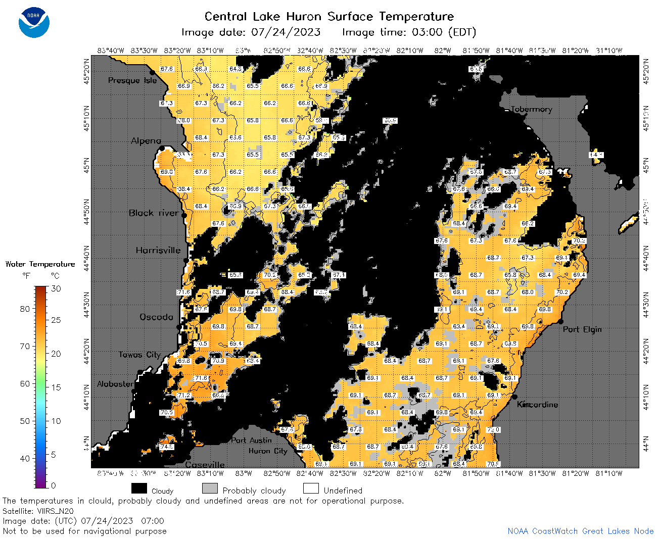
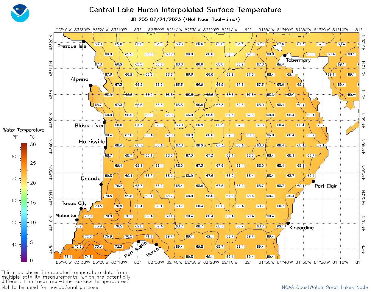
| Dataset Title: | Lake Huron Central Region Surface Temperature Contour Map (2022-present)


|
| Institution: | CoastWatch Great Lakes Node (Dataset ID: LH_NRT_TC_h2) |
| Information: | Summary
| License
| Metadata
| Background | Subset
| Data Access Form
| Make a graph
| Subset
| Data Access Form
| Make a graph
|
![[ICO]](https://apps.glerl.noaa.gov/erddap/images/fileIcons/blank.gif) | Name | Last modified | Size | Description |
|---|---|---|---|---|
![[DIR]](https://apps.glerl.noaa.gov/erddap/images/fileIcons/back.gif) | Parent Directory | - | - | |
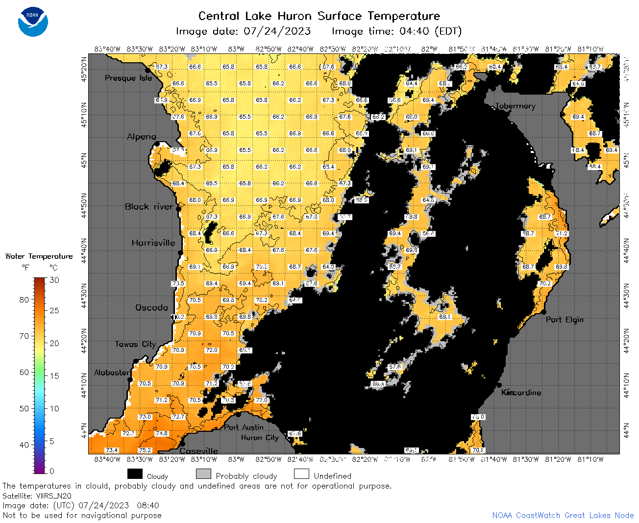
![[IMG]](https://apps.glerl.noaa.gov/erddap/images/fileIcons/image2.gif)  | h2_2023_07_24_0100.png | 24-Jul-2023 05:25 | 50317 | |
 | h2_2023_07_24_0200.png | 24-Jul-2023 05:29 | 64863 | |
 | h2_2023_07_24_0240.png | 24-Jul-2023 05:32 | 78512 | |
 | h2_2023_07_24_0610.png | 24-Jul-2023 10:25 | 43528 | |
 | h2_2023_07_24_0700.png | 24-Jul-2023 10:28 | 94293 | |
 | h2_2023_07_24_0750.png | 24-Jul-2023 11:26 | 108963 | |
 | h2_2023_07_24_0840.png | 24-Jul-2023 12:26 | 95072 | |
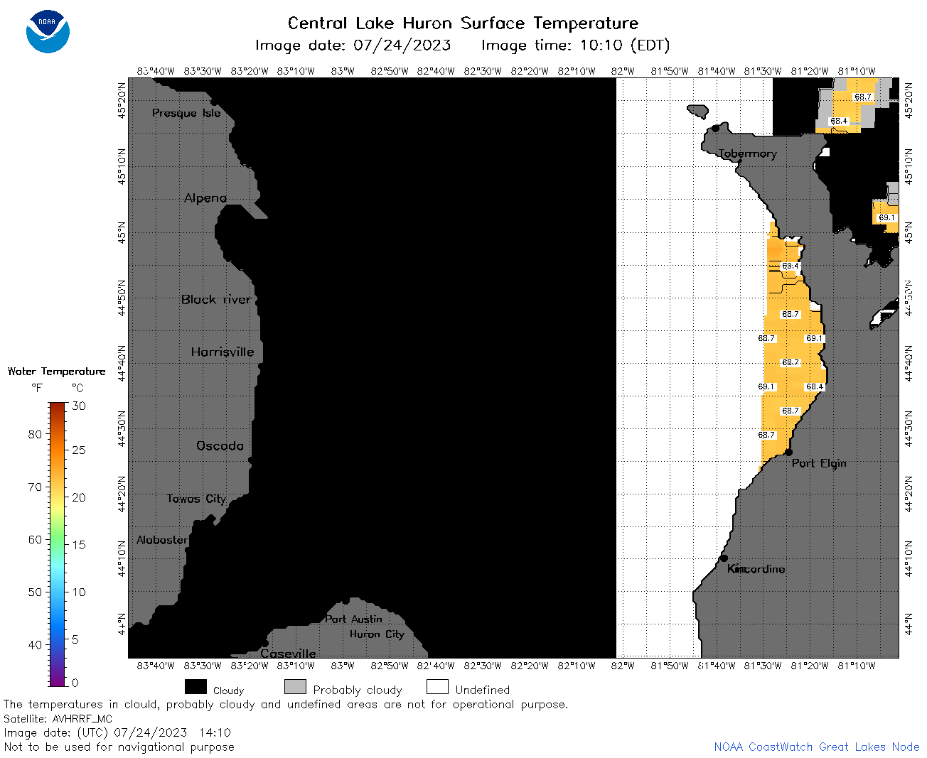 | h2_2023_07_24_1410.png | 24-Jul-2023 18:25 | 34507 | |
 | h2_2023_07_24_1500.png | 24-Jul-2023 18:28 | 86564 | |
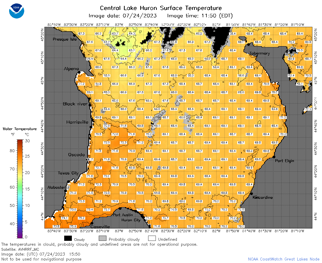 | h2_2023_07_24_1550.png | 24-Jul-2023 20:26 | 100037 | |
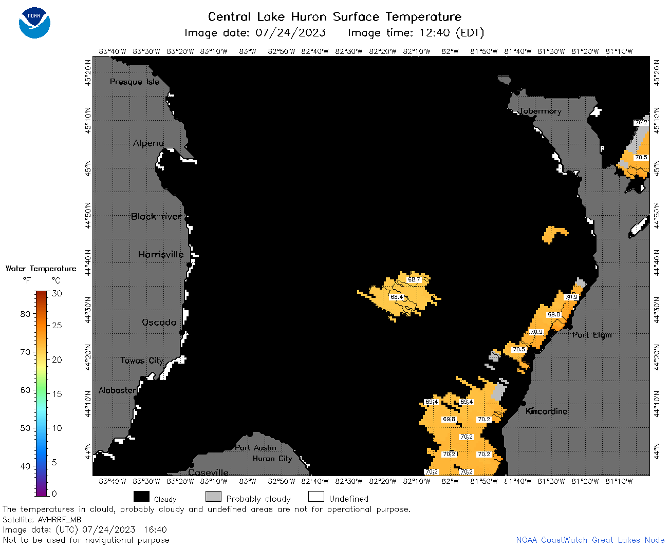 | h2_2023_07_24_1640.png | 24-Jul-2023 20:28 | 35902 | |
 | h2_2023_07_24_1730.png | 24-Jul-2023 20:30 | 52405 | |
 | h2_2023_07_24_1820.png | 24-Jul-2023 21:30 | 88072 | |
 | h2_2023_205.png | 25-Jul-2023 09:14 | 59702 | |