
Easier access to scientific data

Brought to you by NOAA CoastWatch Great Lakes Node
|
ERDDAP
Easier access to scientific data |
|
Brought to you by NOAA CoastWatch Great Lakes Node |
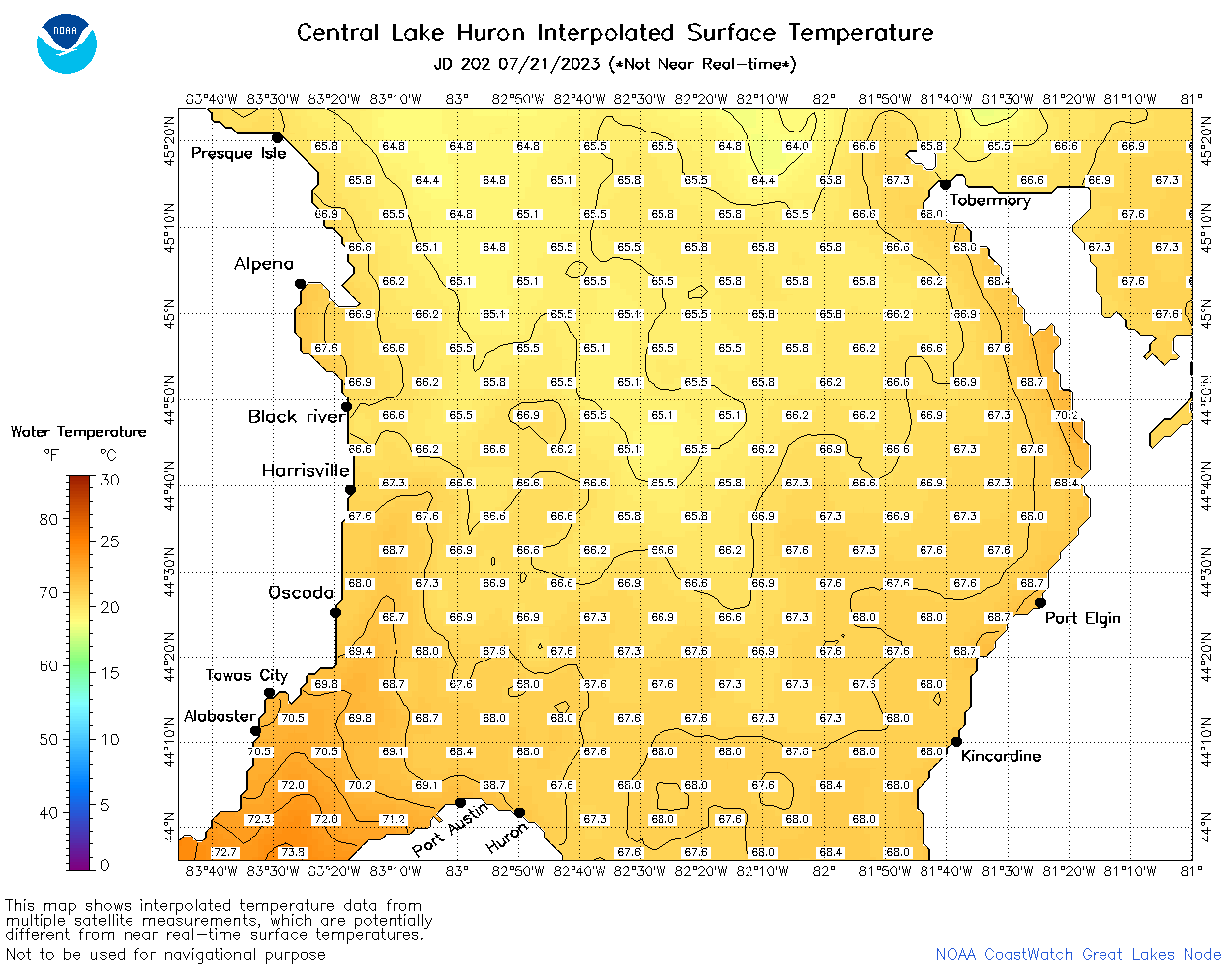
| Dataset Title: | Lake Huron Central Region Surface Temperature Contour Map (2022-present)


|
| Institution: | CoastWatch Great Lakes Node (Dataset ID: LH_NRT_TC_h2) |
| Information: | Summary
| License
| Metadata
| Background | Subset
| Data Access Form
| Make a graph
| Subset
| Data Access Form
| Make a graph
|
![[ICO]](https://apps.glerl.noaa.gov/erddap/images/fileIcons/blank.gif) | Name | Last modified | Size | Description |
|---|---|---|---|---|
![[DIR]](https://apps.glerl.noaa.gov/erddap/images/fileIcons/back.gif) | Parent Directory | - | - | |
![[IMG]](https://apps.glerl.noaa.gov/erddap/images/fileIcons/image2.gif) 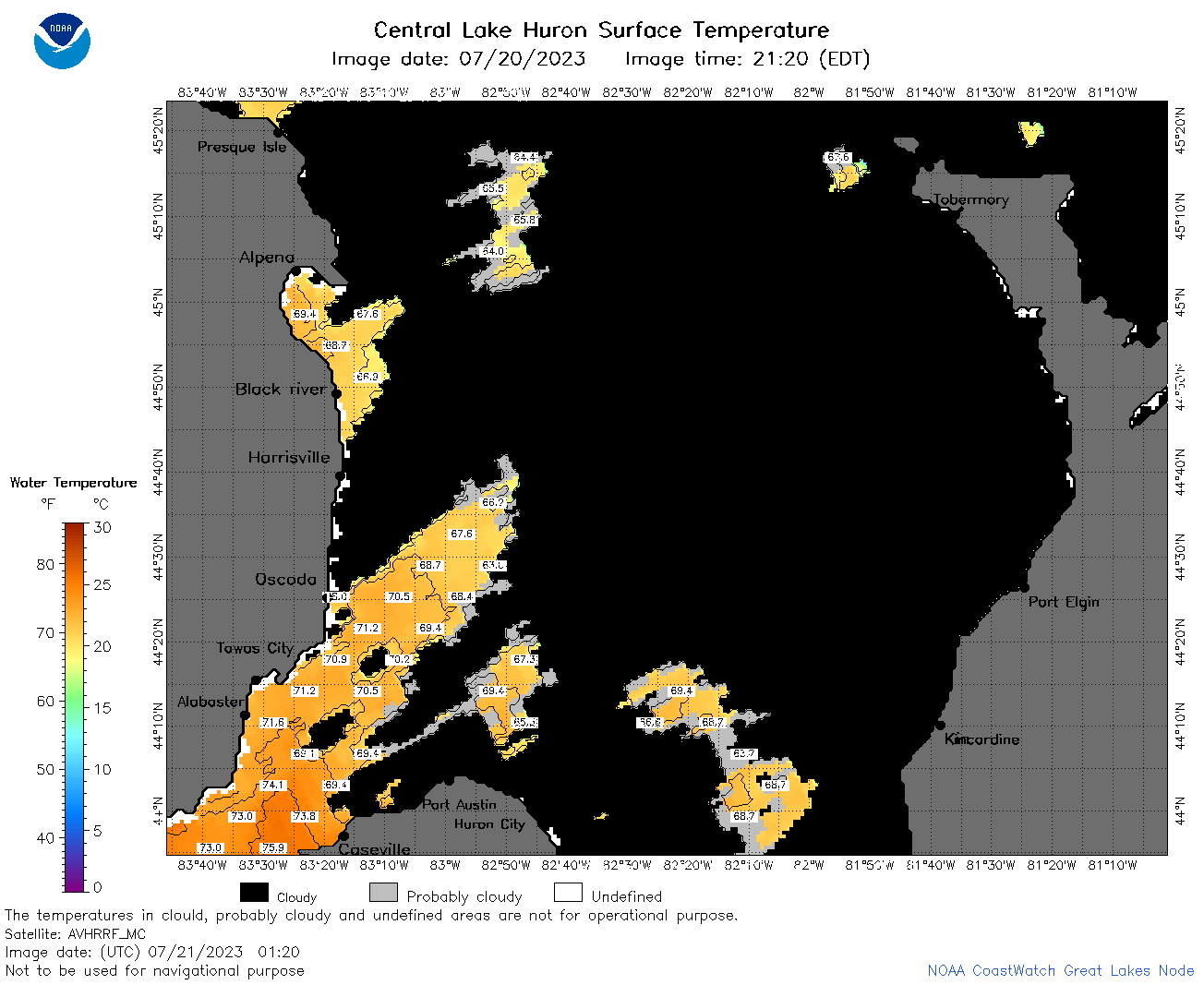 | h2_2023_07_21_0120.png | 21-Jul-2023 05:25 | 54535 | |
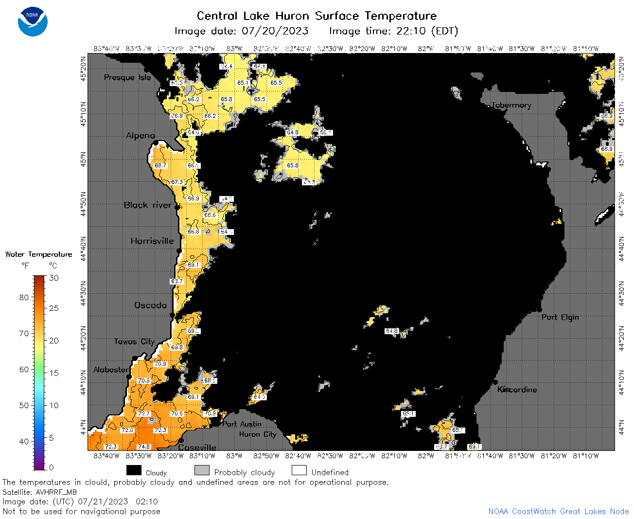 | h2_2023_07_21_0210.png | 21-Jul-2023 07:26 | 59993 | |
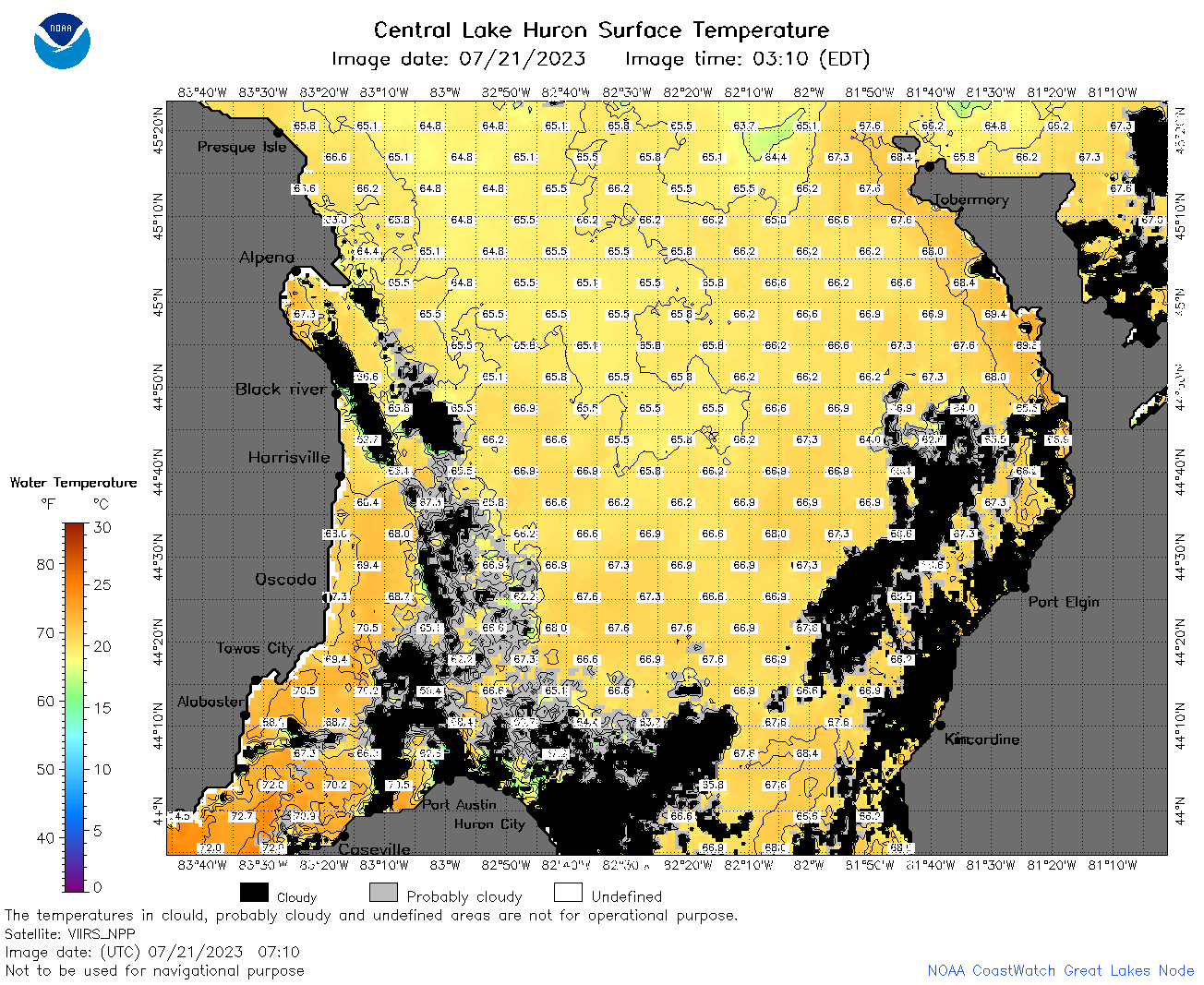
 | h2_2023_07_21_0300.png | 21-Jul-2023 06:26 | 63791 | |
 | h2_2023_07_21_0610.png | 21-Jul-2023 09:25 | 75410 | |
 | h2_2023_07_21_0620.png | 21-Jul-2023 09:27 | 53405 | |
 | h2_2023_07_21_0710.png | 21-Jul-2023 11:27 | 121374 | |
 | h2_2023_07_21_0800.png | 21-Jul-2023 11:32 | 125917 | |
 | h2_2023_07_21_0850.png | 21-Jul-2023 12:26 | 100396 | |
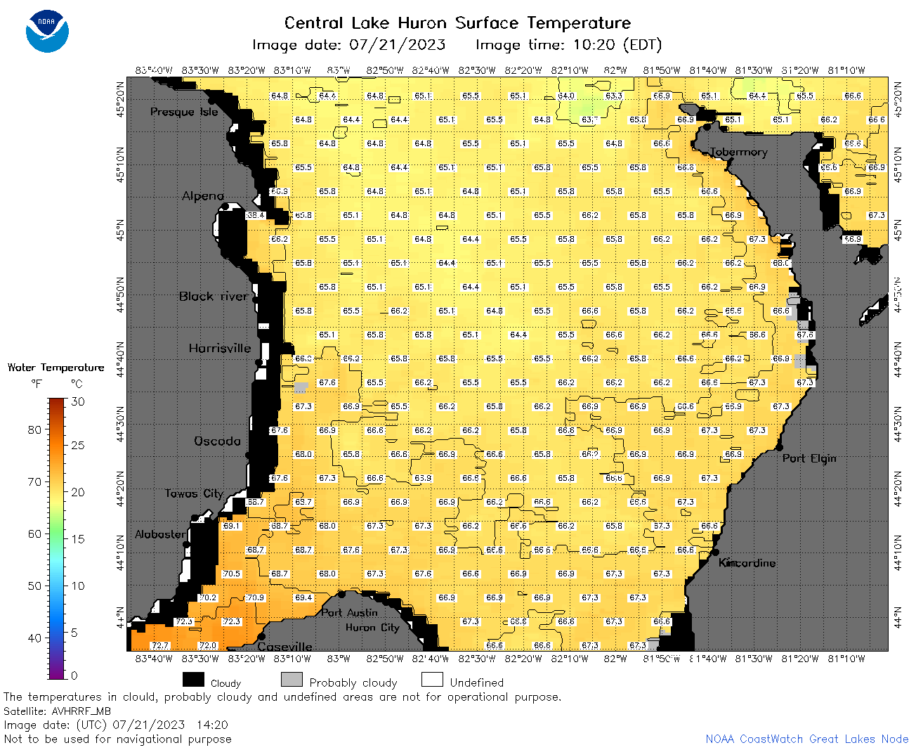 | h2_2023_07_21_1420.png | 21-Jul-2023 17:25 | 72455 | |
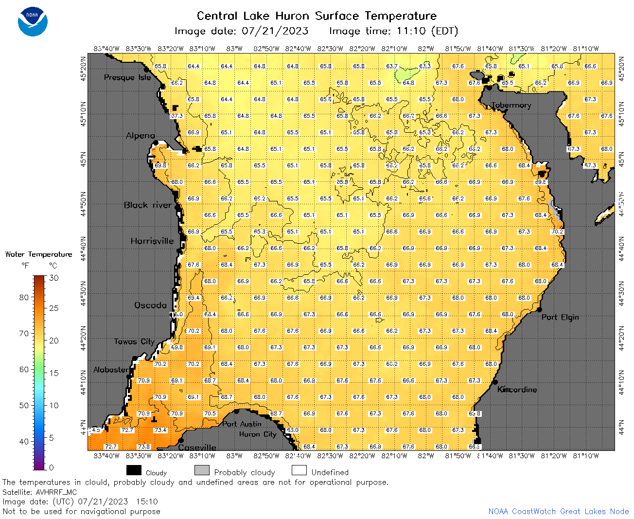 | h2_2023_07_21_1510.png | 21-Jul-2023 19:26 | 88896 | |
 | h2_2023_07_21_1600.png | 21-Jul-2023 19:30 | 94438 | |
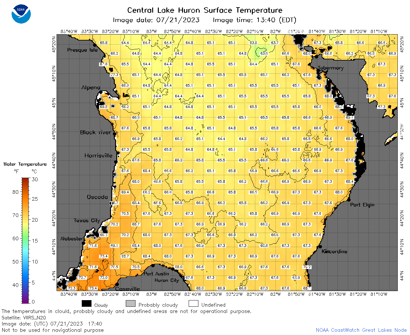 | h2_2023_07_21_1740.png | 21-Jul-2023 20:26 | 92170 | |
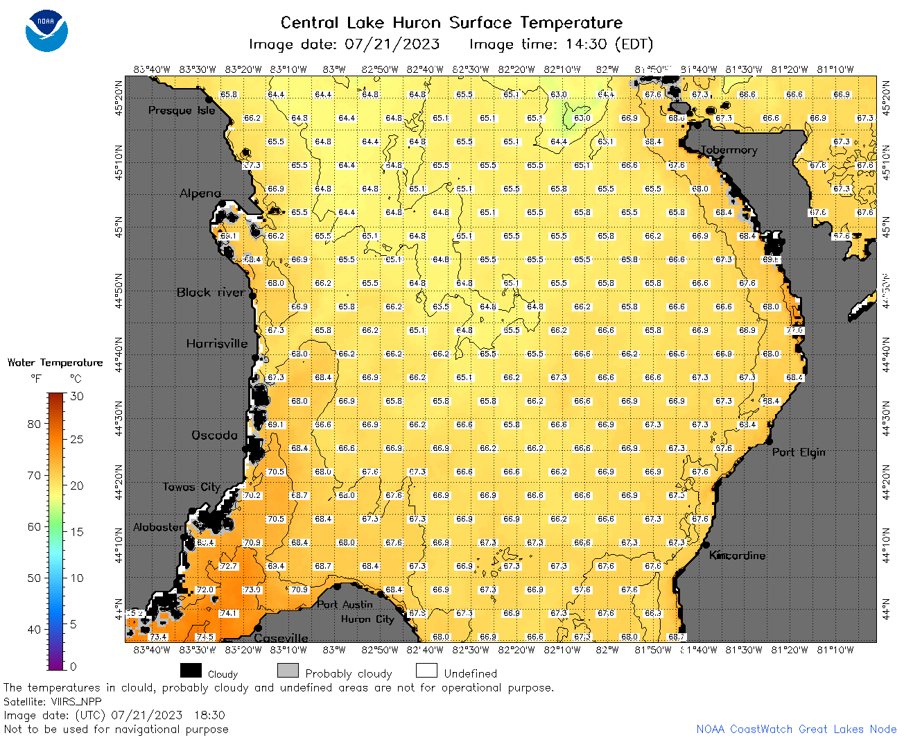 | h2_2023_07_21_1830.png | 21-Jul-2023 21:32 | 92363 | |
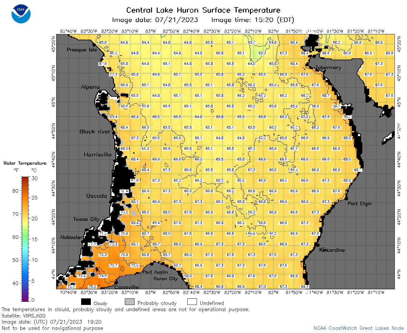 | h2_2023_07_21_1920.png | 21-Jul-2023 22:26 | 91369 | |
 | h2_2023_202.png | 22-Jul-2023 09:14 | 59507 | |