
Easier access to scientific data

Brought to you by NOAA CoastWatch Great Lakes Node
|
ERDDAP
Easier access to scientific data |
|
Brought to you by NOAA CoastWatch Great Lakes Node |
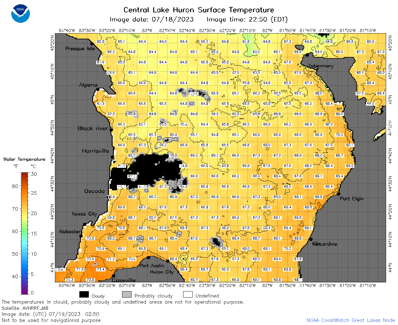
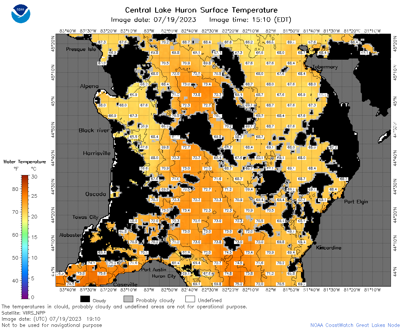
| Dataset Title: | Lake Huron Central Region Surface Temperature Contour Map (2022-present)


|
| Institution: | CoastWatch Great Lakes Node (Dataset ID: LH_NRT_TC_h2) |
| Information: | Summary
| License
| Metadata
| Background | Subset
| Data Access Form
| Make a graph
| Subset
| Data Access Form
| Make a graph
|
![[ICO]](https://apps.glerl.noaa.gov/erddap/images/fileIcons/blank.gif) | Name | Last modified | Size | Description |
|---|---|---|---|---|
![[DIR]](https://apps.glerl.noaa.gov/erddap/images/fileIcons/back.gif) | Parent Directory | - | - | |
![[IMG]](https://apps.glerl.noaa.gov/erddap/images/fileIcons/image2.gif)  | h2_2023_07_19_0110.png | 19-Jul-2023 05:25 | 107459 | |
 | h2_2023_07_19_0200.png | 19-Jul-2023 05:28 | 98592 | |
 | h2_2023_07_19_0250.png | 19-Jul-2023 05:30 | 103237 | |
 | h2_2023_07_19_0600.png | 19-Jul-2023 10:25 | 33392 | |
 | h2_2023_07_19_0650.png | 19-Jul-2023 09:26 | 110331 | |
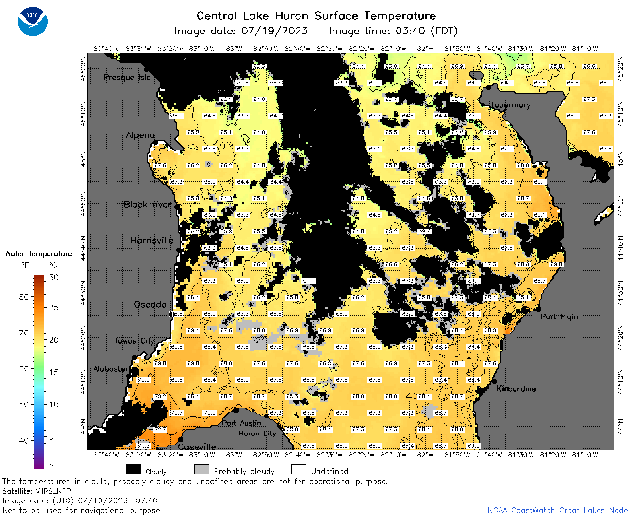 | h2_2023_07_19_0740.png | 19-Jul-2023 11:26 | 112749 | |
 | h2_2023_07_19_0830.png | 19-Jul-2023 11:30 | 106702 | |
 | h2_2023_07_19_1420.png | 19-Jul-2023 18:27 | 43736 | |
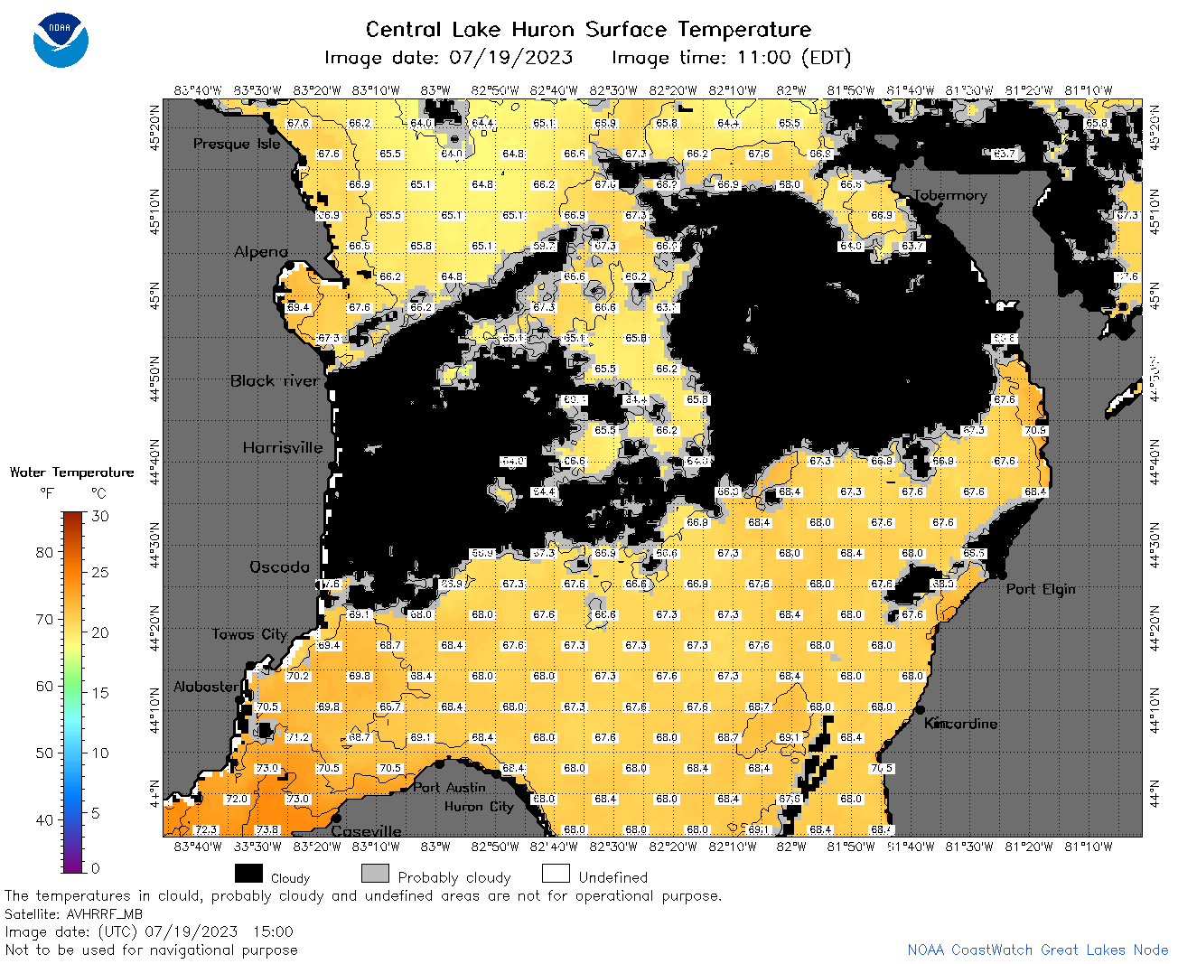 | h2_2023_07_19_1500.png | 19-Jul-2023 18:30 | 84373 | |
 | h2_2023_07_19_1600.png | 19-Jul-2023 20:28 | 97106 | |
 | h2_2023_07_19_1640.png | 19-Jul-2023 20:30 | 64342 | |
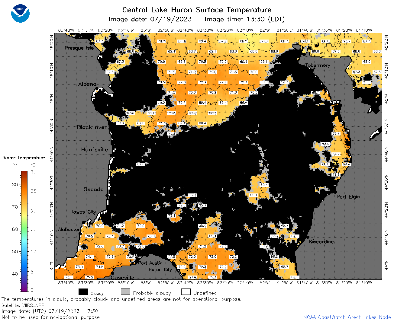 | h2_2023_07_19_1730.png | 19-Jul-2023 20:33 | 82635 | |
 | h2_2023_07_19_1820.png | 19-Jul-2023 21:26 | 95436 | |
 | h2_2023_07_19_1910.png | 19-Jul-2023 23:26 | 102439 | |
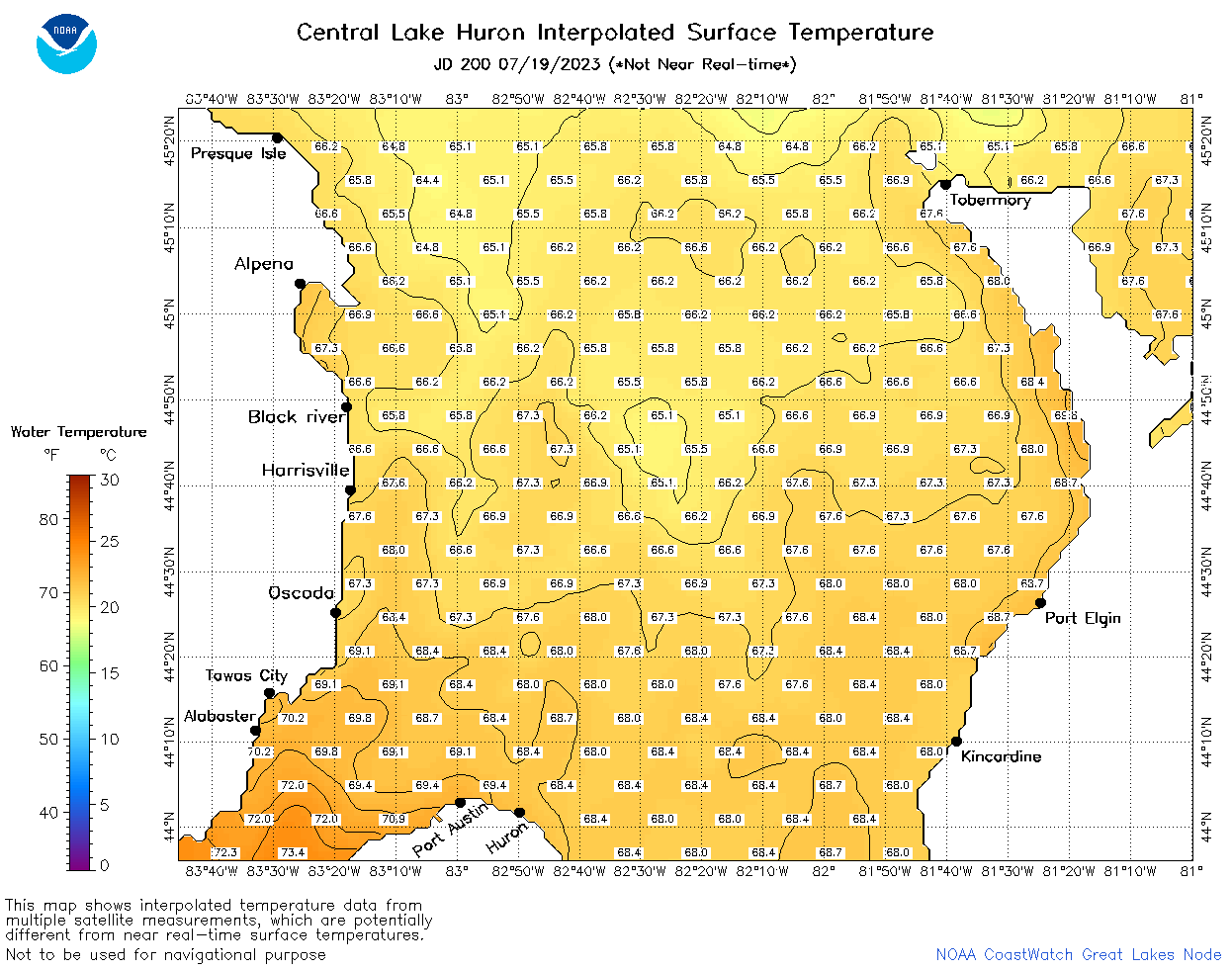 | h2_2023_200.png | 20-Jul-2023 09:14 | 61080 | |