
Easier access to scientific data

Brought to you by NOAA CoastWatch Great Lakes Node
|
ERDDAP
Easier access to scientific data |
|
Brought to you by NOAA CoastWatch Great Lakes Node |
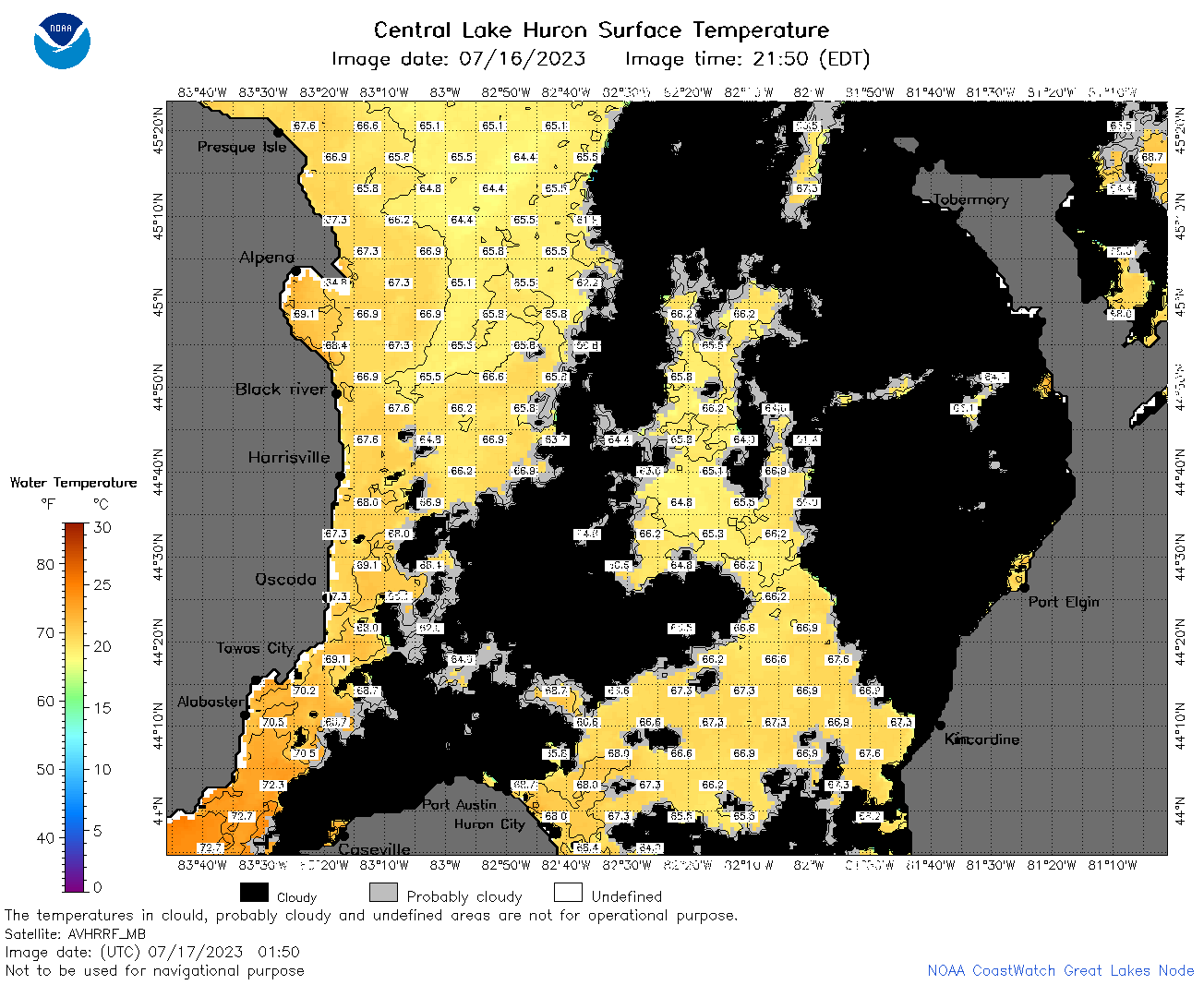
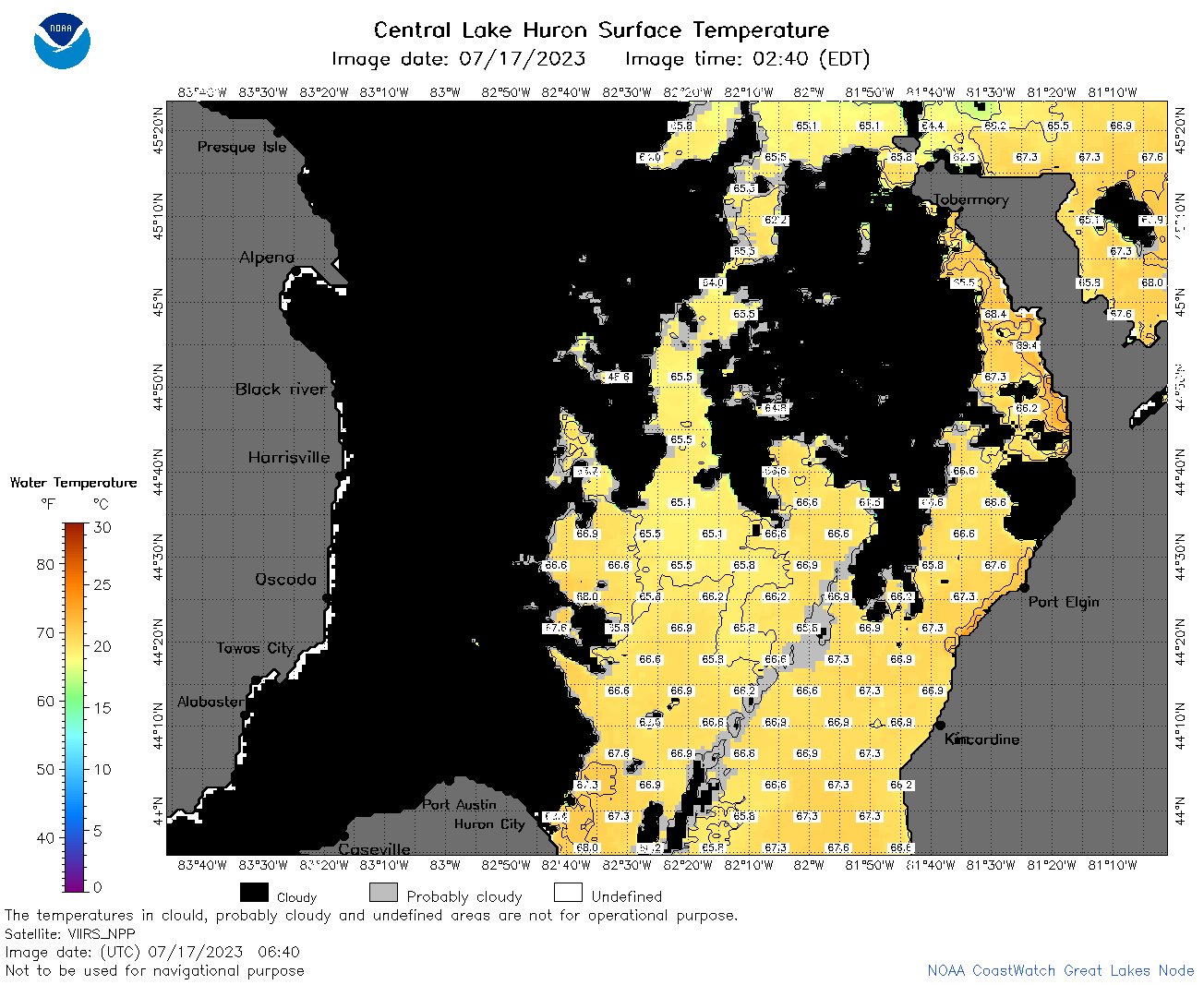
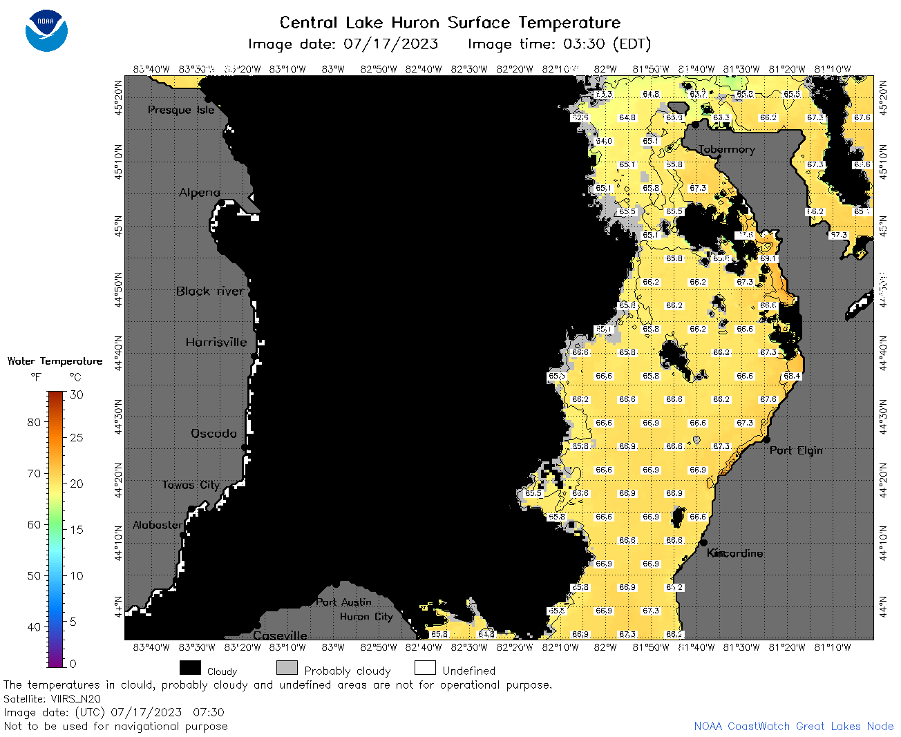
| Dataset Title: | Lake Huron Central Region Surface Temperature Contour Map (2022-present)


|
| Institution: | CoastWatch Great Lakes Node (Dataset ID: LH_NRT_TC_h2) |
| Information: | Summary
| License
| Metadata
| Background | Subset
| Data Access Form
| Make a graph
| Subset
| Data Access Form
| Make a graph
|
![[ICO]](https://apps.glerl.noaa.gov/erddap/images/fileIcons/blank.gif) | Name | Last modified | Size | Description |
|---|---|---|---|---|
![[DIR]](https://apps.glerl.noaa.gov/erddap/images/fileIcons/back.gif) | Parent Directory | - | - | |
![[IMG]](https://apps.glerl.noaa.gov/erddap/images/fileIcons/image2.gif)  | h2_2023_07_17_0100.png | 17-Jul-2023 05:25 | 40736 | |
 | h2_2023_07_17_0150.png | 17-Jul-2023 05:28 | 88749 | |
 | h2_2023_07_17_0240.png | 17-Jul-2023 05:30 | 101643 | |
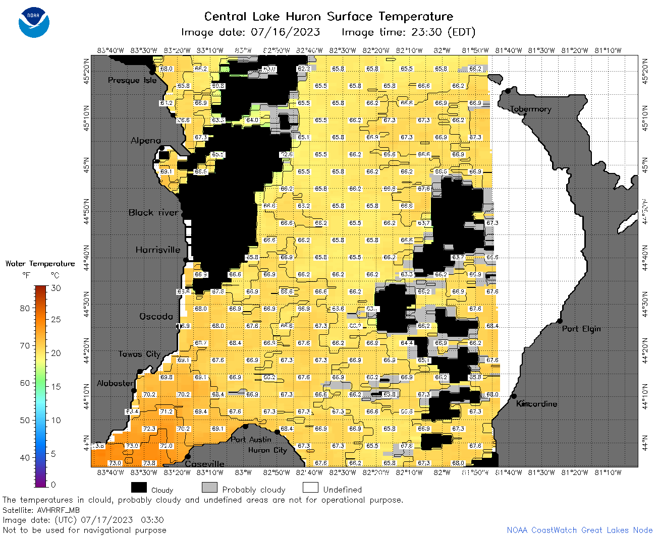 | h2_2023_07_17_0330.png | 17-Jul-2023 06:26 | 72798 | |
 | h2_2023_07_17_0640.png | 17-Jul-2023 10:26 | 74027 | |
 | h2_2023_07_17_0730.png | 17-Jul-2023 11:26 | 64775 | |
 | h2_2023_07_17_0820.png | 17-Jul-2023 12:26 | 56024 | |
 | h2_2023_07_17_1500.png | 17-Jul-2023 19:30 | 92439 | |
 | h2_2023_07_17_1540.png | 17-Jul-2023 19:32 | 94219 | |
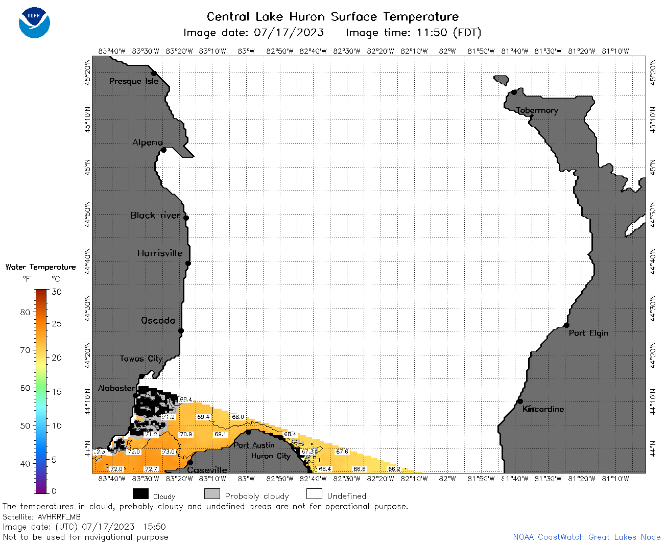 | h2_2023_07_17_1550.png | 17-Jul-2023 19:34 | 37783 | |
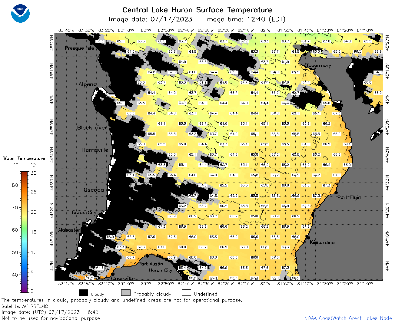 | h2_2023_07_17_1640.png | 17-Jul-2023 20:26 | 86186 | |
 | h2_2023_07_17_1720.png | 17-Jul-2023 20:32 | 94391 | |
 | h2_2023_07_17_1810.png | 17-Jul-2023 22:26 | 90708 | |
 | h2_2023_07_17_1900.png | 17-Jul-2023 21:28 | 79832 | |
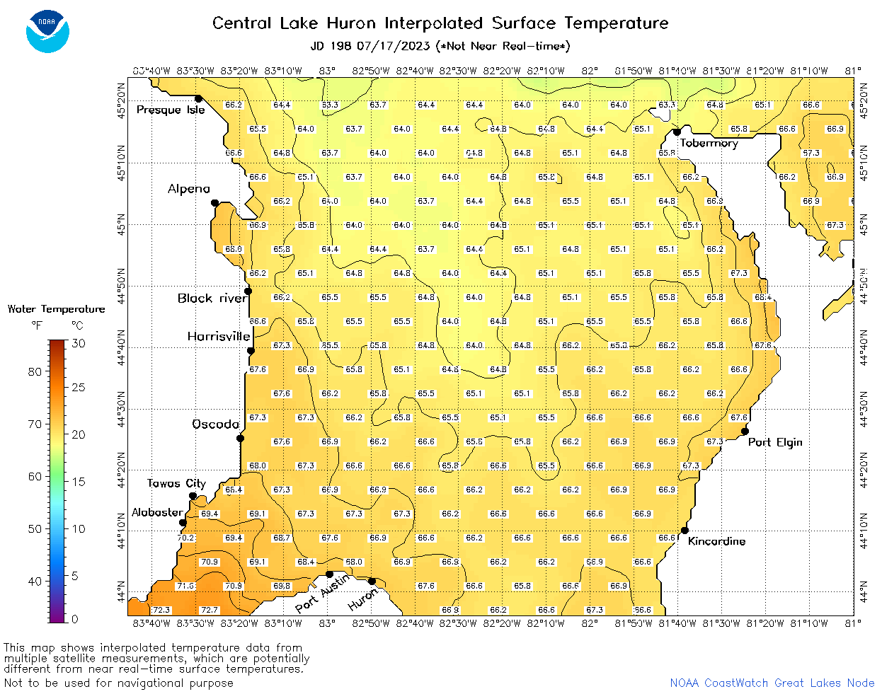 | h2_2023_198.png | 18-Jul-2023 09:14 | 58778 | |