
Easier access to scientific data

Brought to you by NOAA CoastWatch Great Lakes Node
|
ERDDAP
Easier access to scientific data |
|
Brought to you by NOAA CoastWatch Great Lakes Node |
| Dataset Title: | Lake Huron Central Region Surface Temperature Contour Map (2022-present)


|
| Institution: | CoastWatch Great Lakes Node (Dataset ID: LH_NRT_TC_h2) |
| Information: | Summary
| License
| Metadata
| Background | Subset
| Data Access Form
| Make a graph
| Subset
| Data Access Form
| Make a graph
|
![[ICO]](https://apps.glerl.noaa.gov/erddap/images/fileIcons/blank.gif) | Name | Last modified | Size | Description |
|---|---|---|---|---|
![[DIR]](https://apps.glerl.noaa.gov/erddap/images/fileIcons/back.gif) | Parent Directory | - | - | |
![[IMG]](https://apps.glerl.noaa.gov/erddap/images/fileIcons/image2.gif)  | h2_2023_07_14_0110.png | 14-Jul-2023 05:25 | 106113 | |
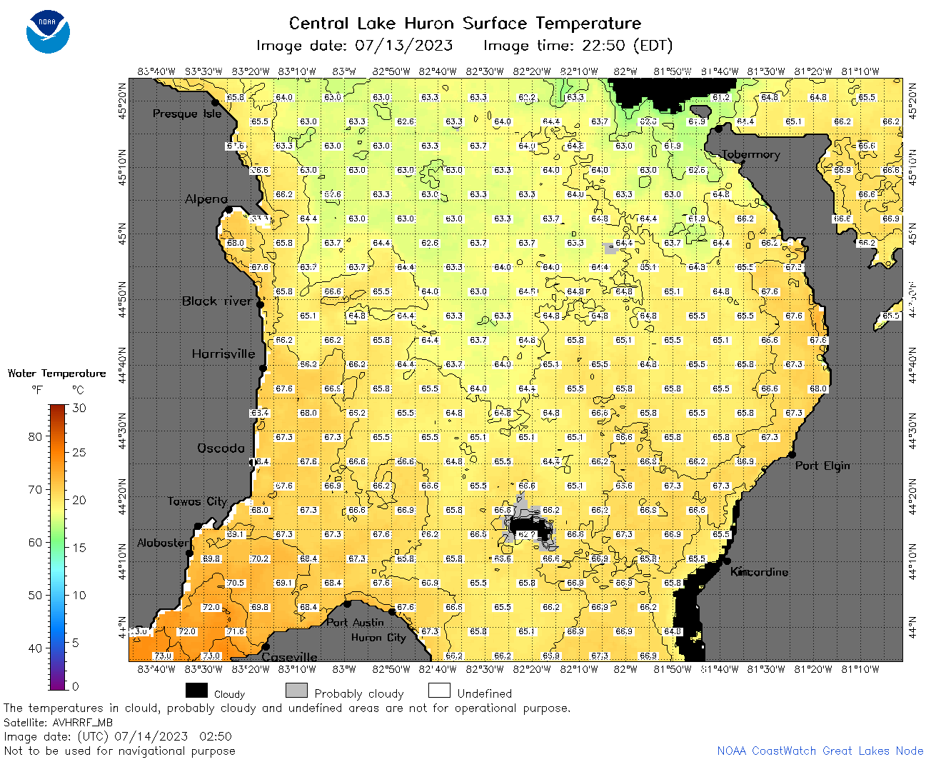 | h2_2023_07_14_0250.png | 14-Jul-2023 05:28 | 101444 | |
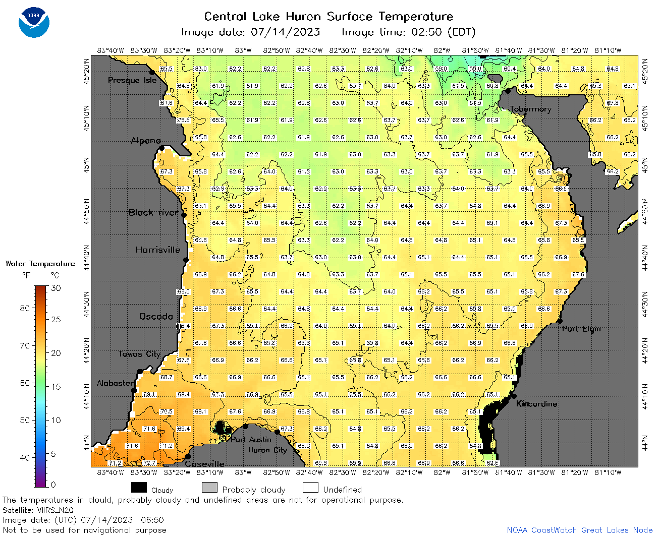 | h2_2023_07_14_0650.png | 14-Jul-2023 09:27 | 99181 | |
 | h2_2023_07_14_0740.png | 14-Jul-2023 11:26 | 100682 | |
 | h2_2023_07_14_0830.png | 14-Jul-2023 11:28 | 109596 | |
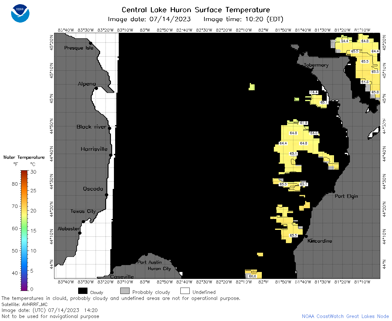 | h2_2023_07_14_1420.png | 14-Jul-2023 18:25 | 36097 | |
 | h2_2023_07_14_1510.png | 14-Jul-2023 18:28 | 43607 | |
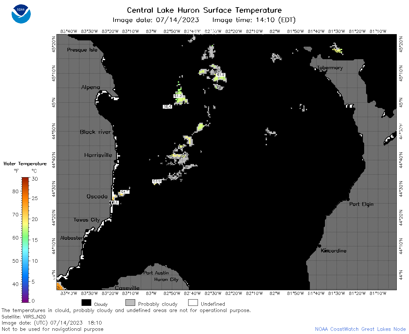 | h2_2023_07_14_1810.png | 14-Jul-2023 21:28 | 34361 | |
 | h2_2023_07_14_1900.png | 14-Jul-2023 22:26 | 32789 | |
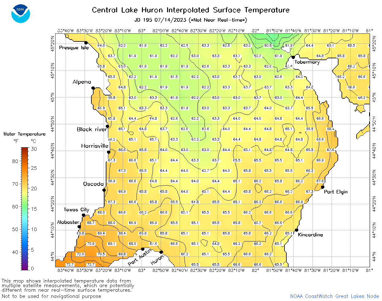 | h2_2023_195.png | 15-Jul-2023 09:14 | 62960 | |