
Easier access to scientific data

Brought to you by NOAA CoastWatch Great Lakes Node
|
ERDDAP
Easier access to scientific data |
|
Brought to you by NOAA CoastWatch Great Lakes Node |
| Dataset Title: | Lake Huron Central Region Surface Temperature Contour Map (2022-present)


|
| Institution: | CoastWatch Great Lakes Node (Dataset ID: LH_NRT_TC_h2) |
| Information: | Summary
| License
| Metadata
| Background | Subset
| Data Access Form
| Make a graph
| Subset
| Data Access Form
| Make a graph
|
![[ICO]](https://apps.glerl.noaa.gov/erddap/images/fileIcons/blank.gif) | Name | Last modified | Size | Description |
|---|---|---|---|---|
![[DIR]](https://apps.glerl.noaa.gov/erddap/images/fileIcons/back.gif) | Parent Directory | - | - | |
![[IMG]](https://apps.glerl.noaa.gov/erddap/images/fileIcons/image2.gif)  | h2_2023_07_10_0150.png | 10-Jul-2023 13:26 | 105867 | |
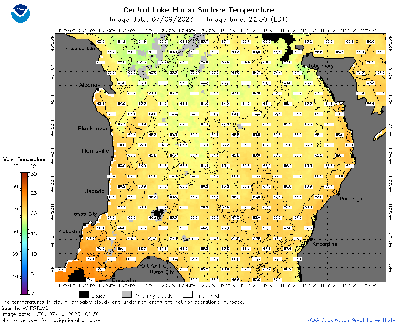 | h2_2023_07_10_0230.png | 10-Jul-2023 05:27 | 115855 | |
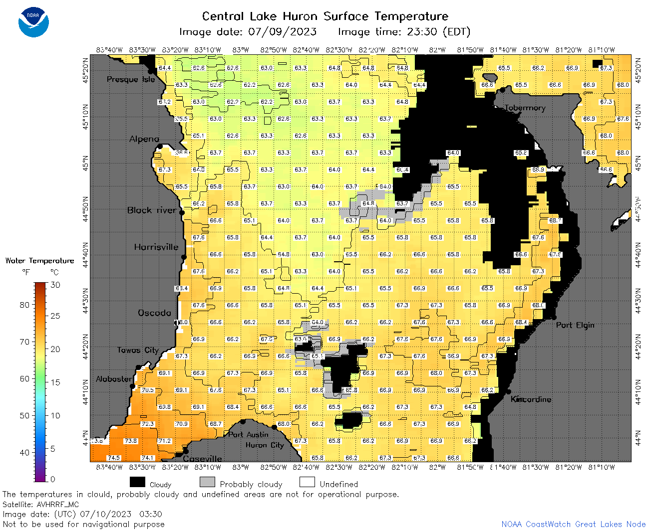 | h2_2023_07_10_0330.png | 10-Jul-2023 07:26 | 75263 | |
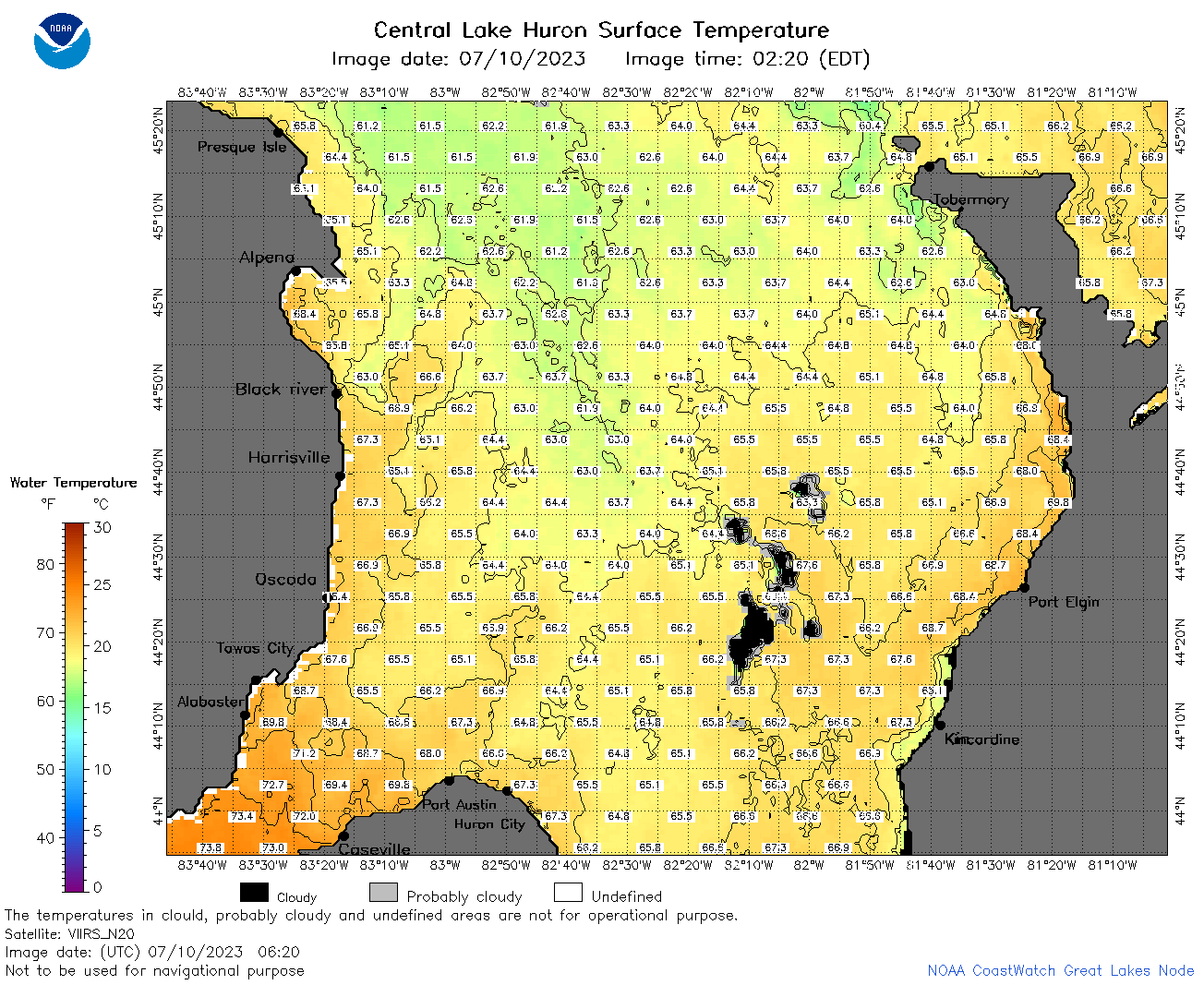 | h2_2023_07_10_0620.png | 10-Jul-2023 09:25 | 112569 | |
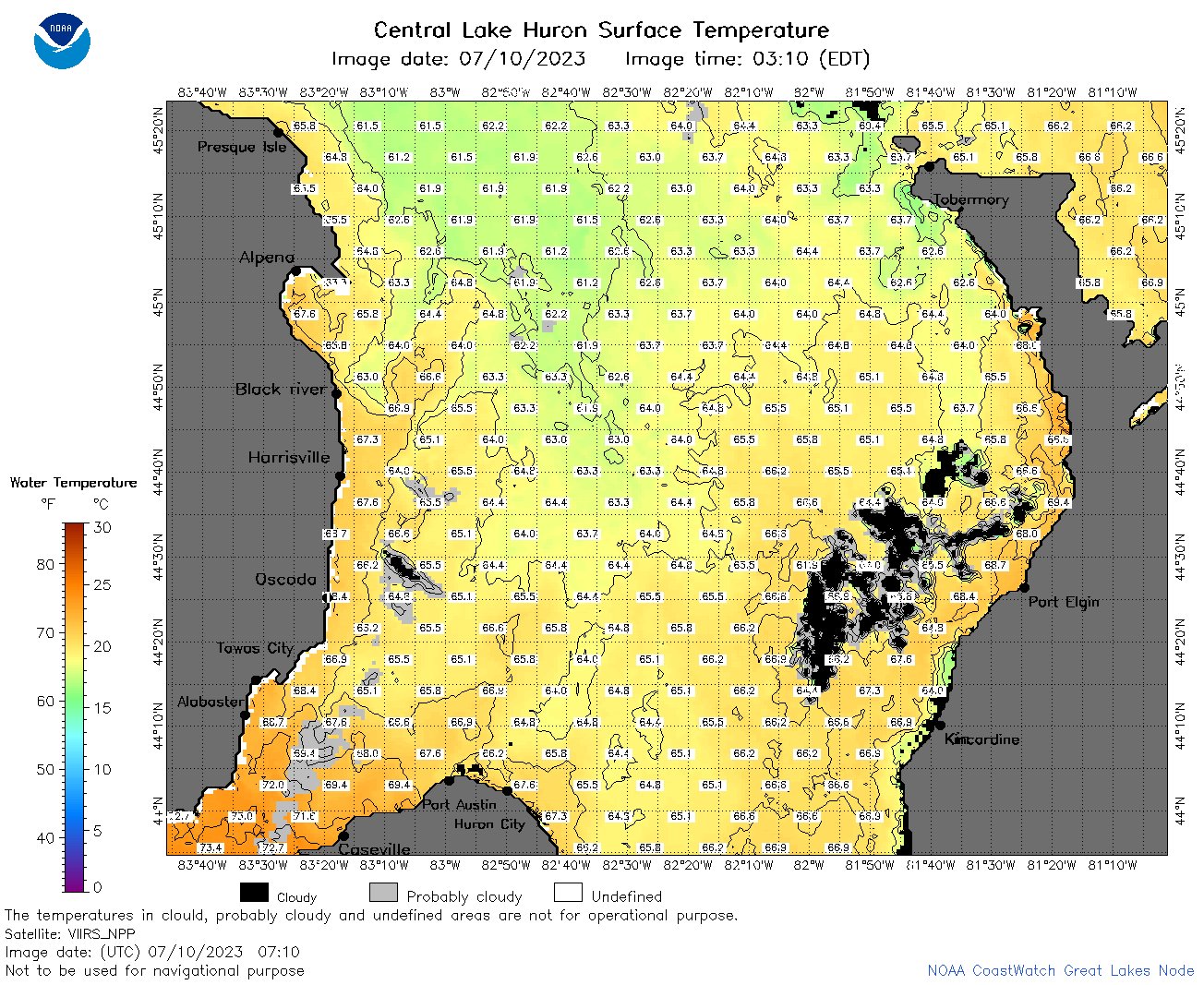 | h2_2023_07_10_0710.png | 10-Jul-2023 11:26 | 117082 | |
 | h2_2023_07_10_0800.png | 10-Jul-2023 11:28 | 110215 | |
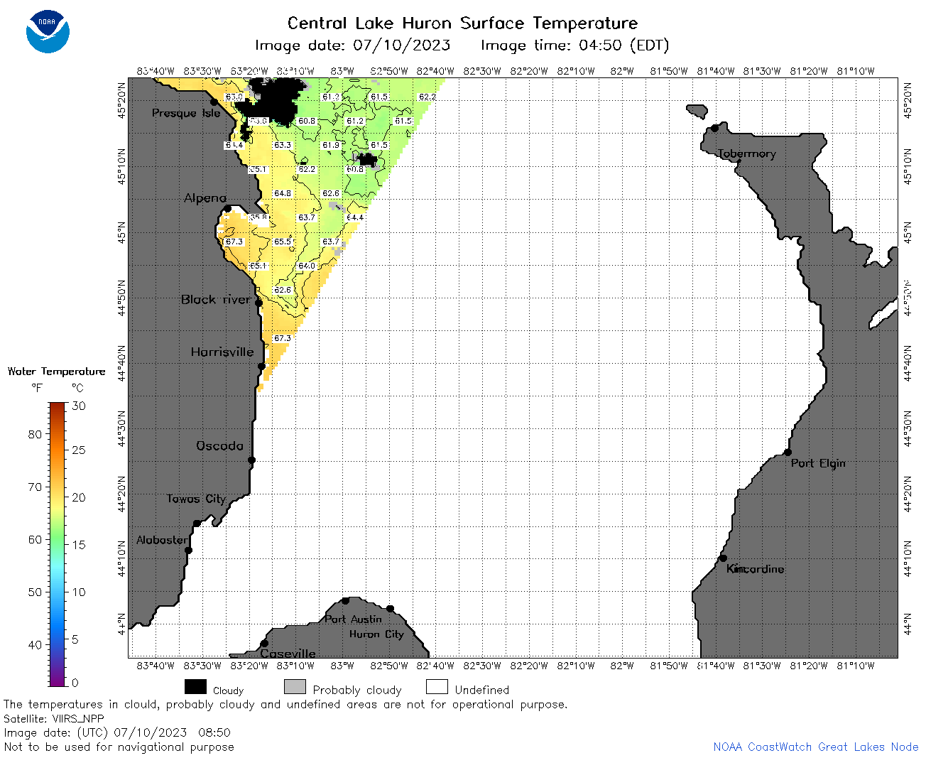 | h2_2023_07_10_0850.png | 10-Jul-2023 12:25 | 44530 | |
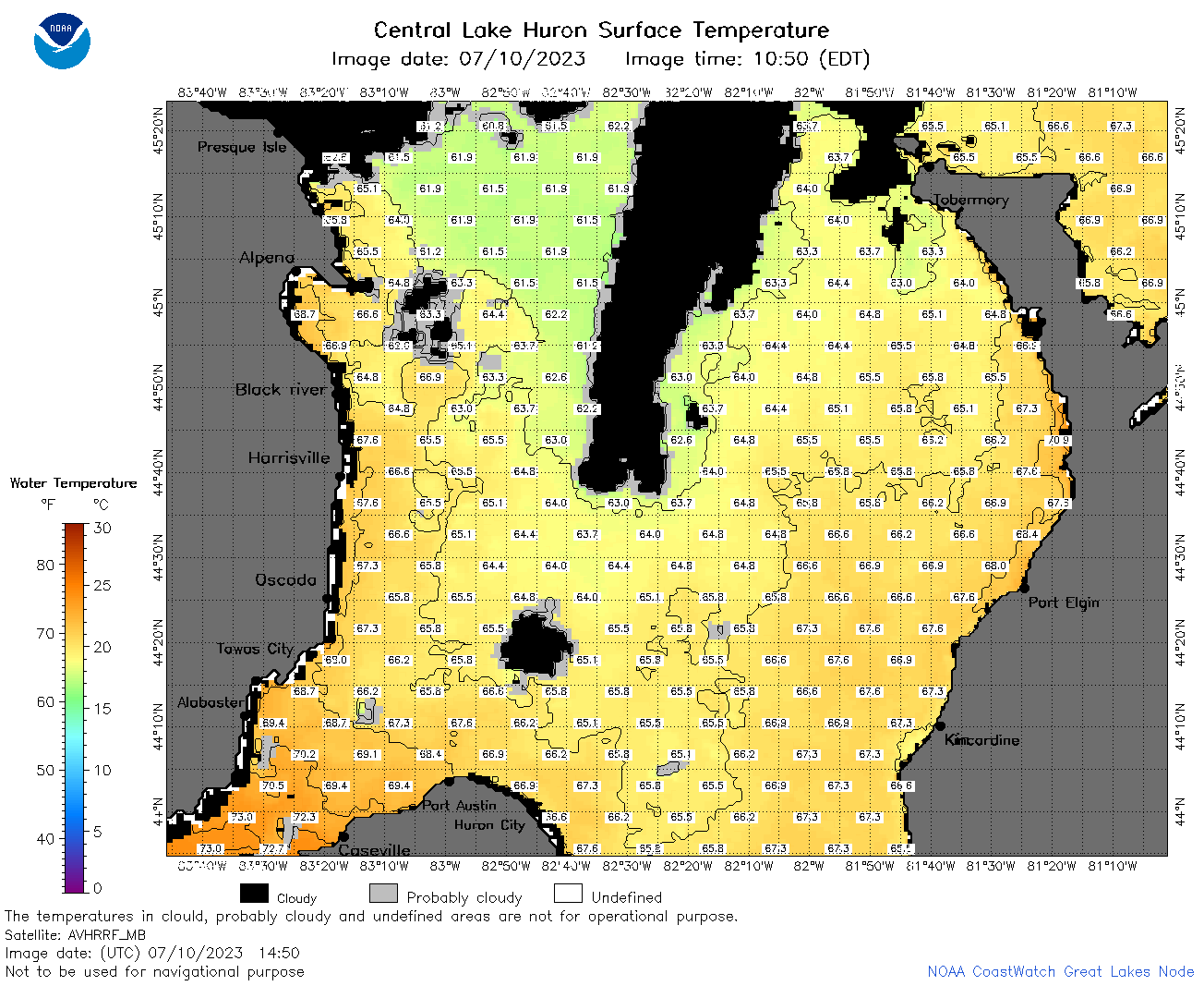 | h2_2023_07_10_1450.png | 10-Jul-2023 18:28 | 89254 | |
 | h2_2023_07_10_1540.png | 10-Jul-2023 19:26 | 100977 | |
 | h2_2023_07_10_1630.png | 10-Jul-2023 20:26 | 71652 | |
 | h2_2023_07_10_1750.png | 10-Jul-2023 23:26 | 85870 | |
 | h2_2023_07_10_1840.png | 10-Jul-2023 23:28 | 75779 | |
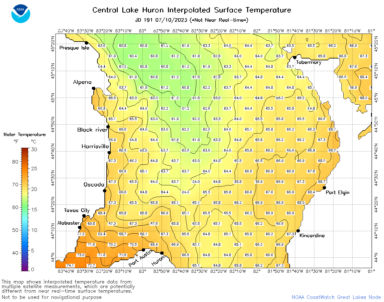 | h2_2023_191.png | 11-Jul-2023 09:14 | 63743 | |