
Easier access to scientific data

Brought to you by NOAA CoastWatch Great Lakes Node
|
ERDDAP
Easier access to scientific data |
|
Brought to you by NOAA CoastWatch Great Lakes Node |
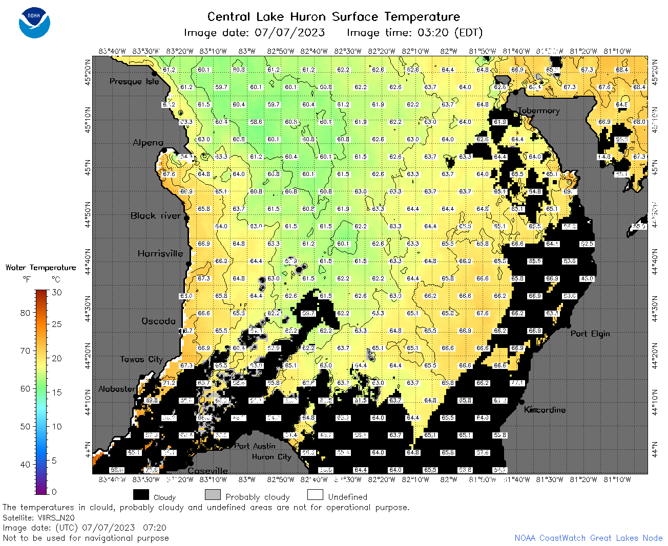
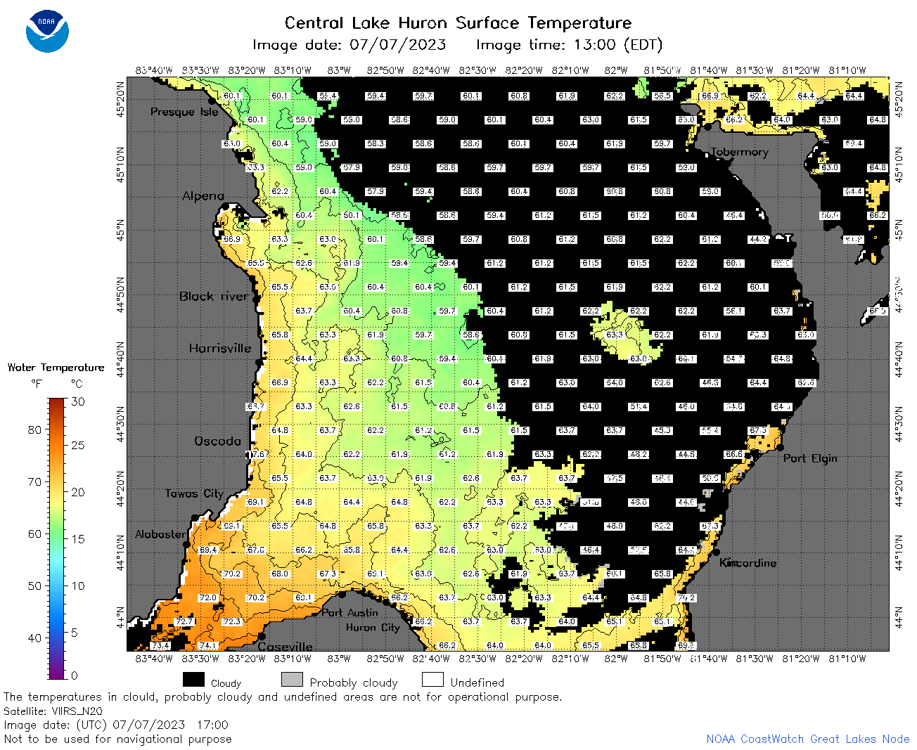
| Dataset Title: | Lake Huron Central Region Surface Temperature Contour Map (2022-present)


|
| Institution: | CoastWatch Great Lakes Node (Dataset ID: LH_NRT_TC_h2) |
| Information: | Summary
| License
| Metadata
| Background | Subset
| Data Access Form
| Make a graph
| Subset
| Data Access Form
| Make a graph
|
![[ICO]](https://apps.glerl.noaa.gov/erddap/images/fileIcons/blank.gif) | Name | Last modified | Size | Description |
|---|---|---|---|---|
![[DIR]](https://apps.glerl.noaa.gov/erddap/images/fileIcons/back.gif) | Parent Directory | - | - | |
![[IMG]](https://apps.glerl.noaa.gov/erddap/images/fileIcons/image2.gif) 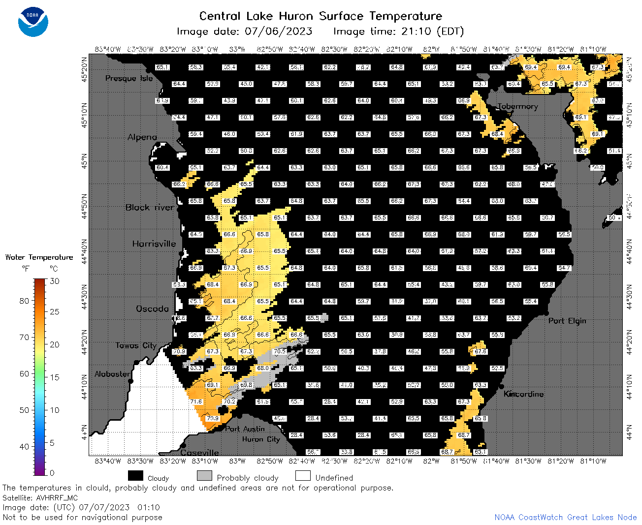 | h2_2023_07_07_0110.png | 07-Jul-2023 05:25 | 58876 | |
 | h2_2023_07_07_0200.png | 07-Jul-2023 05:30 | 76148 | |
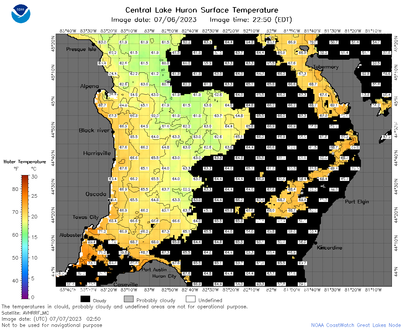 | h2_2023_07_07_0250.png | 07-Jul-2023 06:26 | 79327 | |
 | h2_2023_07_07_0340.png | 07-Jul-2023 06:28 | 34393 | |
 | h2_2023_07_07_0630.png | 07-Jul-2023 10:26 | 91368 | |
 | h2_2023_07_07_0720.png | 07-Jul-2023 10:28 | 101354 | |
 | h2_2023_07_07_0810.png | 07-Jul-2023 12:26 | 118864 | |
 | h2_2023_07_07_1410.png | 07-Jul-2023 17:25 | 35183 | |
 | h2_2023_07_07_1500.png | 07-Jul-2023 19:26 | 81831 | |
 | h2_2023_07_07_1550.png | 07-Jul-2023 19:30 | 86470 | |
 | h2_2023_07_07_1640.png | 07-Jul-2023 20:26 | 68381 | |
 | h2_2023_07_07_1700.png | 07-Jul-2023 19:33 | 85931 | |
 | h2_2023_07_07_1750.png | 07-Jul-2023 20:32 | 83833 | |
 | h2_2023_07_07_1840.png | 07-Jul-2023 21:28 | 86924 | |
 | h2_2023_07_07_1930.png | 07-Jul-2023 22:26 | 69632 | |
 | h2_2023_188.png | 08-Jul-2023 09:14 | 68180 | |