
Easier access to scientific data

Brought to you by NOAA CoastWatch Great Lakes Node
|
ERDDAP
Easier access to scientific data |
|
Brought to you by NOAA CoastWatch Great Lakes Node |
| Dataset Title: | Lake Huron Central Region Surface Temperature Contour Map (2022-present)


|
| Institution: | CoastWatch Great Lakes Node (Dataset ID: LH_NRT_TC_h2) |
| Information: | Summary
| License
| Metadata
| Background | Subset
| Data Access Form
| Make a graph
| Subset
| Data Access Form
| Make a graph
|
![[ICO]](https://apps.glerl.noaa.gov/erddap/images/fileIcons/blank.gif) | Name | Last modified | Size | Description |
|---|---|---|---|---|
![[DIR]](https://apps.glerl.noaa.gov/erddap/images/fileIcons/back.gif) | Parent Directory | - | - | |
![[IMG]](https://apps.glerl.noaa.gov/erddap/images/fileIcons/image2.gif)  | h2_2023_07_05_0100.png | 05-Jul-2023 05:25 | 32972 | |
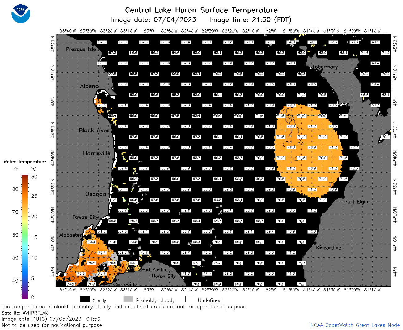 | h2_2023_07_05_0150.png | 05-Jul-2023 05:28 | 54931 | |
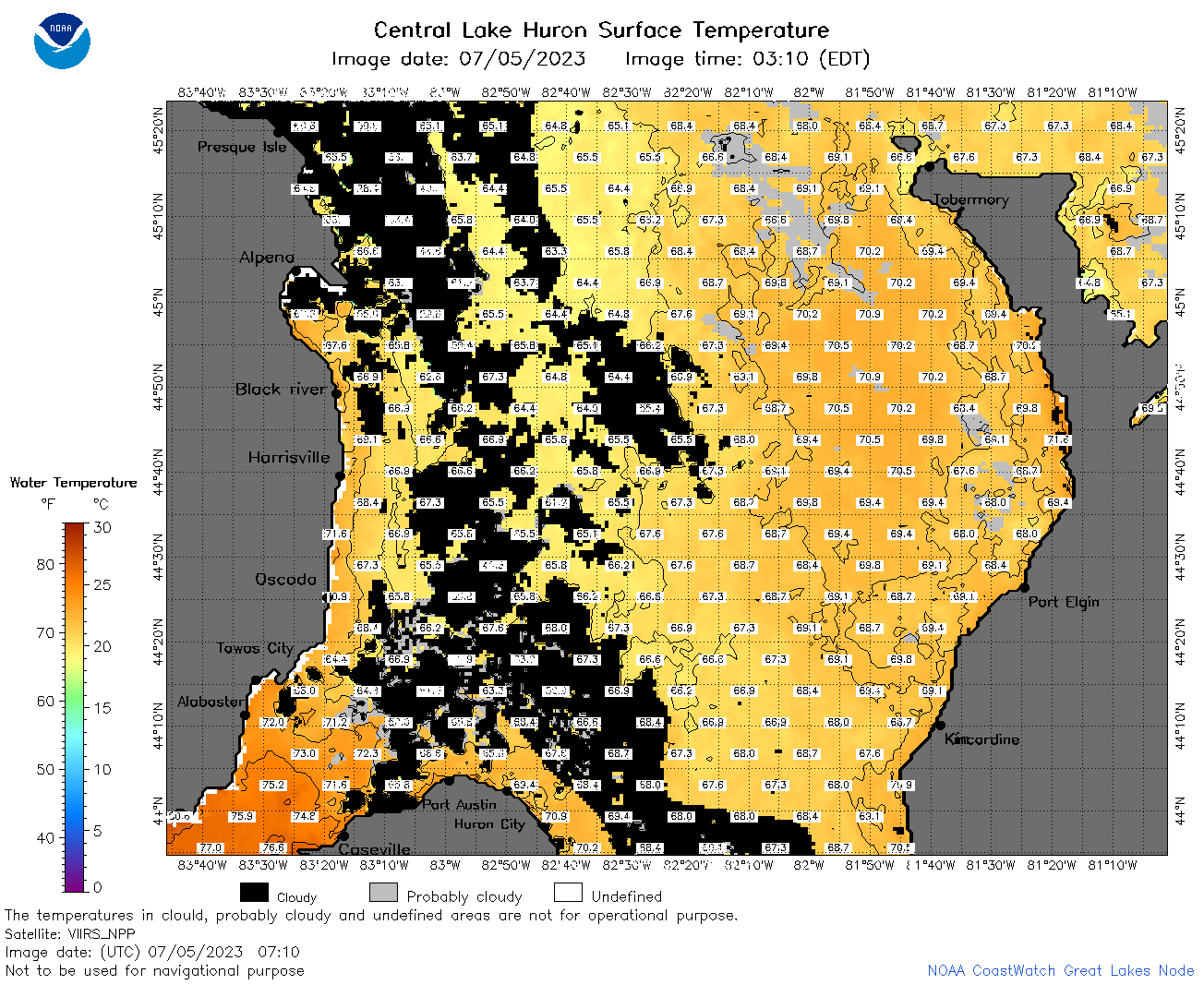
 | h2_2023_07_05_0240.png | 05-Jul-2023 05:30 | 53558 | |
 | h2_2023_07_05_0330.png | 05-Jul-2023 06:26 | 52169 | |
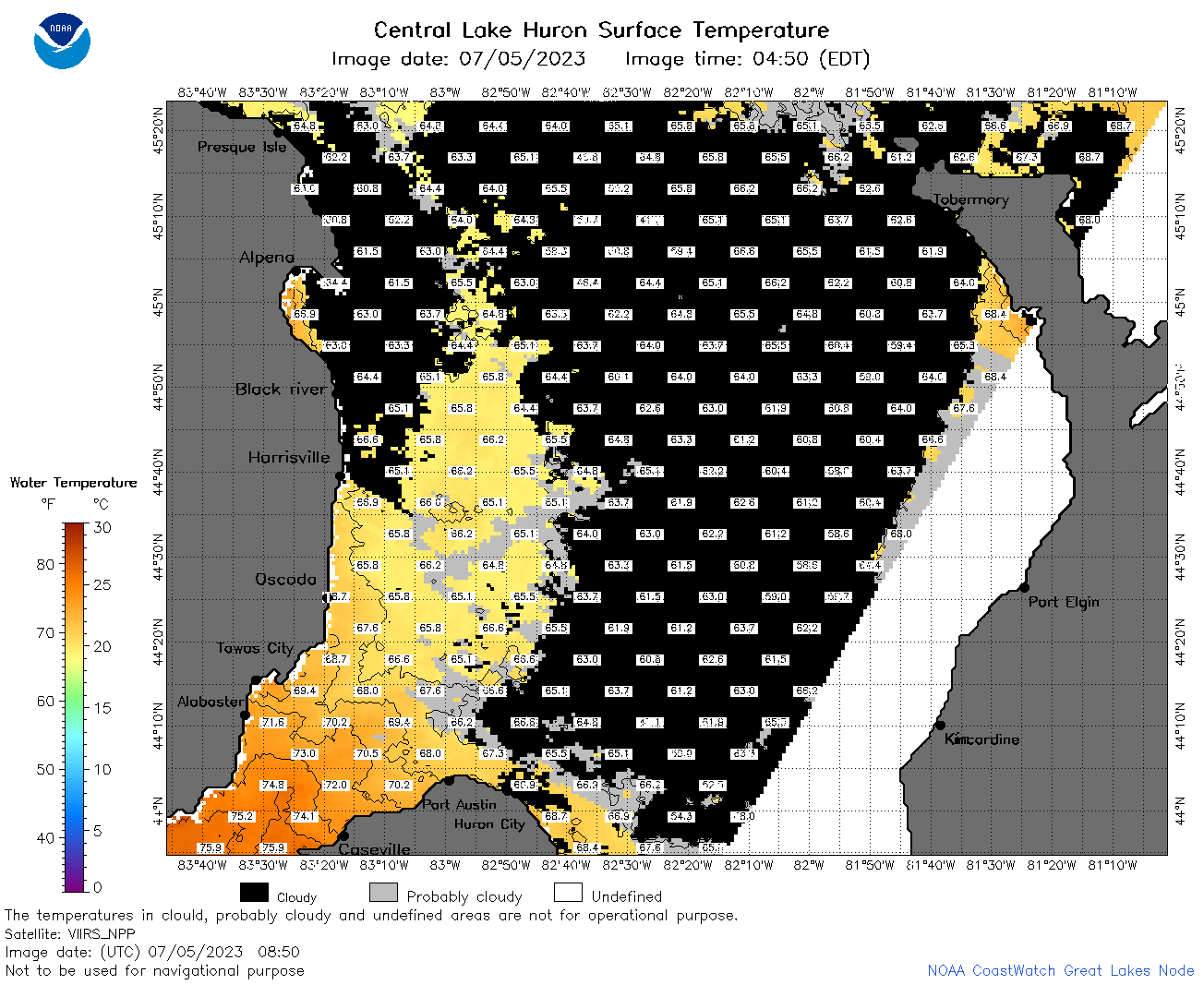
 | h2_2023_07_05_0610.png | 05-Jul-2023 09:25 | 75209 | |
 | h2_2023_07_05_0620.png | 05-Jul-2023 09:27 | 36902 | |
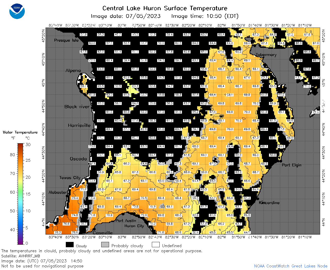
 | h2_2023_07_05_0710.png | 05-Jul-2023 11:27 | 111579 | |
 | h2_2023_07_05_0800.png | 05-Jul-2023 11:32 | 110916 | |
 | h2_2023_07_05_0850.png | 05-Jul-2023 18:28 | 69593 | |
 | h2_2023_07_05_1450.png | 05-Jul-2023 18:34 | 83075 | |
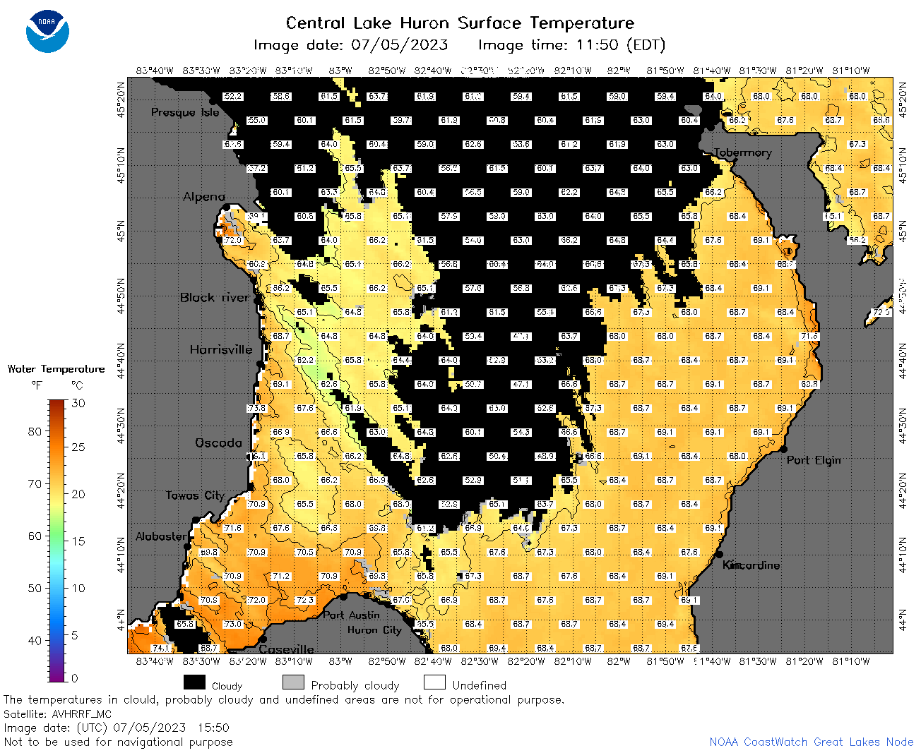 | h2_2023_07_05_1550.png | 05-Jul-2023 20:28 | 95153 | |
 | h2_2023_07_05_1630.png | 05-Jul-2023 20:30 | 82788 | |
 | h2_2023_07_05_1740.png | 05-Jul-2023 20:33 | 107763 | |
 | h2_2023_07_05_1830.png | 05-Jul-2023 21:28 | 92631 | |
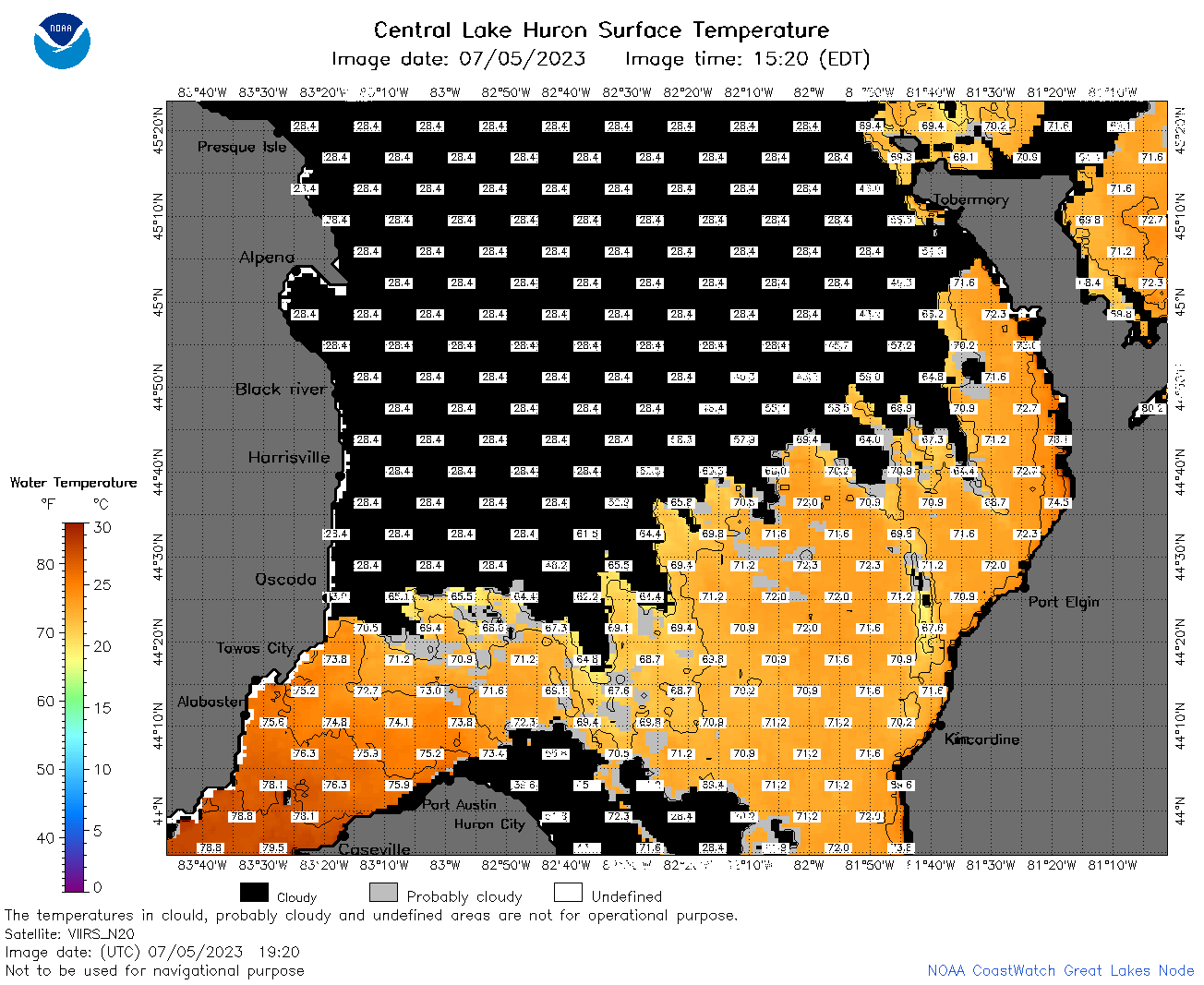 | h2_2023_07_05_1920.png | 05-Jul-2023 22:26 | 77647 | |
 | h2_2023_186.png | 06-Jul-2023 09:14 | 67249 | |