
Easier access to scientific data

Brought to you by NOAA CoastWatch Great Lakes Node
|
ERDDAP
Easier access to scientific data |
|
Brought to you by NOAA CoastWatch Great Lakes Node |
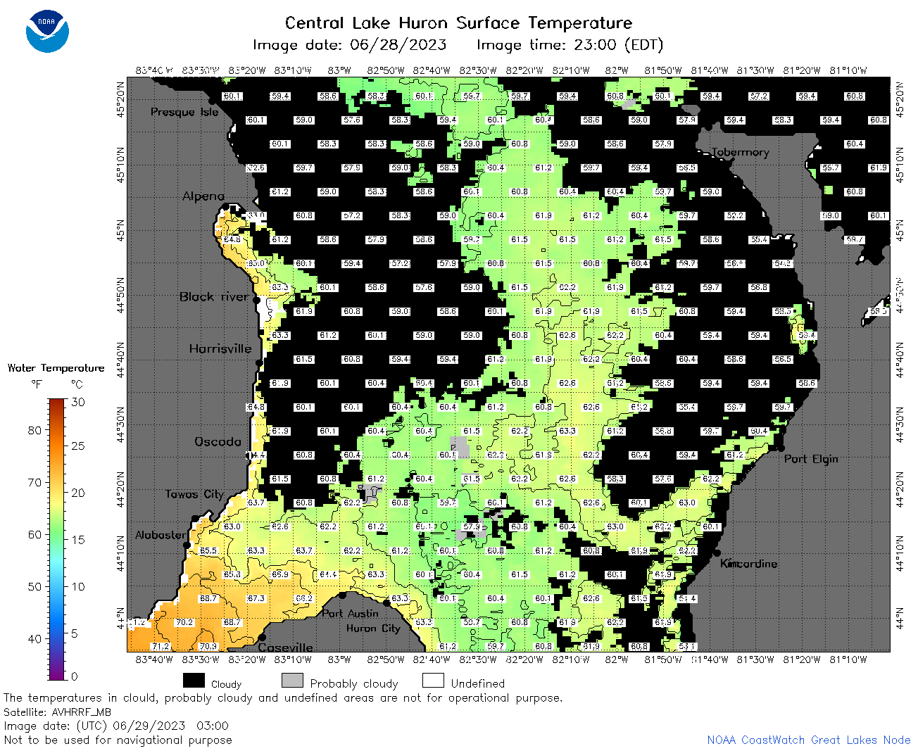
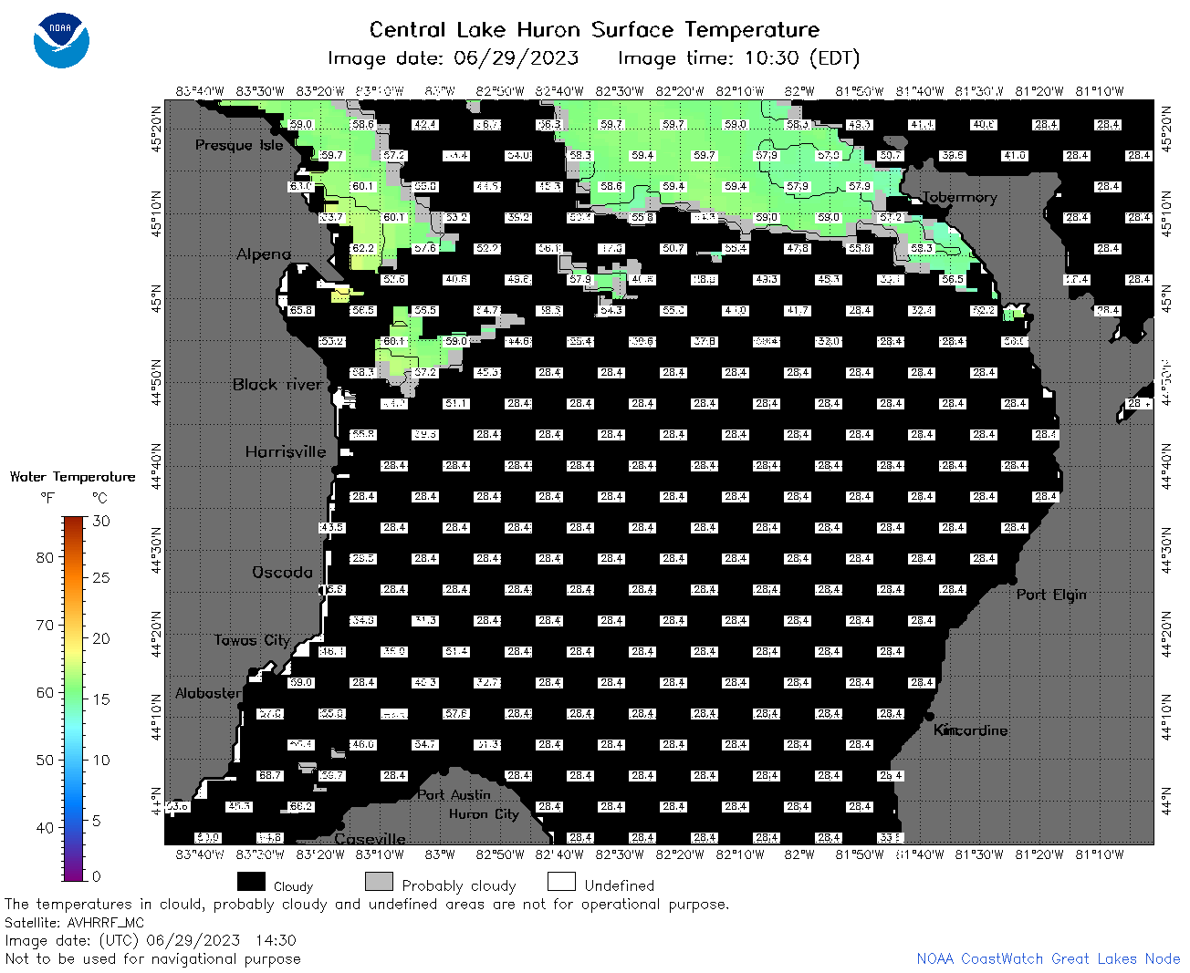
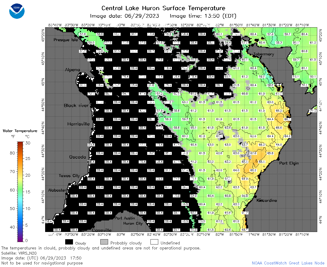
| Dataset Title: | Lake Huron Central Region Surface Temperature Contour Map (2022-present)


|
| Institution: | CoastWatch Great Lakes Node (Dataset ID: LH_NRT_TC_h2) |
| Information: | Summary
| License
| Metadata
| Background | Subset
| Data Access Form
| Make a graph
| Subset
| Data Access Form
| Make a graph
|
![[ICO]](https://apps.glerl.noaa.gov/erddap/images/fileIcons/blank.gif) | Name | Last modified | Size | Description |
|---|---|---|---|---|
![[DIR]](https://apps.glerl.noaa.gov/erddap/images/fileIcons/back.gif) | Parent Directory | - | - | |
![[IMG]](https://apps.glerl.noaa.gov/erddap/images/fileIcons/image2.gif)  | h2_2023_06_29_0120.png | 29-Jun-2023 05:26 | 66370 | |
 | h2_2023_06_29_0210.png | 29-Jun-2023 05:28 | 81009 | |
 | h2_2023_06_29_0300.png | 29-Jun-2023 06:26 | 77843 | |
 | h2_2023_06_29_0630.png | 29-Jun-2023 09:26 | 91339 | |
 | h2_2023_06_29_0720.png | 29-Jun-2023 11:26 | 77098 | |
 | h2_2023_06_29_0810.png | 29-Jun-2023 11:28 | 51623 | |
 | h2_2023_06_29_1430.png | 29-Jun-2023 18:26 | 46188 | |
 | h2_2023_06_29_1520.png | 29-Jun-2023 18:28 | 74780 | |
 | h2_2023_06_29_1610.png | 29-Jun-2023 20:26 | 91310 | |
 | h2_2023_06_29_1700.png | 29-Jun-2023 20:31 | 58173 | |
 | h2_2023_06_29_1750.png | 29-Jun-2023 21:28 | 81657 | |
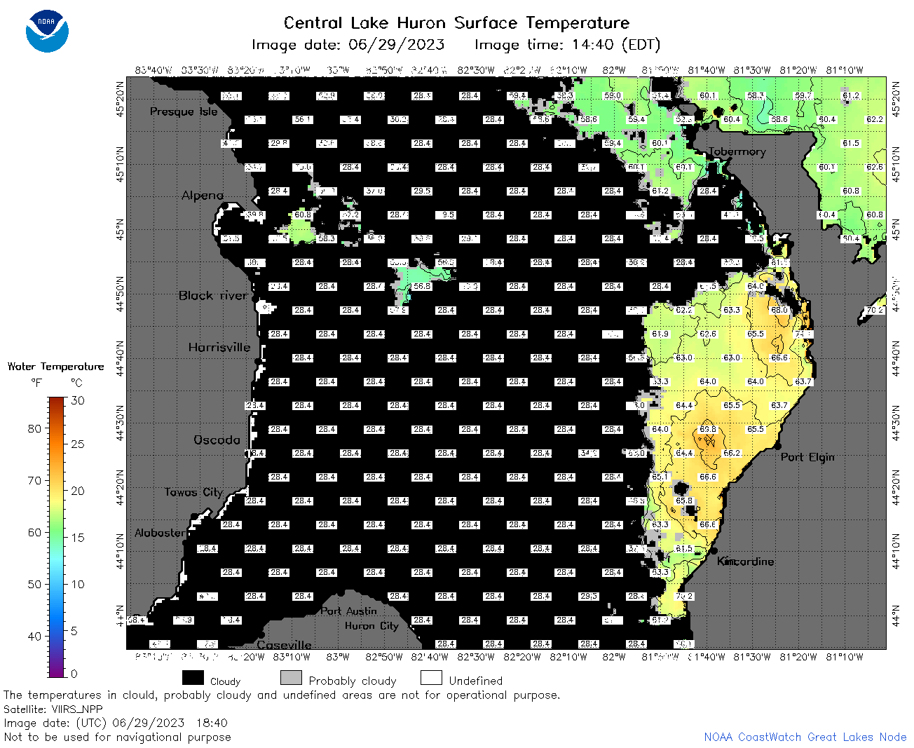 | h2_2023_06_29_1840.png | 29-Jun-2023 21:31 | 63406 | |
 | h2_2023_06_29_1930.png | 29-Jun-2023 22:26 | 38162 | |
 | h2_2023_180.png | 30-Jun-2023 09:14 | 68821 | |