
Easier access to scientific data

Brought to you by NOAA CoastWatch Great Lakes Node
|
ERDDAP
Easier access to scientific data |
|
Brought to you by NOAA CoastWatch Great Lakes Node |
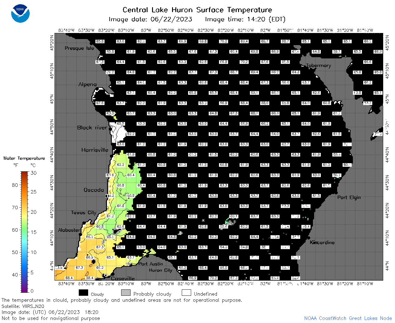
| Dataset Title: | Lake Huron Central Region Surface Temperature Contour Map (2022-present)


|
| Institution: | CoastWatch Great Lakes Node (Dataset ID: LH_NRT_TC_h2) |
| Information: | Summary
| License
| Metadata
| Background | Subset
| Data Access Form
| Make a graph
| Subset
| Data Access Form
| Make a graph
|
![[ICO]](https://apps.glerl.noaa.gov/erddap/images/fileIcons/blank.gif) | Name | Last modified | Size | Description |
|---|---|---|---|---|
![[DIR]](https://apps.glerl.noaa.gov/erddap/images/fileIcons/back.gif) | Parent Directory | - | - | |
![[IMG]](https://apps.glerl.noaa.gov/erddap/images/fileIcons/image2.gif) 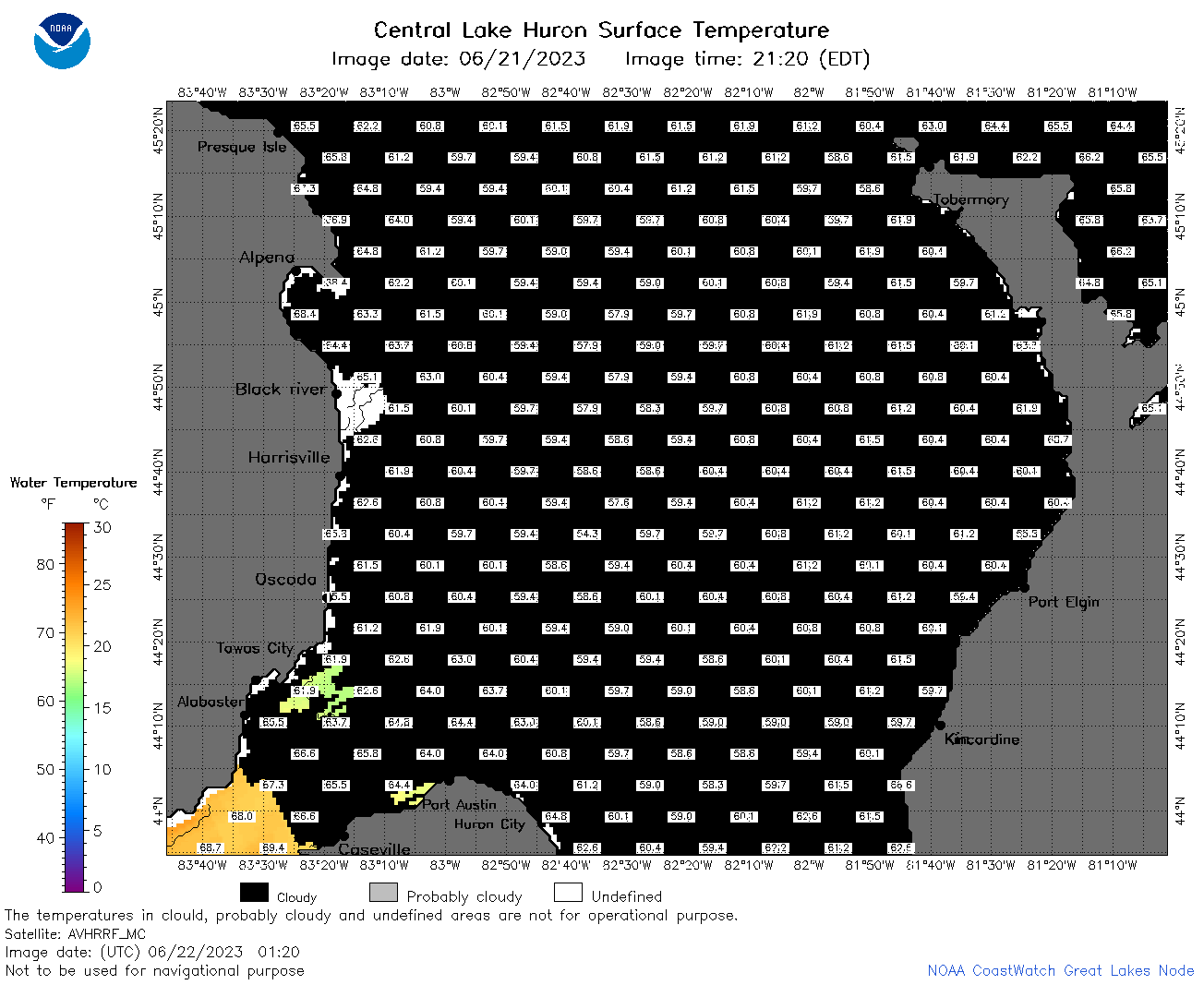 | h2_2023_06_22_0120.png | 22-Jun-2023 05:25 | 41906 | |
 | h2_2023_06_22_0210.png | 22-Jun-2023 05:28 | 41886 | |
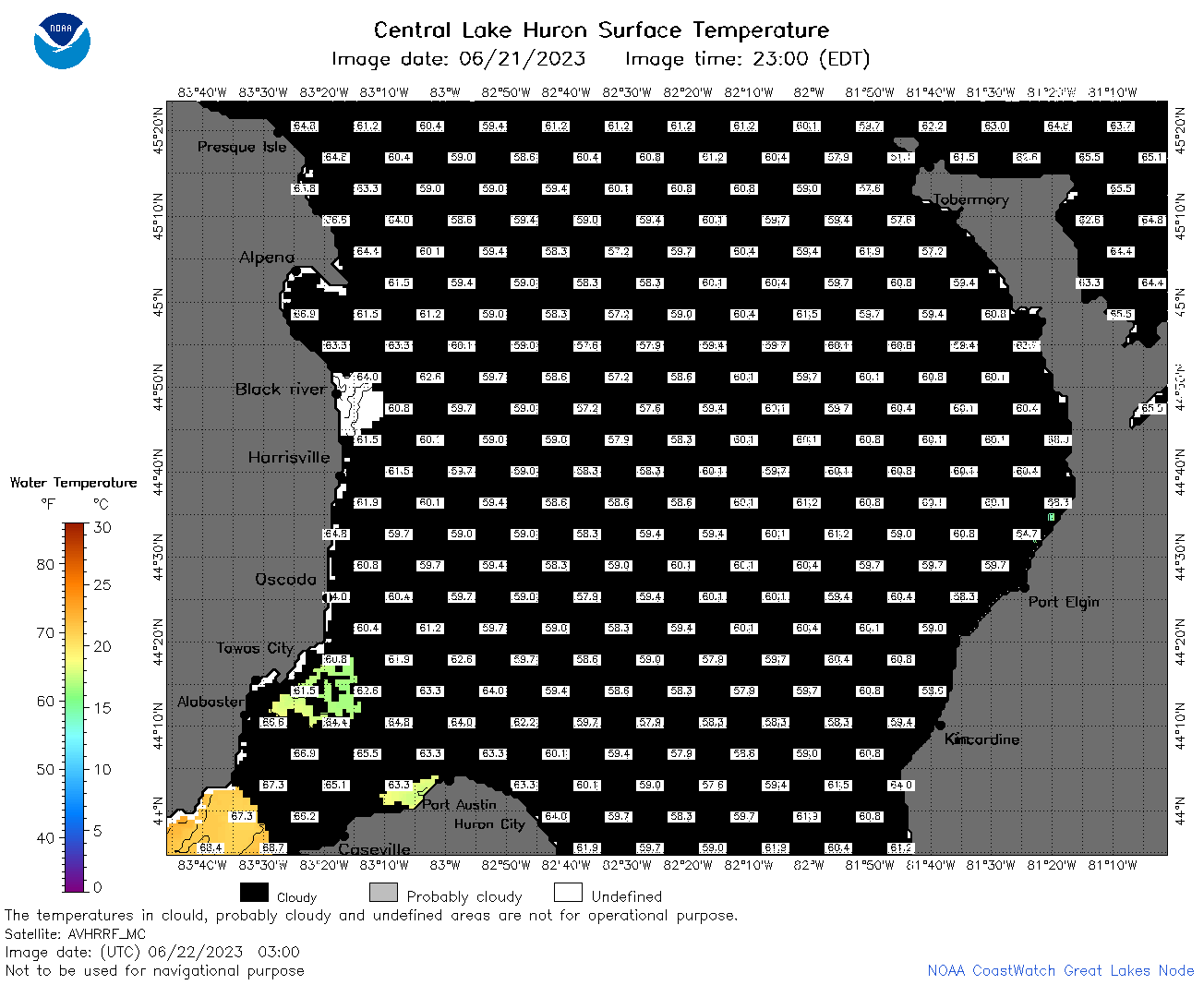 | h2_2023_06_22_0300.png | 22-Jun-2023 05:30 | 41856 | |
 | h2_2023_06_22_0610.png | 22-Jun-2023 10:25 | 53268 | |
 | h2_2023_06_22_0700.png | 22-Jun-2023 09:26 | 88244 | |
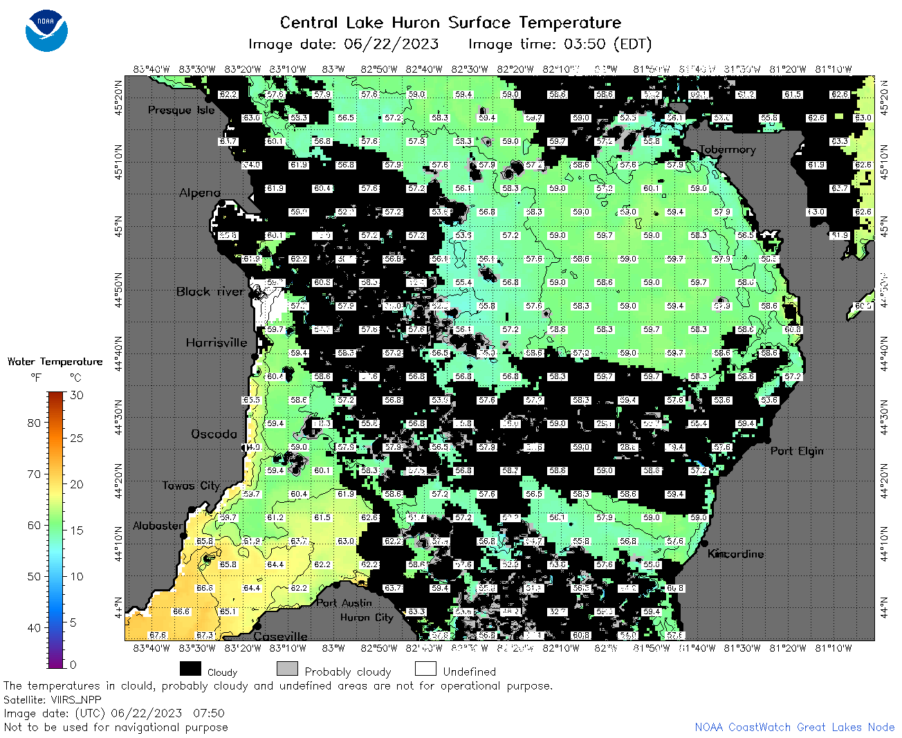 | h2_2023_06_22_0750.png | 22-Jun-2023 11:26 | 99278 | |
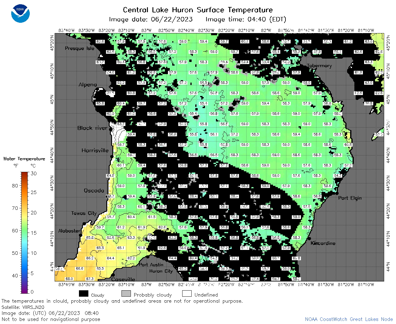 | h2_2023_06_22_0840.png | 22-Jun-2023 11:28 | 94574 | |
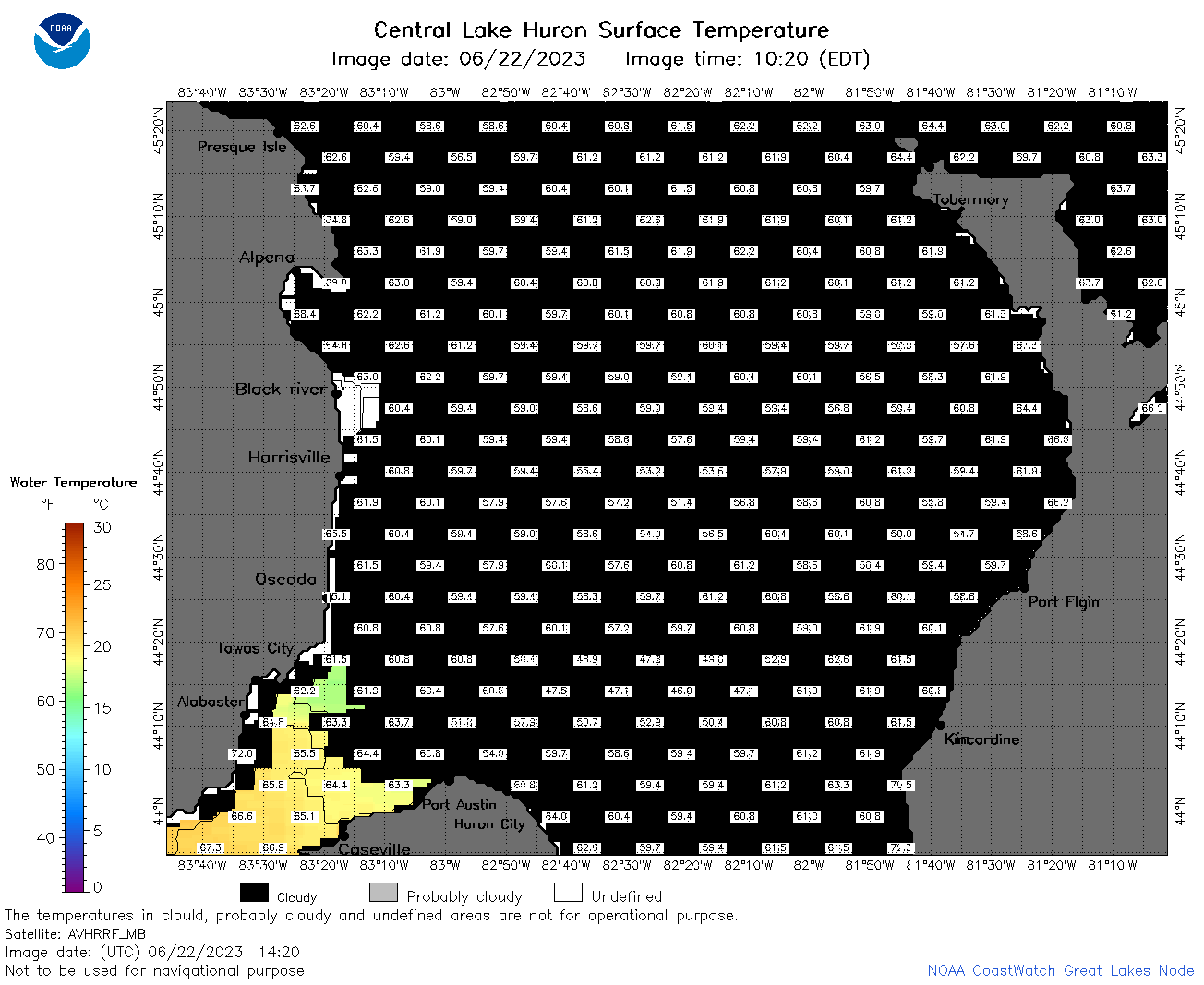 | h2_2023_06_22_1420.png | 22-Jun-2023 17:25 | 42014 | |
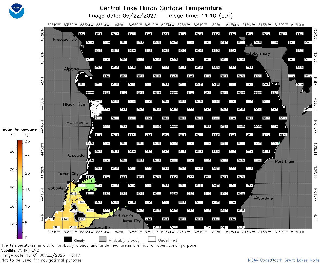 | h2_2023_06_22_1510.png | 22-Jun-2023 19:26 | 43891 | |
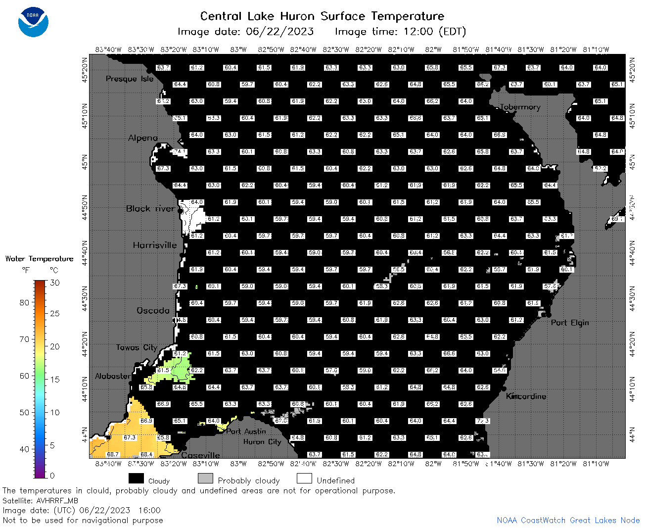 | h2_2023_06_22_1600.png | 22-Jun-2023 19:30 | 43657 | |
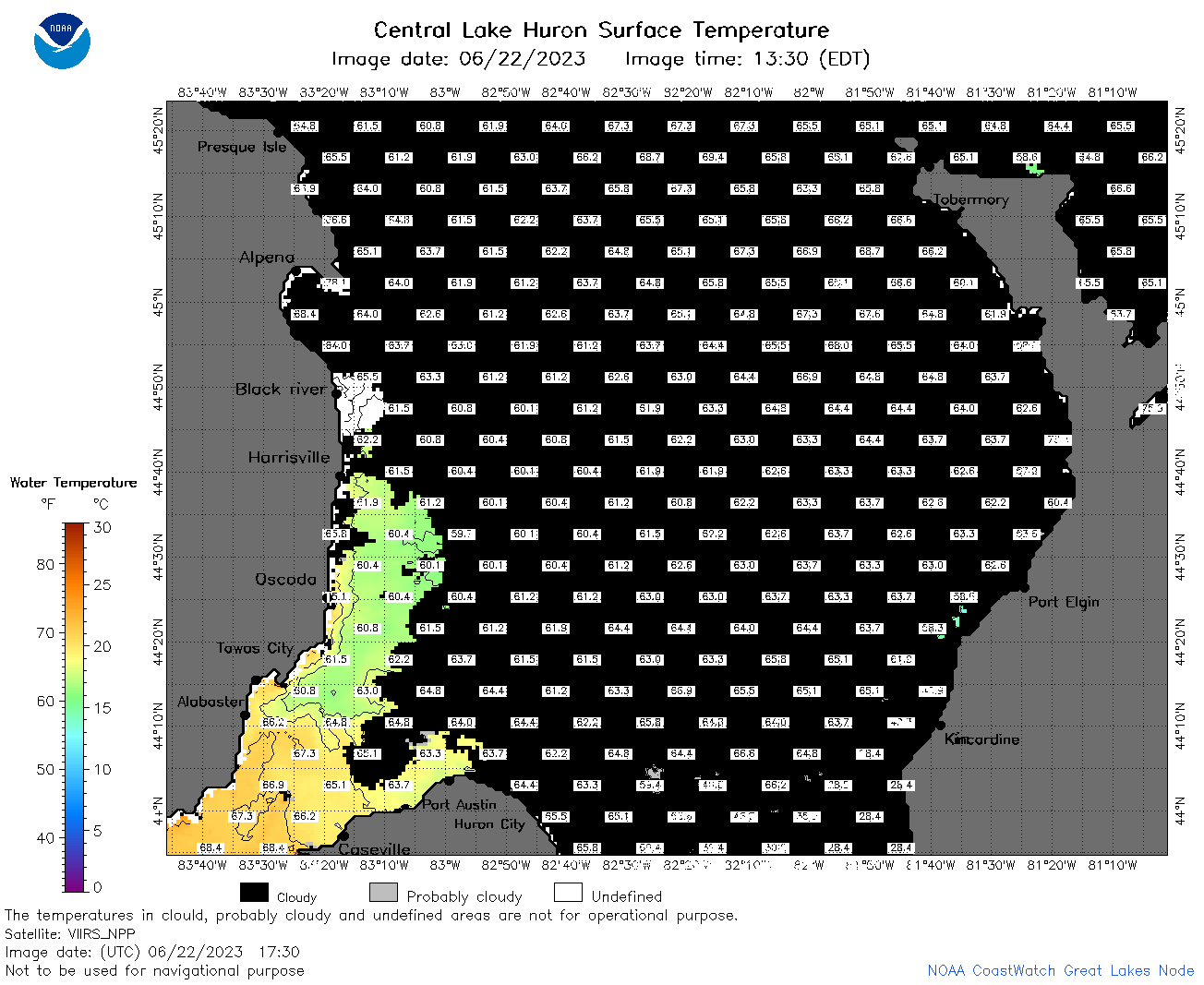 | h2_2023_06_22_1730.png | 22-Jun-2023 21:30 | 50456 | |
 | h2_2023_06_22_1820.png | 22-Jun-2023 21:34 | 49896 | |
 | h2_2023_06_22_1910.png | 22-Jun-2023 22:27 | 48606 | |
 | h2_2023_173.png | 23-Jun-2023 09:14 | 80130 | |