
Easier access to scientific data

Brought to you by NOAA CoastWatch Great Lakes Node
|
ERDDAP
Easier access to scientific data |
|
Brought to you by NOAA CoastWatch Great Lakes Node |
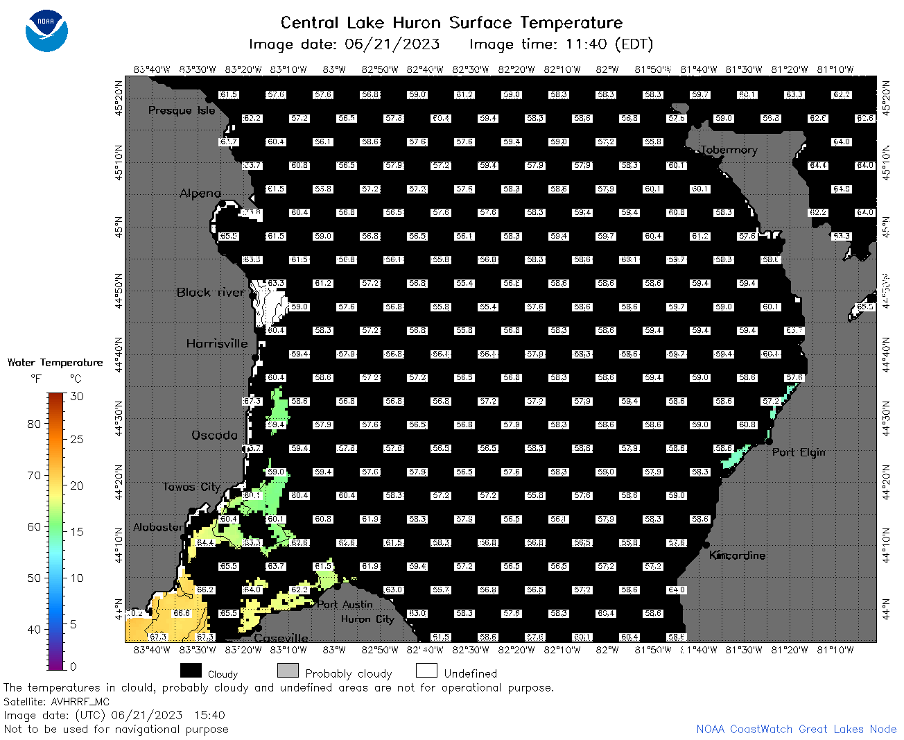
| Dataset Title: | Lake Huron Central Region Surface Temperature Contour Map (2022-present)


|
| Institution: | CoastWatch Great Lakes Node (Dataset ID: LH_NRT_TC_h2) |
| Information: | Summary
| License
| Metadata
| Background | Subset
| Data Access Form
| Make a graph
| Subset
| Data Access Form
| Make a graph
|
![[ICO]](https://apps.glerl.noaa.gov/erddap/images/fileIcons/blank.gif) | Name | Last modified | Size | Description |
|---|---|---|---|---|
![[DIR]](https://apps.glerl.noaa.gov/erddap/images/fileIcons/back.gif) | Parent Directory | - | - | |
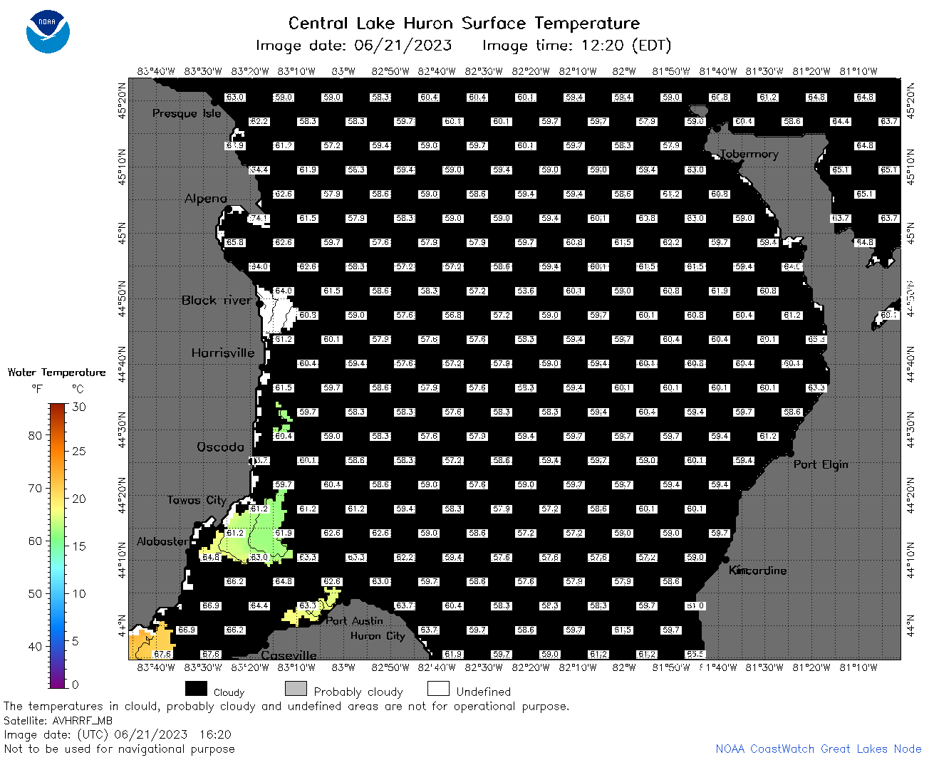
![[IMG]](https://apps.glerl.noaa.gov/erddap/images/fileIcons/image2.gif) 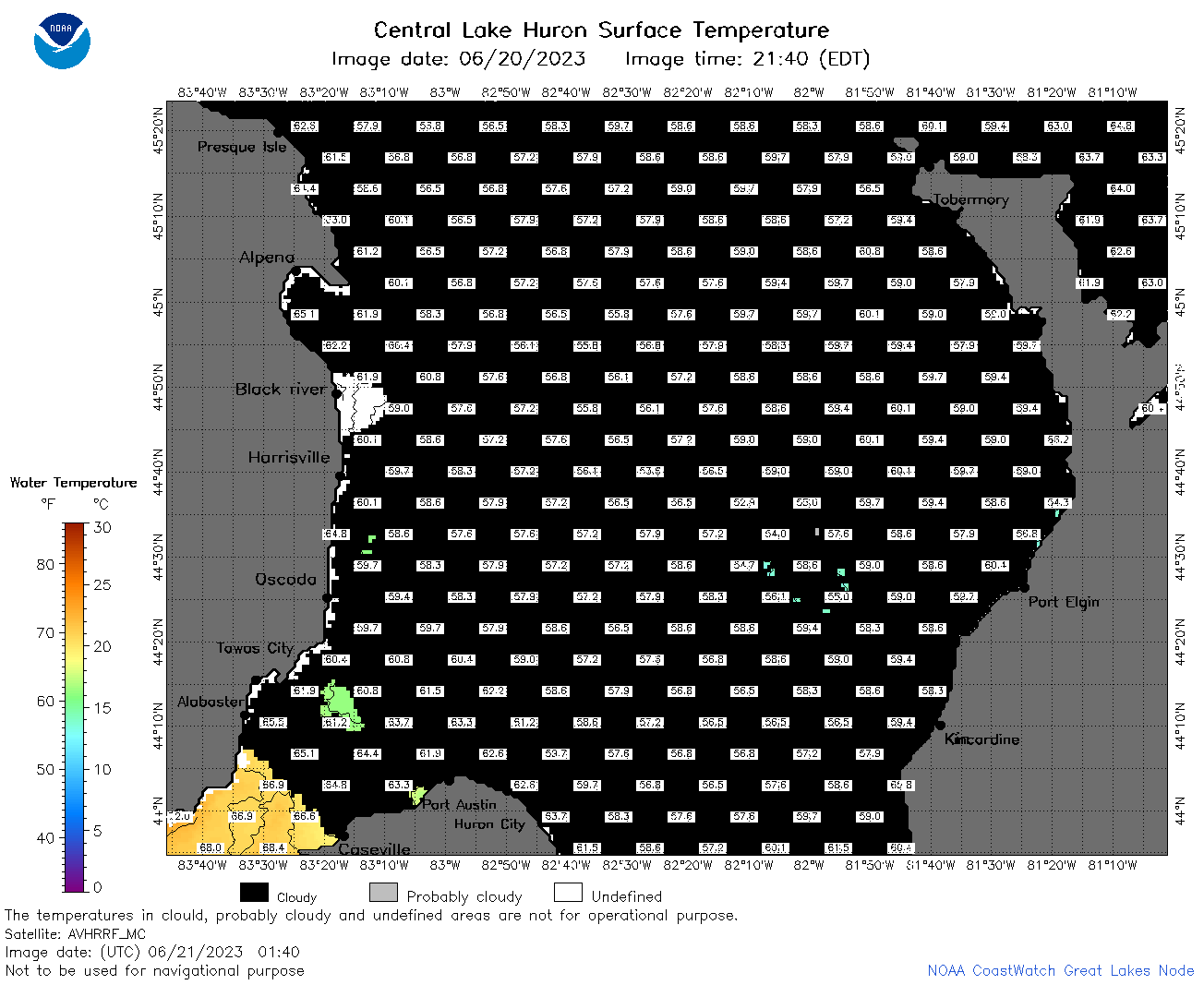 | h2_2023_06_21_0140.png | 21-Jun-2023 21:36 | 42523 | |
 | h2_2023_06_21_0230.png | 21-Jun-2023 21:38 | 42994 | |
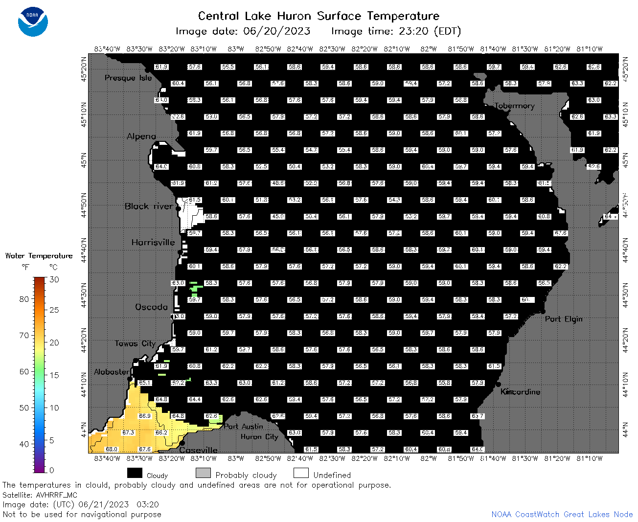 | h2_2023_06_21_0320.png | 21-Jun-2023 21:41 | 41484 | |
 | h2_2023_06_21_0630.png | 21-Jun-2023 21:43 | 113526 | |
 | h2_2023_06_21_0720.png | 21-Jun-2023 21:45 | 104147 | |
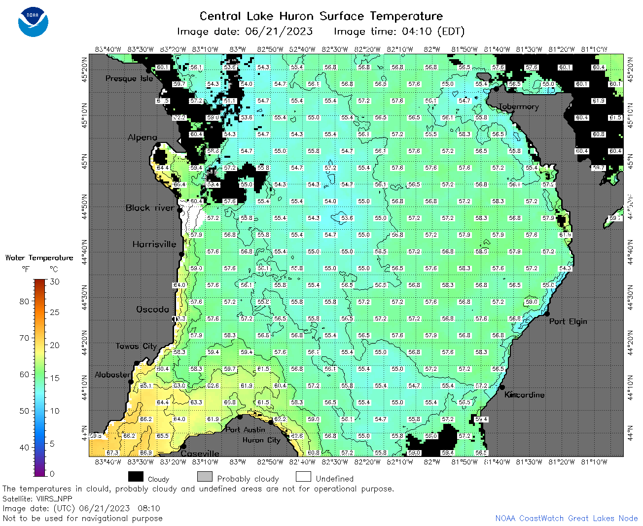 | h2_2023_06_21_0810.png | 21-Jun-2023 21:48 | 108216 | |
 | h2_2023_06_21_1440.png | 21-Jun-2023 21:56 | 43320 | |
 | h2_2023_06_21_1540.png | 21-Jun-2023 22:01 | 44279 | |
 | h2_2023_06_21_1620.png | 21-Jun-2023 22:03 | 42082 | |
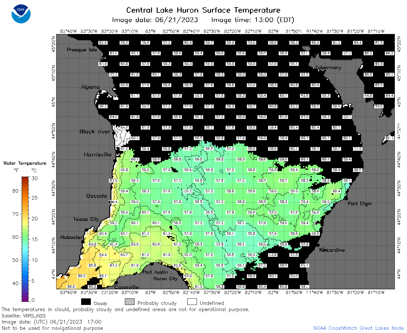 | h2_2023_06_21_1700.png | 21-Jun-2023 22:05 | 74503 | |
 | h2_2023_06_21_1750.png | 21-Jun-2023 22:12 | 68482 | |
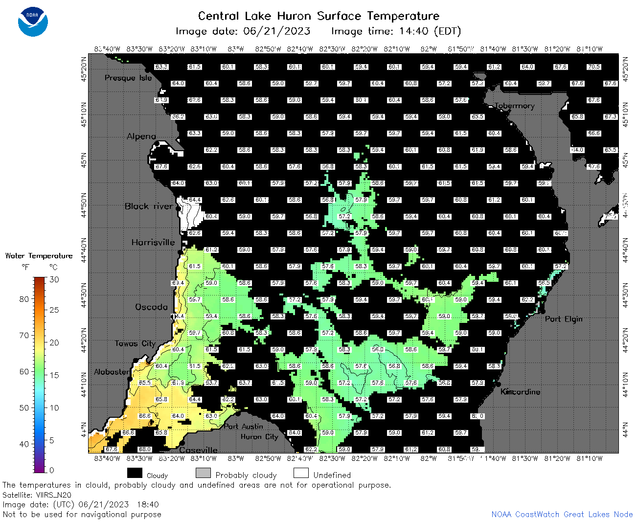 | h2_2023_06_21_1840.png | 21-Jun-2023 22:16 | 59008 | |
 | h2_2023_06_21_1930.png | 21-Jun-2023 22:18 | 54672 | |
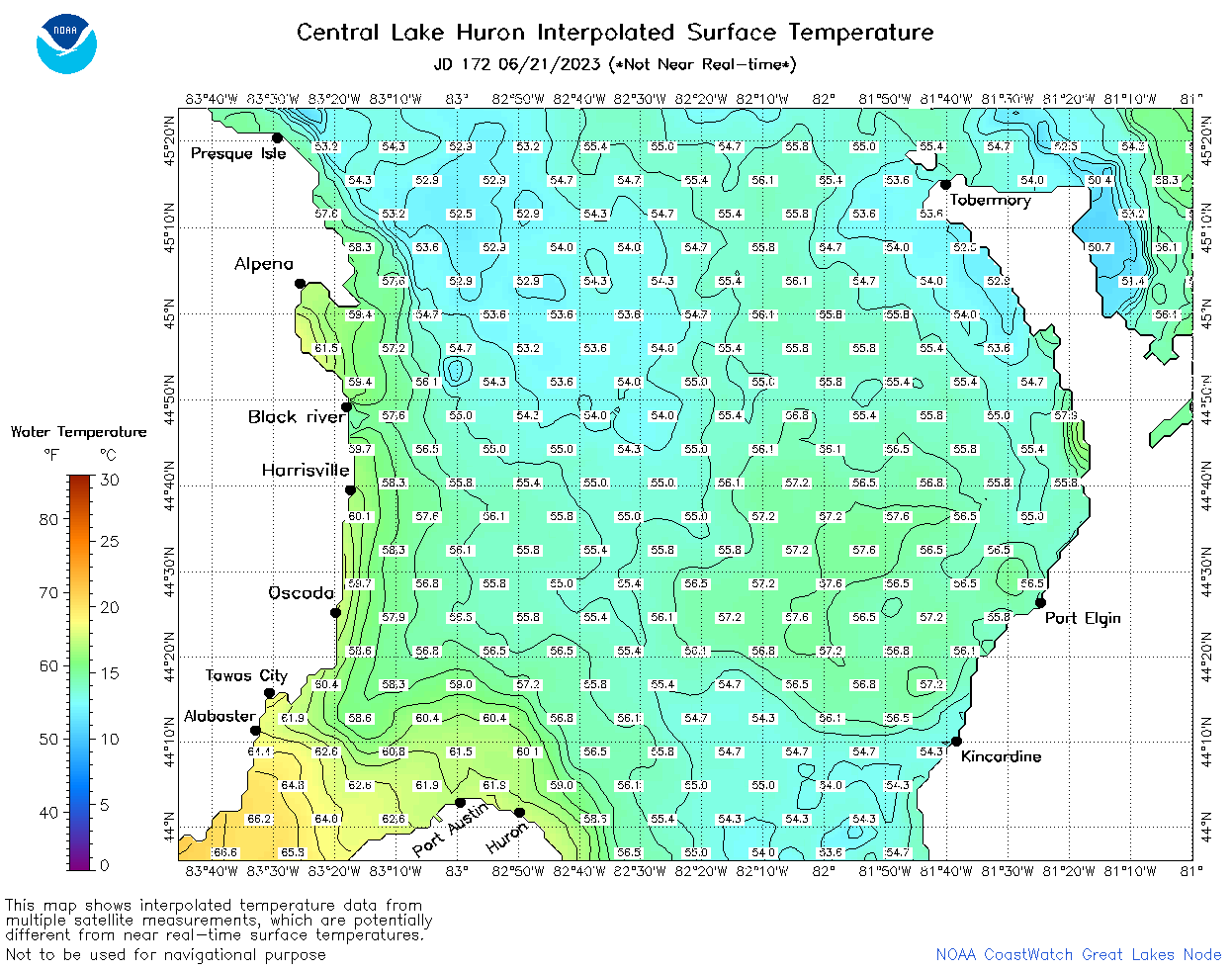 | h2_2023_172.png | 22-Jun-2023 09:14 | 75580 | |