
Easier access to scientific data

Brought to you by NOAA CoastWatch Great Lakes Node
|
ERDDAP
Easier access to scientific data |
|
Brought to you by NOAA CoastWatch Great Lakes Node |
| Dataset Title: | Lake Huron Central Region Surface Temperature Contour Map (2022-present)


|
| Institution: | CoastWatch Great Lakes Node (Dataset ID: LH_NRT_TC_h2) |
| Information: | Summary
| License
| Metadata
| Background | Subset
| Data Access Form
| Make a graph
| Subset
| Data Access Form
| Make a graph
|
![[ICO]](https://apps.glerl.noaa.gov/erddap/images/fileIcons/blank.gif) | Name | Last modified | Size | Description |
|---|---|---|---|---|
![[DIR]](https://apps.glerl.noaa.gov/erddap/images/fileIcons/back.gif) | Parent Directory | - | - | |
![[IMG]](https://apps.glerl.noaa.gov/erddap/images/fileIcons/image2.gif)  | h2_2023_06_19_0130.png | 19-Jun-2023 05:26 | 56663 | |
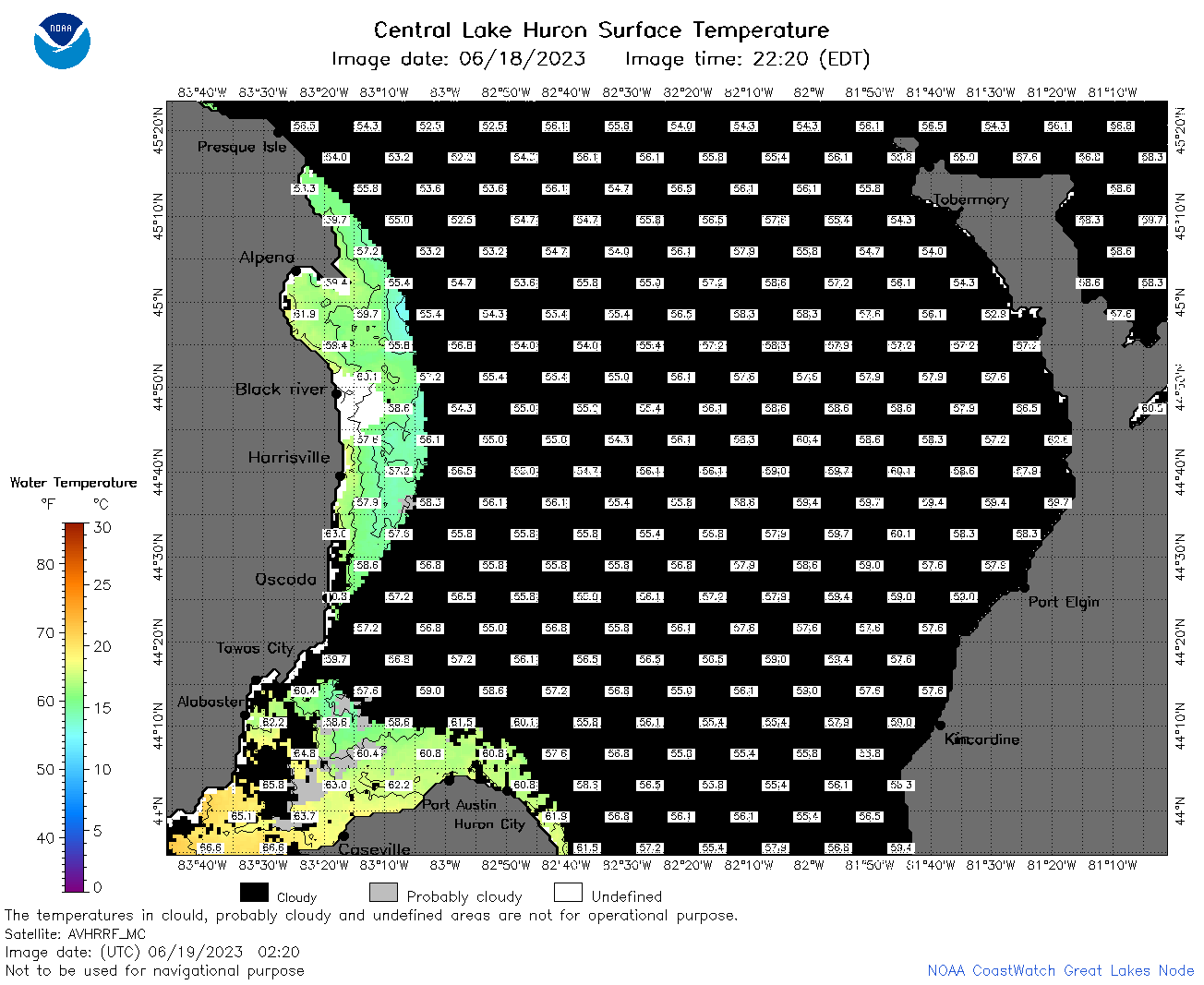 | h2_2023_06_19_0220.png | 19-Jun-2023 05:28 | 54862 | |
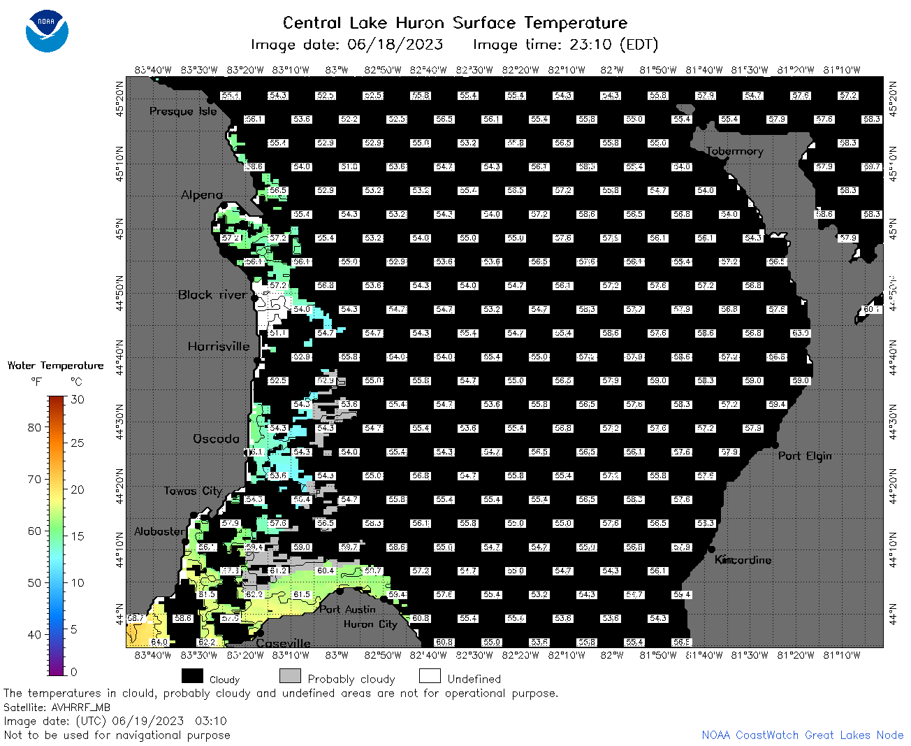 | h2_2023_06_19_0310.png | 19-Jun-2023 06:26 | 50115 | |
 | h2_2023_06_19_0610.png | 21-Jun-2023 15:13 | 66331 | |
 | h2_2023_06_19_0710.png | 21-Jun-2023 15:19 | 122944 | |
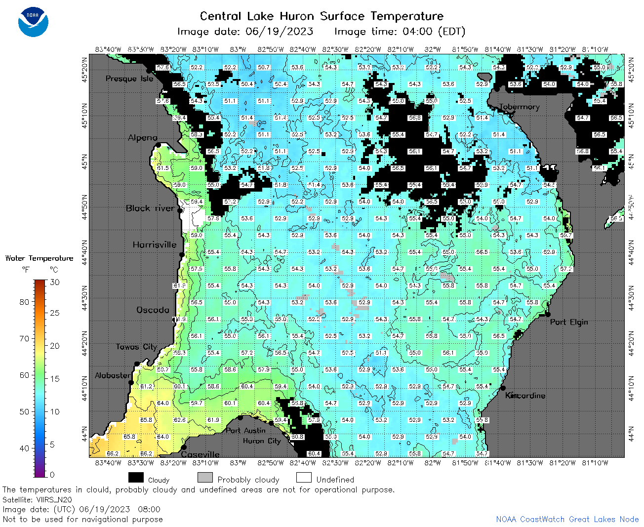 | h2_2023_06_19_0800.png | 21-Jun-2023 15:23 | 122583 | |
 | h2_2023_06_19_0850.png | 21-Jun-2023 15:28 | 116885 | |
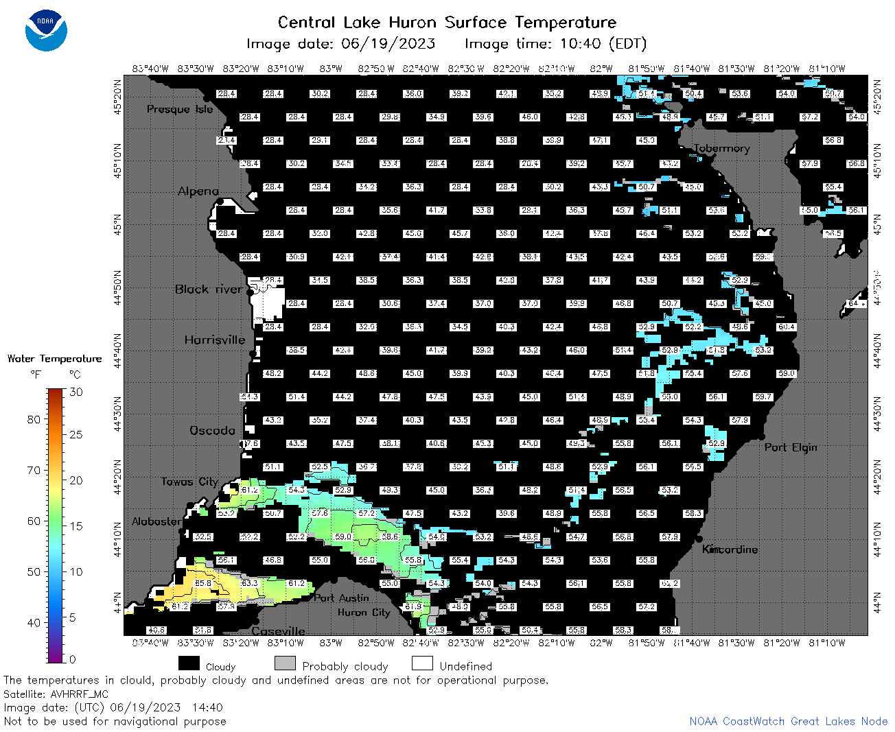 | h2_2023_06_19_1440.png | 21-Jun-2023 15:33 | 52474 | |
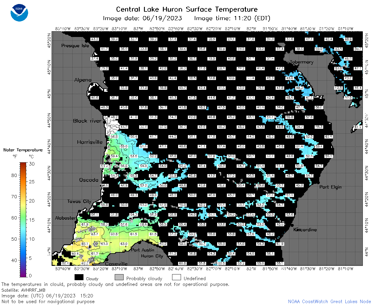 | h2_2023_06_19_1520.png | 21-Jun-2023 15:36 | 68769 | |
 | h2_2023_06_19_1620.png | 21-Jun-2023 15:42 | 48738 | |
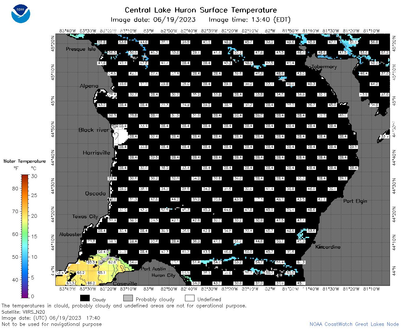 | h2_2023_06_19_1740.png | 21-Jun-2023 15:48 | 50530 | |
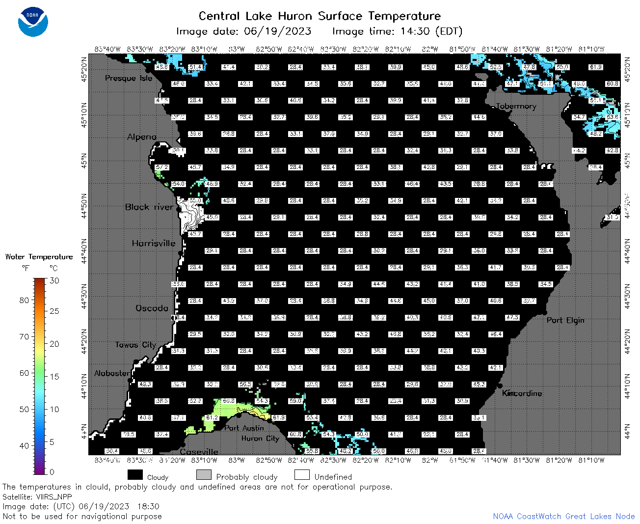 | h2_2023_06_19_1830.png | 21-Jun-2023 15:51 | 50414 | |
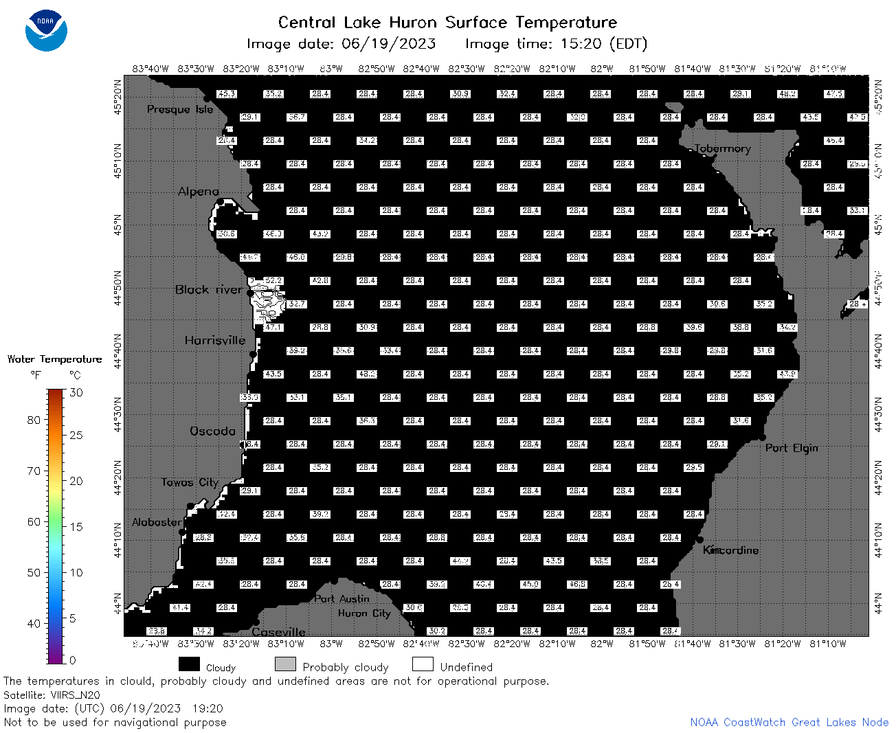 | h2_2023_06_19_1920.png | 21-Jun-2023 15:53 | 37022 | |
 | h2_2023_170.png | 20-Jun-2023 09:15 | 77745 | |