
Easier access to scientific data

Brought to you by NOAA CoastWatch Great Lakes Node
|
ERDDAP
Easier access to scientific data |
|
Brought to you by NOAA CoastWatch Great Lakes Node |
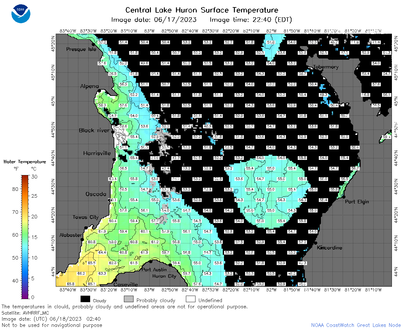
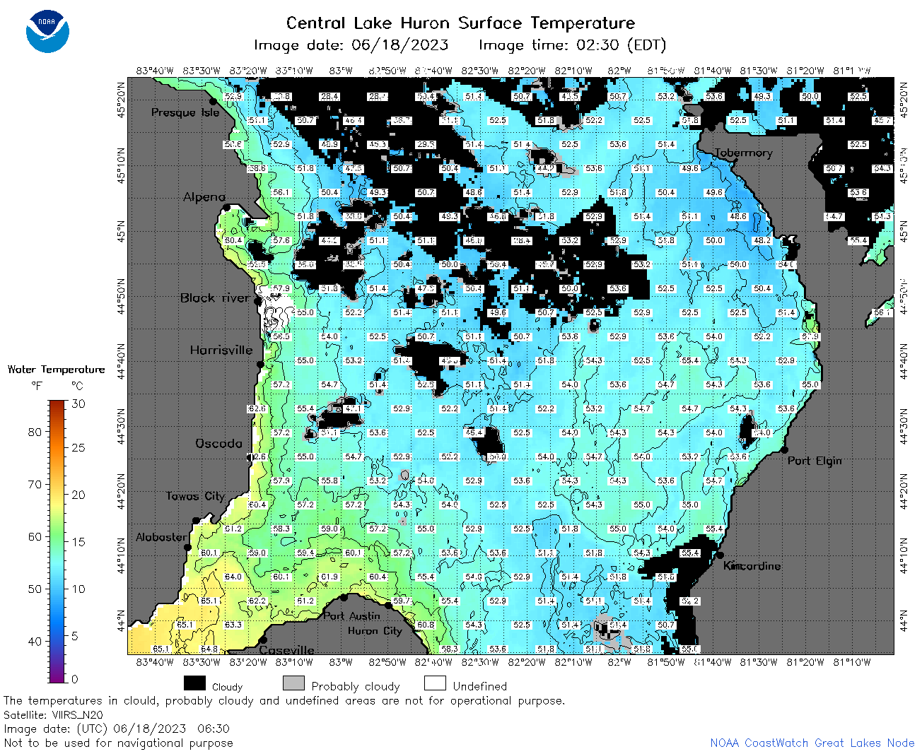
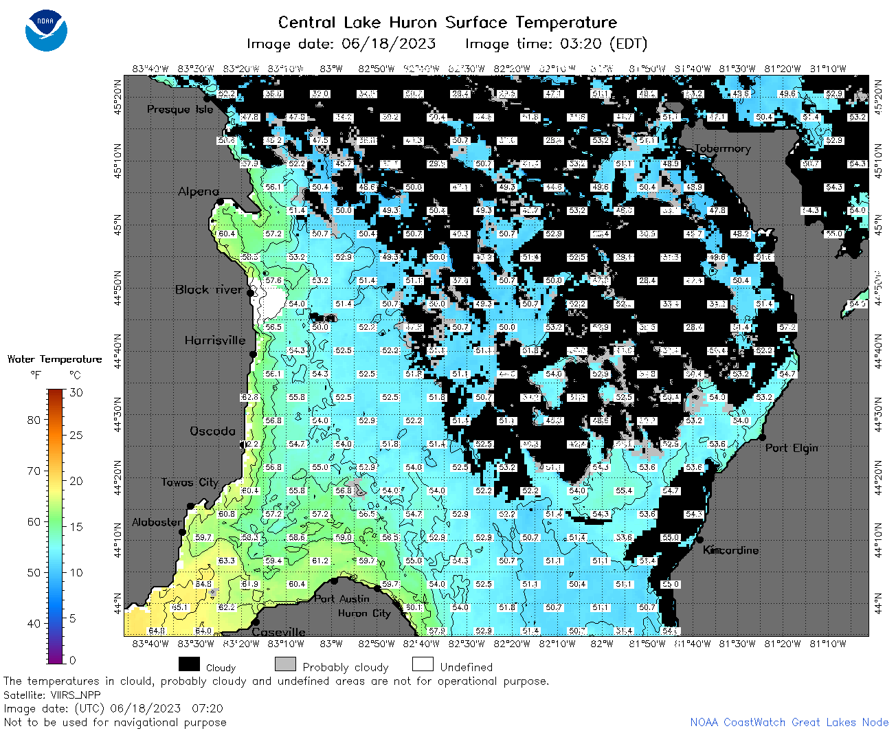
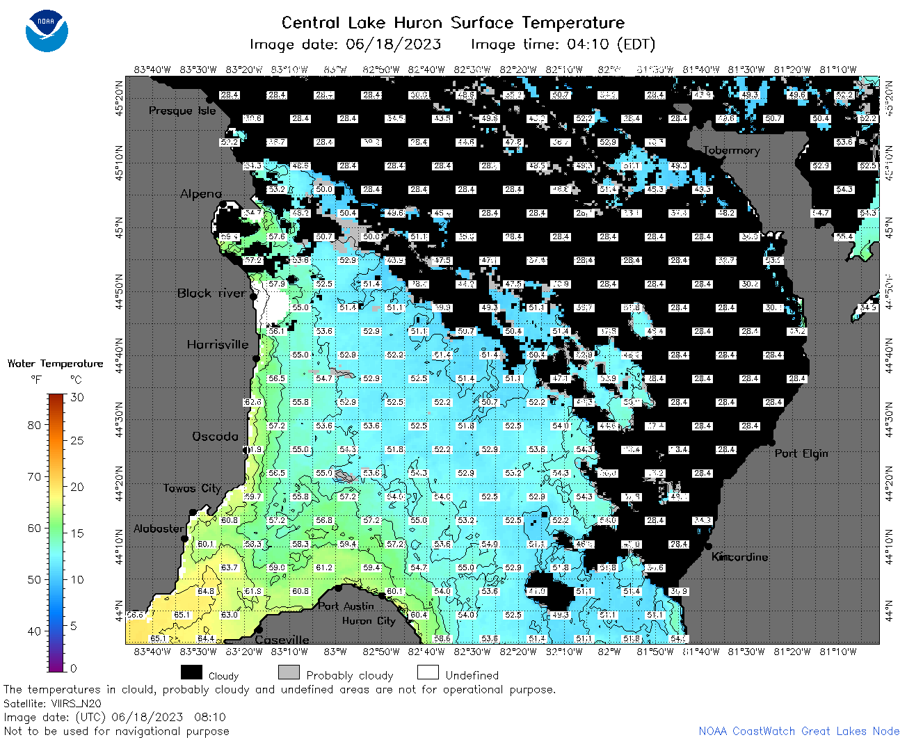
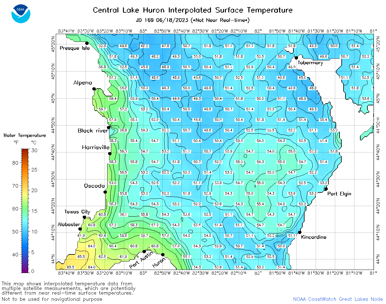
| Dataset Title: | Lake Huron Central Region Surface Temperature Contour Map (2022-present)


|
| Institution: | CoastWatch Great Lakes Node (Dataset ID: LH_NRT_TC_h2) |
| Information: | Summary
| License
| Metadata
| Background | Subset
| Data Access Form
| Make a graph
| Subset
| Data Access Form
| Make a graph
|
![[ICO]](https://apps.glerl.noaa.gov/erddap/images/fileIcons/blank.gif) | Name | Last modified | Size | Description |
|---|---|---|---|---|
![[DIR]](https://apps.glerl.noaa.gov/erddap/images/fileIcons/back.gif) | Parent Directory | - | - | |
![[IMG]](https://apps.glerl.noaa.gov/erddap/images/fileIcons/image2.gif)  | h2_2023_06_18_0100.png | 18-Jun-2023 05:26 | 39456 | |
 | h2_2023_06_18_0150.png | 18-Jun-2023 05:28 | 69847 | |
 | h2_2023_06_18_0240.png | 18-Jun-2023 05:30 | 78832 | |
 | h2_2023_06_18_0330.png | 18-Jun-2023 06:26 | 64069 | |
 | h2_2023_06_18_0630.png | 18-Jun-2023 09:26 | 122673 | |
 | h2_2023_06_18_0720.png | 18-Jun-2023 11:26 | 111543 | |
 | h2_2023_06_18_0810.png | 18-Jun-2023 11:28 | 102500 | |
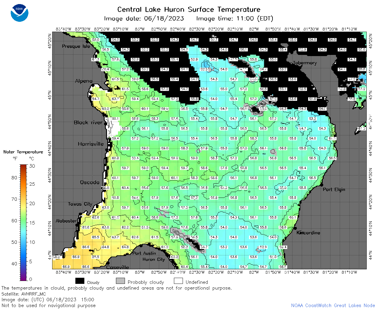 | h2_2023_06_18_1500.png | 18-Jun-2023 18:26 | 94475 | |
 | h2_2023_06_18_1540.png | 18-Jun-2023 19:26 | 33734 | |
 | h2_2023_06_18_1550.png | 18-Jun-2023 19:28 | 76969 | |
 | h2_2023_06_18_1640.png | 18-Jun-2023 20:26 | 97405 | |
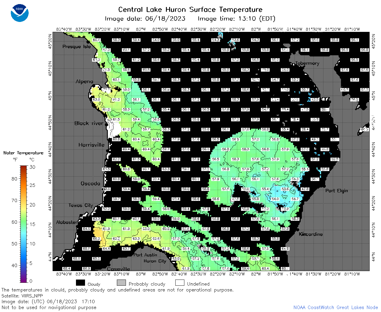 | h2_2023_06_18_1710.png | 18-Jun-2023 20:28 | 78129 | |
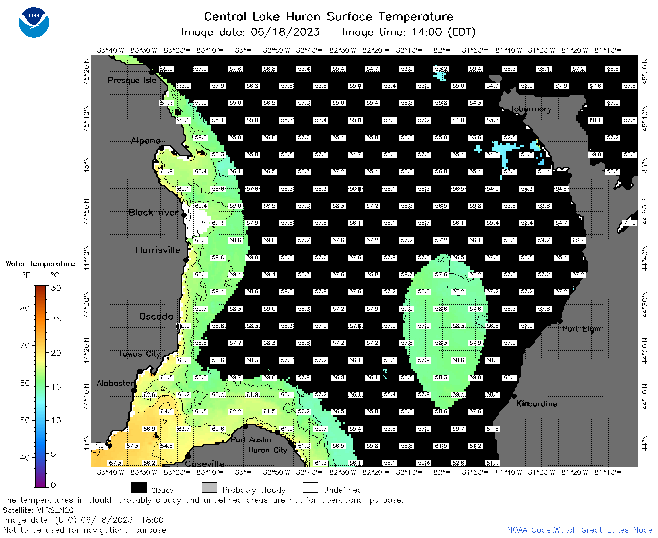 | h2_2023_06_18_1800.png | 18-Jun-2023 20:34 | 64753 | |
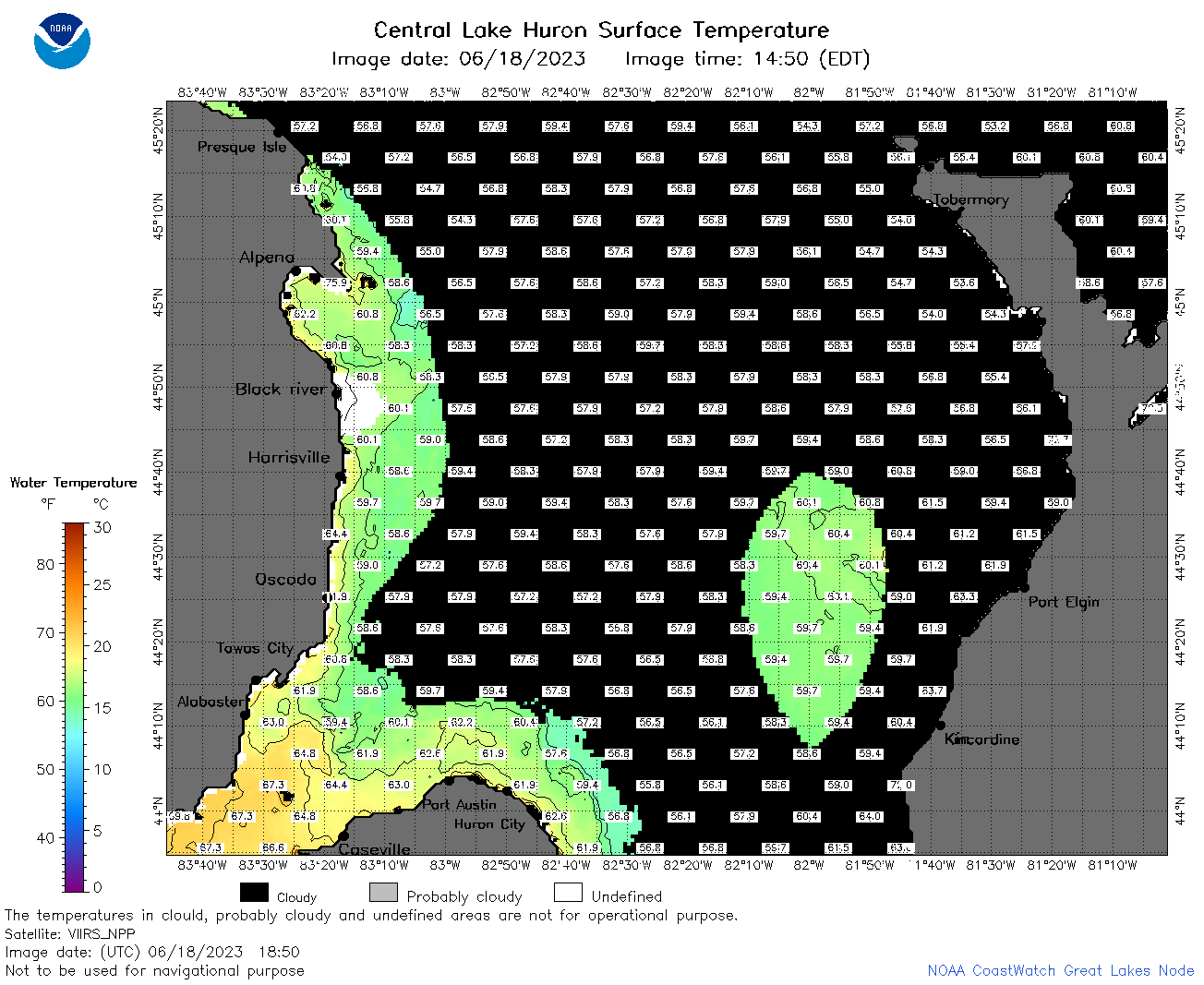 | h2_2023_06_18_1850.png | 18-Jun-2023 21:26 | 63244 | |
 | h2_2023_169.png | 19-Jun-2023 09:14 | 78359 | |