
Easier access to scientific data

Brought to you by NOAA CoastWatch Great Lakes Node
|
ERDDAP
Easier access to scientific data |
|
Brought to you by NOAA CoastWatch Great Lakes Node |
| Dataset Title: | Lake Huron Central Region Surface Temperature Contour Map (2022-present)


|
| Institution: | CoastWatch Great Lakes Node (Dataset ID: LH_NRT_TC_h2) |
| Information: | Summary
| License
| Metadata
| Background | Subset
| Data Access Form
| Make a graph
| Subset
| Data Access Form
| Make a graph
|
![[ICO]](https://apps.glerl.noaa.gov/erddap/images/fileIcons/blank.gif) | Name | Last modified | Size | Description |
|---|---|---|---|---|
![[DIR]](https://apps.glerl.noaa.gov/erddap/images/fileIcons/back.gif) | Parent Directory | - | - | |
![[IMG]](https://apps.glerl.noaa.gov/erddap/images/fileIcons/image2.gif)  | h2_2023_06_16_0140.png | 16-Jun-2023 05:26 | 37544 | |
 | h2_2023_06_16_0230.png | 16-Jun-2023 05:30 | 39272 | |
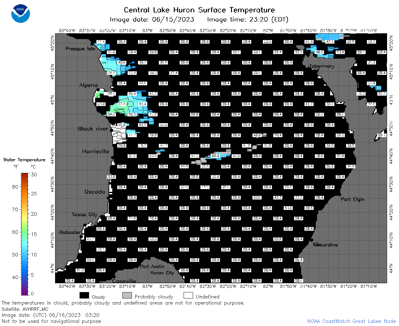 | h2_2023_06_16_0320.png | 16-Jun-2023 06:26 | 43526 | |
 | h2_2023_06_16_0620.png | 16-Jun-2023 10:26 | 61035 | |
 | h2_2023_06_16_0710.png | 16-Jun-2023 10:28 | 75891 | |
 | h2_2023_06_16_0800.png | 16-Jun-2023 11:26 | 69981 | |
 | h2_2023_06_16_0850.png | 16-Jun-2023 12:26 | 35926 | |
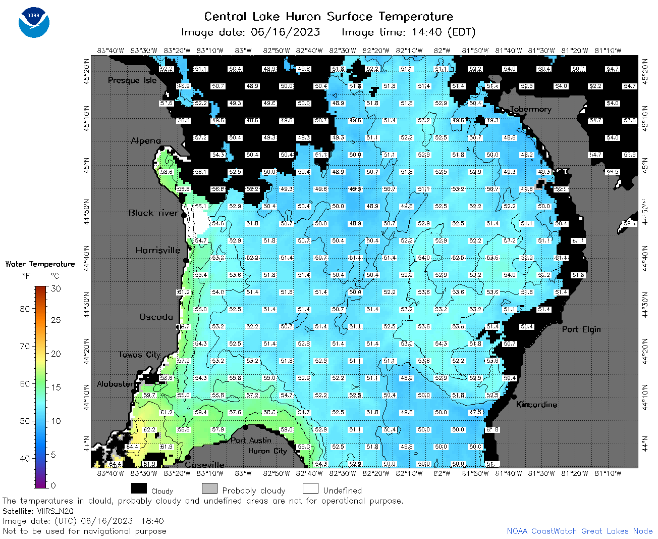
 | h2_2023_06_16_1450.png | 16-Jun-2023 18:28 | 44646 | |
 | h2_2023_06_16_1540.png | 16-Jun-2023 19:26 | 59427 | |
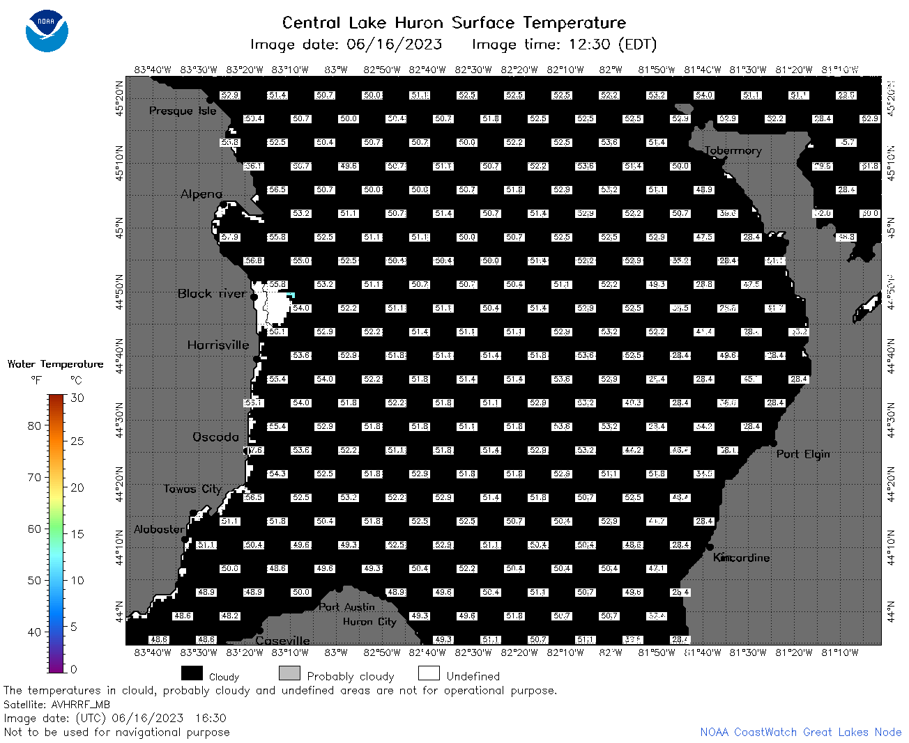 | h2_2023_06_16_1630.png | 16-Jun-2023 19:28 | 39753 | |
 | h2_2023_06_16_1700.png | 16-Jun-2023 19:31 | 40363 | |
 | h2_2023_06_16_1750.png | 16-Jun-2023 20:26 | 75201 | |
 | h2_2023_06_16_1840.png | 16-Jun-2023 21:28 | 93722 | |
 | h2_2023_06_16_1930.png | 16-Jun-2023 22:26 | 47313 | |
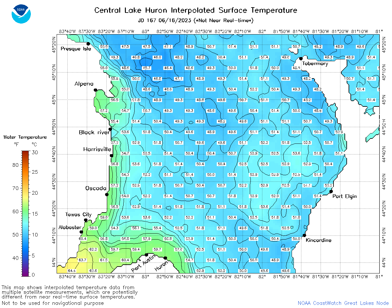 | h2_2023_167.png | 17-Jun-2023 09:14 | 73502 | |