
Easier access to scientific data

Brought to you by NOAA CoastWatch Great Lakes Node
|
ERDDAP
Easier access to scientific data |
|
Brought to you by NOAA CoastWatch Great Lakes Node |
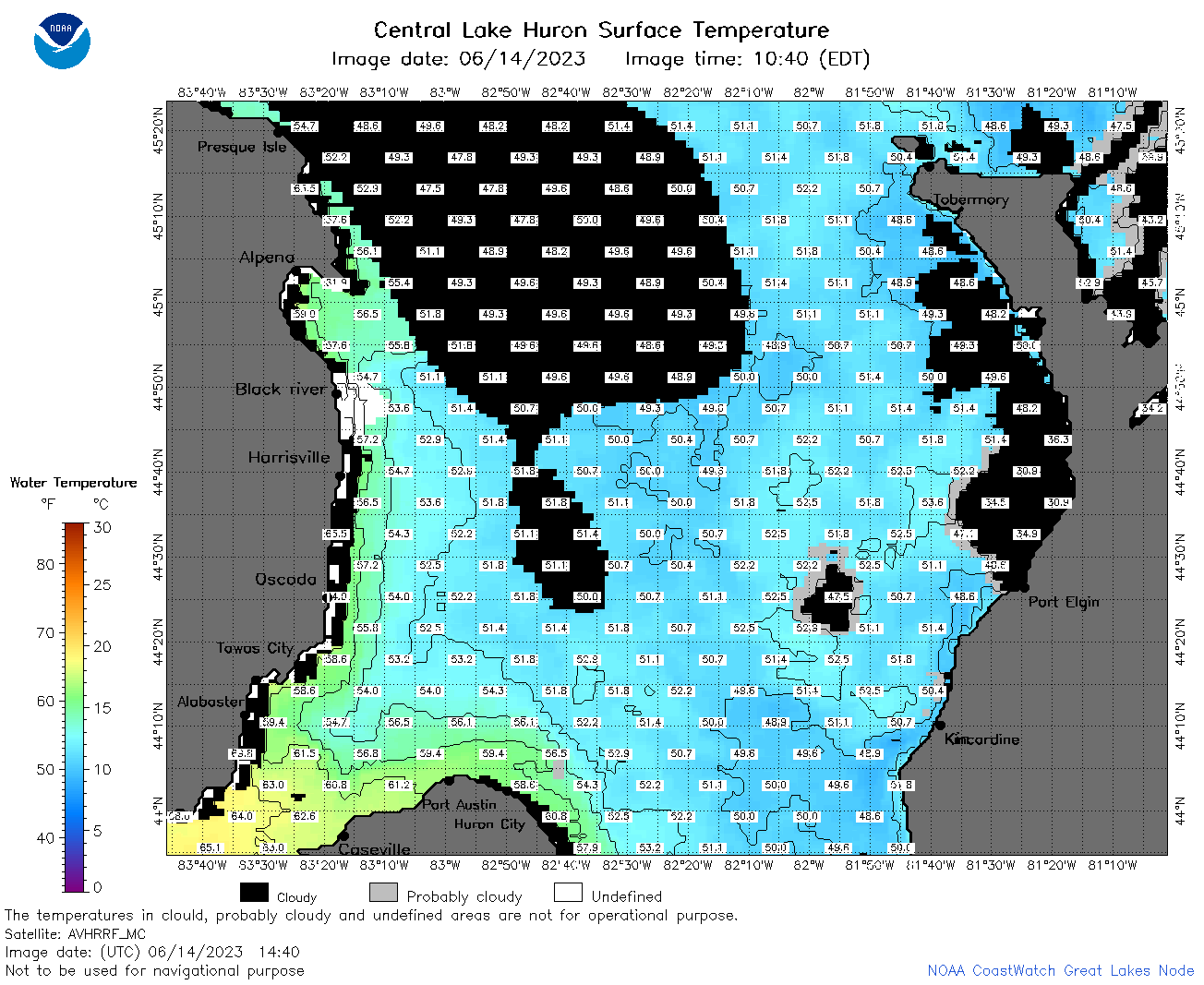
| Dataset Title: | Lake Huron Central Region Surface Temperature Contour Map (2022-present)


|
| Institution: | CoastWatch Great Lakes Node (Dataset ID: LH_NRT_TC_h2) |
| Information: | Summary
| License
| Metadata
| Background | Subset
| Data Access Form
| Make a graph
| Subset
| Data Access Form
| Make a graph
|
![[ICO]](https://apps.glerl.noaa.gov/erddap/images/fileIcons/blank.gif) | Name | Last modified | Size | Description |
|---|---|---|---|---|
![[DIR]](https://apps.glerl.noaa.gov/erddap/images/fileIcons/back.gif) | Parent Directory | - | - | |
![[IMG]](https://apps.glerl.noaa.gov/erddap/images/fileIcons/image2.gif) 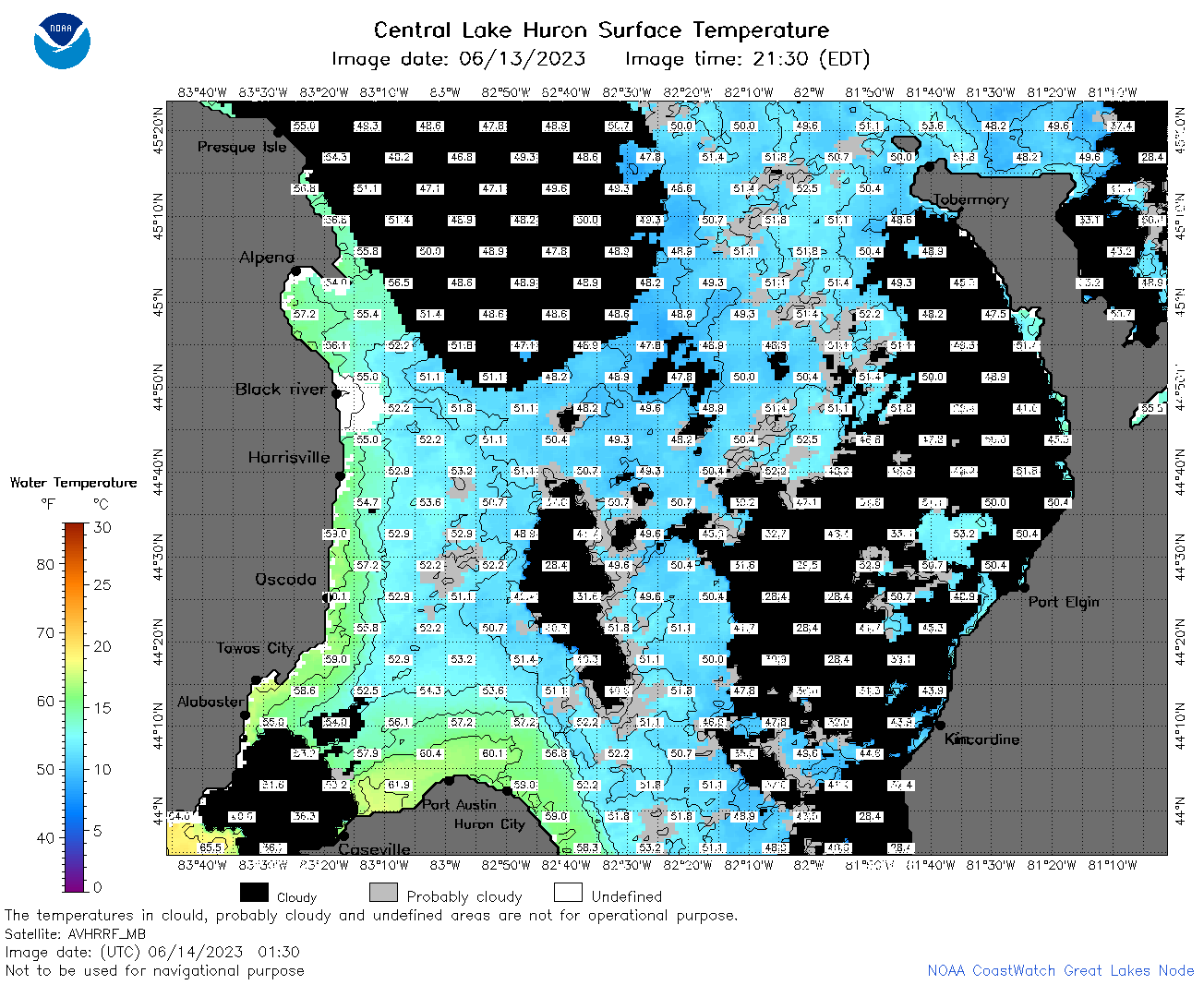 | h2_2023_06_14_0130.png | 14-Jun-2023 07:26 | 107911 | |
 | h2_2023_06_14_0220.png | 14-Jun-2023 07:28 | 106697 | |
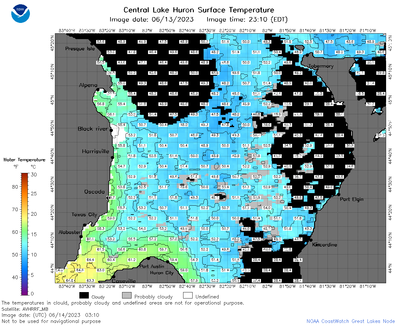 | h2_2023_06_14_0310.png | 14-Jun-2023 07:33 | 90772 | |
 | h2_2023_06_14_0610.png | 14-Jun-2023 09:26 | 77242 | |
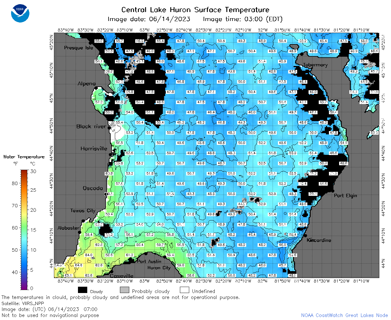 | h2_2023_06_14_0700.png | 14-Jun-2023 11:26 | 121364 | |
 | h2_2023_06_14_0750.png | 14-Jun-2023 10:26 | 118523 | |
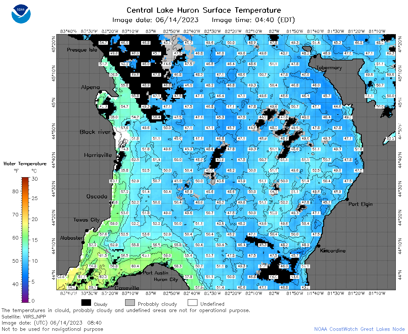 | h2_2023_06_14_0840.png | 14-Jun-2023 12:26 | 141306 | |
 | h2_2023_06_14_1440.png | 14-Jun-2023 18:26 | 79814 | |
 | h2_2023_06_14_1530.png | 14-Jun-2023 18:28 | 78173 | |
 | h2_2023_06_14_1620.png | 14-Jun-2023 20:26 | 88149 | |
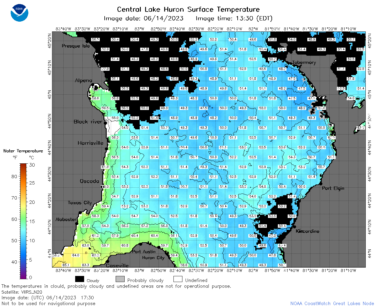 | h2_2023_06_14_1730.png | 14-Jun-2023 20:30 | 102707 | |
 | h2_2023_06_14_1820.png | 14-Jun-2023 21:26 | 100985 | |
 | h2_2023_06_14_1910.png | 14-Jun-2023 22:28 | 97991 | |
 | h2_2023_165.png | 15-Jun-2023 09:15 | 76892 | |