
Easier access to scientific data

Brought to you by NOAA CoastWatch Great Lakes Node
|
ERDDAP
Easier access to scientific data |
|
Brought to you by NOAA CoastWatch Great Lakes Node |
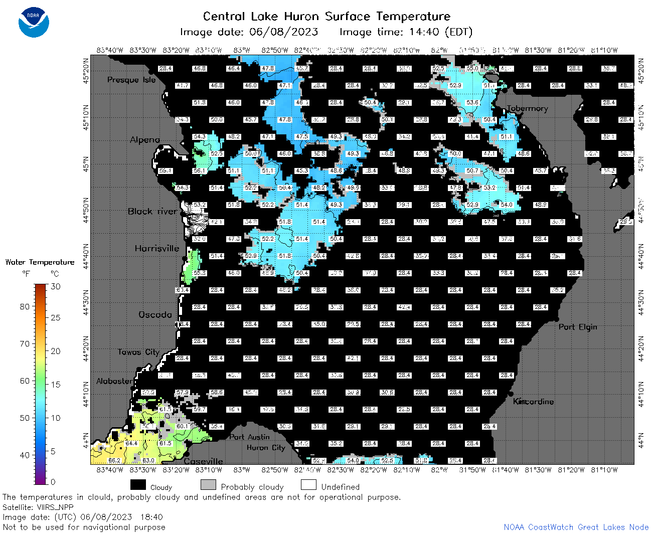
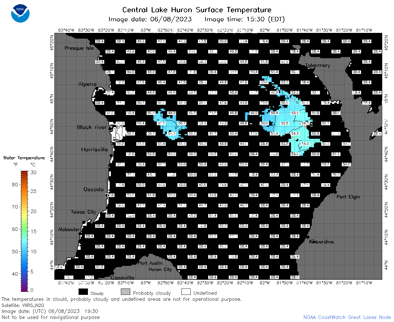
| Dataset Title: | Lake Huron Central Region Surface Temperature Contour Map (2022-present)


|
| Institution: | CoastWatch Great Lakes Node (Dataset ID: LH_NRT_TC_h2) |
| Information: | Summary
| License
| Metadata
| Background | Subset
| Data Access Form
| Make a graph
| Subset
| Data Access Form
| Make a graph
|
![[ICO]](https://apps.glerl.noaa.gov/erddap/images/fileIcons/blank.gif) | Name | Last modified | Size | Description |
|---|---|---|---|---|
![[DIR]](https://apps.glerl.noaa.gov/erddap/images/fileIcons/back.gif) | Parent Directory | - | - | |
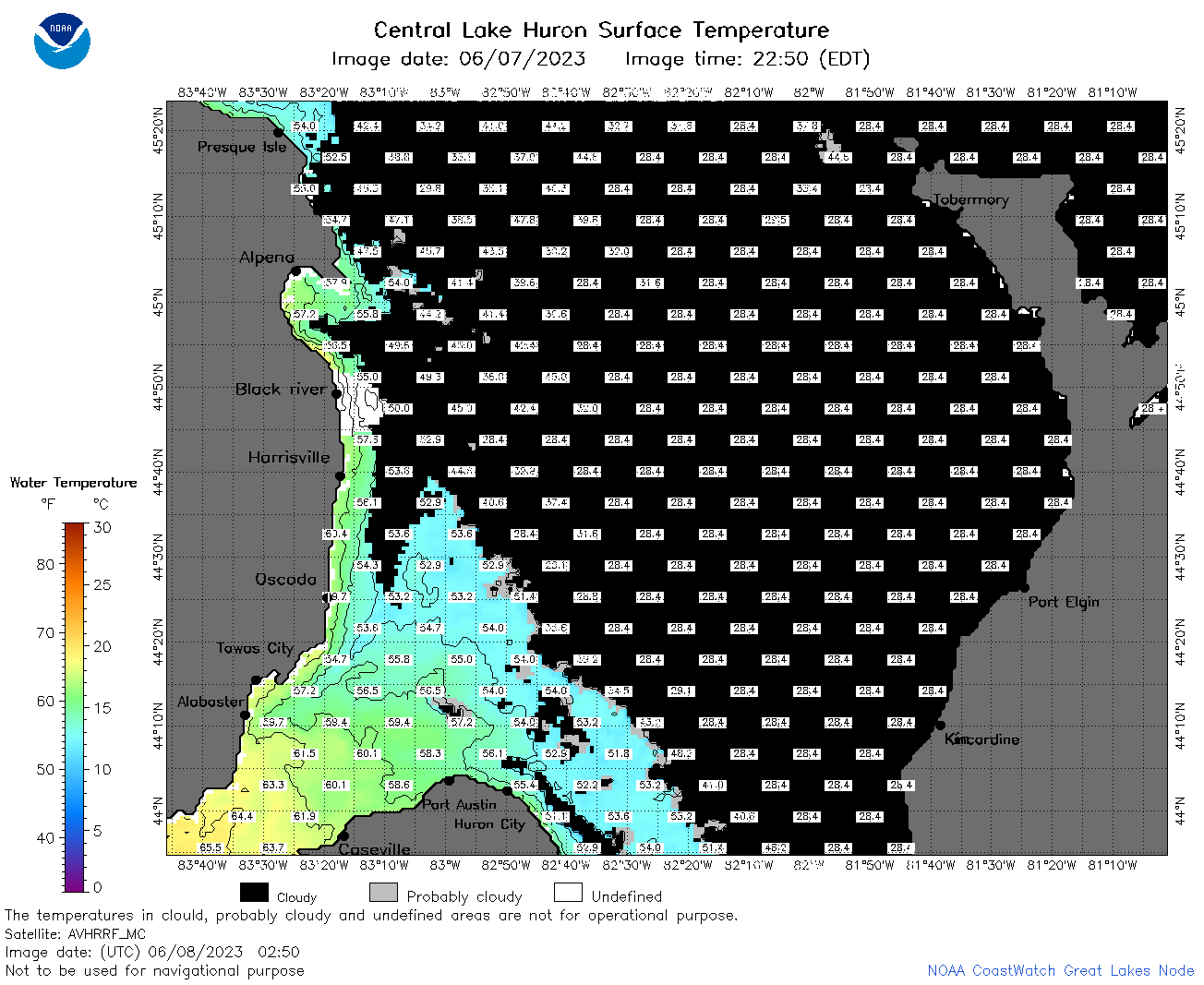
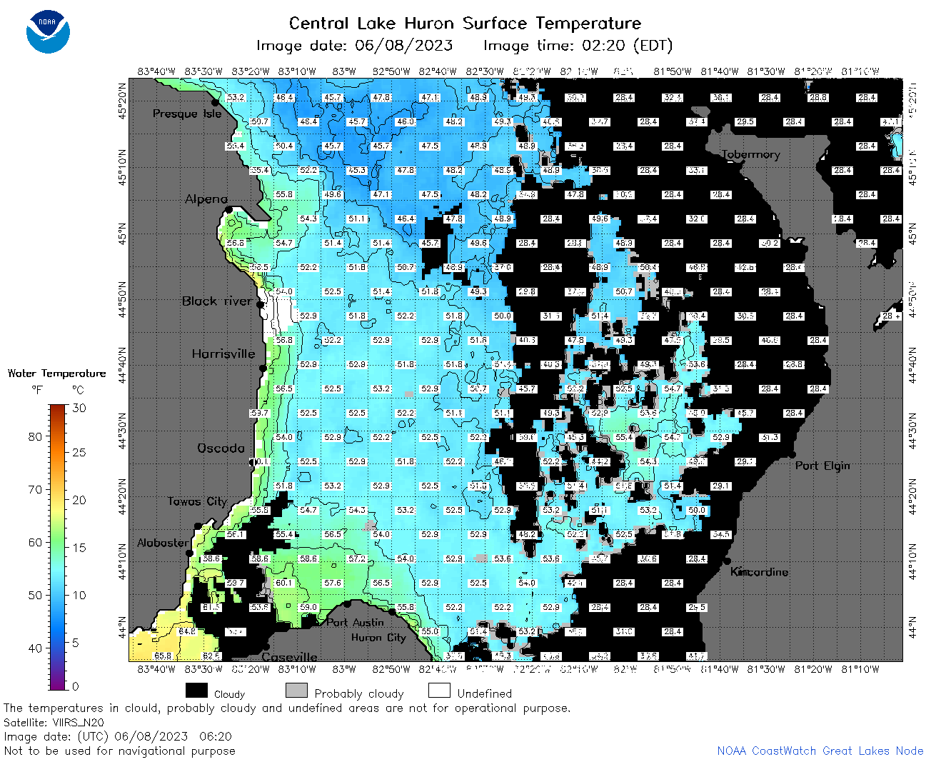
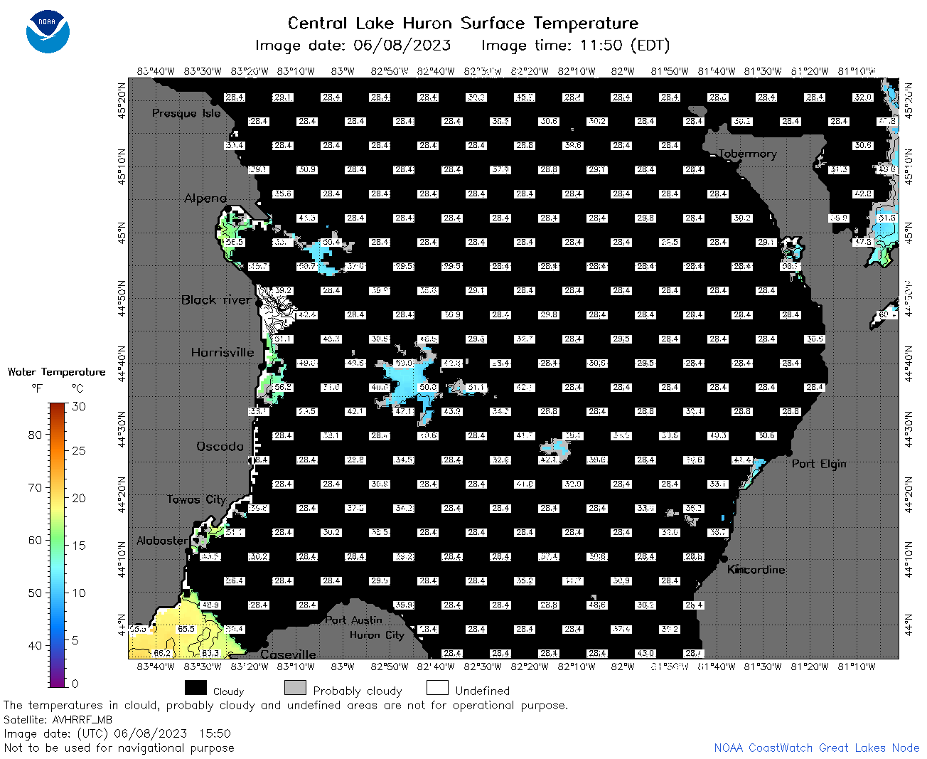
![[IMG]](https://apps.glerl.noaa.gov/erddap/images/fileIcons/image2.gif)  | h2_2023_06_08_0200.png | 08-Jun-2023 05:26 | 69015 | |
 | h2_2023_06_08_0250.png | 08-Jun-2023 07:26 | 61939 | |
 | h2_2023_06_08_0340.png | 08-Jun-2023 06:26 | 34516 | |
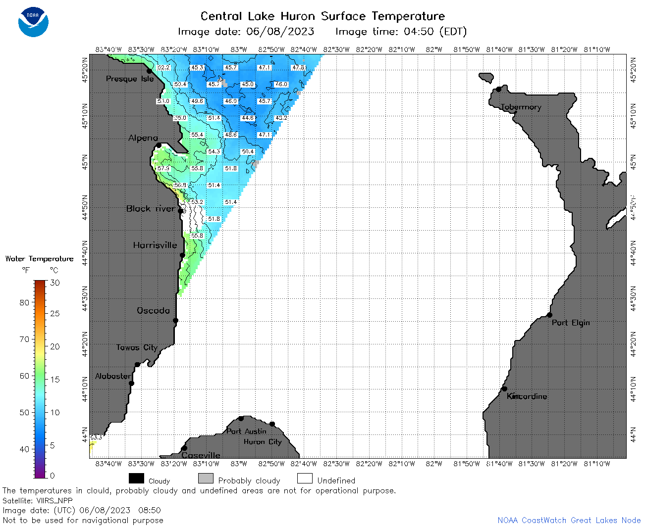
 | h2_2023_06_08_0620.png | 08-Jun-2023 09:26 | 98802 | |
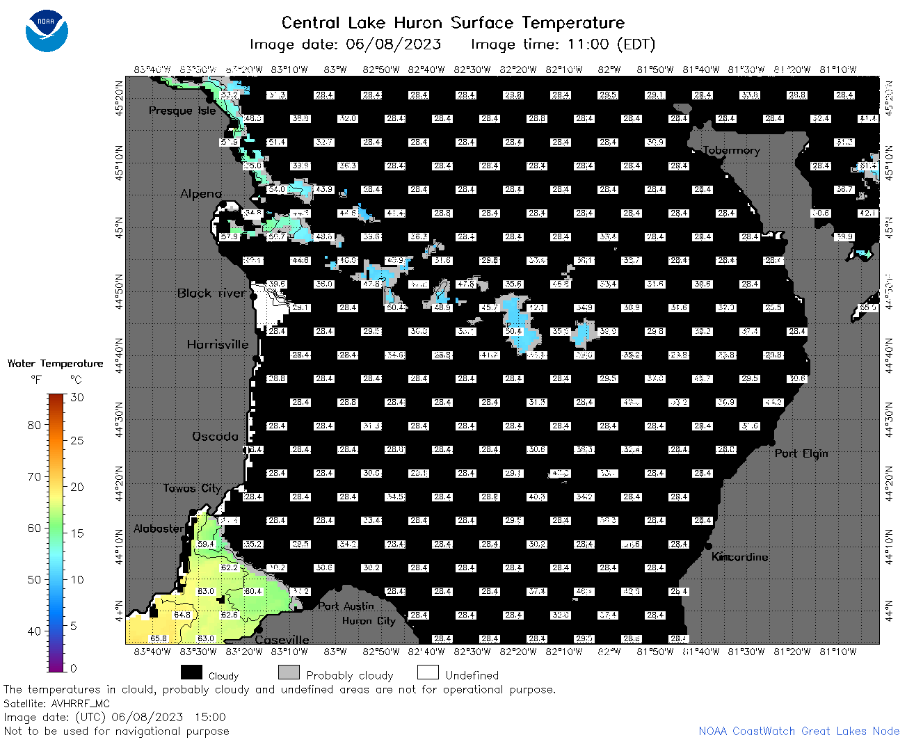
 | h2_2023_06_08_0710.png | 08-Jun-2023 11:26 | 100806 | |
 | h2_2023_06_08_0800.png | 08-Jun-2023 11:28 | 96732 | |
 | h2_2023_06_08_0850.png | 08-Jun-2023 12:26 | 50327 | |
 | h2_2023_06_08_1410.png | 08-Jun-2023 21:26 | 33809 | |
 | h2_2023_06_08_1500.png | 08-Jun-2023 21:28 | 48852 | |
 | h2_2023_06_08_1550.png | 08-Jun-2023 21:32 | 49108 | |
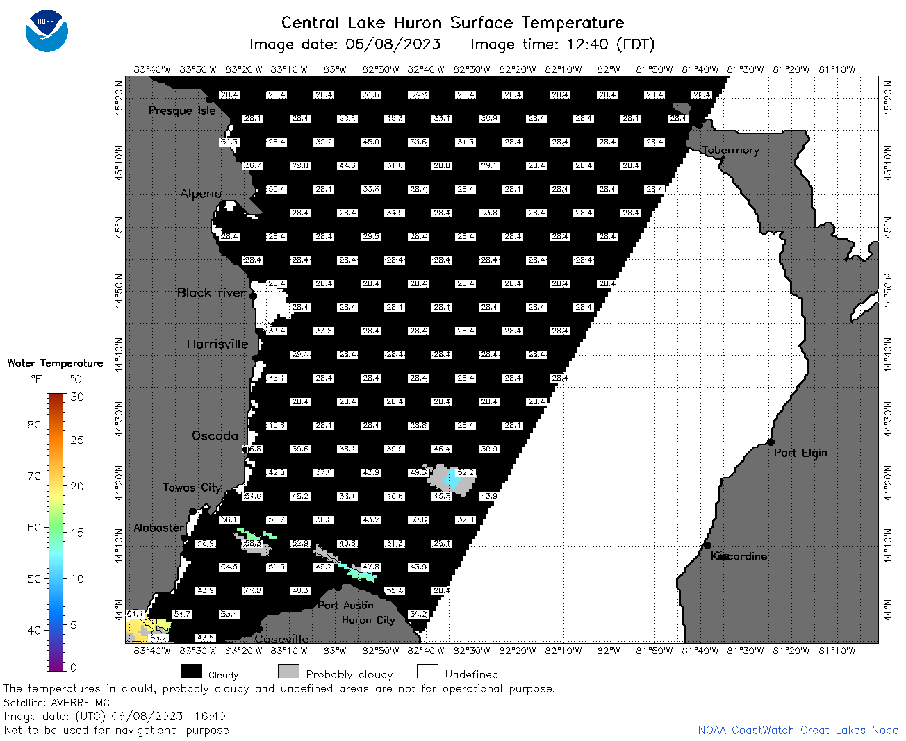 | h2_2023_06_08_1640.png | 08-Jun-2023 21:35 | 40394 | |
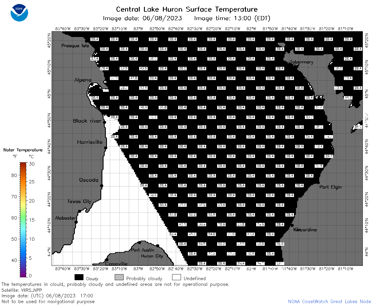 | h2_2023_06_08_1700.png | 08-Jun-2023 20:26 | 36921 | |
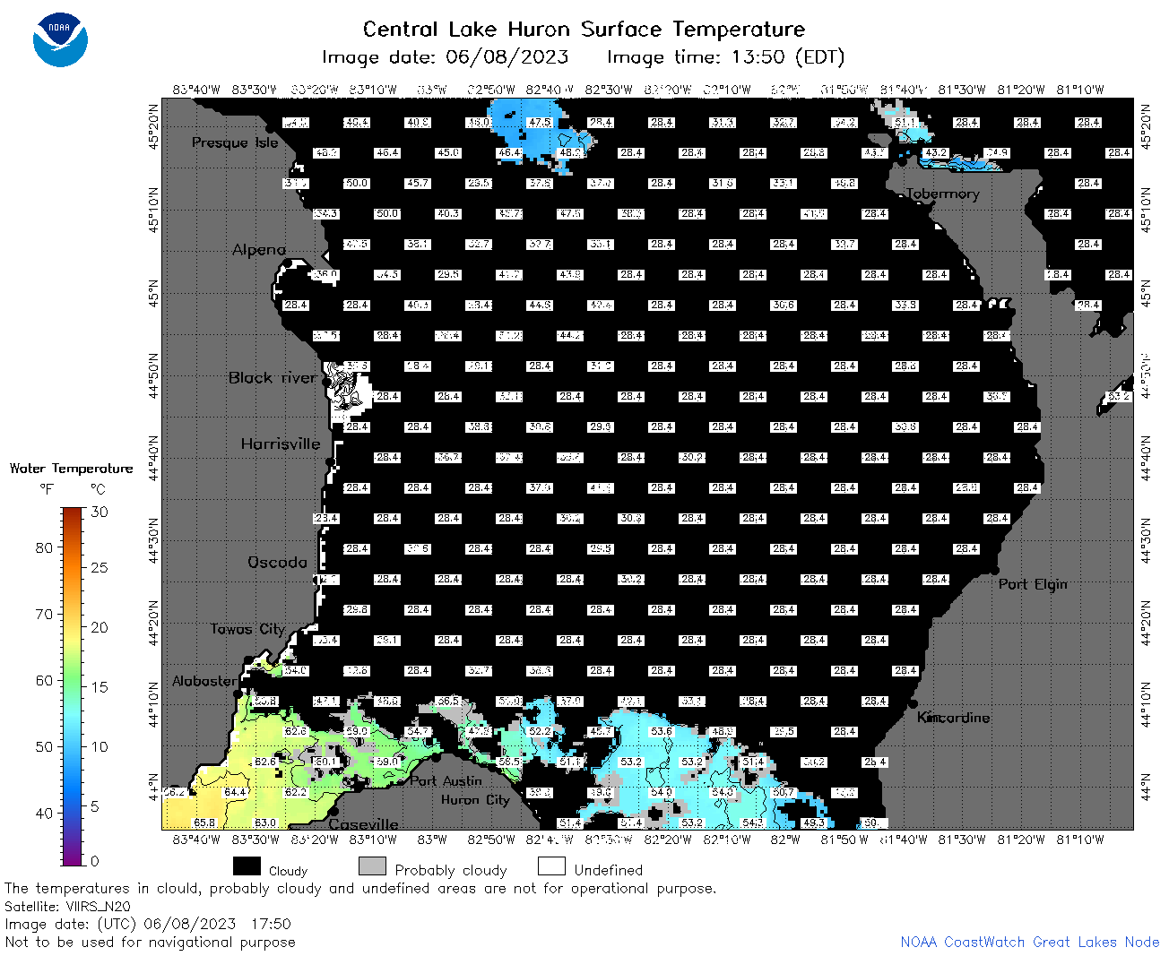 | h2_2023_06_08_1750.png | 08-Jun-2023 20:30 | 53622 | |
 | h2_2023_06_08_1840.png | 08-Jun-2023 21:41 | 62122 | |
 | h2_2023_06_08_1930.png | 08-Jun-2023 22:26 | 44255 | |
 | h2_2023_159.png | 09-Jun-2023 09:15 | 74068 | |