
Easier access to scientific data

Brought to you by NOAA CoastWatch Great Lakes Node
|
ERDDAP
Easier access to scientific data |
|
Brought to you by NOAA CoastWatch Great Lakes Node |
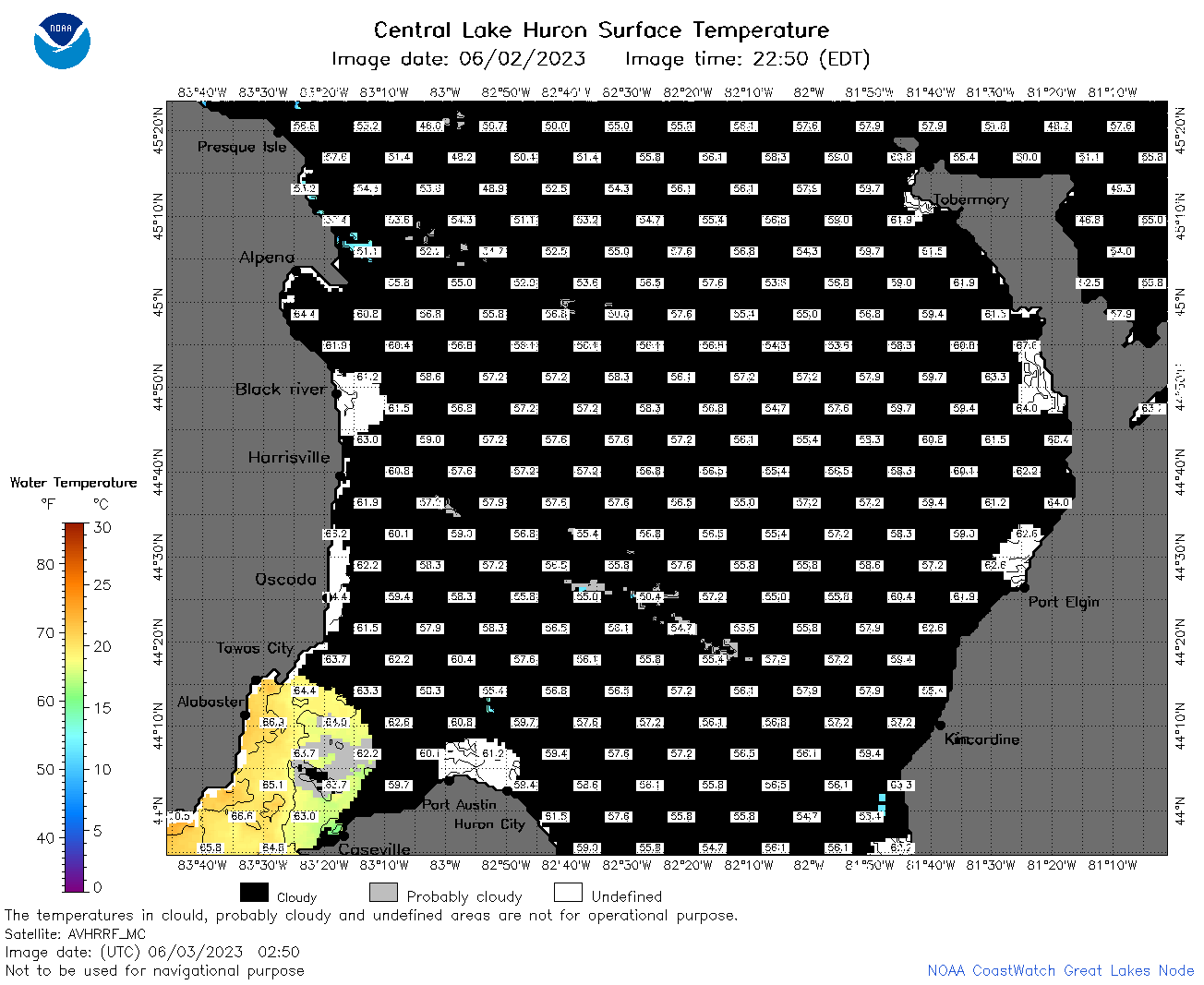
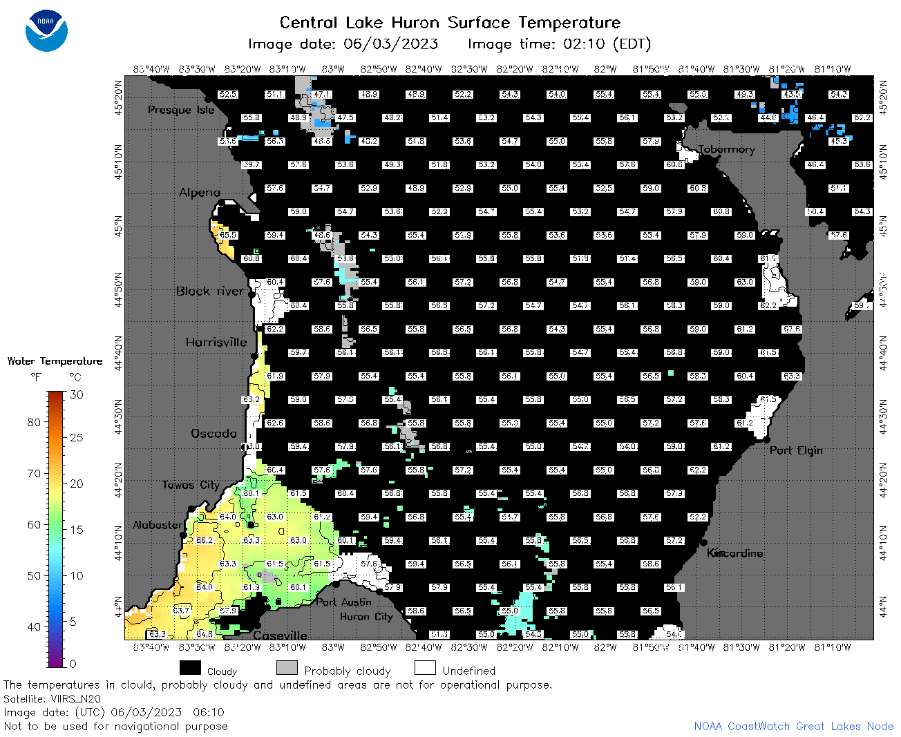
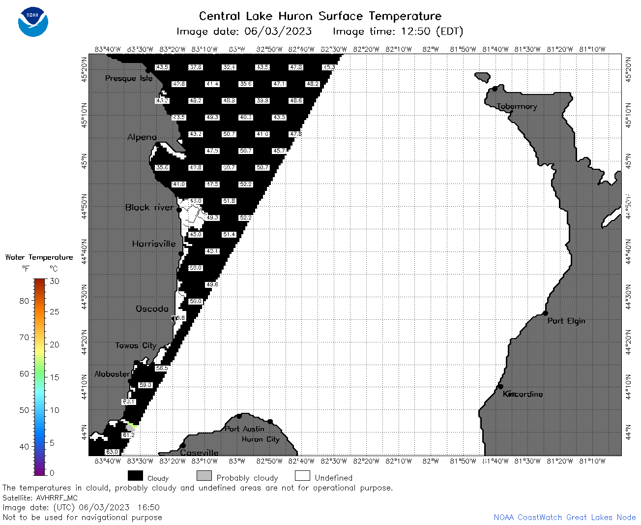
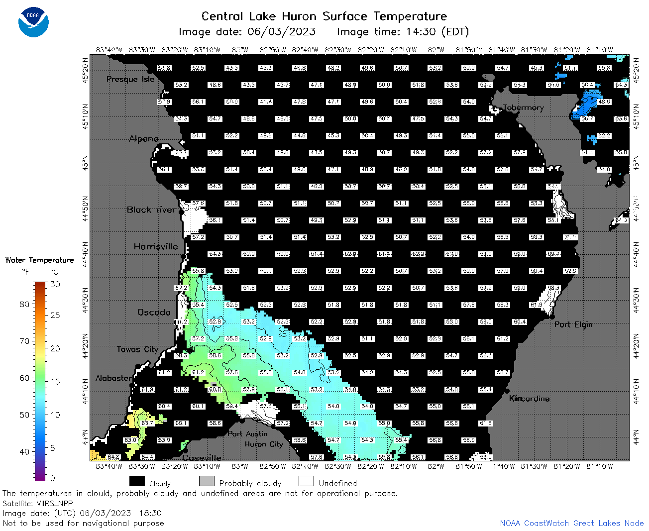
| Dataset Title: | Lake Huron Central Region Surface Temperature Contour Map (2022-present)


|
| Institution: | CoastWatch Great Lakes Node (Dataset ID: LH_NRT_TC_h2) |
| Information: | Summary
| License
| Metadata
| Background | Subset
| Data Access Form
| Make a graph
| Subset
| Data Access Form
| Make a graph
|
![[ICO]](https://apps.glerl.noaa.gov/erddap/images/fileIcons/blank.gif) | Name | Last modified | Size | Description |
|---|---|---|---|---|
![[DIR]](https://apps.glerl.noaa.gov/erddap/images/fileIcons/back.gif) | Parent Directory | - | - | |
![[IMG]](https://apps.glerl.noaa.gov/erddap/images/fileIcons/image2.gif)  | h2_2023_06_03_0110.png | 03-Jun-2023 05:26 | 55650 | |
 | h2_2023_06_03_0200.png | 03-Jun-2023 05:28 | 47561 | |
 | h2_2023_06_03_0250.png | 03-Jun-2023 06:26 | 48319 | |
 | h2_2023_06_03_0610.png | 03-Jun-2023 09:26 | 53415 | |
 | h2_2023_06_03_0710.png | 03-Jun-2023 11:26 | 96004 | |
 | h2_2023_06_03_0800.png | 03-Jun-2023 10:28 | 100245 | |
 | h2_2023_06_03_0850.png | 03-Jun-2023 12:26 | 92310 | |
 | h2_2023_06_03_1410.png | 03-Jun-2023 17:26 | 32477 | |
 | h2_2023_06_03_1420.png | 03-Jun-2023 17:28 | 38413 | |
 | h2_2023_06_03_1510.png | 03-Jun-2023 19:26 | 64601 | |
 | h2_2023_06_03_1600.png | 03-Jun-2023 19:31 | 76731 | |
 | h2_2023_06_03_1650.png | 03-Jun-2023 20:26 | 36752 | |
 | h2_2023_06_03_1740.png | 03-Jun-2023 20:28 | 53568 | |
 | h2_2023_06_03_1830.png | 03-Jun-2023 21:26 | 54565 | |
 | h2_2023_06_03_1920.png | 03-Jun-2023 22:26 | 41201 | |
 | h2_2023_154.png | 04-Jun-2023 09:15 | 94563 | |