
Easier access to scientific data

Brought to you by NOAA CoastWatch Great Lakes Node
|
ERDDAP
Easier access to scientific data |
|
Brought to you by NOAA CoastWatch Great Lakes Node |
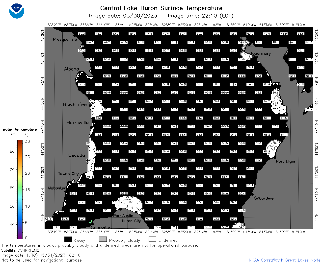
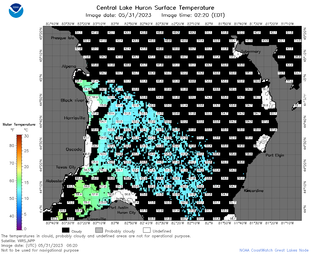
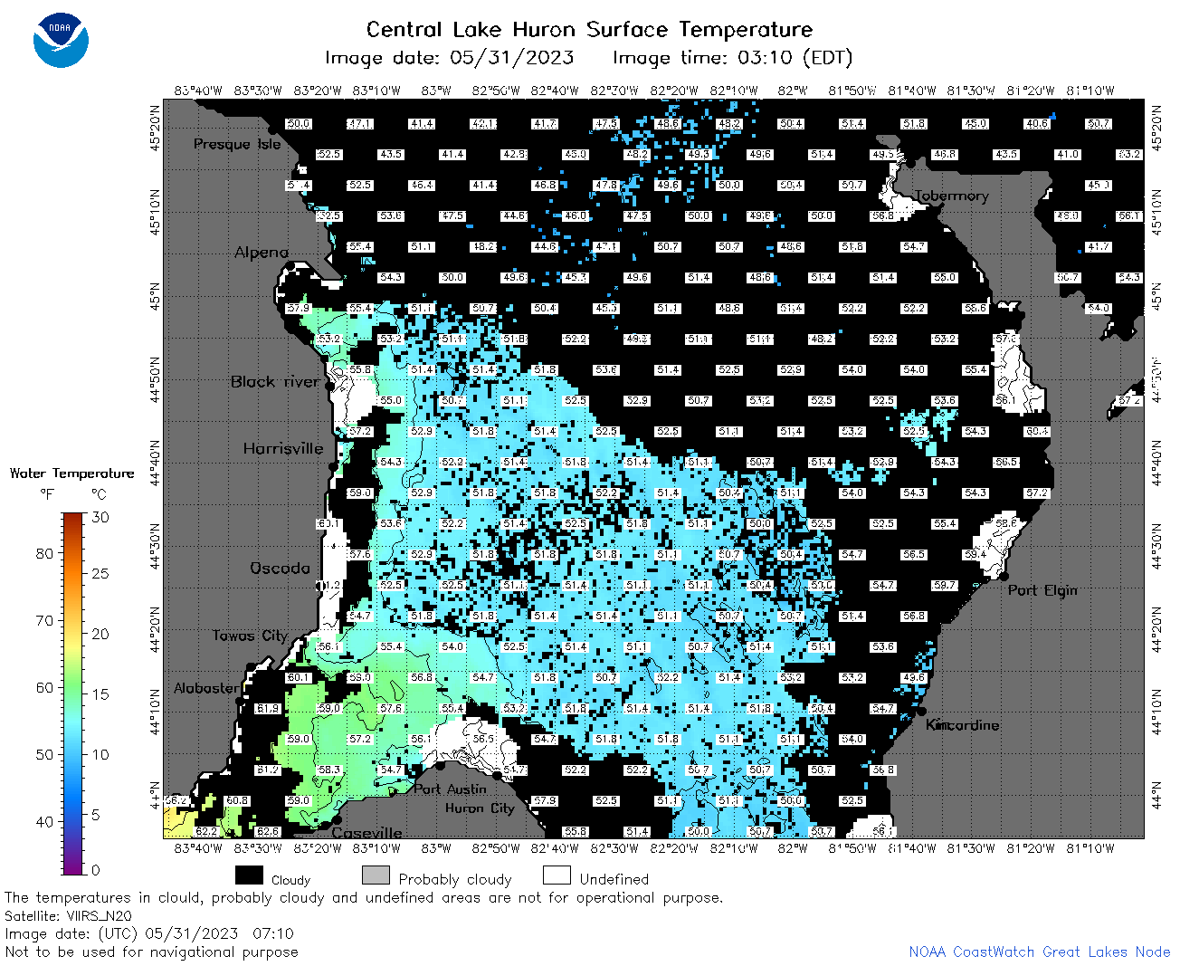
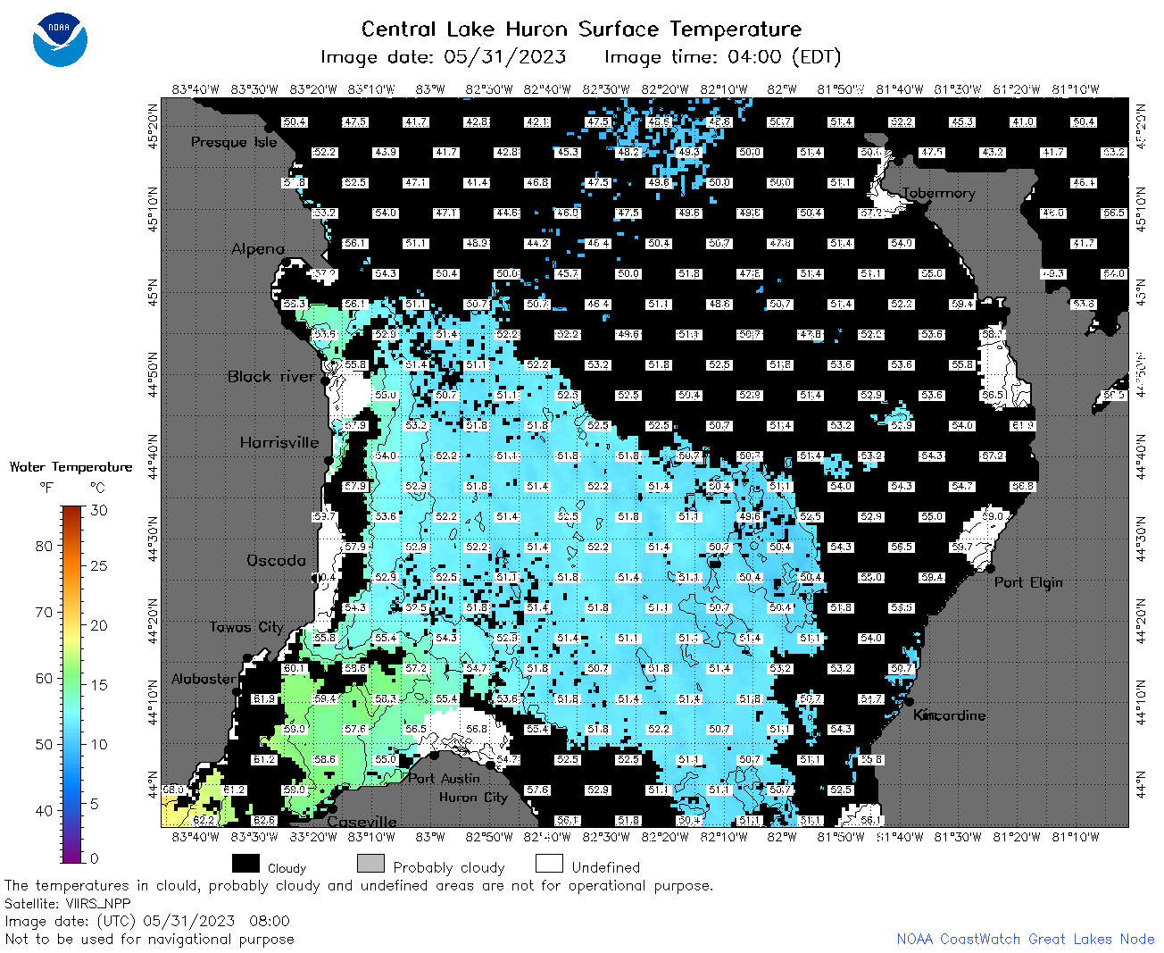
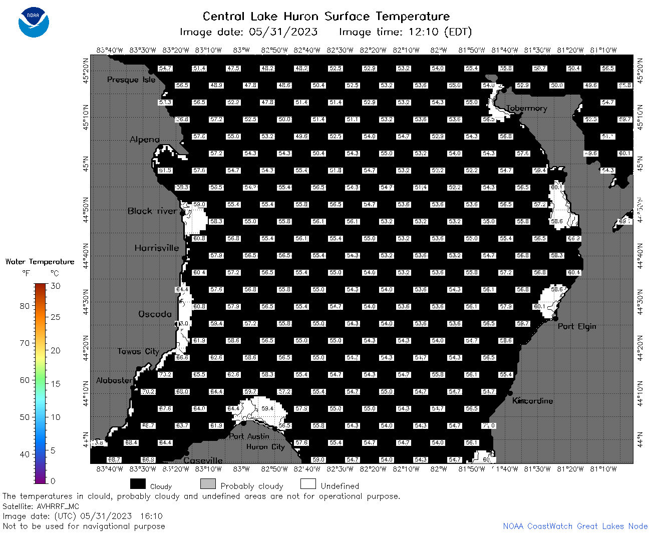
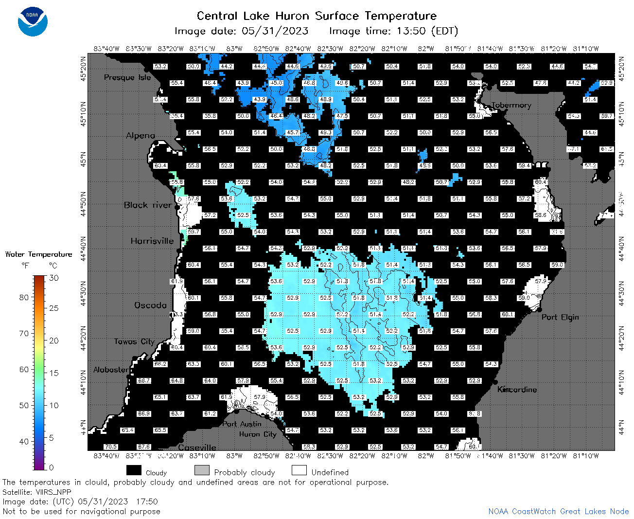
| Dataset Title: | Lake Huron Central Region Surface Temperature Contour Map (2022-present)


|
| Institution: | CoastWatch Great Lakes Node (Dataset ID: LH_NRT_TC_h2) |
| Information: | Summary
| License
| Metadata
| Background | Subset
| Data Access Form
| Make a graph
| Subset
| Data Access Form
| Make a graph
|
![[ICO]](https://apps.glerl.noaa.gov/erddap/images/fileIcons/blank.gif) | Name | Last modified | Size | Description |
|---|---|---|---|---|
![[DIR]](https://apps.glerl.noaa.gov/erddap/images/fileIcons/back.gif) | Parent Directory | - | - | |
![[IMG]](https://apps.glerl.noaa.gov/erddap/images/fileIcons/image2.gif)  | h2_2023_05_31_0120.png | 31-May-2023 05:26 | 41884 | |
 | h2_2023_05_31_0210.png | 31-May-2023 05:28 | 42318 | |
 | h2_2023_05_31_0300.png | 31-May-2023 05:33 | 41760 | |
 | h2_2023_05_31_0620.png | 31-May-2023 10:26 | 63019 | |
 | h2_2023_05_31_0710.png | 31-May-2023 10:28 | 75717 | |
 | h2_2023_05_31_0800.png | 31-May-2023 11:26 | 78320 | |
 | h2_2023_05_31_0850.png | 31-May-2023 11:28 | 33704 | |
 | h2_2023_05_31_1430.png | 31-May-2023 18:26 | 41063 | |
 | h2_2023_05_31_1520.png | 31-May-2023 18:28 | 42407 | |
 | h2_2023_05_31_1610.png | 31-May-2023 20:26 | 41464 | |
 | h2_2023_05_31_1700.png | 31-May-2023 19:26 | 47367 | |
 | h2_2023_05_31_1750.png | 31-May-2023 20:31 | 62113 | |
 | h2_2023_05_31_1840.png | 31-May-2023 21:26 | 51896 | |
 | h2_2023_05_31_1930.png | 31-May-2023 22:26 | 47799 | |
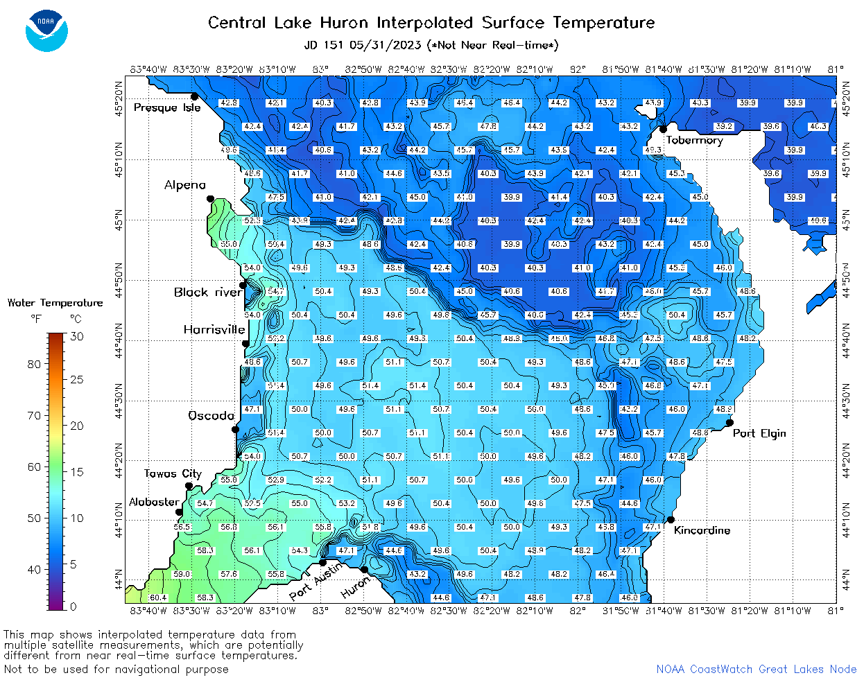 | h2_2023_151.png | 01-Jun-2023 09:15 | 97643 | |