
Easier access to scientific data

Brought to you by NOAA CoastWatch Great Lakes Node
|
ERDDAP
Easier access to scientific data |
|
Brought to you by NOAA CoastWatch Great Lakes Node |
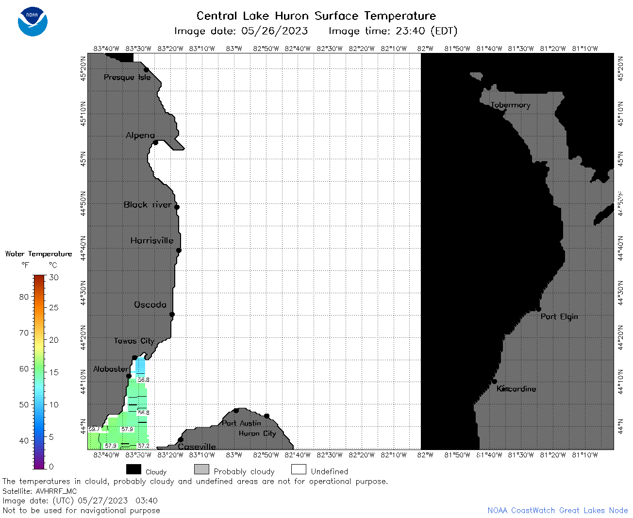
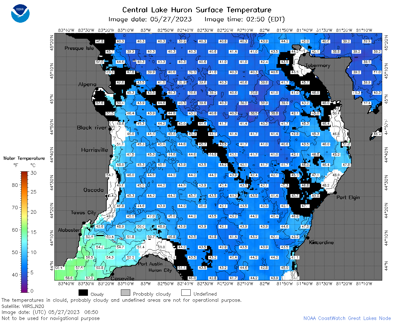
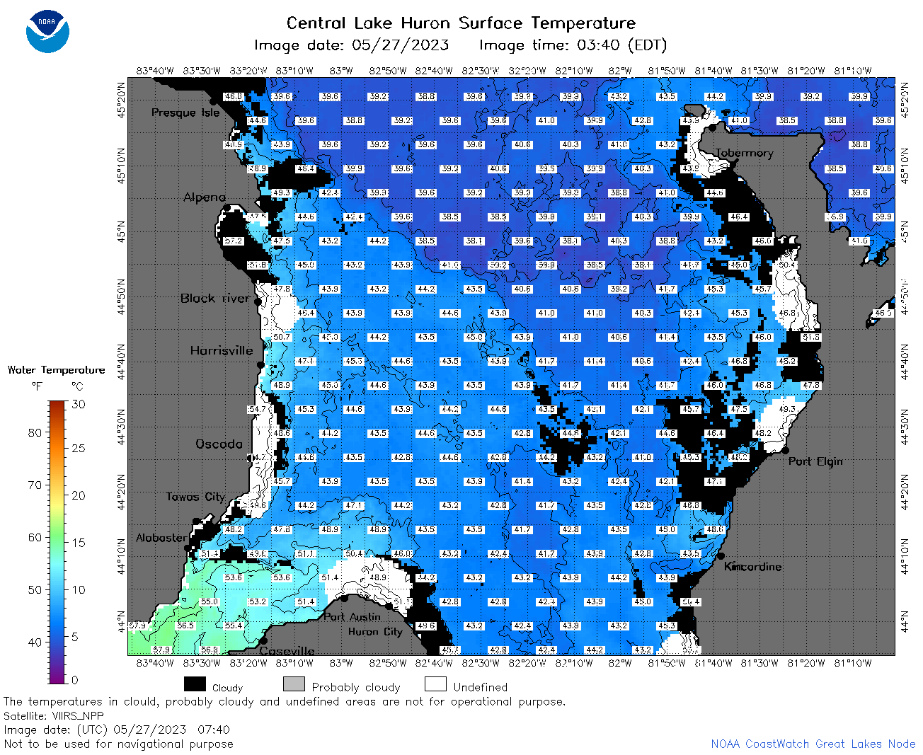
| Dataset Title: | Lake Huron Central Region Surface Temperature Contour Map (2022-present)


|
| Institution: | CoastWatch Great Lakes Node (Dataset ID: LH_NRT_TC_h2) |
| Information: | Summary
| License
| Metadata
| Background | Subset
| Data Access Form
| Make a graph
| Subset
| Data Access Form
| Make a graph
|
![[ICO]](https://apps.glerl.noaa.gov/erddap/images/fileIcons/blank.gif) | Name | Last modified | Size | Description |
|---|---|---|---|---|
![[DIR]](https://apps.glerl.noaa.gov/erddap/images/fileIcons/back.gif) | Parent Directory | - | - | |
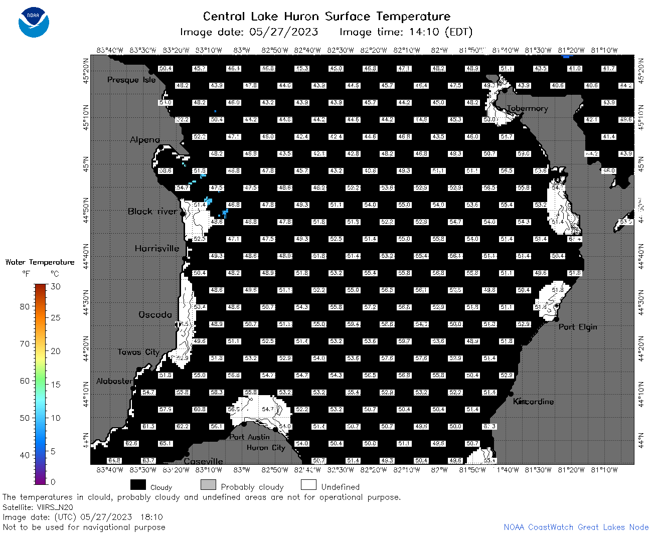
![[IMG]](https://apps.glerl.noaa.gov/erddap/images/fileIcons/image2.gif)  | h2_2023_05_27_0110.png | 27-May-2023 05:28 | 40994 | |
 | h2_2023_05_27_0200.png | 27-May-2023 05:30 | 48822 | |
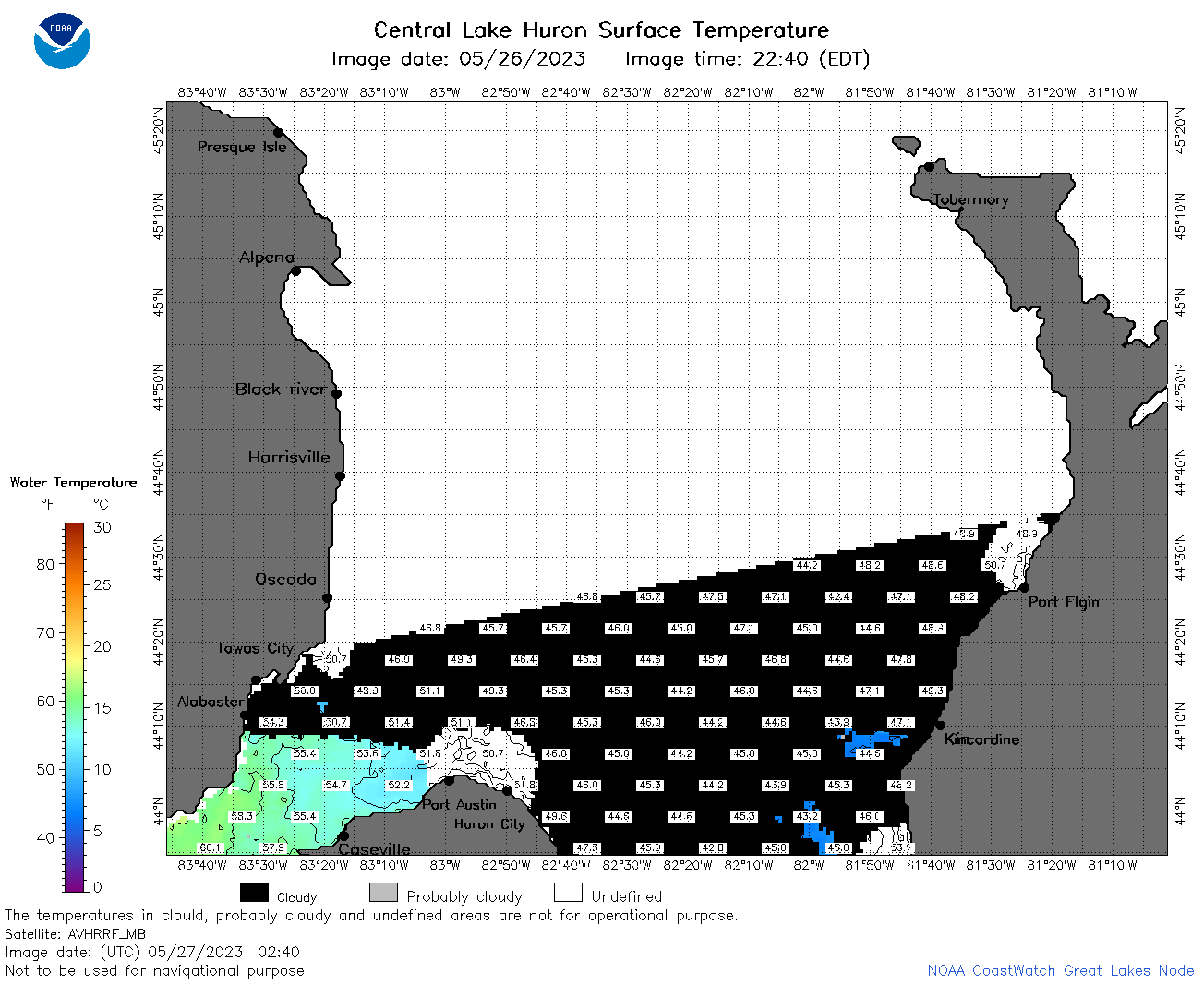 | h2_2023_05_27_0240.png | 27-May-2023 05:32 | 42395 | |
 | h2_2023_05_27_0250.png | 27-May-2023 05:34 | 38991 | |
 | h2_2023_05_27_0340.png | 27-May-2023 06:26 | 34325 | |
 | h2_2023_05_27_0650.png | 27-May-2023 09:30 | 114879 | |
 | h2_2023_05_27_0740.png | 27-May-2023 11:26 | 121785 | |
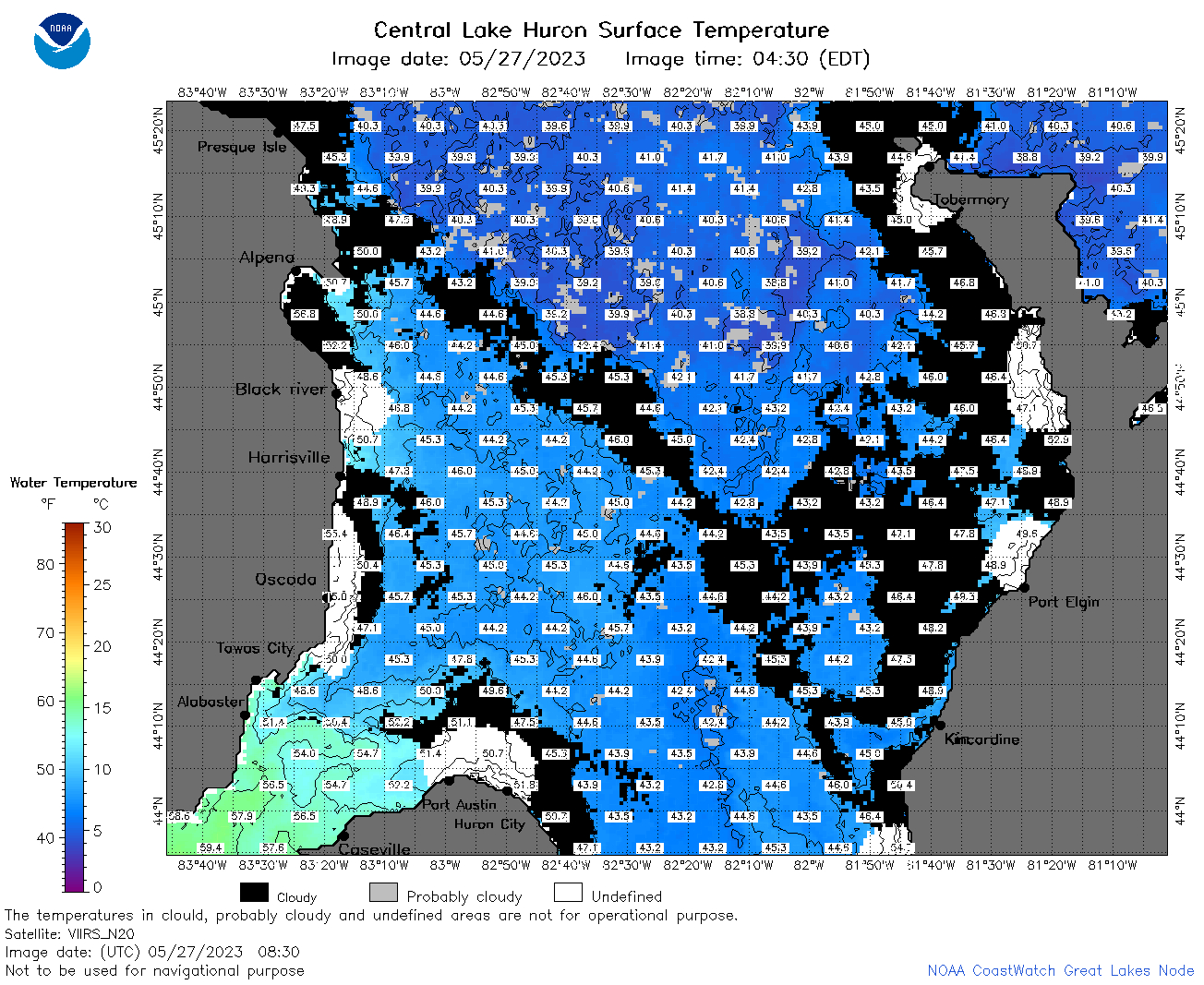 | h2_2023_05_27_0830.png | 27-May-2023 11:28 | 117790 | |
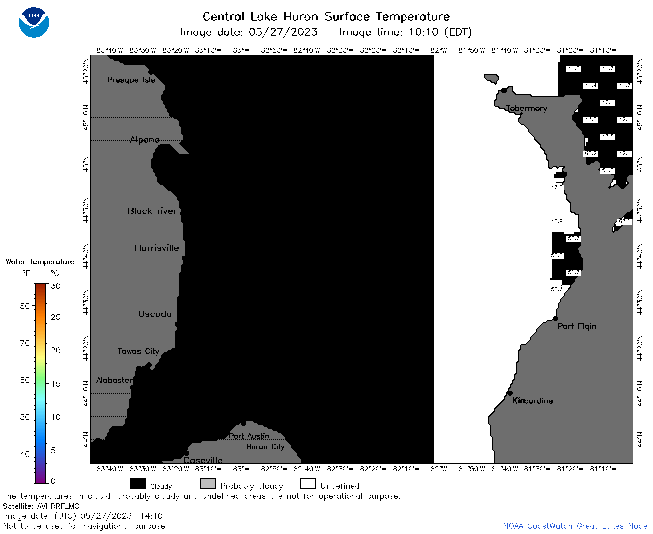 | h2_2023_05_27_1410.png | 27-May-2023 18:26 | 33473 | |
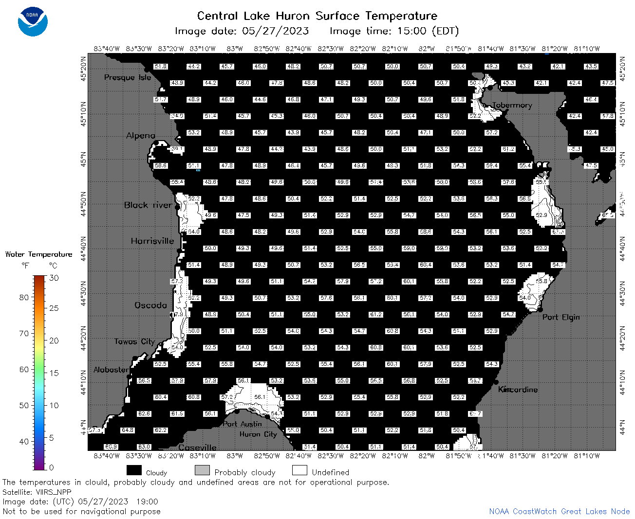
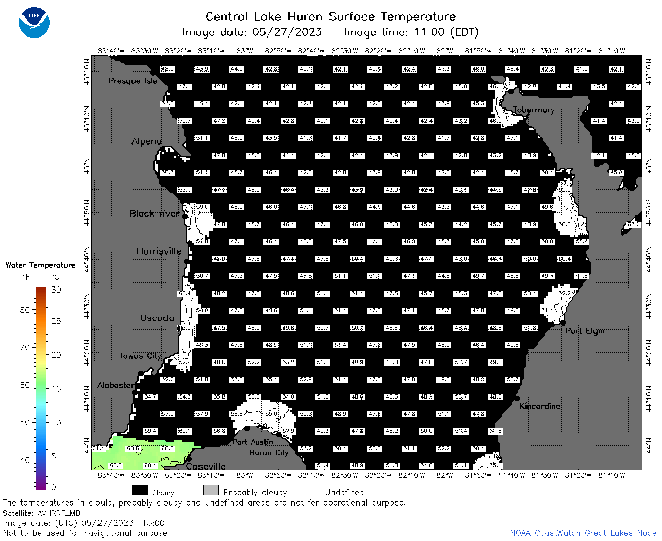 | h2_2023_05_27_1500.png | 27-May-2023 18:28 | 43747 | |
 | h2_2023_05_27_1550.png | 27-May-2023 20:26 | 44979 | |
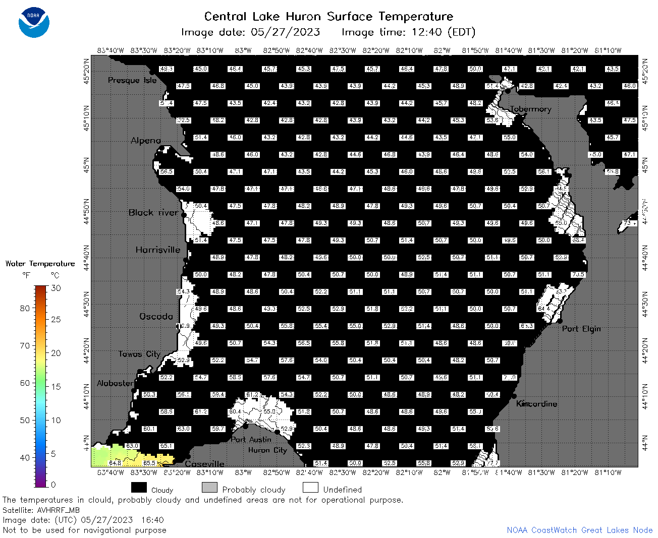 | h2_2023_05_27_1640.png | 27-May-2023 20:28 | 44272 | |
 | h2_2023_05_27_1720.png | 27-May-2023 20:30 | 43624 | |
 | h2_2023_05_27_1810.png | 27-May-2023 21:28 | 43892 | |
 | h2_2023_05_27_1900.png | 27-May-2023 21:30 | 43368 | |
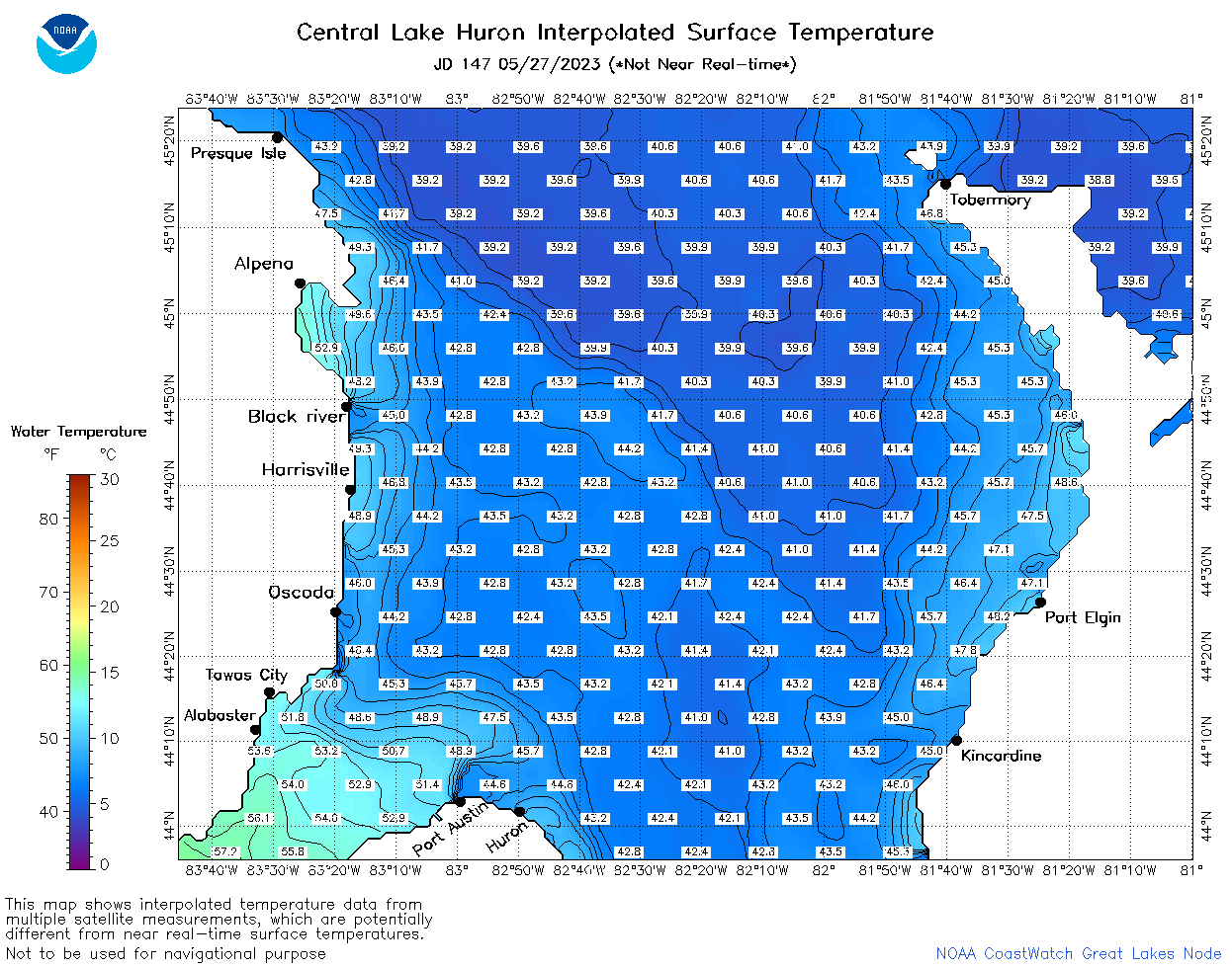 | h2_2023_147.png | 28-May-2023 09:14 | 73953 | |