
Easier access to scientific data

Brought to you by NOAA CoastWatch Great Lakes Node
|
ERDDAP
Easier access to scientific data |
|
Brought to you by NOAA CoastWatch Great Lakes Node |
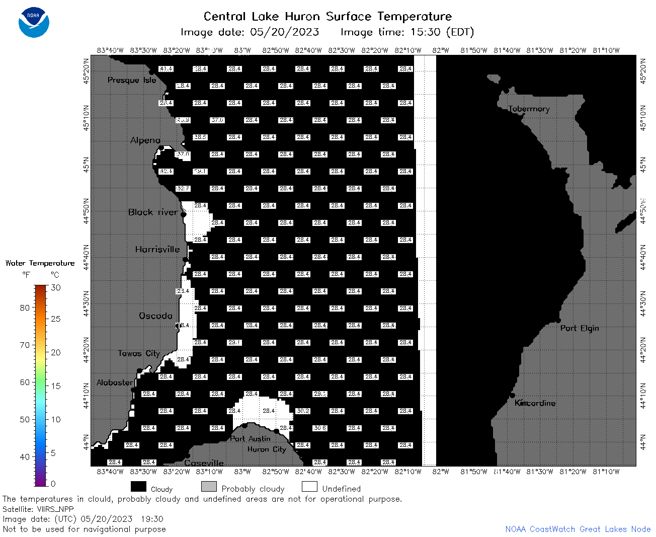
| Dataset Title: | Lake Huron Central Region Surface Temperature Contour Map (2022-present)


|
| Institution: | CoastWatch Great Lakes Node (Dataset ID: LH_NRT_TC_h2) |
| Information: | Summary
| License
| Metadata
| Background | Subset
| Data Access Form
| Make a graph
| Subset
| Data Access Form
| Make a graph
|
![[ICO]](https://apps.glerl.noaa.gov/erddap/images/fileIcons/blank.gif) | Name | Last modified | Size | Description |
|---|---|---|---|---|
![[DIR]](https://apps.glerl.noaa.gov/erddap/images/fileIcons/back.gif) | Parent Directory | - | - | |
![[IMG]](https://apps.glerl.noaa.gov/erddap/images/fileIcons/image2.gif) 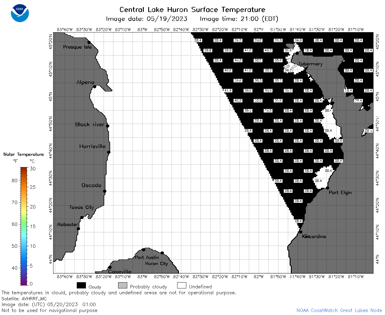 | h2_2023_05_20_0100.png | 20-May-2023 05:26 | 37151 | |
 | h2_2023_05_20_0150.png | 20-May-2023 05:28 | 42271 | |
 | h2_2023_05_20_0240.png | 20-May-2023 05:30 | 42962 | |
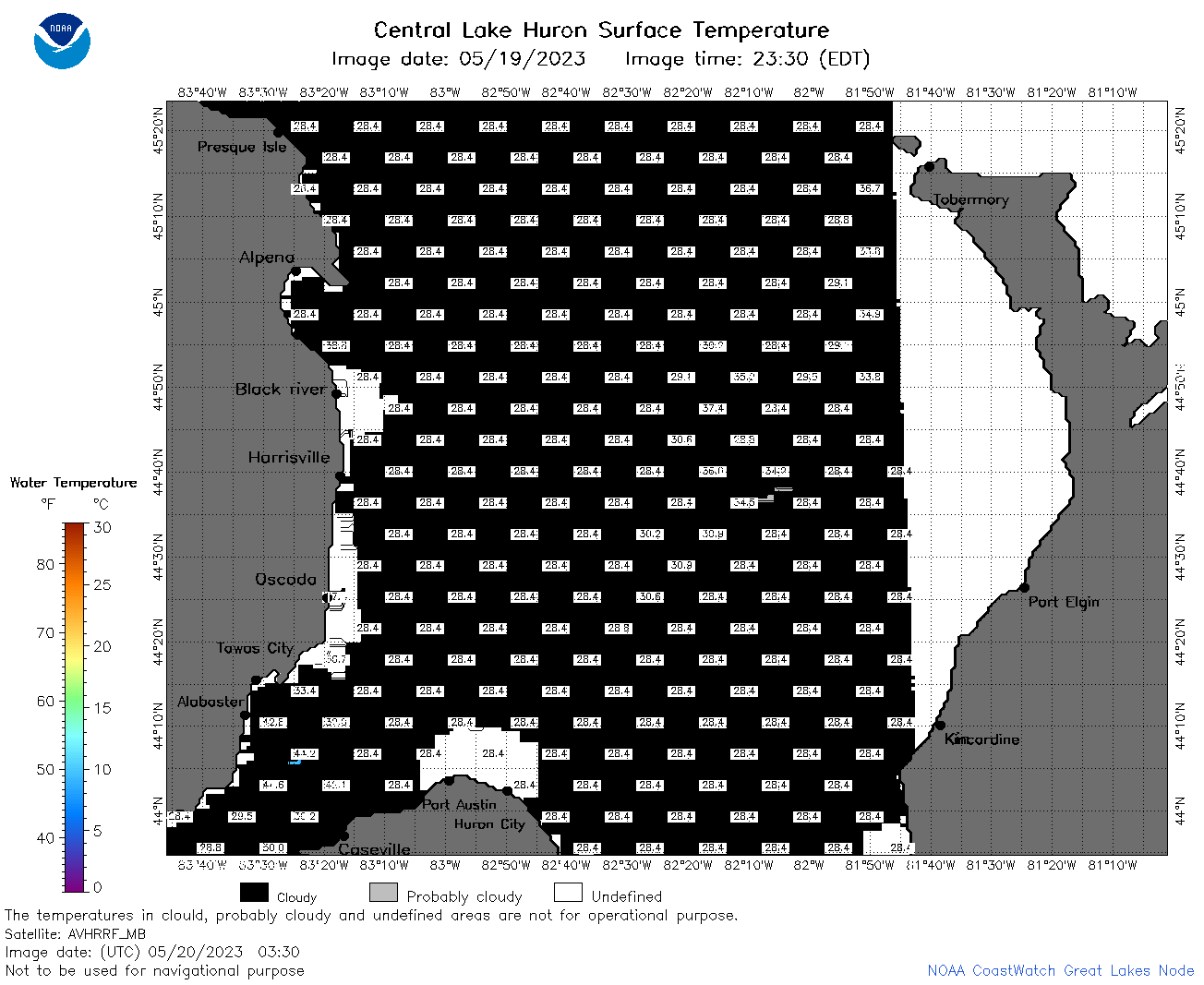 | h2_2023_05_20_0330.png | 20-May-2023 06:26 | 38036 | |
 | h2_2023_05_20_0630.png | 20-May-2023 10:26 | 40773 | |
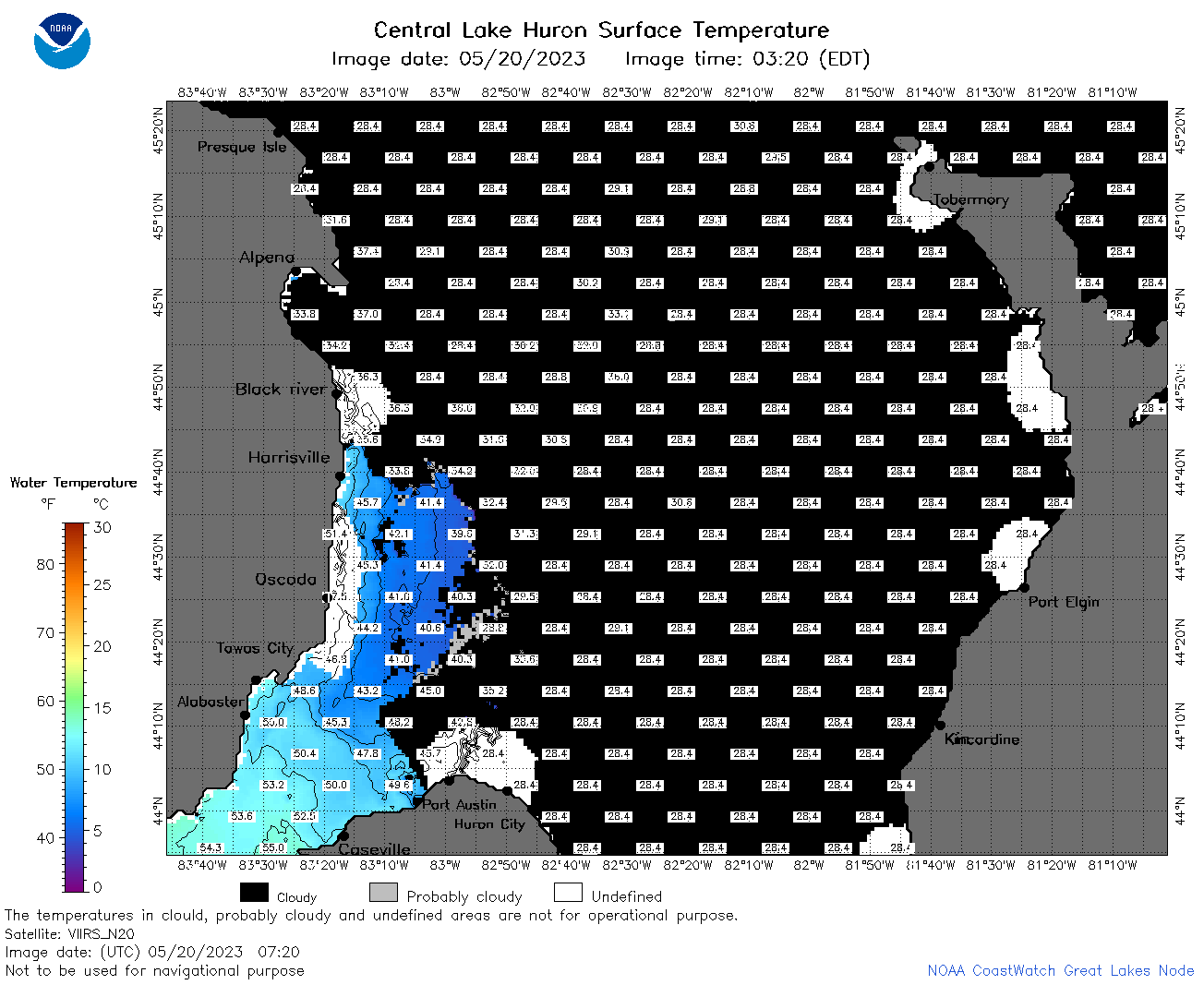 | h2_2023_05_20_0720.png | 20-May-2023 10:28 | 51595 | |
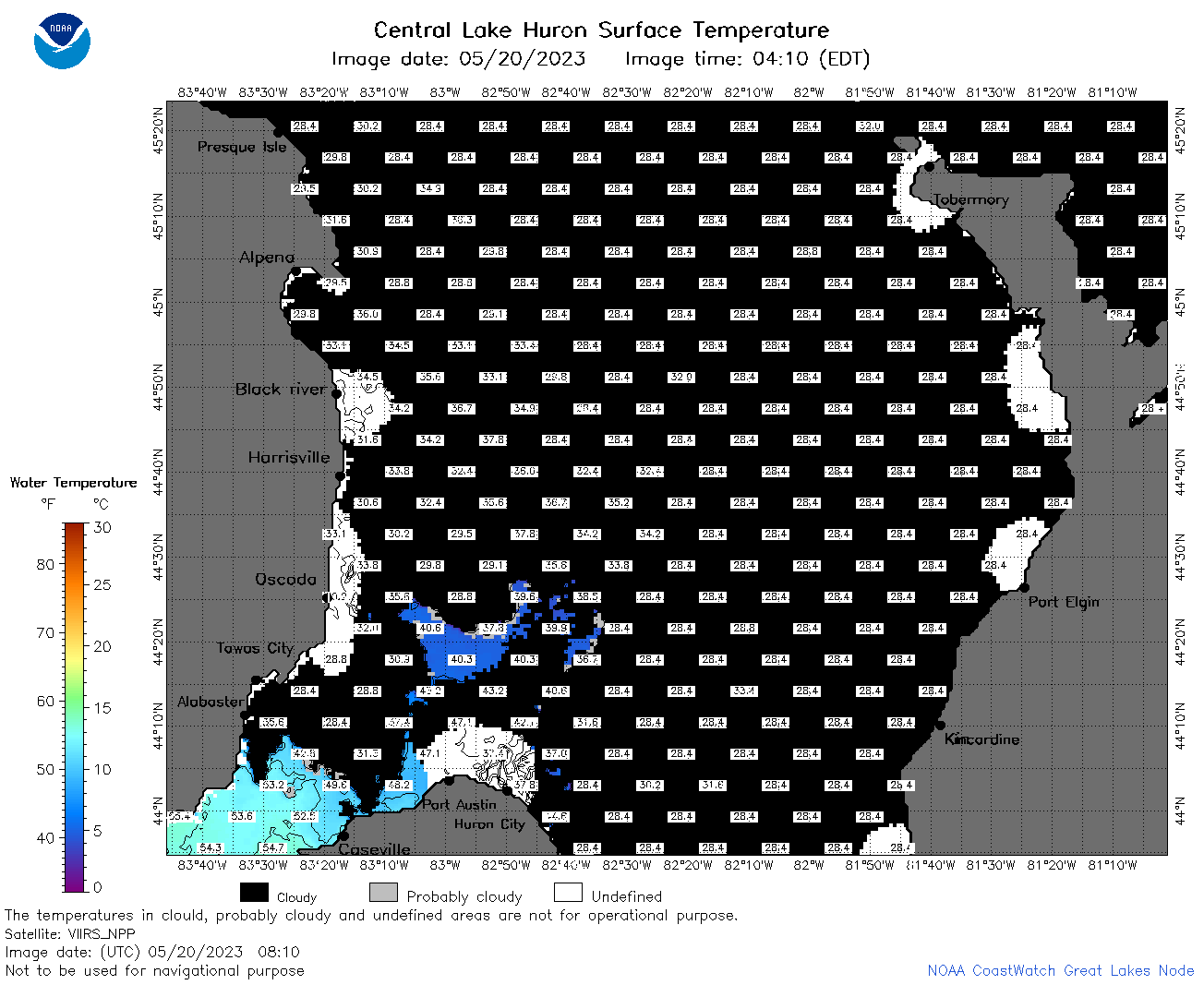 | h2_2023_05_20_0810.png | 20-May-2023 12:26 | 46892 | |
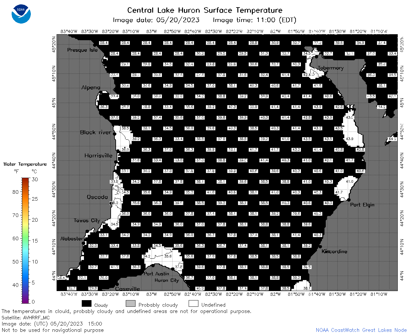 | h2_2023_05_20_1500.png | 20-May-2023 19:26 | 41737 | |
 | h2_2023_05_20_1550.png | 20-May-2023 19:30 | 43133 | |
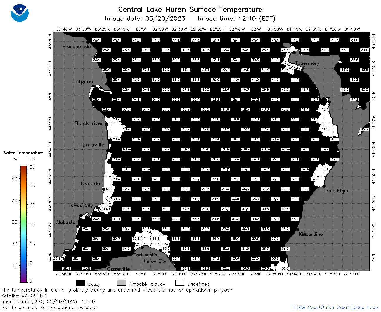 | h2_2023_05_20_1640.png | 20-May-2023 20:26 | 41810 | |
 | h2_2023_05_20_1700.png | 20-May-2023 19:32 | 40425 | |
 | h2_2023_05_20_1750.png | 20-May-2023 20:32 | 41593 | |
 | h2_2023_05_20_1840.png | 20-May-2023 21:26 | 40174 | |
 | h2_2023_05_20_1930.png | 20-May-2023 22:28 | 36670 | |
 | h2_2023_140.png | 21-May-2023 09:14 | 70967 | |